Showing posts with label Ferry Trips. Show all posts

Saturday, June 20, 2009

Dark week

From blue blue winter skies to dark dark winter skies. Pissing down again as we speak. It's been a dark wet week in Woy Woy. I've been having the lights on at three in the afternoon.

Male duck Empire Bay foreshore June 2009

Boy duck.

Went to Empire Bay when the sun was still with us. Had fish & chips on the foreshore. Bloody lovely day for it.


Female duck Empire Bay foreshore June 2009

Girl duck.


Empire Bay foreshore Empire Bay

Beautiful warm winter sun on water and shore.

And a couple of planes making weird contrails in the distance. See them? Above the boats. They looked like they were over Sydney.


Still missing

Can't find any fresh news about the Woy Woy bloke who went missing last week. They found his surf ski and life jacket and paddle off Saratoga but no sign of him, poor bastard.

Map

Full article at The Australian


Dementia walkies

Regular walkies helped a Dear Old Thing survive when he got lost in the bush last week.

"Dr Fulde believed Mr Ludbrook's regular long walks would have been crucial to his survival.

"Big time. People who walk serious distances - not just the 20-minute stroll with the dog, which is also good - do well in situations like this.

"His heart would have been able to deal with the stress much more easily that the average lounge lizard.

"In the end, that's what hypothermia does - it leads to heart attack - and having a healthy heart from lots of walking protects from heart attach as the patient cools down."
...
For decades, Mr Ludbrook's neighbours had become used to the sight of him walking the streets of Fernhill."


There you go. Us walkers are on the right track. Even when we're demented.


Full article at SMH

Tuesday, October 07, 2008

Clear blue sky

(Random ferry rides)

I am buggered so very few words today. But after a long weekend of wind and storms and rain, the pictures speak for themselves.

Brisbane Water

Gone fishing. Off Woy Woy.


Sandbar on Brisbane Water

Wading on the sandbar off Ettalong.

(Both photos have low res at larger size. Click on them to get to it.)


Bits & bobs

Umina bloke gets medal for rescue

Ghost Plane - always put the handbrake on, people!

Tourist's review of The Excrescence & some beach photos

The Excrescence

Friday, August 15, 2008

Palm Beach

While the Palm Beach ferry is a hot topic, let's pop back across to Palmy.


Brisbane Water & Pittwater

Pittwater and Brisbane Water ferry routes. The bottom route goes from Ettalong to Palm Beach and is the one threatened by the sandbank.

(Incidentally, everything on the green and blue map is on the Central Coast and everything on the blue map is in Sydney.)


Fantasea Crystal

Fantasea Crystal at Palm Beach. A comfy and efficient ferry but not exciting as ferries go.

These two are also of the Palm Beach fleet:

Crystal Spirit, at Wagstaffe
Myra & friend, wooden ferries at Palm Beach

Floating life - ferries, dingies, wooden boats, putt-putts, a hull, a raised wreck, and a sub


Lion Island from Palm Beach ferry

Lion Island from the Palm Beach ferry. I never get tired of Lion Island.

List of birds & beasts on Lion Island
Islands of Broken Bay


Sea plane at Palm Beach


Seaplane at Palm Beach

Seaplane at Palm Beach, with Barrenjoey Head behind it. The seaplane takes off from Sydney Harbour and does sightseeing tours up the coast to Pittwater.


Work work work

Have been working long hours. Hence the late posts recently. Made the deadline though and there's a bit of calmer water ahead, thank christ.

Thursday, December 20, 2007

Palm Beach again

(Palm Beach again)

Fantasea Crystal at Ettalong Wharf Ettalong

Our trusty steed Fantasea Crystal at Ettalong Wharf. She is a 25 metre aluminium catamaran and takes a max of 192 passengers.


Lion Island, looking south from the Palm Beach ferry

Lion Island, looking south from the Palm Beach ferry. Notice the cliff at the head end, facing out therough the heads of Broken Bay, and the lion-ish shape of the whole thing.


Lion Island from the Pam Beach ferry

Lion Island from the Palm Beach ferry.


Lion Island head on from the Palm Beach ferry

Head on of Lion Island. Rock climbers can occasionally be spotted inching their way up its face.

The island is on a couple of my old maps as Elliott Island, named in 1789 by Governor Phillip after another Island where his mate General Elliott gave the Spanish and French a kicking. It's 8 hectares and was made into Lion Island Nature Reserve in 1956. There's quite a few beasties living on it, mostly birds though of course.

White-bellied Sea-Eagle
Osprey
Kookaburra
Grey Teal
Fork-tailed Swift
White-throated Needletail
Pied Currawong
Australian Raven
Mistletoe bird
Nankeen Kestrel
Peregrine Falcon
Silver Gull
Crested Tern
Yellow-faced Honeyeater
White-cheeked Honeyeater
Great Cormorant
Little Pied Cormorant
Little Black Cormorant
Tawny Frogmouth
Blue Petrel
Fluttering Shearwater
Sooty Shearwater
Wedge-tailed Shearwater
Short-tailed Shearwater
Eastern Rosella
Little Penguin
Southern Boobook
Silvereye

Water-rat
House mouse

Eastern Water Dragon
Robust Ctenotus
Copper-tailed Skink
Eastern Water-skink
Three-toed Skink
Lace Monitor

Proper names at NSW National Parks

Sydney Climbing


Barrenjoey Head from the Palm Beach ferry
Embiggen

Barrenjoey Head from Pittwater. Note the flat strip of land on the right hand side of the Head. That's the golf course, with Palm Beach itself on the other side of it and Barrenjoey Beach on the Pittwater side, which is this side.


Myra leaving Palm Beach Wharf

Myra leaving Palm Beach wharf. She does the bays and wharves of Pittwater. She's too small to go across the mouth of Broken Bay to Ettalong. She'd be all over the place in a decent swell.

She is a 15 metre woodern ferry and "the pride of Palm Beach Ferry Service". She takes a max of 130 passengers.

Sister ship Crystal Spirit at Wagstaffe wharf

Palm Beach ferry fleet

Ettalong to Palm Beach map

More Broken ferries & boats

Islands of Broken Bay


And that's yer lot for the year. I'm on me holidays now and will be laying on the beach and having barbies for a couple of weeks, storms permitting. Have a good Chrissy and come back on the 15th of January.

Monday, July 30, 2007

Saratoga views

(Saratoga walkies #9)

Saratoga, Davistown & Yattalunga map
Embiggmification

There yer go. Now you can see what I mean when I say the Saratoga/Davistown peninsula is hammer-shaped. Saratoga is the first stop on the Saratoga and Codock II ferry runs.

(In an hour the Flickr version map & photos will be annotated. Which will save you reading all that stuff and looking for the third tree on the left.)

Gosford is off the map up past the top left corner. Woy Woy is, obviously, the one marked Woy Woy, down there at the bottom.

Rileys Island and Pelican Island and those two little ones are uninhabited. St Huberts is the canal'd one with all the seventies houses on it.

The cross halfway up the right hand edge is the Holy Cross church and St Joseph's orphanage, where the old ferries were operated from.

View to Woy Woy from Shaw Street Saratoga
Embiggmification

View to Woy Woy from Shaw Street.

We're looking straight across to the Bowls at Woy Woy, at the end of North Burge Road.

To the left of the Bowls is the foreshore park running parallel to North Burge Road.

To the right of the Bowls is the foreshore park running parallel to Brick Wharf Road and into Bustling Downtown Woy Woy between the pubs.

The Woy Woy Channel is running back from the furtherest cluster of boats and that's the tip of Pelican Island to the right of the boats and the Veteran Hall Wharf on Henderson Street below Pelican Island.

View to St Huberts from Shaw Street Saratoga
Embiggmification

View to St Huberts from Shaw Street. Took a while to work out what I was looking at with this one.

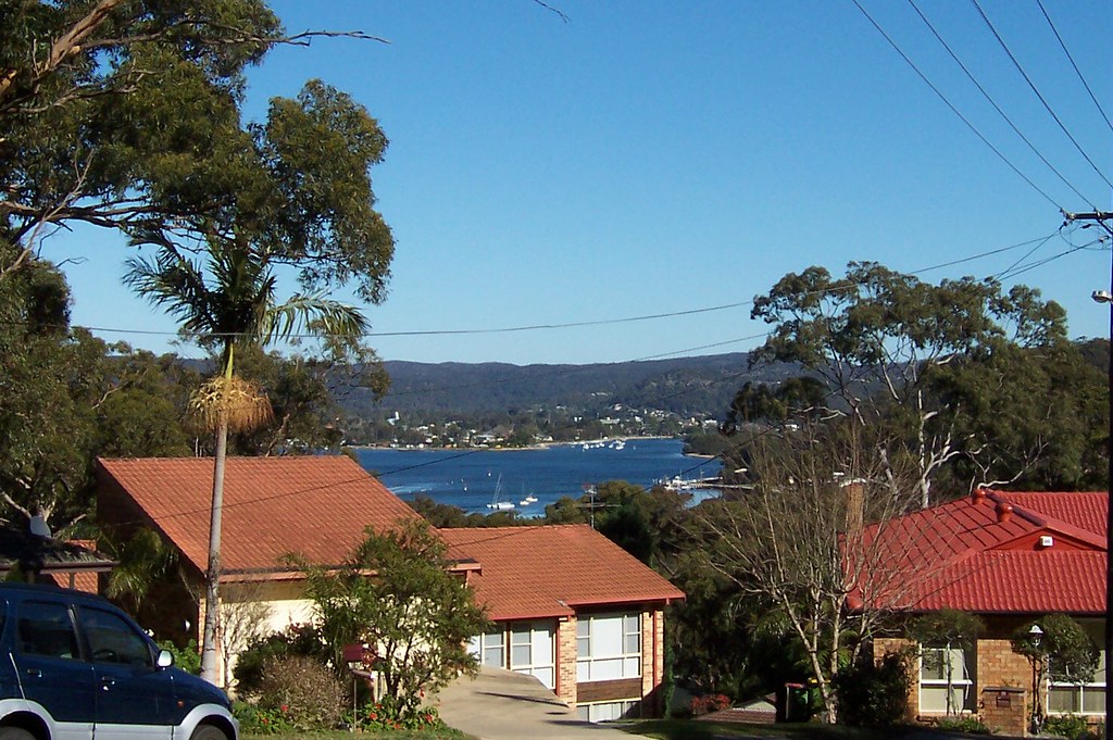
First is that tight grove of trees on the grassy area (between foreground trees). That is Illoura Reserve, the part at the end of Malinya Road. Passengers on the Saratoga ferry will see it as the ferry turns the corner from Lintern Channel into Cockle Channel and heads for Central Wharf.

Empire bay is beyond that and to the left of the foreground trees, and the house there is on Myler Avenue or Yaringa Parade. The hill above that house is also Empire Bay.

To the right of the left foreground tree is the ramp down to St Huberts Island.

St Huberts is hard to distinguish from the houses of Daleys Point behind it so we won't give ourselves eyestrain trying.

The hill behind St Huberts & Daleys Point is Killcare and beyond Killcare is the Tasman Sea.

On the right edge of the photo is Blackwall Mountain. Probably. It's too close to be Mt Ettalong and nothing else in that direction is high.

To the left of that, just visible in the far distance, is Barrenjoey Head and in front of that is the sandstone cliff that forms the eastern end of Lion Island and the chest of the lion.

View to Gosford from Kapala Avenue Saratoga
Embiggmification

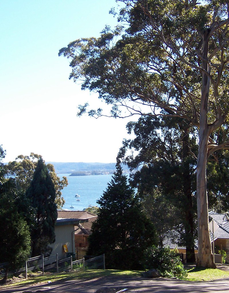
View to Gosford from Kapala Avenue.

That's Longnose there, Point Frederick, with the old cemetery on the end there in Pioneer Park.

Behind it is the hills of West Gosford and beyond them we're looking at the Peats Ridge/Mangrove Mountain area.