Anyways, here's some I took last week when the sun was out.
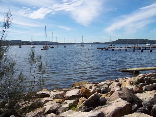
Rocks and yachts at Koolewong.
Looking north-north-east up towards East Gosford/Springfield. The low ground in the left background is the low bit of Tascott/Point Clare and Longnose (Pt Frederick) and the flat hill on the right is Kincumba Mountain.
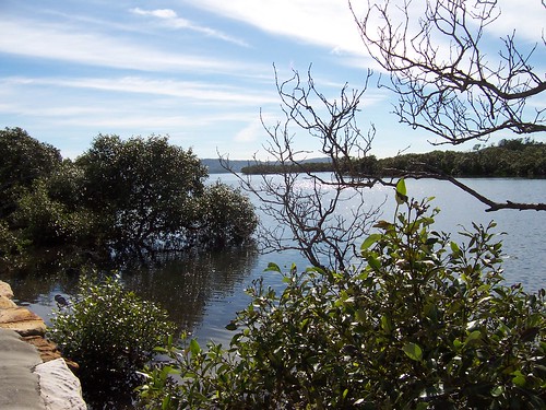
Mangroves beside Brisbane Water Drive. The bare-branched one isn't bare-branched because it's winter. It's just dead. Mangroves are evergreen, like most Australian trees. It's mostly the imported species of trees that are deciduous.
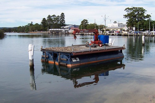
Jetty building equipment near Woy Woy wharf.
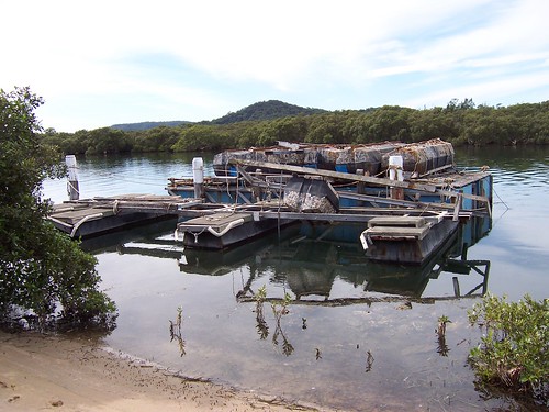
Jetty building equipment near Woy Woy wharf.
That's Pelican Island in the near background, with the pointy hill of Saratoga behind it.
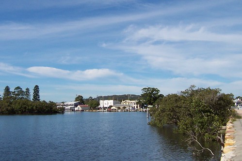
Woy Woy from Brisbane Water Drive
The pines are at the war memorial on Brick Wharf Road, the white building with the dark side is the fish and chip shop, the red-roofed building is a storage thingy either for the fish and chip shop or the commercial wharf in front of it. I forget.
The square white building is Roma (now St. Vinnie's), the two-storey building beside it is the pub (Woy Woy Hotel, the CWA is the low grey roof in front of the pub.
The ferry wharf is all those white pylons in the water and that big gum is in Anderson Park, a wee park behind the other pub.
Not drowning, wading
As soggy as it is here in Woy Woy, our rain is fuck-all compared to what they're copping up north.
"The worst drought in South-East Queensland's history is over." That's what the Queensland Premier said about the flooding in Brissie. Give that pollie an award for understatement.
Brissie (Brisbane) is a fucking disaster area. Brissie is one of Australia's bigger cities. It has about 2 million peeps. And it's built on a flood plain.
Thousands of peeps around the Queensland/NSW border were told to pack up and bugger off to higher ground. And maybe something has been learnt from the Victorian bushfires because they went and they went without a murmur. (Apart from a few argumentative types of course, but you always get them.)
The good news is Lake Eyre is filling with trickle-down from the flooding in Queensland a couple of months back (during the Victorian bushfires). Lake Eyre is a fucking huge salt lake in South Australia. Since 1885 it has filled six times.
Mappage:
Australia, with Queensland highlighted (New South Wales is immediately below Queensland)
A river runs through it (Satellite photo showing why Brissie is currently flooded)
Luscious satellite photo of Lake Eyre
Speaking of water
Lately I've been hoicking my carcass up to North Gosford and Wyoming and the like for walkies.
And not loving it. They are too far from the water. I like walking near the water. There's no two ways around it.
So I'm temporarily re-focussing my walkies to only towns and suburbs that border on the water.
That includes, from south to north:
Pretty Beach (started but not finished)
Hardys Bay (started but not finished)
Killcare
Killcare Heights
Empire Bay (started but not finished)
Bensville
Kincumber South
Kincumber (started but not finished)
Green Point
Rocky Point (part of Green Point)
Ironbark Point (part of Green Point)
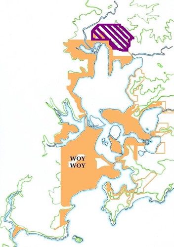
(Walkies Map May 2009)
The purple bit is what I've temporarily crossed off my list.
The orange lines outline my walkies target area. The filled-in orange bits are already walked.
The blank islands are uninhabited and have no roads. The green lines are landscape contours lines indicating hills and ridges.
Walked so far:
Woy Woy Peninsula:
(clockwise from station)
Woy Woy (station)
Blackwall
Orange Grove
Booker Bay
Ettalong
Umina, Ocean Beach & Umina Beach
Pearl Beach
Patonga, Dark Corner & Brisk Bay
Woy Woy South/Correa Bay
The Bays:
(where the fires were, next to Woy Woy)
Horsfield Bay (Deadmans Bay)
Phegans Bay
Woy Woy Bay
Parks Bay (old/semi-official name, part of Koolewong)
Clockwise round Brisbane Water from Woy Woy:
Koolewong /Murphys Bay
Tascott
Noonan Point (old/semi-official name, part of Tascott & Point Clare)
Point Clare
Fagans Bay
West Gosford (started but not finished, outside revised target area)
Gosford (started but not finished)
Point Frederick (Longnose)
Caroline Bay (part of East Gosford)
East Gosford (started but not finished)
Peeks Point
Springfield (started but not finished, outside revised target area)
Erina (started but not finished)
Yattalunga
Saratoga
Davistown
Kincumber (started but not finished)
Empire Bay (started but not finished)
St Huberts Island
Daleys Point (started but not finished)
Fishermans Bay
Hardys Bay (started but not finished)
Pretty Beach
Wagstaffe
Kourung Gourong Point (part of Wagstaffe)
'Started but not finished' doesn't mean I've abandoned that walk. It just means it's now outside my revides target are. Plus I'm just a random bastard these days.
1 comment:
'revides target are'?
revised target area!
Jesus, what was I on?
Post a Comment