My video editing software has been chucking a wobbly lately. Finally got this one open today only to dicover the bastard didn't need editing.
(Watch it & my other videos on YouTube)
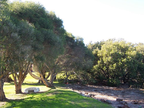
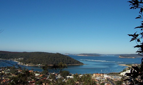
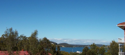
Anyways, here it is. Surf breaking on the rocks below the Maitland Bay lookout on The Bouddi National Park's Putty Beach to Little Beach track.
Lovely bit of wind today. Might pop out for another walk. Went this morning. Took the camera but there's just one photo of an upside-down me squinting into the lens in a bewildered manner then the battery went flat.
Monday, July 31, 2006
Friday, July 28, 2006
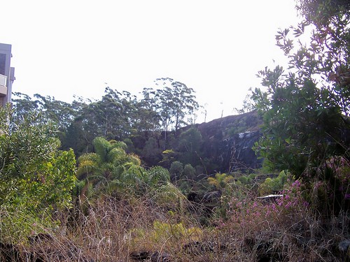
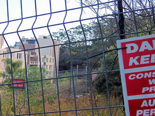
The old quarry
(Gosford walkies #15)
The sun was in and out like a fiddler's elbow today. While it was out though it warmed the place up very nicely. It's August next week and that means the temperature will start to rise. Spring starts on the first of September. But there's still some cold weather left to walk in and enjoy.
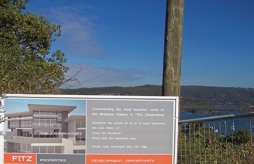
Fagans Bay from The Observatory building site. New lot of flats going up on John Whiteway Drive (upper section).
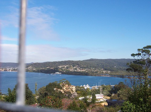
Point Clare & TS Hawkesbury from John Whiteway Drive. View from The Observatory once its built. TS Hawkesbury is Training Ship Hawkesbury, a naval training facility. Though it's hardly big enough to be a training ship, more like a training rowboat.
This was taken from the upper section of J.W. Drive. It's a sort of loop road thingy and this part is higher. Go up Donnison Street (on the Mann Street side of the railway) to the top and turn right. Go straight ahead up the hill for the upper part or take the first right turn for the lower part.
I can see The Blackett in this photo, the little old sandstone church on Mann Street. Click on the photo above and run your mouse over the photo.
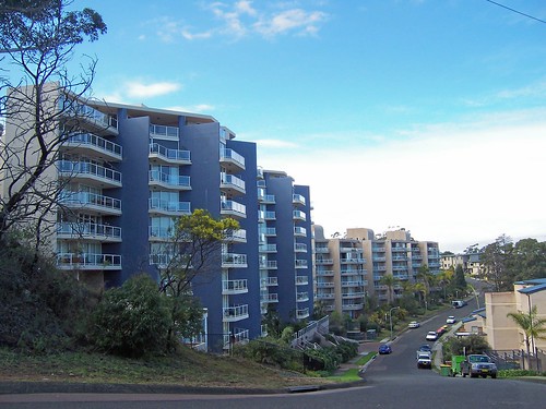
As you can see the view from John Whiteway Drive is already enriching some developer. From these flats you'd be able to see straight down Brisbane Water to Woy Woy and, on a clear day, probably to Barrenjoey Head.
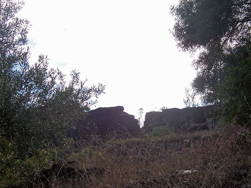
The old quarry is partially fenced off and there's a building site sign on it. Another block of flats will go there presumably. It's on the uppermost part of the upper part of John Whiteway Drive.
The Old Courthouse (now the Conservatorium of Music) on Mann Street was built in 1848-49 of local sandstone. I don't yet know if that sandstone came from the quarry on Mullet Creek (look out of the train as it passes Wondabyne station) or from this quarry.
The flats in front of the quarry won't block the view much.
It's s'posed to be clearing on the weekend and fine next week. That'll be pleasant. Nice cold sunshiny days again.
The sun was in and out like a fiddler's elbow today. While it was out though it warmed the place up very nicely. It's August next week and that means the temperature will start to rise. Spring starts on the first of September. But there's still some cold weather left to walk in and enjoy.
Fagans Bay from The Observatory building site. New lot of flats going up on John Whiteway Drive (upper section).
Point Clare & TS Hawkesbury from John Whiteway Drive. View from The Observatory once its built. TS Hawkesbury is Training Ship Hawkesbury, a naval training facility. Though it's hardly big enough to be a training ship, more like a training rowboat.
This was taken from the upper section of J.W. Drive. It's a sort of loop road thingy and this part is higher. Go up Donnison Street (on the Mann Street side of the railway) to the top and turn right. Go straight ahead up the hill for the upper part or take the first right turn for the lower part.
I can see The Blackett in this photo, the little old sandstone church on Mann Street. Click on the photo above and run your mouse over the photo.
As you can see the view from John Whiteway Drive is already enriching some developer. From these flats you'd be able to see straight down Brisbane Water to Woy Woy and, on a clear day, probably to Barrenjoey Head.
The old quarry is partially fenced off and there's a building site sign on it. Another block of flats will go there presumably. It's on the uppermost part of the upper part of John Whiteway Drive.
The Old Courthouse (now the Conservatorium of Music) on Mann Street was built in 1848-49 of local sandstone. I don't yet know if that sandstone came from the quarry on Mullet Creek (look out of the train as it passes Wondabyne station) or from this quarry.
The flats in front of the quarry won't block the view much.
It's s'posed to be clearing on the weekend and fine next week. That'll be pleasant. Nice cold sunshiny days again.
Thursday, July 27, 2006
The Bouddi Track
(Random walkies)
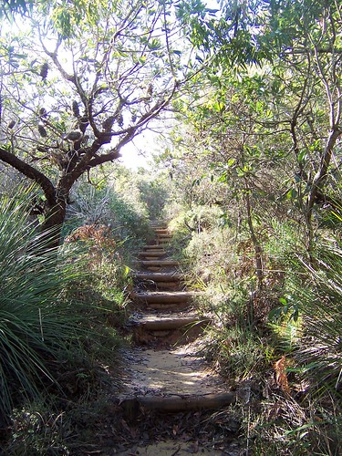
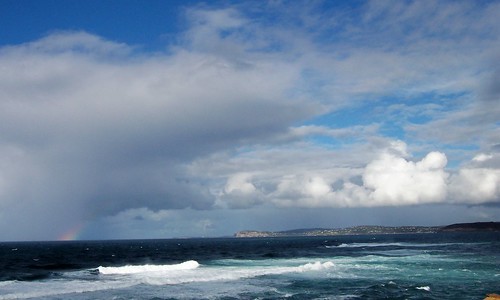
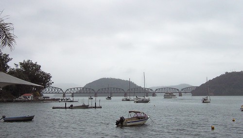
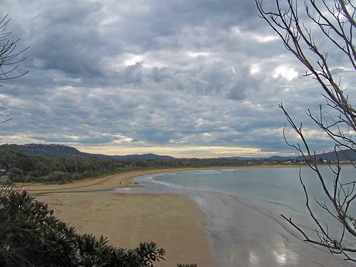
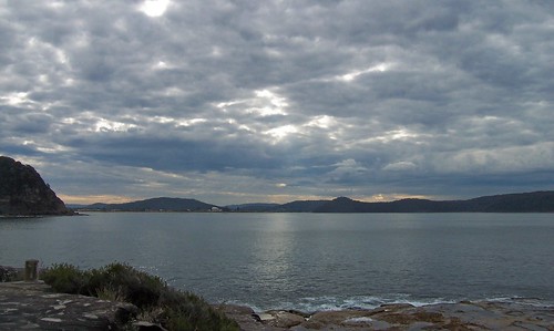
It was quiet down in the valley. There were birds tweeting and an occasional brush turkey rustling in the undergrowth. Nearer the top the wave sounds could be heard. Up the top at the lookout the wind was fierce and cold and the surf was crashing on the rock ledges below. I scrunched down into my jacket and enjoyed the buffetting and the view.
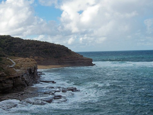
Maitland Bay & Bouddi Point from the lookout. It was as cold as it looks. There was a fair wind howling in off the Tasman Sea.
You can see the track there on the left. It continues round to near the Little Beach camping area. Get to that end from Grahame Drive off The Scenic Drive at MacMasters Beach.
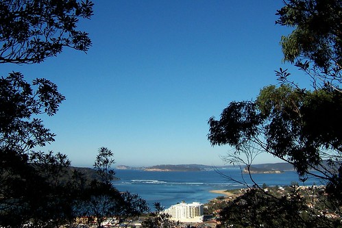
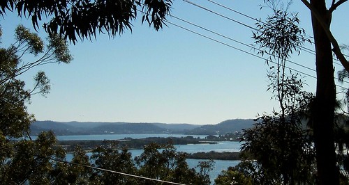
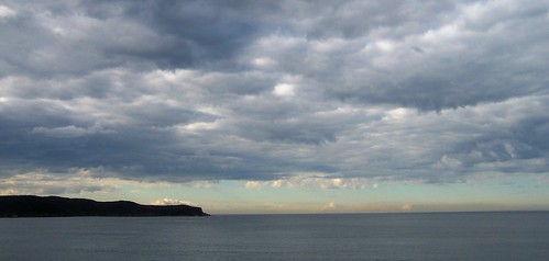
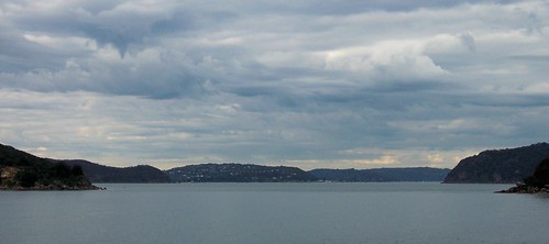
Long Reef & Manly from Gerrin Point near Putty Beach.
Far distance, in the middle of the photo is Manly, right down at Sydney Harbour (large size). In the middle distance is Long Reef, between Collaroy and Dee Why on Sydney's Northern Beaches and the dark point on the right is Bangalley Head near Whale Beach.
It was a pleasant surprise to find you can see all the way down to Manly. Then the weather closed in and the visibly was half that. It was time to head home for a nice hot whisky.
It was quiet down in the valley. There were birds tweeting and an occasional brush turkey rustling in the undergrowth. Nearer the top the wave sounds could be heard. Up the top at the lookout the wind was fierce and cold and the surf was crashing on the rock ledges below. I scrunched down into my jacket and enjoyed the buffetting and the view.
Maitland Bay & Bouddi Point from the lookout. It was as cold as it looks. There was a fair wind howling in off the Tasman Sea.
You can see the track there on the left. It continues round to near the Little Beach camping area. Get to that end from Grahame Drive off The Scenic Drive at MacMasters Beach.
Long Reef & Manly from Gerrin Point near Putty Beach.
Far distance, in the middle of the photo is Manly, right down at Sydney Harbour (large size). In the middle distance is Long Reef, between Collaroy and Dee Why on Sydney's Northern Beaches and the dark point on the right is Bangalley Head near Whale Beach.
It was a pleasant surprise to find you can see all the way down to Manly. Then the weather closed in and the visibly was half that. It was time to head home for a nice hot whisky.
Wednesday, July 26, 2006
Putty Beach
(Random walkies)

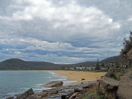
Went across to Putty Beach near Box Head. It was bloody cold. I was in me padded jacket, zipped right up to the nostrils and a wooly hat on. Three nutters were swimming, another bloke was marching along the beach in shorts and a fisherman was out there on the rock ledge. Barmy.
Putty Beach is about 20 minutes drive from Woy Woy. Come down from MacMasters via The Scenic Drive or off Empire Bay Road on Wards Hill Road to the corner with The Scenic Drive, turn left into Putty Beach Drive and go along past the camping area to the last carpark where the loos (toilets) are.
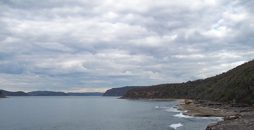
Putty Beach is on the Killcare peninsula that forms the north side of the mouth of Broken Bay. On one side the peninsula looks down into Brisbane Water and on the other out to sea (the Tasman Sea) and down the North Shore of Sydney.
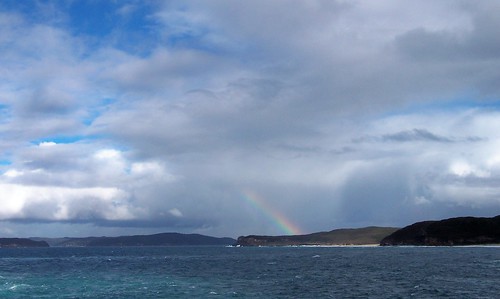
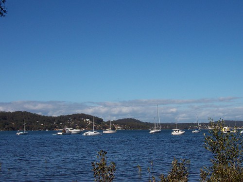
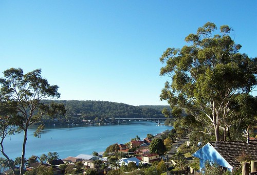
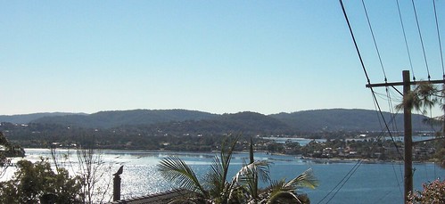
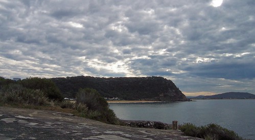
Broken Bay & Pittwater from Gerrin Point, the point at the east end of Putty Beach, looking down south into Pittwater (Sydney). Pittwater is on the left, Box Head is the point touched by the rainbow. The point on the right is the other end of Putty Beach.
Headed back to the car when the rain got up to Pittwater. It's been raining off and on for a fortnight here. Weird. Not weird because it's winter but because we're in drought. The rain is not enough to make much difference to the dams. Good water news in this week's Local Rag. We're getting a groundwater treatment plant in the Council Depot on Ocean Beach Road.
It's raining now but maybe it'll clear after lunch and I can get in a Gosford walk. Meanwhile, think I'll have some nice hot pancakes for lunch.
The shipping news
Last Aussie mass escape ships at sea. Over 5,000 people have been shipped out of Lebanon by the Australian government. There's a few still trapped there unfortunately, including two kids seen on last night's news being left on the docks watching their mother and their siblings leaving on the last boat. Harrowing viewing.
Some good news
"THE Jenolan Caves in the Blue Mountains have been dated at 340 million years old, making them the oldest known open caves in the world." says the Herald. The Blue Mountains are just outside Sydney and Jenolan Caves are a popular domestic and foreign tourist thingy.
Went across to Putty Beach near Box Head. It was bloody cold. I was in me padded jacket, zipped right up to the nostrils and a wooly hat on. Three nutters were swimming, another bloke was marching along the beach in shorts and a fisherman was out there on the rock ledge. Barmy.
Putty Beach is about 20 minutes drive from Woy Woy. Come down from MacMasters via The Scenic Drive or off Empire Bay Road on Wards Hill Road to the corner with The Scenic Drive, turn left into Putty Beach Drive and go along past the camping area to the last carpark where the loos (toilets) are.
Putty Beach is on the Killcare peninsula that forms the north side of the mouth of Broken Bay. On one side the peninsula looks down into Brisbane Water and on the other out to sea (the Tasman Sea) and down the North Shore of Sydney.
Broken Bay & Pittwater from Gerrin Point, the point at the east end of Putty Beach, looking down south into Pittwater (Sydney). Pittwater is on the left, Box Head is the point touched by the rainbow. The point on the right is the other end of Putty Beach.
Headed back to the car when the rain got up to Pittwater. It's been raining off and on for a fortnight here. Weird. Not weird because it's winter but because we're in drought. The rain is not enough to make much difference to the dams. Good water news in this week's Local Rag. We're getting a groundwater treatment plant in the Council Depot on Ocean Beach Road.
It's raining now but maybe it'll clear after lunch and I can get in a Gosford walk. Meanwhile, think I'll have some nice hot pancakes for lunch.
The shipping news
Last Aussie mass escape ships at sea. Over 5,000 people have been shipped out of Lebanon by the Australian government. There's a few still trapped there unfortunately, including two kids seen on last night's news being left on the docks watching their mother and their siblings leaving on the last boat. Harrowing viewing.
Some good news
"THE Jenolan Caves in the Blue Mountains have been dated at 340 million years old, making them the oldest known open caves in the world." says the Herald. The Blue Mountains are just outside Sydney and Jenolan Caves are a popular domestic and foreign tourist thingy.
Monday, July 24, 2006
Dangar Island
(Every street walkies)
Did Dangar in a day. Not that it was hard. It's barely a mile across. There's one shop and maybe fifty houses. The residents are the usual Central Coast mix of Dear Old Things who've lived there forever, yuppie commuters and cashed-up retirees.
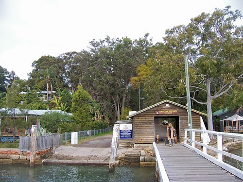
Dangar Island ferry wharf. Get off the train at Hawkesbury River and catch the ferry from Brooklyn wharf (next to the station) to Dangar Island.
I went last weekend. It was one of those iffy days when it might rain and it might not. Mostly it didn't.
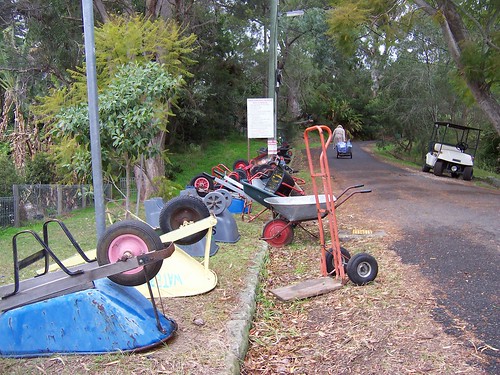
Being so tiny the island has no need of cars. There's just Bob-the-odd-job-bloke's ute for garbage collection and cartage of fallen branches. The next most powerful vehicles are two golf carts and several dozen wheelbarrows for carting one's stuff home from the ferry. Good exercise but probably a bit tiresome on those dark and stormy evenings.
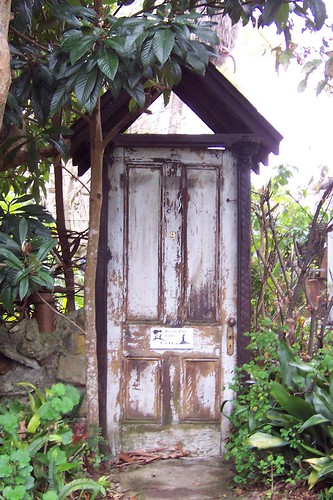
A gate substitute near the Bowls club. It says "Beware of the Rabbit". I was.
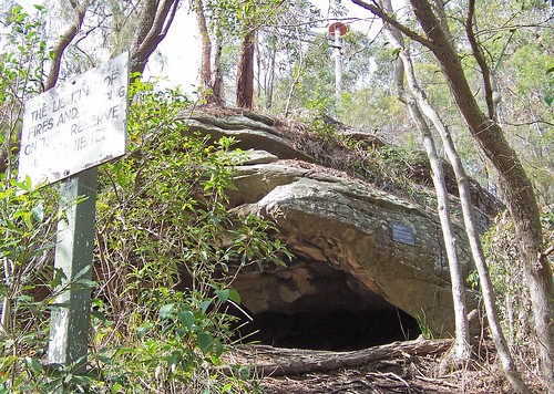
Evidence in Kiparra Park of Aboriginal habitation on or visits to the island before white peeps came. I don't yet have a lot of info on the Aboriginal inhabitants of the Brisbane Water area. I do know though that caves are few and far between so housing was probably the bark humpy backed up by rock shelters like this in bad weather.
That pole with the red thingy on top above the rock is some sort of electrical thingy. The island is fully wired for power and phones.
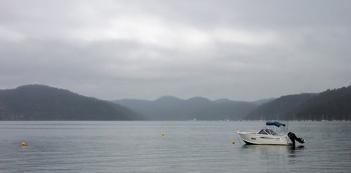
Porto Bay from the Bradleys Bay beach. Porto Bay is one of the smaller bays in Ku-ring-gai National Park. The other side of Ku-ring-gai faces into Pittwater, which can be seen from Pearl Beach.
Hawkesbury River Railway Bridge & Spectacle Island from the Dangar Island cafe (the only shop on the island) next to the wharf. The island in the centre is Spectacle. In the distance is Mooney Mooney and the F3 Freeway from Sydney to Newcastle. On the right is Cogra Point. From there the railway runs north-ish along the edge of Mullet Creek then goes into NSW's longest railway tunnel and pops out a few minutes later at Woy Woy.
Brooklyn is behind (west-south-west of) the Woy Woy Peninsula. It and Dangar Island are technically part of Hornsby Council (Borough) in Sydney.
It held off raining until we were ready to go. Very considerate. But I love a rainy view anyways. Makes all the colours soft. It's raining again today. Nipped out for a paper earlier but it looks like that's all the walking I'll be doing today, sod it.
Did Dangar in a day. Not that it was hard. It's barely a mile across. There's one shop and maybe fifty houses. The residents are the usual Central Coast mix of Dear Old Things who've lived there forever, yuppie commuters and cashed-up retirees.
Dangar Island ferry wharf. Get off the train at Hawkesbury River and catch the ferry from Brooklyn wharf (next to the station) to Dangar Island.
I went last weekend. It was one of those iffy days when it might rain and it might not. Mostly it didn't.
Being so tiny the island has no need of cars. There's just Bob-the-odd-job-bloke's ute for garbage collection and cartage of fallen branches. The next most powerful vehicles are two golf carts and several dozen wheelbarrows for carting one's stuff home from the ferry. Good exercise but probably a bit tiresome on those dark and stormy evenings.
A gate substitute near the Bowls club. It says "Beware of the Rabbit". I was.
Evidence in Kiparra Park of Aboriginal habitation on or visits to the island before white peeps came. I don't yet have a lot of info on the Aboriginal inhabitants of the Brisbane Water area. I do know though that caves are few and far between so housing was probably the bark humpy backed up by rock shelters like this in bad weather.
That pole with the red thingy on top above the rock is some sort of electrical thingy. The island is fully wired for power and phones.
Porto Bay from the Bradleys Bay beach. Porto Bay is one of the smaller bays in Ku-ring-gai National Park. The other side of Ku-ring-gai faces into Pittwater, which can be seen from Pearl Beach.
Hawkesbury River Railway Bridge & Spectacle Island from the Dangar Island cafe (the only shop on the island) next to the wharf. The island in the centre is Spectacle. In the distance is Mooney Mooney and the F3 Freeway from Sydney to Newcastle. On the right is Cogra Point. From there the railway runs north-ish along the edge of Mullet Creek then goes into NSW's longest railway tunnel and pops out a few minutes later at Woy Woy.
Brooklyn is behind (west-south-west of) the Woy Woy Peninsula. It and Dangar Island are technically part of Hornsby Council (Borough) in Sydney.
It held off raining until we were ready to go. Very considerate. But I love a rainy view anyways. Makes all the colours soft. It's raining again today. Nipped out for a paper earlier but it looks like that's all the walking I'll be doing today, sod it.
Friday, July 21, 2006
The shipping news
I'm posting this instead of putting it in the relevant comments thingy because I know some of my readers don't read the comments.
Casade, I hope your family and friends in Lebanon stay safe and come through this whole business as unscathed as possible. Please pass on my best wishes if you're in contact with them.
I know what you mean about things going backwards over there. I don't remember a time when there wasn't a war or threat of war going on in that region. And even when the war's two countries over it's still too bloody close and must wreak some serious economic havoc.
When I trained as an English teacher I learned a set of questions to ask my migrant students. The questions assessed the student's level of experience at language learning and their general education. From the answers they gave us we could start them off at levels that suited each one of them.
Two of the questions made me think about how very lucky I am. One was 'how old where you when you started school and when you finished?' and the second was 'was there a war when you were a child?'.
That second one was the killer. I was born after World war Two, after the threat of wartime invasion was well and truly over. I never felt the fear of invasion and war on home soil. Bombs never fell in my childhood, my streets were never shelled, I never played in bomb craters or spent long nights listening to other people's houses being destroyed. I went to school every day and got a full education and, whatever else happened there, death never dropped out of the sky.
Don't ever think I don't appreciate how lucky I am to have been born Anglo-saxon Australian.
Just saw the news on Aunty about all the evacuees still waiting for ships to get out of Lebanon and they said there's Australian citizens fleeing Israel as well. And of course Australian citizens aren't the only ones fleeing either country. Here's hoping they all get out in time and all your families, Jewish and Lebanese and anyone else who's there, stay safe.
Frederick Street
Flickr's back online so here's the photos I wanted to post yesterday.
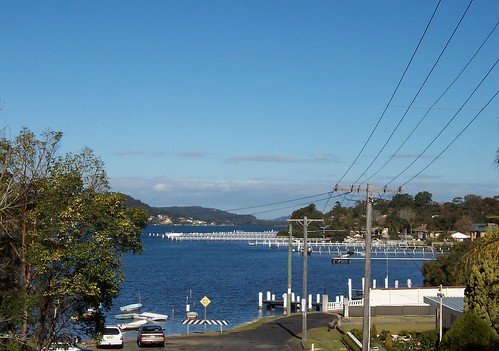
From Caroline Bay in the foreground across to Green Point (half hidden on the left), Daleys Point and, in the far distance, possibly Wagstaffe. Woy Woy is not visible but if it was it'd be to the right of Wagstaffe.
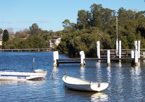
Private dingies and jetties at the bottom end of Frederick Street. There's no public boat ramp or jetty more's the pity. Private jetties make me wish I was a rich bastard so I could totter out of the house in the morning in me slippers clutching a cuppa tea, onto my boat and putter off for a spot of boating.
Green Point (left), Davistown (small peak) and Killcare Heights (far distance) from the park at the bottom of Frederick Street.
Tea trees & mangroves in the park at the bottom end of Frederick Street. Lovely spot. Sat on a log and ate my elevenses and listened to the water lapping.
Cast of thousands
The morning news said there's 10,000 Australians still waiting for evacuation from Lebanon. It was a commercial channel so they probably exaggerated by 5,000 but that's still a shitload of frightened and bewildered peeps hiding out while they wait for rescue. Good luck.
I am tired and cross and am off for an afternoon nap. Talk amongst yerselves.
From Caroline Bay in the foreground across to Green Point (half hidden on the left), Daleys Point and, in the far distance, possibly Wagstaffe. Woy Woy is not visible but if it was it'd be to the right of Wagstaffe.
Private dingies and jetties at the bottom end of Frederick Street. There's no public boat ramp or jetty more's the pity. Private jetties make me wish I was a rich bastard so I could totter out of the house in the morning in me slippers clutching a cuppa tea, onto my boat and putter off for a spot of boating.
Green Point (left), Davistown (small peak) and Killcare Heights (far distance) from the park at the bottom of Frederick Street.
Tea trees & mangroves in the park at the bottom end of Frederick Street. Lovely spot. Sat on a log and ate my elevenses and listened to the water lapping.
Cast of thousands
The morning news said there's 10,000 Australians still waiting for evacuation from Lebanon. It was a commercial channel so they probably exaggerated by 5,000 but that's still a shitload of frightened and bewildered peeps hiding out while they wait for rescue. Good luck.
I am tired and cross and am off for an afternoon nap. Talk amongst yerselves.
Thursday, July 20, 2006
Caroline Bay
It's shaping up to be another crap day for walkies here. Got something left over from last week's sunny walk up at Longnose though.
(Watch it at YouTube)
View into Caroline Bay and down Brisbane Water's east side to Daleys Point from Frederick Street Longnose (Point Frederick) near the old school.
On the soundtrack you can hear the wind in the pine trees in the park and a clicking sound which is me forgetting I'm chewing gum near a microphone.
Flickr's having a little lie-down so no photos. But they're giving away a free pro account.
Or you can pop across to Callisto's blog and check out her photos from Pittwater which is northern beaches Sydney and visible from Umina. This is my favourite of her photos and takes me back too, to the shop across the road from my old primary school.
Bad news
This war crap in Israel and Lebanon. Not interested in who started it or why. I've got a couple of Israeli readers and an occasional Lebanese reader. Hope all you Lebs and Israelis and your families and all those in the afflicted areas stay safe.
The same goes for the poor buggers in Indonesia who copped a tsunami on Monday after a 6.2 earthquake hit the Jakarta region. Last night's news said they found four survivors out at sea clinging to their wrecked boats. Cold, wet and hungry but alive.
Wednesday, July 19, 2006
Blackwall Mountain video
The bastard finally fucking uploaded. Read an article yesterday about YouTube having 60% market share of video uploads. Which explains why they're so clogged already.
(Watch it at YouTube)
Pamorama from Mount Ettalong and Umina Beach, across Lion Island, Pittwater, Barrenjoey Head and the mouth of Broken Bay, Wagstaffe and Hardys Bay, with Ettalong in the foreground at the foot of the Mountain.
Soundtrack removed due to a pair of my mates squabbling over the map. Snipped off the bit of video at the end where they say 'oh fuck!' and I turn the camera on them in time to see the map sailing off into the breeze. That was my contour map so I can't check the height of the Mountain on it. Bastards.
Tuesday, July 18, 2006
Blackwall Mountain
(Random walkies)
Wet and wild day today. The wind's howling through a crack in my window and twigs are raining down on the roof. It was raining when I woke up and it might rain again. Lovely day for a hot cuppa in a warm living room. Lucky for you I've got some forgotten photos from a sunny weekend last month.
Went up the Mountain last September, a few weeks before I finished walking Woy Woy. I was using a different camera then, a much dropped instamatic, and it was a different season. A couple of the photos from this lot today were taken from the same spot as September's. It was a hot day and I was buggered. Couldn't find the track to the lookout and gave up after a while. This time I found it.
Rip Bridge with Daleys Point behind it, from the elbow of Bay View Crescent on the Mountain right above Blackwall Point. Orange Grove Road in the foreground.
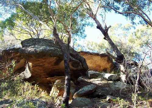
Rocks on Blackwall Mountain. Look at those beautiful golden colours on the undersides.
Go up to the elbow of Bay View Crescent. Just past it is a metal gate. Go round the rock on the right of the gate and follow the track. It's wide to begin with then narrows. Stick to the well-worn track. The lookout with the views is on the right off the narrow track when you're right up on the flat top of the Mountain. There's no fence or whatever at the lookout, just a flat rock shelf.
The Excrescence at Ettalong, the mouth of Broken Bay, Barrenjoey Head, Lion Island and Pittwater from the south-east side of the Mountain. The pointlessly large white building is The Excrescence (Outrigger Resort & the Memorial Club).
Wagstaffe, Ettalong (foreground), the sandbar, Barrenjoey Head, Lion Island and Pittwater from the lookout.
From the elbow of Bay View Crescent on the nor'-nor'-west side of the Mountain. Looking out over one of the unnamed islets, Blackwall foreshore park, Pelican Island and the tip of Saratoga (the hill of Saratoga's behind the tree on the right). Then across the width of Brisbane Water to Tascott and Point Clare and beyond to Somersby and Central Mangrove.
St Huberts Island and Rileys Island, the low ground between Saratoga's hill and Davistown's, Yattalunga and Green Point/Kincumba Mountain beyond and Gosford in the left distance.
Bloody YouTube is having a spack attack today so the video is coming tomorrow. I'm off to put the kettle on for a hot chocolate and a Scotch finger.
Wet and wild day today. The wind's howling through a crack in my window and twigs are raining down on the roof. It was raining when I woke up and it might rain again. Lovely day for a hot cuppa in a warm living room. Lucky for you I've got some forgotten photos from a sunny weekend last month.
Went up the Mountain last September, a few weeks before I finished walking Woy Woy. I was using a different camera then, a much dropped instamatic, and it was a different season. A couple of the photos from this lot today were taken from the same spot as September's. It was a hot day and I was buggered. Couldn't find the track to the lookout and gave up after a while. This time I found it.
Rip Bridge with Daleys Point behind it, from the elbow of Bay View Crescent on the Mountain right above Blackwall Point. Orange Grove Road in the foreground.
Rocks on Blackwall Mountain. Look at those beautiful golden colours on the undersides.
Go up to the elbow of Bay View Crescent. Just past it is a metal gate. Go round the rock on the right of the gate and follow the track. It's wide to begin with then narrows. Stick to the well-worn track. The lookout with the views is on the right off the narrow track when you're right up on the flat top of the Mountain. There's no fence or whatever at the lookout, just a flat rock shelf.
The Excrescence at Ettalong, the mouth of Broken Bay, Barrenjoey Head, Lion Island and Pittwater from the south-east side of the Mountain. The pointlessly large white building is The Excrescence (Outrigger Resort & the Memorial Club).
Wagstaffe, Ettalong (foreground), the sandbar, Barrenjoey Head, Lion Island and Pittwater from the lookout.
From the elbow of Bay View Crescent on the nor'-nor'-west side of the Mountain. Looking out over one of the unnamed islets, Blackwall foreshore park, Pelican Island and the tip of Saratoga (the hill of Saratoga's behind the tree on the right). Then across the width of Brisbane Water to Tascott and Point Clare and beyond to Somersby and Central Mangrove.
St Huberts Island and Rileys Island, the low ground between Saratoga's hill and Davistown's, Yattalunga and Green Point/Kincumba Mountain beyond and Gosford in the left distance.
Bloody YouTube is having a spack attack today so the video is coming tomorrow. I'm off to put the kettle on for a hot chocolate and a Scotch finger.
Monday, July 17, 2006
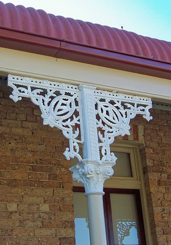
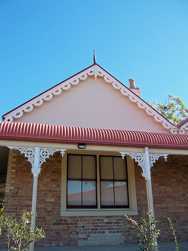
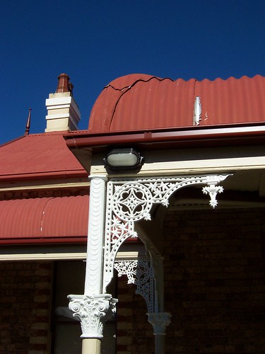
Gingerbread Gothic
(Gosford walkies #14)
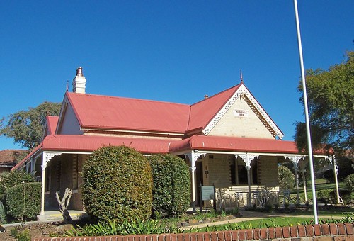
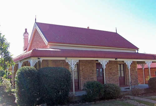
Went back up to Point Frederick this morning and photographed this lovely old building at St Edward's. It's Victorian Rustic Gothic (circa1840 - c.1890). Steeply pitched roofs, all those gables and chimneys, iron lace brackets on the veranda posts, decorated bargeboards on the gables, pendants and finials at the point of the gables and that lovely bullnose veranda roof. The plaque on the gable reads "MONA,VALE. 1889". It's the administration bulding now but presumably it once housed the classrooms.
The rest of the school is red brick with roofs in the same red as this building. The other buildings look like they were built in the twentieth century, post war. The setting is lovely. There's a playground and oval on the waterfront behind the buildings and a view from them down into Caroline Bay and across to Green Point and Saratoga. Lovely spot to go to school.
The view from the school is down into Caroline Bay between Point Frederick and Peeks Point, across to Green Point (behind the trees), the lower ground of Saratoga, Davistown and, in the far distance, what looks to be Killcare Heights.
South end of St Edward's. There's three doors across the back there. Put in when the white brick part was added at the front (above) maybe.
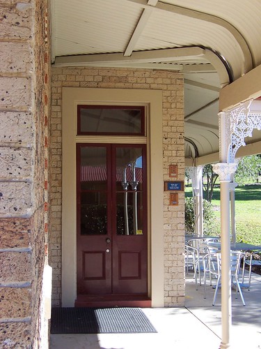
The front door. The fanlight seems pretty common in the Victorian Rustic Gothic style. But the mix of brick & wood window frames and wood-only window frames is making me think the white brick section on the front wall here, the quoin-bricks and the wood-only framed windows and the back door were added a few years after the place was built.
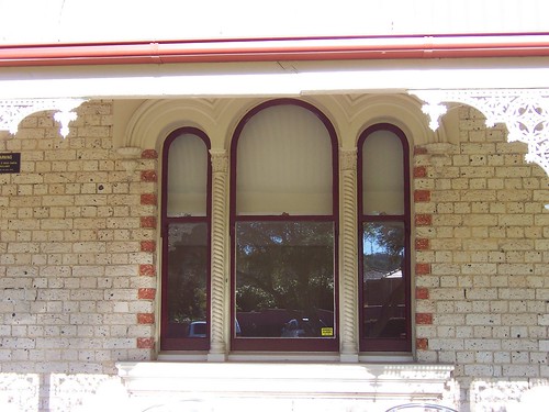
Stilted arch window on the front of the building. The same brick pattern as down the sides of the brick framed windows. Stitled arch windows are quite common on 19th century terrace houses in Sydney. Apart from this one, there's only one other I've seen on the Central Coast so far and that's just up the road on a green and white house on York Street.
Cast iron bracket on the south side of the building. It's quite different to the ones on the front (above).
Bargeboards & cast iron brackets on the east side of the building. The bargeboards are different again from those on the front and back.
Looks like there was a door instead of a window there once. You can see the replacement bricks under the window in the shape and size of a door. The window is also wider than rest (except the stilted arch one at the front) so it could be a 20th century alteration.
Detail of the veranda and iron lace. The iron lace I think is original. It was in pretty good nick but I've never seen any 20th or 21st century reproduction in that pattern.
I don't know about the post section, below the brackets. Could be reproduction. They look very similar to 1970s reproduction. There's a lot of bashes and scrapes on the posts under their paint but this is a school building so they could've happened in the last few decades.
It was a lovely building. The only one of its kind I've seen so far in the Brisbane Water area but hopefully a few more will surface. There's a few more detail photos of it on Flickr.
It's come over cloudy this afternoon. Grey cloud. Hope there's some more rain coming.
Went back up to Point Frederick this morning and photographed this lovely old building at St Edward's. It's Victorian Rustic Gothic (circa1840 - c.1890). Steeply pitched roofs, all those gables and chimneys, iron lace brackets on the veranda posts, decorated bargeboards on the gables, pendants and finials at the point of the gables and that lovely bullnose veranda roof. The plaque on the gable reads "MONA,VALE. 1889". It's the administration bulding now but presumably it once housed the classrooms.
The rest of the school is red brick with roofs in the same red as this building. The other buildings look like they were built in the twentieth century, post war. The setting is lovely. There's a playground and oval on the waterfront behind the buildings and a view from them down into Caroline Bay and across to Green Point and Saratoga. Lovely spot to go to school.
The view from the school is down into Caroline Bay between Point Frederick and Peeks Point, across to Green Point (behind the trees), the lower ground of Saratoga, Davistown and, in the far distance, what looks to be Killcare Heights.
South end of St Edward's. There's three doors across the back there. Put in when the white brick part was added at the front (above) maybe.
The front door. The fanlight seems pretty common in the Victorian Rustic Gothic style. But the mix of brick & wood window frames and wood-only window frames is making me think the white brick section on the front wall here, the quoin-bricks and the wood-only framed windows and the back door were added a few years after the place was built.
Stilted arch window on the front of the building. The same brick pattern as down the sides of the brick framed windows. Stitled arch windows are quite common on 19th century terrace houses in Sydney. Apart from this one, there's only one other I've seen on the Central Coast so far and that's just up the road on a green and white house on York Street.
Cast iron bracket on the south side of the building. It's quite different to the ones on the front (above).
Bargeboards & cast iron brackets on the east side of the building. The bargeboards are different again from those on the front and back.
Looks like there was a door instead of a window there once. You can see the replacement bricks under the window in the shape and size of a door. The window is also wider than rest (except the stilted arch one at the front) so it could be a 20th century alteration.
Detail of the veranda and iron lace. The iron lace I think is original. It was in pretty good nick but I've never seen any 20th or 21st century reproduction in that pattern.
I don't know about the post section, below the brackets. Could be reproduction. They look very similar to 1970s reproduction. There's a lot of bashes and scrapes on the posts under their paint but this is a school building so they could've happened in the last few decades.
It was a lovely building. The only one of its kind I've seen so far in the Brisbane Water area but hopefully a few more will surface. There's a few more detail photos of it on Flickr.
It's come over cloudy this afternoon. Grey cloud. Hope there's some more rain coming.
Friday, July 14, 2006
Mount Ettalong track
(Random walkies)
At the end of Mount Ettalong there's a rock ledge where blokes go fishing and a track round to Pearl Beach. You park in the public carpark beside the loo at Berrima Close and walk up the road going over Mount Ettalong for a few metres. There's a track heading down to the rocks. It's a bit rough in places but there's a good view.
If you want to get into that caravan park for a holiday, you have to book a year ahead or something. Lovely spot for a laid back holiday though. Creek, beach, walk to the shops and all that stuff.
Same beach showing more to give you an idea how long it is.
From the very tip of Mount Ettalong looking across at Box Head and out to the Tasman Sea.
Taken from the Mount Ettalong track, looking towards Green Point. That's Green Point at Pearl Beach not Green Point near Kincumber.
Pearl Beach won Tidy Town awards a few years running and is shit hot on the real estate market.
Mount Ettalong (middle distance) and Blackwall Mountain from Green Point.
Go along Diamond Road to Crystal Avenue and turn left. Follow the road out to the end of Green Point, go through the Paul Landa Reserve and down the track on the right.
Left to right: tip of Mount Ettalong, Saratoga (far distance), Blackwall Mountain (flattish top), Davistown (far distance), Daleys Point (flattish top #2), Wagstaffe, Lobster Beach and Little Box Head. The white blob left of centre is The Excrescence.
The backside end of Lion Island on the left, Pittwater (part of Sydney) in the middle. Not sure which bit is what suburb or which is Scotland Island. Haven't been to Pittwater yet.
Looking into Pittwater from the tip of Green Point. Warrah Trig on the right. Good spot for rock fishing I expect.
Flickr's bloody slow today. Must be Bastille Day uploads or something.
Thursday, July 13, 2006
Jephson's Corner
(Gosford walkies #13)
The trouble with air-conditioned buses is that when a bloke who smells like a rancid badger gets on, there's no getting away from the whiff. This guy smelt like he'd been drinking since April and sleeping on a compost heap.
Weather was good though. Sunny and warm. Bugger all breeze. Lovely walkies day. I wandered about pretty much at random for a bit then got down to the business of photographing a building that might be demolished soon.
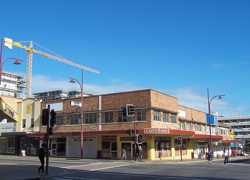
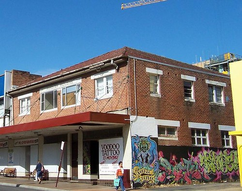
Jephson's Corner is nearly empty and that usually spells a change in fortunes for a commercial building. Might be renovated, might be knocked down. As you can see it's not in a bad way. I couldn't find any real structural damage or decay on the outside, back or front.
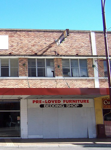
The only damage I could see was superficial. A broken window, the usual chips and knocks of half a century's wear and tear.
It's empty except the curry shop on the corner and the milkbar that looks deserted but claims to be open.
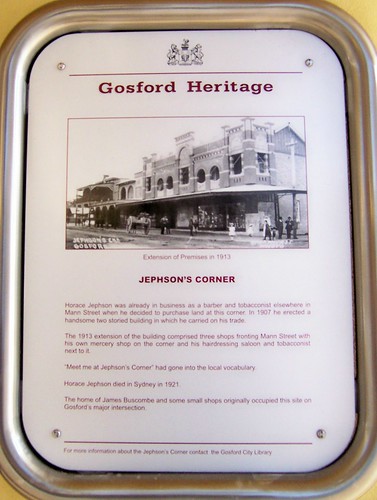
(Click photo for text of plaque)
In 1907 Horace Jepson bunged up a two storey brick building on the corner and in 1913 he added three shops on the Mann Street side. The style of the Mann Street frontage was Federation Free Classical (circa 1890 - c. 1915). In the black and white photo on the Heritage plaque it looks like brown or red brick with white trim.
The current building looks like Inter-War Functionalist (circa 1915 - c. 1940). That certainly fits the age of the materials. (And gives me some clues about several Woy Woy buildings too but that's a whole other post.)
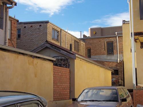
Round the back you can see three clear stages of building. The oldest part in brown brick with the flat arches (bricks laid vertically over a window or door), an Inter-War bit in beige brick and the addition on the right of the alley in reddish brick (just visible on the left).
From the street it looks like the 1907 and 1913 sections are completely gone but the flat arches on the brown brick section here at the back suggest a bit is still standing.
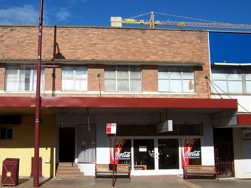
Included the Annousa Building and the tyre shop for the hell of it. Handily, this one has a date on it. 1949.
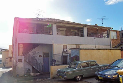
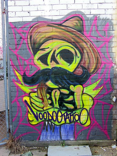
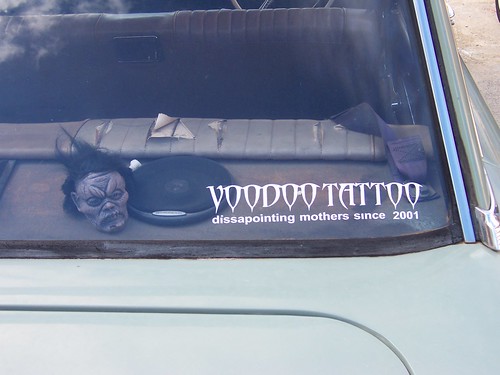
Voodoo Tattoo moved out at least a year ago but there's some of their painting on the wall out the back and I guess the car with a Voodoo Tattoo sticker on it parked out the back means the owner still lives over the shop.
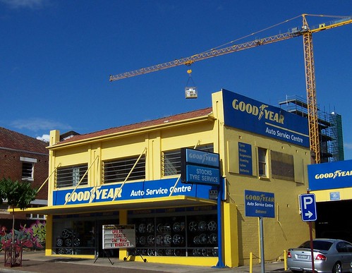
The tyre shop I can't date with certainty but I'm getting an Inter-War Art Deco vibe (circa 1915 - circa 1940).
It's nippy again now but it was lovely out in the sun today. Rain's forecast for tomorrow but most of the time the forecast's wrong. Probably it'll be another sunny warm winter day.
The trouble with air-conditioned buses is that when a bloke who smells like a rancid badger gets on, there's no getting away from the whiff. This guy smelt like he'd been drinking since April and sleeping on a compost heap.
Weather was good though. Sunny and warm. Bugger all breeze. Lovely walkies day. I wandered about pretty much at random for a bit then got down to the business of photographing a building that might be demolished soon.
Jephson's Corner is nearly empty and that usually spells a change in fortunes for a commercial building. Might be renovated, might be knocked down. As you can see it's not in a bad way. I couldn't find any real structural damage or decay on the outside, back or front.
The only damage I could see was superficial. A broken window, the usual chips and knocks of half a century's wear and tear.
It's empty except the curry shop on the corner and the milkbar that looks deserted but claims to be open.
(Click photo for text of plaque)
In 1907 Horace Jepson bunged up a two storey brick building on the corner and in 1913 he added three shops on the Mann Street side. The style of the Mann Street frontage was Federation Free Classical (circa 1890 - c. 1915). In the black and white photo on the Heritage plaque it looks like brown or red brick with white trim.
The current building looks like Inter-War Functionalist (circa 1915 - c. 1940). That certainly fits the age of the materials. (And gives me some clues about several Woy Woy buildings too but that's a whole other post.)
Round the back you can see three clear stages of building. The oldest part in brown brick with the flat arches (bricks laid vertically over a window or door), an Inter-War bit in beige brick and the addition on the right of the alley in reddish brick (just visible on the left).
From the street it looks like the 1907 and 1913 sections are completely gone but the flat arches on the brown brick section here at the back suggest a bit is still standing.
Included the Annousa Building and the tyre shop for the hell of it. Handily, this one has a date on it. 1949.
Voodoo Tattoo moved out at least a year ago but there's some of their painting on the wall out the back and I guess the car with a Voodoo Tattoo sticker on it parked out the back means the owner still lives over the shop.
The tyre shop I can't date with certainty but I'm getting an Inter-War Art Deco vibe (circa 1915 - circa 1940).
It's nippy again now but it was lovely out in the sun today. Rain's forecast for tomorrow but most of the time the forecast's wrong. Probably it'll be another sunny warm winter day.
Subscribe to:
Posts (Atom)