Wet and wild day today. The wind's howling through a crack in my window and twigs are raining down on the roof. It was raining when I woke up and it might rain again. Lovely day for a hot cuppa in a warm living room. Lucky for you I've got some forgotten photos from a sunny weekend last month.
Went up the Mountain last September, a few weeks before I finished walking Woy Woy. I was using a different camera then, a much dropped instamatic, and it was a different season. A couple of the photos from this lot today were taken from the same spot as September's. It was a hot day and I was buggered. Couldn't find the track to the lookout and gave up after a while. This time I found it.
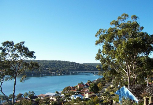
Rip Bridge with Daleys Point behind it, from the elbow of Bay View Crescent on the Mountain right above Blackwall Point. Orange Grove Road in the foreground.
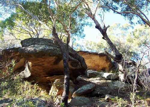
Rocks on Blackwall Mountain. Look at those beautiful golden colours on the undersides.
Go up to the elbow of Bay View Crescent. Just past it is a metal gate. Go round the rock on the right of the gate and follow the track. It's wide to begin with then narrows. Stick to the well-worn track. The lookout with the views is on the right off the narrow track when you're right up on the flat top of the Mountain. There's no fence or whatever at the lookout, just a flat rock shelf.
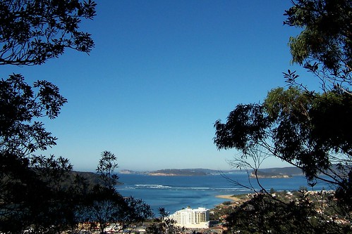
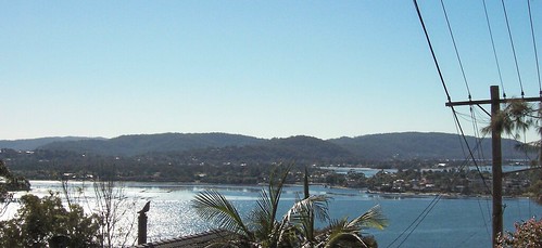
The Excrescence at Ettalong, the mouth of Broken Bay, Barrenjoey Head, Lion Island and Pittwater from the south-east side of the Mountain. The pointlessly large white building is The Excrescence (Outrigger Resort & the Memorial Club).
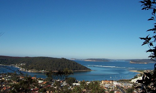
Wagstaffe, Ettalong (foreground), the sandbar, Barrenjoey Head, Lion Island and Pittwater from the lookout.
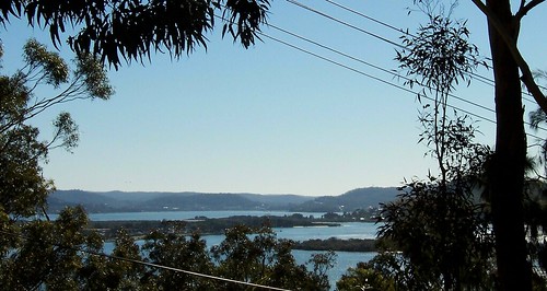
From the elbow of Bay View Crescent on the nor'-nor'-west side of the Mountain. Looking out over one of the unnamed islets, Blackwall foreshore park, Pelican Island and the tip of Saratoga (the hill of Saratoga's behind the tree on the right). Then across the width of Brisbane Water to Tascott and Point Clare and beyond to Somersby and Central Mangrove.
St Huberts Island and Rileys Island, the low ground between Saratoga's hill and Davistown's, Yattalunga and Green Point/Kincumba Mountain beyond and Gosford in the left distance.
Bloody YouTube is having a spack attack today so the video is coming tomorrow. I'm off to put the kettle on for a hot chocolate and a Scotch finger.
7 comments:
Just a quick question.
Do they surf on that sandbar. It looks like a superb spot?
Nah. They surf just round the corner past the sandbar at Ocean Beach/Umina Beach. Surf's not much chop but it's handy for the locals. McMasters up the coast a few minutes is good surfing.
That is a pointlessly large white building.
I enjoyed your photos, especially looking south down to Pittwater (where I am). Here's looking to you up north.
Here's looking at you down south. Hope you can't see The Excrescence from down there.
Why "pointlessly large"? As a business owner I am so glad the resort is now here, it has awakened the town and bought my business from the point of bankrupcy to a level where I can now support my little girls again. Get a clue before you critisice a community icon.
bought my business from the point of bankrupcy
That's nice for you, Anonymous. oesn't make the building any less unlovely.
Callisto that building is a hotel called the mantra - so it is not just 'a pointlessly large white building.' as you put it.
Post a Comment