Thursday, March 27, 2008

Manly & Muriel

(Random Sydney walkies)

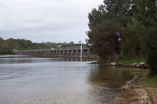
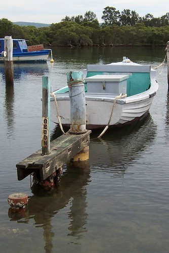
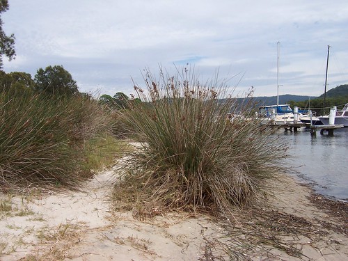
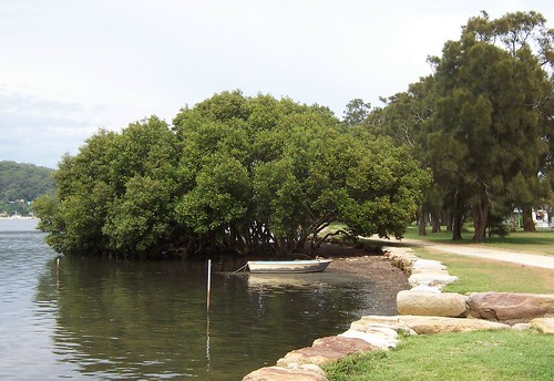
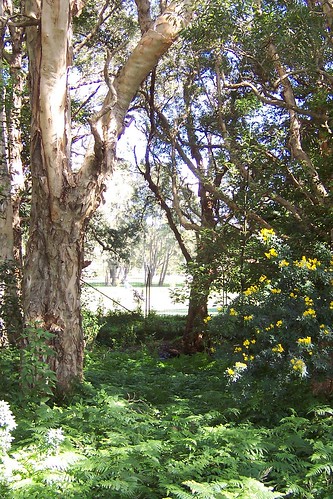
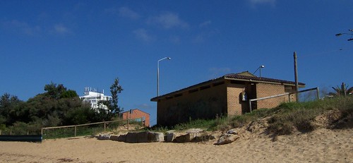
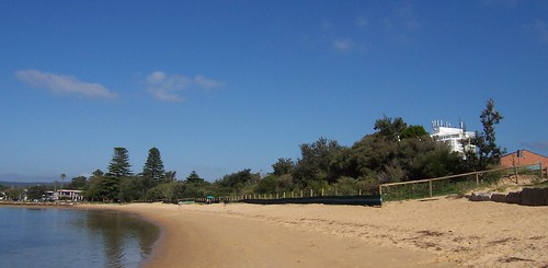
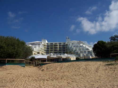
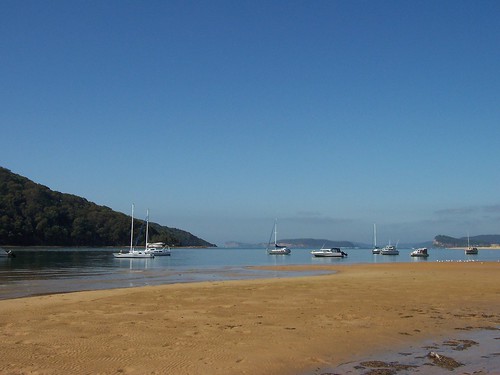
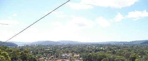
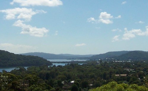
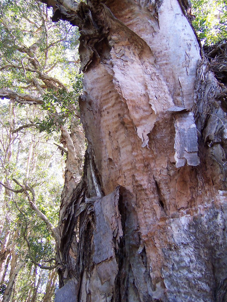
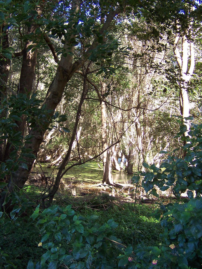
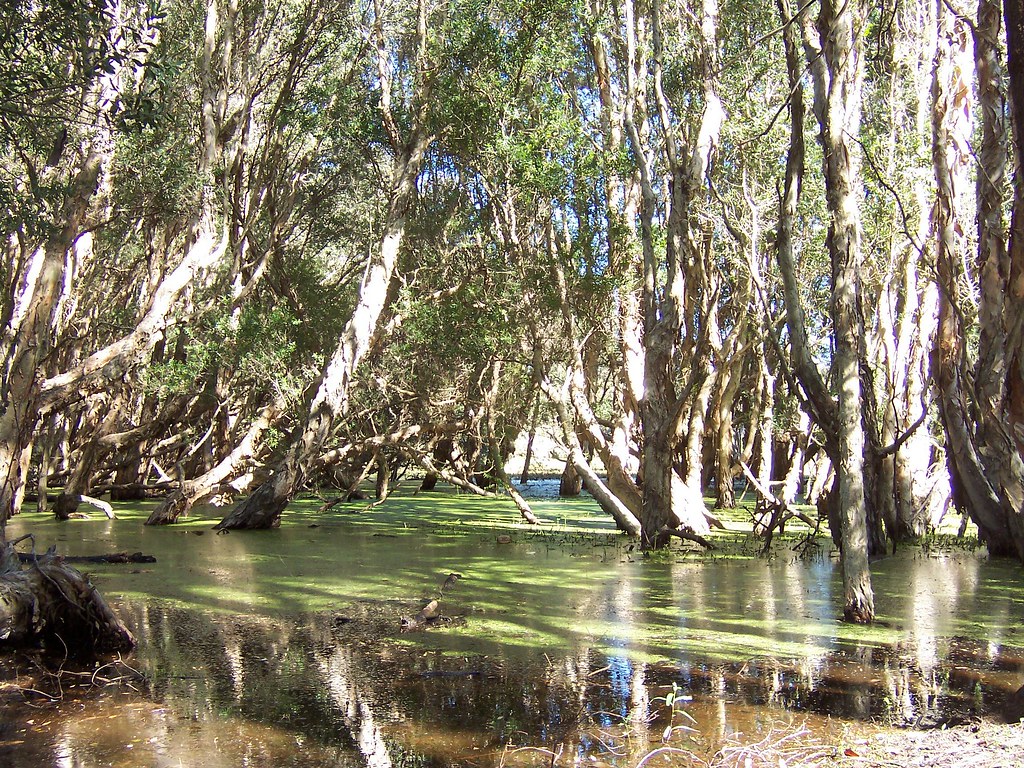
Up to my arse in work today. Took these at Easter just out the back of Manly Beach. Manly is the beach at North Head, which is at the mouth of Sydney Harbour. There used to be a Quarantine Station there. You can do a ghost tour.


Manly Weir

Went to a mate of a mate's birthday, ate an ear off of an Easter bilby, messed about in boats, and helped rescue the birthday boy when he got drunk and fell in. A good time was had by all.

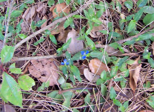
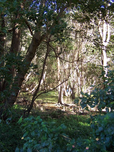
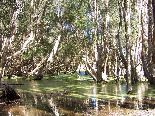
Lovely spot. There was hardly anyone around. It rained in the morning and the sky was still pretty black. We fossicked about in the bush on the shore and had a barbie and were only mildly eaten to death by the ants.


Manly Weir Manly

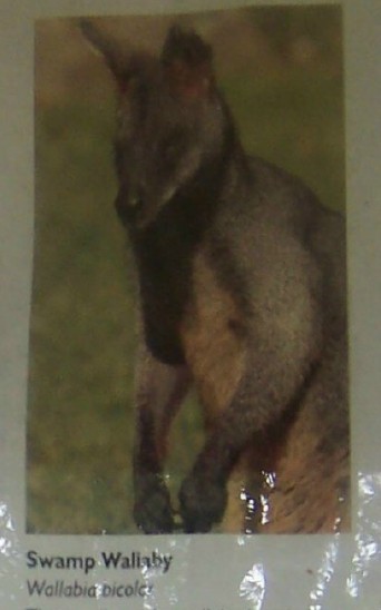
Swamp Wallaby (Wallabia bicolor)

"This small, stocky wallaby has dark brown fur, often with rusty patches on the belly, chest and base of the ears. It feeds on shrubs, grasses and ferns, Swamp Wallabies have been spotted at here in recent times."

"Body 66-85 cm, tail 64-86 cm." says Faunanet

For yer average non-biologist person, there's bugger-all difference between a wallaby and a roo except roos can get as tall as people and wallabies are short-arses.


Manly Weir Manly

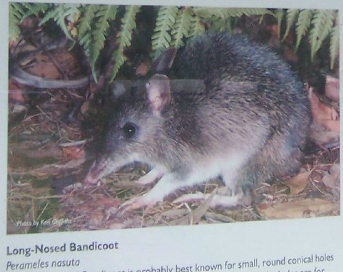
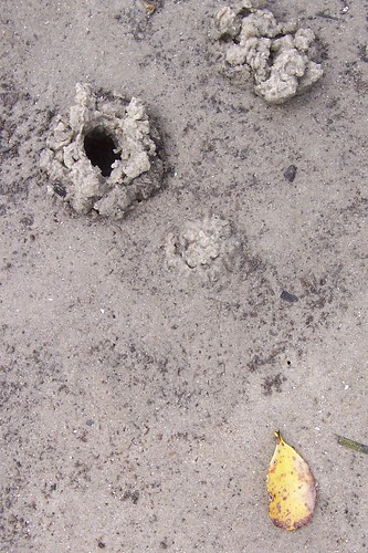
Long-Nosed Bandicoot (Perameles nasuta)

"The long-nosed Bandicoot is probably best known for small, round conical holes it leaves behind as it forages at night. Dug with the front feet, the holes are for the animal's long, sensitive snout to reach in and detect insects, small inverterbrate prey and succulent plant material.

Once common in Sydney, it now occurs in isolated populations in bushland areas to the south and north of Sydney, including Manly. The small colony at nearby North Head is classified as an 'endangered population'."


Manly Weir Manly

Short-Beaked Echidna (Tachyglossus aculeatus) (left) and Bush Rat (Rattus fuscipes)

Wee beasties native to the area.


Muriel

West Street Umina

Back to Woy Woy for this one, to West Street Umina to be exact. There's an empty shop on the corner near the brick church. Sacred Heart or something. The one that's due for demolition. Anyways. Shop's empty and there's these big murals left on the walls.

There's another one with a unicorn.


Time off for good behaviour

I am off for an unexpected holiday. And I bloody need it I can tell you. Comments and emails will go unanswered. I will be putting my feet up and resting my weary brian. And my weary brain.

See you in three weeks.

Tuesday, March 25, 2008

Sweat and boats

Arsed about this morning and never made it on a ferry walk. Not that it mattered in the end. The light was so bad all the view photos I was going to take would've been crap. So I walked round the foreshore a bit, got very hot and sticky and came home early. Hope that bloody storm shows tonight.


Woy Woy Channel Woy Woy

Platform boat in Woy Woy Channel just behind the Bowls (Woy Woy Bowling Club). Is there some boaty type reading who can tell us if this is purely for fishing in calm channels or what?


Woy Woy Channel Woy Woy

The jetty you have when you're not having a jetty. There were a good dozen like this, in a crowded spot near the Bowls.


Woy Woy Channel Woy Woy

Don't know if this reedy plant is native to the area but it grows here and there along the channels and creeks of Woy Woy and Brisbane Water. Whatcha think, Erica?


Woy Woy Channel Woy Woy

Crabs. Crab holes anyways. I think they only come out at dawn or at night. Never seen them during the day.


Woy Woy Channel Woy Woy

Is this your sunken treasure? Looks like a nice old wooden boat.

It too is just behind the Bowls in the Woy Woy Channel.


Woy Woy Channel Woy Woy

Ah, the old dingy and mangroves photo. How do I love thee? Let me count the ways.

This one's on the foreshore between Brick Wharf and Blackwall Mountain.

Notice the nice pines on the right. They make a beautiful soft rushing sound in the wind.


Tell you what, it's getting bloody dark now at 3.40. Hope it pisses--Yep, it's pissing down. Smells great.

Thursday, March 20, 2008

The Easter Wombat

No walkies today. I am not feeling terribly sprightly. Nothing major.


Easter Wombat

Easter this year has been out-sourced and will be brought to you by the Easter Wombat and his long-time companion the Easter Koala.

Russell's Burrow and other wombat sites list three species of wombat, the Common Wombat, the Southern Hairy Nosed Wombat and the Northern Hairy Nosed Wombat. But every true Straylyan knows there's a fourth species: the Fat Arsed Wombat.

Happy Easter, peeps. May you burrow deep and find many tender leaves!

Tuesday, March 18, 2008

Paperbark Forest

(Random walkies in Woy Woy)

The Paperbark Forest is one of my favourite spots on the Peninsula. It's official name is the Everglades Lagoon Wetland, because it's next to the Everglades golf course.

The area of Woy Woy South the forest and the golf course are in was pretty boggy and swampy before it was developed for housing and golf. The streets on the northern side of the golf course are named Florida Avenue, Miami Avenue and Everglades Crescent, the street trees are paperbarks and the lanes behind the houses are ditches instead of the usual drive-able lanes.


Everglades Lagoon Wetland Kerrawah Blvd Woy Woy
Bigger, bushier

Strange red flowers on a large bush on the edge of the forest.


Everglades Lagoon Wetland Kerrawah Blvd Woy Woy
Bigger

The golf course visible through the thin end of the forest. It was a warm clear day and the golfers were puttering about happily and stopping for a yack in the shade of the trees.

The trees on the golf course are mainly paperbarks and banksias, plus some pines up the Veron Road end.


Paperbark Forest Kerrawah Blvd Woy Woy
Bigger

Yellow whatsit bush. Broom, I think someone said last week.


Paperbark Forest Kerrawah Blvd Woy Woy
Bigger

Wee blue flowers on the forest floor. Don't think they're native.


Paperbark Forest Kerrawah Blvd Woy Woy
Bigger

Sheets of paperbark bark slowly peel from the trees, hanging down all through the forest.


Paperbark Forest Kerrawah Blvd Woy Woy
Bigger

The bark is layers and layers of sheets as thin as onion skin with string strips between them.


Paperbark Forest Kerrawah Blvd Woy Woy
Bigger

Into the forest, with the glint of the lagoon visible through the trees.


Paperbark Forest Kerrawah Blvd Woy Woy
Bigger

The lagoon after La Nina's rain. Still and silent, but teeming with life. A lovely green jewel in a tiny hidden forest.

Other than the occasional cry of victory or despair from the golf course, it's quiet and still and only the sound of a bird slowly wading and the breeze in the crowns of the trees can be heard.

Paperbark Forest in 2005


Sydney & Kormoran found

Australia's great wartime mystery solved. The wrecks of the German warship Kormoran and HMAS Sydney have been found at last, off the coast of Western Australia. It's been 66 years snce all those boys, ours and theirs, were lost.

Kormoran on Wiki (Deutsch)

Sydney on Wiki

HMAS Sydney II and the Kormoran

HMAS Sydney website

SMH Faces of the lost found at last - SMH slideshow of the men who went down on her*

Video

Remembering life on board HMAS Sydney II

HMAS Sydney piped home in Geraldton

Historic protection for HMAS Sydney, Kormoran


* Who were aboard her when she sunk! What filthy minds you buggers have.

Thursday, March 13, 2008

Loos with a view

(Random walkies in Woy Woy)

The bulldozer returneth. The local rag reports that bulldozing of the dune vegetation at Ettalong is going ahead after all. The vegetation is right in front of The Excrescence and when it's gone it will push up the price on those rooms they're always trying to flog on their middle floors. (The Excresence is the over-sized white building below).


Loos & dunes Ettalong Beach

I am bloody annoyed about the dunes being menaced. However, the bulldozer may do its worst on this fugly block of seventies toilets at the end of the dunes. They are used by no-one by the drunk and the desperate.

Locals, the loos are at the end of Picnic Parade, down beside the pub and barely 5 yards from this lovely bungalow.


Vegetated dunes at Ettalong Beach

The vegetation causing all the angst.

The white blob on the right behind the dunes is The Excrescence. Its view is partly obscured by the vegetation. The red brick building is in fact the purple and orange motel on The Esplanade. Its view is almost entirely blocked by the vegetation.


Dune vegetation Ettalong Beach

Native plants holding the sand down and stopping it from being blown into the streets and buildings behind.

The clump of trees on the left are tea trees. I love tea trees. They're twisty and they've got beautiful rough silvery bark and tiny waxy flowers and can take a shitload of wind and salt air.


The Excrescence as seen from Ettalong Beach

The Excrescence as seen from Ettalong Beach.

The top half of the bastard has water views, the cafe, bar, etc doesn't. Hence the desire to rip out the dune vegetation and build "viewing platforms". The vegetation growing on the dunes prevents the beach sand from constantly being blown up into Ettalong's main streets (just behind the Excrescence), the "viewing platforms" most likely will not.


Low tide at Ettalong Beach

The desired view.

Wagstaffe coming in from the left in the middle distance, to its right is a distance cliff, which I'm assured is Manly. To the right of Manly is Barrenjoey Head, then Pittwater to its right then Lion Island.

It was low tide and the sand was pitted with tiny crab holes. The sea gulls were lined up along the edge of the water (right edge of photo). Don't know what they were waiting for. Don't know much about seagulls, except they shit on everything and steal your chips. Other than that, they're orright.

Tuesday, March 11, 2008

Zoom with a view

(Random walkies in Woy Woy)

Been bloody tired the last couple of weeks. That blasted lethargy thing again. Feeling a bit perkier today so I went up a hill to re-photograph some views I snapped on another sunny day in 2005 and in 2006 when it was pissing down raining and the views were soft and misty.


Woy Woy Peninsula & Brisbane Water from Timbertop Drive Woy Woy
Embiggen

The Peninsula dozing under the warm autumn sun.

Phegans Bay & Brisbane Water in the distance on the left. Stretching across on the right to Kincumba Mountain and, in front of it, a dark corner of Blackwall Mountain.

Map


Phegans Bay & Brisbane Water from Timbertop Drive Woy Woy

Phegans Bay & Brisbane Water.

Left to right: Phegans Bay. To the right of it is what looks like Rumbalara Reserve which is the hill the east side of Gosford. The furtherest hill has got to be up around Wyoming or Lisarow. Could be The Ridgeway. On the right edge of the picture is Saratoga and behind it is the flattish top of Kincumba Mountain.


Knobs

Giant cactus budding in someone's backyard. The flowers looked like they're going to come out pink. The huge one in Ettalong has pale yellow flowers.


Golden dildo hakea

Here's one for yer, Device dear. Golden dildo hakea. Might actually be called giant candle.


Linkage

Australian Flora Online - one of them database thingies.


Sing along

Can't get that blasted song off the HugePuddle ad out of my head.

From Wiki
"The song "I've Been Everywhere" was written by Geoff Mack in 1959 and made popular by the singer Lucky Starr in 1962.

It listed Australian towns. It was later adapted for North American (primarily United States) place names and by John Hore (later known as John Grenell) with New Zealand place names (1966).

The song was a number 1 hit in Country Music in November 1962 in the United States for the recording artist Hank Snow. The song was also recorded by : Lynn Anderson (USA 1970); Asleep At The Wheel (USA 1973); Johnny Cash (USA 1996); the Countdown Singers; Chip Dockery; Ted Egan; the "Farrelly Brothers" from the television series The Aunty Jack Show (Australia 1974 (parody)); John Grenell (NZ 1966); Mike Ford (Canada, 2005); Rolf Harris (UK 1963); Clifton Jansky; Willie Nelson; and The Statler Brothers."


Straylyan version:

(Pommy readers should remember the U in Tullamore, Muckadilla, etc is not as in took and mook but as is smut and fuck.)

Verse 1
Tullamore, Seymour, Lismore, Mooloolaba, Nambour, Maroochydore, Kilmore, Murwillumbah, Birdsville, Emmaville, Wallaville, Cunnamulla, Condamine, Strathpine, Proserpine, Ulladulla, Darwin, Gin Gin, Deniliquin, Muckadilla, Wallumbilla, Boggabilla, Kumbarilla

Verse 2
Moree, Taree, Jerilderie, Bambaroo, Toowoomba, Gunnedah, Caringbah, Woolloomooloo, Dalveen, Tamborine, Engadine, Jindabyne, Lithgow, Casino, Brigalow, Narromine, Megalong, Wyong, Tuggeranong, Wanganella, Morella, Augathella, Brindabella

Verse 3
Wollongong, Geelong, Kurrajong, Mullumbimby, Mittagong, Molong, Grong Grong, Goondiwindi, Yarra Yarra, Bouindarra, Wallangarra, Turramurra, Boggabri, Gundagai, Narrabri, Tibooburra, Gulgong, Adelong, Billabong, Cabramatta, Parramatta, Wangaratta, Coolangatta

Verse 4
Ettalong, Dandenong, Woodenbong, Ballarat, Canberra, Milperra, Unanderra, Captains Flat, Cloncurry, River Murray, Kurri Kurri, Girraween, Terrigal, Stockinbingal, Collaroy, Narrabeen, Bendigo, Dorrigo, Bangalow, Indooroopilly, Kirribilli, Yeerongpilly, Wollondilly


Kiwi version:

The New Zealand version starts: Well I was hitching a ride on a winding Hokitika road, when along came a lorry....

First verse
Kaparoa, Whangaroa, Akaroa, Motueka, Taramoa, Benmore, Pongaroa, Horoeka, Rimutaka, Te Karaka, Whangarei, Nuhaka, Waimahaka, Motuhura, Waikaka, Motonui, Hokonui, Papanui, Wainui, Matawai, Rongotai, Pikowai

Second verse
Woodville, Dargaville, Lumsden, Katikati, Naseby, Cambridge, Porirua, Mararoa, Hastings, Tikitiki, Tauranga, Auckland, Naenae, Waitaha, Hamilton, Poroporo, Taupo, Timaru, Oamaru, Tihoi, Awanui, Wanganui, Pauanui

Third verse
Featherston, Palmerston, Woolston, Te Awamutu, Riverton, Queenstown, Picton, Ohinemutu, Morere, Korere, Rotorua, Kaikoura, Matamata, Ruakura, Ikamatua, Papakura, Waitaki, Pukaki, Taranaki, Te Kauwhata, Ropata, Ikowai, Waitemata

Fourth verse
Ruatoki, Matahura, Taupiri, Maketu, Kyeburn, Sowburn, Wedderburn, Mossburn, Washdyke, Arawhata, Paparoa, Kaponga, Teraha, Thames, Kerikeri, Kokoma, Tapanui, Porinui, Tawanui, Otahuhu, Ruatapu, Mosgiel, Whareroa

Fifth verse
Kapiti, Ngawaka, Onepu, Reporoa, Tongariro, Tomoana, Renwick, Papamoa, Karitane, Oxford, Parihaka, Karetu, Coalgate, Whitecliffs, Urenui, Mamaku, Waimea, Waharoa, Dannevirke, Ngahere, Gordonton, Kingston, Oban


Map with the Straylyan towns marked at Wiki

MP3 of the Straylyan version

Thursday, March 06, 2008

Fagans Bay

Nameless Cove in Fagans Bay on Brisbane Water

Fagans Bay is a small bay up near Gosford, one of Brisbane Water's many bays. It's a bit of a forgotten place. Even some of the people who live around it don't know what it's called.

This photo shows a small cove in Fagans Bay. The bay is fringed with mangroves and has a mangrove islet within it. It's a haven for ducks and lovely to walk round.

Woy Woy to Gosford Cycleway

Only dog walkers and cyclists really notice it as they go along the cycleway. You can't really see it from the road, except on the Pacific Highway overpass next to the footy stadium.


Fagans Bay

I've walked round it but never mapped it and I know how much you buggers are liking the maps, so here it is.


Fagans Bay & Phegans Bay

Fagans Bay is the banana-shaped bay at the top with the two red dots.
Phegans Bay is down the bottom left with one red dot. It is the home of the lovely pink house Minerva.


Red Cow Inn

A few hundred yards from Fagans Bay is Fagan's pub, the old Red Cow Inn. Peter Fagan owned it and Henry Kendall hung out there.


Narara Creek West Gosford


Narara Creek goes under Henry Kendall Bridge/the Pacific Highway and on into Fagans Bay. Just round that corner and yer in the bay. The kayaker, on the left, will be there in a minute.


Fagans Bay

He can paddle around amid the ducks on the calm waters of Fagans Bay or venture out into Brisbane Water and paddle down towards Woy Woy.


Sorry and Sydney history

A snippet of info about the start of Sydney.

In 1788 the First Fleet and its load of English convicts and marines arrived.

It was summer and there were plenty of fish in the harbour. The Eora, the Aboriginal people of Sydney Cove, shared their catch with the funny-looking strangers.

Then winter came and the fish stock was low, as usual. The strangers hadn't left and they were taking all the fish.

The Eora took some of the fish away from the strangers. The strangers came after them with their guns and also shot some kangaroos, which were an important source of winter meat for the Eora. The Eora took a goat, a sheep and a few lambs from the strangers' camp. The strangers came after them with their guns again.

Relations went downhill from there.

Tuesday, March 04, 2008

Peeks Point

(Gosford walkies #33, East Gosford)

My records say the last time I walked in Gosford was November 2006. Bollocks! More like November 2007.


View from Caroline Street Peeks Point
(Clicking leads to embiggening)

View from Caroline Street. Lovely clear day for photography today. Now that summer's over the rain has gone away.

Left to right: Rocky Point, Green Point/Kincumba Mountain behind it, Killcare in the distance, and Saratoga's Bayview Wharf area on the right.


Samuel Peek's Township at Brisbane Water

The sign reads:

"East Gosford
Samuel Peek's Township
at Brisbane Water

The population of Brisbane Water in 1828 was 99 [white people],
of whom 56 were assigned servants [convicts], with only 11
women living on the estates of 14 large landholders.
There was no urban development, no township
or village, no provision for young couples to buy
an allotment where they could build a cottage and
raise a family while practising an independent trade
There was no road, no bridge, no shop, baker
butcher or general store.

Samuel Peek was a Sydney businessman of many
interests and achievments. The population of the colony
had much increased since 1831 & he saw the need
for a township, and seized the opportunity offered.
He bought a vacant area of 500 acres of land at
Brisbane Waters and commissioned a proficient
surveyor to lay out a proper township with provision
for public amenities: Court House Churches,
Marketplace, and Pound.

The first allotment was offered for sale in Sydney on
13 February 1838.
The Census of 1841 informs us that already 178 people
lived at east Gosford:
95 men, 33 women, 50 children in 21 dwellings.

Sponsored by
EAST GOSFORD PROGRESS ASSOCIATION
ROTARY CLUB of EAST GOSFORD".

Bugger all remains to be seen of the original township. The houses there now are mostly 1940s and '70s with an occasional Federation cottage like this.


View from Caroline Street park Peeks Point
(Clicking leads to embiggening)

View from the park in Caroline Street.

Left to right: Ironbark Point (pair of yachts), Rocky Point, Green Point/Kincumba Mountain behind, Saratoga, and the water tank of Woy Woy Peninsula's Mount Ettalong on the right.

The water views were taken within an hour of each other and at pretty much the same angle from the sun, but check out how different the colour of the water is.


Ironbark Point from Russell Street Peeks Point
(Clicking leads to embiggening)

Looking across the water to Ironbark Point from Russell Street. Another quiet little bay in an estuary full of quiet little bays.


Red-tipped tree leaves
(Clicking leads to embiggening)

Red-tipped leaves on some sort of eucalyptus tree. Don't ask me what sort. I ain't no botanist.

Extra photo, didn't quite make the grade.