Showing posts with label Ettalong Beach. Show all posts

Saturday, July 17, 2010

Winter weather watch

(Random winter walkies)

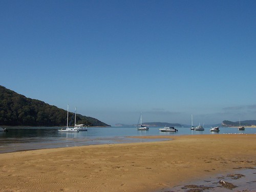
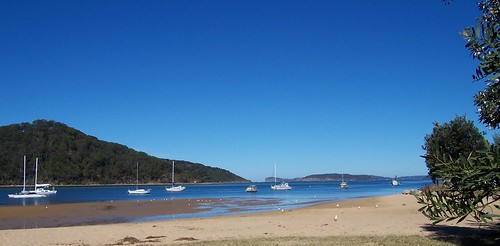
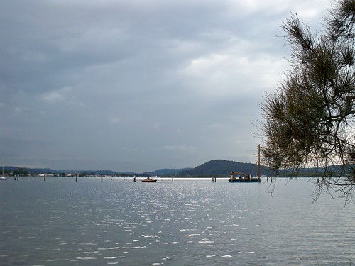
Winter sun on the water at Blackwall Point July 2010

Last week in Woy Woy.

Saratoga from Blackwall Point. Go down Blackwall Road from the railway station. When you get to the mountain, go left and left again at the carpark sign.


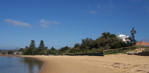
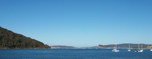
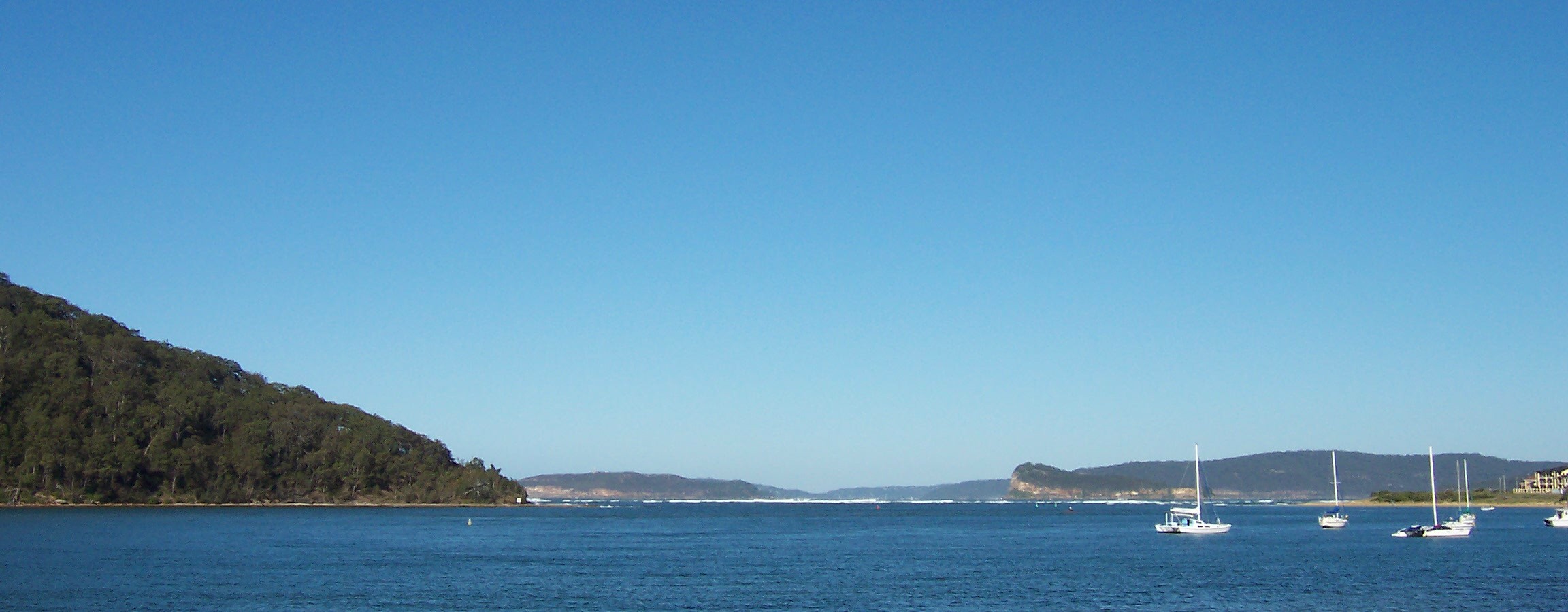
Winter at Ettalong Beach July 2010

This week in Woy Woy.

Barrenjoey Head and Lion Island from Ettalong Beach. Get the ferry from Palm Beach or go down Blackwall Road from the station then Memorial Avenue, straight ahead through the first roundabout, left at the second one (into Bourke Road) and park when you get to The Excresence.


I'd better piss off quick. Off to a nice sunny barbie. Will have a sausage sanger for yer.

Wednesday, September 23, 2009

Red dawn

(Dust storm over NSW)

Red dawn, dust storm 23rd September 2009

The view out my window at 6am this morning.

The dust was covering the coast from Woollongong to Newcastle (includes Sydney) at six. Few hours later it had reached Brisbane.

The airport was shut down and international flights were diverted to Melbourne. The ferries on Sydney Harbour were stopped. They move heaps of communters every morning but they couldn't see far enough not to prang into each other.

The local ferries were stopped due to the visibility plus the big winds. Sydney traffic was on a go-slow and traffic here was quieter than usual.

It was bloody spooky. Not to mention, bloody dusty.


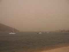
Dust storm from Ettalong, 23rd September 2009

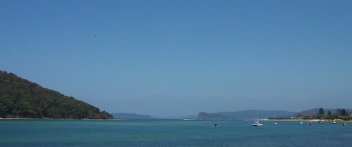
Taken from Ettalong Beach at lunchtime. Note the invisibility of Lion Island and Barrenjoey Head.

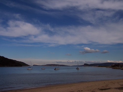
Dust storm from Ettalong, 23rd September 2009Messing about in boats at Ettalong Beach

Same view today (left) and any other day (right).


Dust storm photos from Sydney (Flickr)


From the Sydney Morning Herald:

"The fiery haze was the result of the sun hitting the blanket of dust, Bureau of Meteorology senior forecaster Jane Golding said.

"The reason for the dust is we had some really strong winds in the inland areas of NSW and in South Australia for a sustained period yesterday," she said.

"That's lifted a whole lot of dust off the ground because it's quite dry out there, many of those areas are still drought affected."

The lifted dust had been carried by the winds into Sydney.

"I've not seen anything like this before," Ms Golding said.

The reddish haze was expected to fade as the sun got higher in the sky, Ms Golding said. The haze had turned from a crimson red to orange by about 7am, and then faded to yellow by about 7.30am.

But it was not known what would happen to the dust."

Dust turns Sydney sky red (links to video & photos, including a really fabulous one of The Coathanger)


Central Coast Ferries (Woy Woy etc. ferries) said:

"Ferries cancelled until further notice due to low visibilty and poor conditions as a result of the gale force winds and dust storm. Call skippers on 0418631313 for info on resumption of services predicted for this arvo."

It's clear now so they might be back on but it's still bloody blowy.
Tuesday, August 12, 2008

To the beach

(Random walkies in Woy Woy)

Umina Beach

The sun was fucking glorious again today. Freezing morning then warm warm sun. Went to the beach and toasted myself in a sheltered spot, gazed at Barrenjoey Head and wondered what it would be like to live in a lighthouse.

These top two photos were taken last month just after a big rain. It was a lovely warm day and everyone was out about after being cooped up for a week of dark wet days.

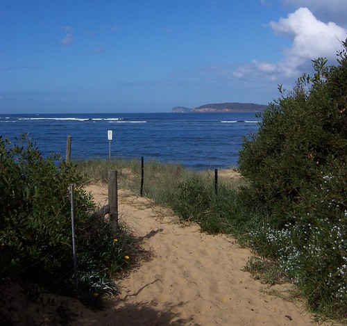
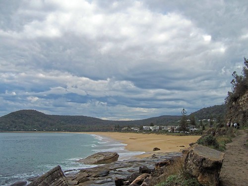
This one is the path to Umina Beach, down through the native bushes, the tea trees and the scrubby dune plants to the long beach stretching from the sandbar at Ettalong to the caravan park tucked into the fold of Mount Ettalong.


Umina Beach

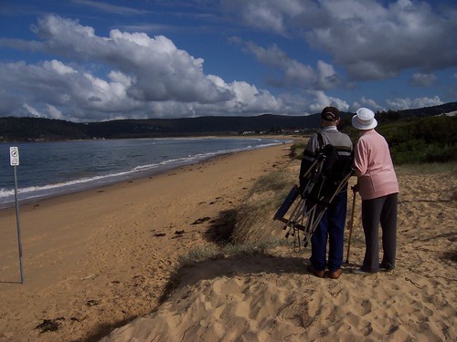
Dear Old Things examining the beach for a comfy spot to settle. Umina Beach.


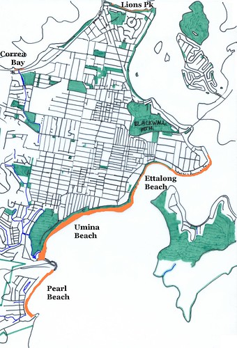
Beaches of the Woy Woy Peninsula

The orange bits are beaches.

Umina Beach and Pearl Beach get some surf, which comes in through the mouth of Broken Bay.

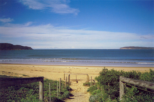
While we're on the beach theme, here's some old paths-to-beaches photos to extend the beach-y feel.


Out Through The Heads

Out through the heads. Looking from Umina Beach out through the mouth of Broken Bay, Box Head on the left, Barrenjoey Head on the right.

From the mouth of Broken Bay you go out into the Tasman Sea. Go straight ahead and you'll graze the top of New Zealand and end up in the South Pacific. Go left and you'll go up the coast of NSW (New South Wales) to Queensland and the Great Barrier Reef. Turn right and you'll go down the Central Coast to Sydney then down to Tassie (Tasmania) and eventually to the Antartic.


Pearl Beach from the Mount Ettalong track

Pearl Beach from the Mount Ettalong track. The track goes round the bottom of Mount Ettalong, along the bottom of the cliff. As you walk along you can see across to Box Head and Barrenjoey Head, and down into Pittwater where the Palm Beach ferry goes. You can also see the boulders that've falen off the cliff at random over the years.


Beach Steps

An old one, just because. High tide at Ettalong Beach. Steps down to the beach from Lance Webb Reserve, off Picnic Parade Ettalong.


Coming to a night sky near you

There's another lunar eclipse in a couple of days.

How to photograph a lunar eclipse

I'm off to me dinner. This post is so bloody late because I stopped to watch Time Team.

Saturday, August 09, 2008

Ettalong Beach

(Random walkies on the Woy Woy Peninsula)

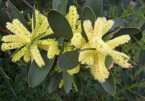
Golden Wattle at Ettalong Beach

Golden Wattle. Acacia is the proper name of the golden wattles. This one seems to be the Coastal Wattle AKA Acacia longifolia or A. sophorae and as you can see it's growing happily on the beach and the link below says "[g]rows in dunal, heath and sclerophyll communities including headlands" and "[d]istribution: Queensland to Victoria".

Species page at some govt site

Wattle wattle wattle - all my wattle photos at Flickr


Golden Wattle at Ettalong Beach

These photos were all taken just opposite the Excresence, that great white whale of a resort on the foreshore at Ettalong.


Lion Island & Ettalong Beach foreshore

Lion Island there in the distance, and on the right the Ettalong foreshore where the pines, drain and barbies are and where Mr Whippy dispenses icecreams of a weekend.

Barrenjoey Head & Lion Island from Ettalong Beach

Barrenjoey Head and Lion Island from Ettalong Beach.


Bustling Downtown Ettalong (Map)

Thursday, March 13, 2008

Loos with a view

(Random walkies in Woy Woy)

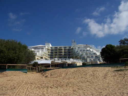
The bulldozer returneth. The local rag reports that bulldozing of the dune vegetation at Ettalong is going ahead after all. The vegetation is right in front of The Excrescence and when it's gone it will push up the price on those rooms they're always trying to flog on their middle floors. (The Excresence is the over-sized white building below).


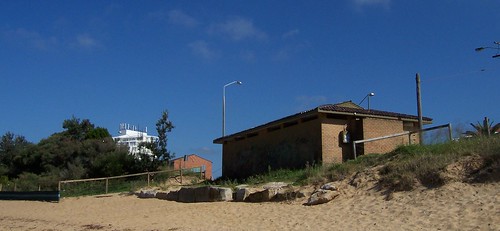
Loos & dunes Ettalong Beach

I am bloody annoyed about the dunes being menaced. However, the bulldozer may do its worst on this fugly block of seventies toilets at the end of the dunes. They are used by no-one by the drunk and the desperate.

Locals, the loos are at the end of Picnic Parade, down beside the pub and barely 5 yards from this lovely bungalow.


Vegetated dunes at Ettalong Beach

The vegetation causing all the angst.

The white blob on the right behind the dunes is The Excrescence. Its view is partly obscured by the vegetation. The red brick building is in fact the purple and orange motel on The Esplanade. Its view is almost entirely blocked by the vegetation.


Dune vegetation Ettalong Beach

Native plants holding the sand down and stopping it from being blown into the streets and buildings behind.

The clump of trees on the left are tea trees. I love tea trees. They're twisty and they've got beautiful rough silvery bark and tiny waxy flowers and can take a shitload of wind and salt air.


The Excrescence as seen from Ettalong Beach

The Excrescence as seen from Ettalong Beach.

The top half of the bastard has water views, the cafe, bar, etc doesn't. Hence the desire to rip out the dune vegetation and build "viewing platforms". The vegetation growing on the dunes prevents the beach sand from constantly being blown up into Ettalong's main streets (just behind the Excrescence), the "viewing platforms" most likely will not.


Low tide at Ettalong Beach

The desired view.

Wagstaffe coming in from the left in the middle distance, to its right is a distance cliff, which I'm assured is Manly. To the right of Manly is Barrenjoey Head, then Pittwater to its right then Lion Island.

It was low tide and the sand was pitted with tiny crab holes. The sea gulls were lined up along the edge of the water (right edge of photo). Don't know what they were waiting for. Don't know much about seagulls, except they shit on everything and steal your chips. Other than that, they're orright.

Friday, November 16, 2007

Jacaranda Avenue

Back on deck. Feeling like I've been slugged in an alley but that's the flu for yer. Managed to totter out for a walk this morning. Bloody hot day for it.


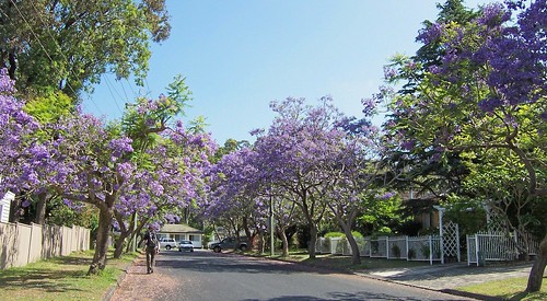
Naroo Road Umina

Naroo Road. Tiny street off Veron Road in Umina, near the High School. A favourite site at this time of year. Locals often refer to it as Jacaranda Avenue.

The jacarandas are still in flower all over the Peninsula. Love their soft trumpet-shaped flowers and their warm soft honey scent.


Lion Island from Ettalong Beach

Hot and hazy day on the Coast. That's just low cloud or leftover mist hanging over Sydney, not smog. Been foggy up and down the NSW coast for a few days.

Taken from Ettalong Beach, near the dunnies at the end of Picnic Parade.

Left to right: Wagstaffe (closeest), Barrenjoey Head (distant), Pittwater (most distant), Lion Island (right of centre), Commodore Heights in the Ku-ring-gai (behind the Lion), Ettalong Beach (closest) and Mt Ettalong (behind it).


Pop over and have a gander at this wee old house on Mullet Creek. A Umina resident has snapped it from the train.

Mullet Creek is an offshoot of the Hawkesbury River, which is one of the branches of Broken Bay. Woy Woy is in Brisbane Water and Brisbane Water is also part of Broken Bay. Mullet Creek is stoppered at its end by Dangar Island, which has electricity but only one car.

Rumour has it this house has no electricity nor running water. Dear God! It's rather pleasant though and is either a late example of Old Colonial Georgian (1788 - circa 1840) or Victorian Georgian (circa 1840 - c.1890). I plump for Victorian. The area wasn't built in until the 1860s from what I can gather.

To get home its residents would have to get off at tiny Wondabyne station("passengers for Wondabyne please inform the guard and alight from the rear door or the rear carriage") or row for 20 minutes from Brooklyn township.


Dangar Island map

Dangar Island is the red dot the arrow is pointing at. Mullet Creek is the wee offshoot of river rising vertically above it and half obscured by the name of Woy Woy.

Wednesday, October 10, 2007

Iron lace

(Freo)

Nose to the bloody grindstone again today and anyways, the light's crap for local photos. Overcast again but the forecast was for not a drop of rain to fall. Bastards.

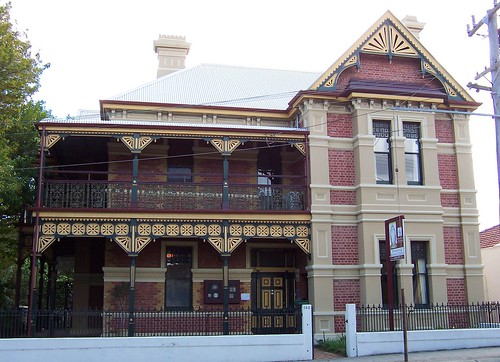
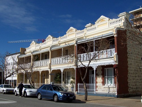
160 High Street Fremantle

Private house once, most likely, and I'm pretty sure it housed a clutch of doctors for a few decades. Some sort of yoga thingy now.

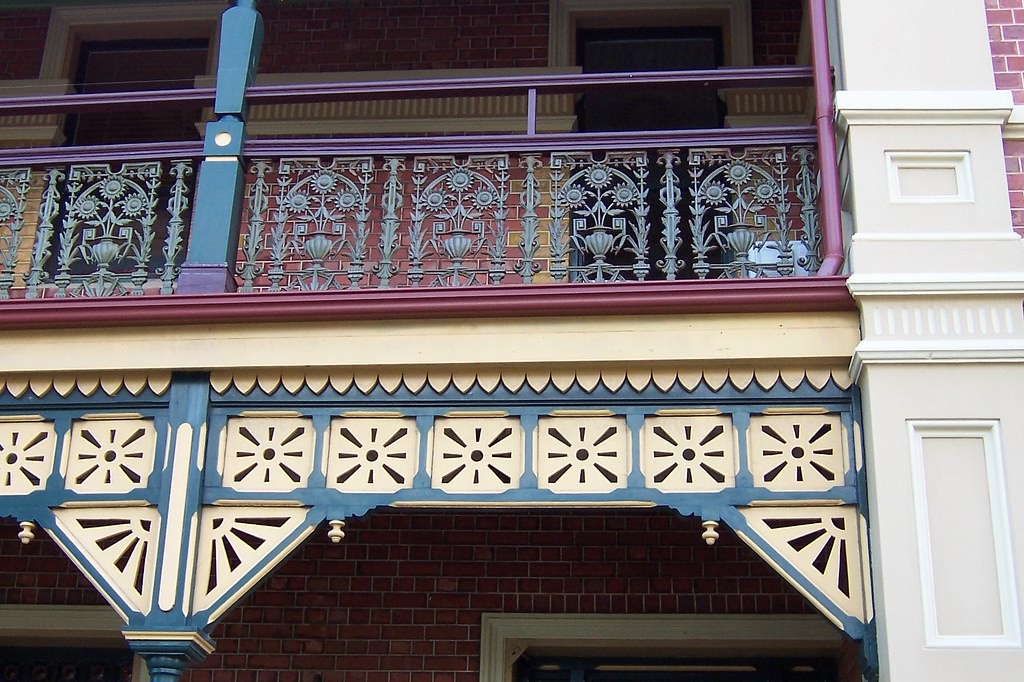
Victorian Filligree (circa 1840 - c. 1890) again. Very nice. Deep shady verandas as well. Just the thing for before the Freo Doctor* comes in.

160 High Street, corner of Ellen Street. Coupla blocks from Bustling Downtown Freo.


* Freo Doctor. Sea breeze that comes ashore in Fremantle early afternoon.


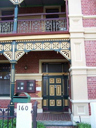
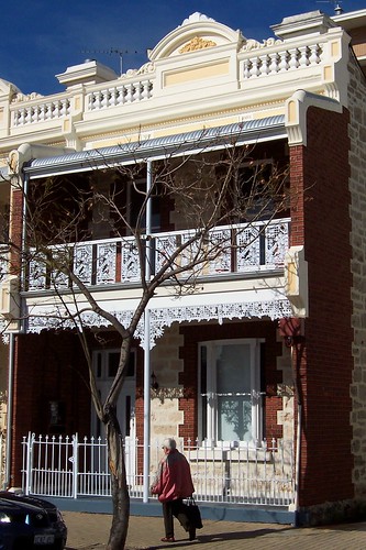
160 High Street Fremantle

Yer classic Freo red-and-white for the main colours of the building then the Federation (circa 1890 - c.1915) colours on the details.


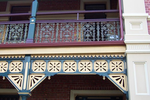
160 High Street Fremantle

There you go. Iron lace and a wooden valance. Don't say I don't spoil yer.

Embiggen it and tell me if you reckon those are sunflowers in the lace.


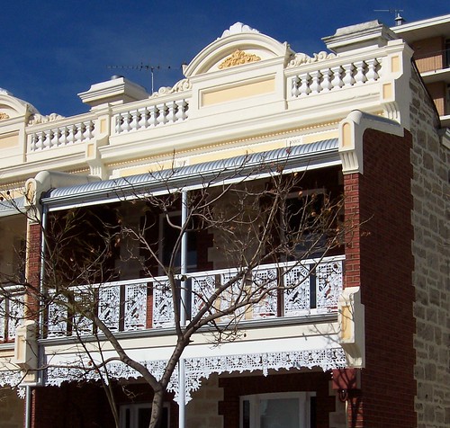
Point Street Fremantle

Point Street. Victorian Filligree (circa 1840 - c. 1890) this is. And in point of fact, this very row of terraces is in my Big Book of Australian Architecture as a classic example of the style. "Architect and [exact] date unknown" more's the pity.

And you see that blue car? I swear that's the same car parked in the photo in the book.


Point Street Fremantle

Look at that classic Victorian detail. All that missing is a couple of them urn thingies on the top there.


Point Street Fremantle
Embiggened version with clear detail

The lacy iron bits on the veranda and balcony are called, not surprisingly, iron lace. Well loved style then and now.

In the right top background you can see a wee snippet of the hideous highrise just a block away on Adelaide Street. I'll take a nice terrace over a highrise any day.


Water torture

Chained to yer desk today? Excellent photos of Ettalong Beach by Nelson at Flickr.

Wednesday, May 16, 2007

Ettalong

Overcast this morning, completely overcast. Won't need the camera, says I, I'll just be going walkies without it. And I don't need it because it's overcast all through my walkies. Then the minute I step back inside the bloody sky clears! It's a conspiracy I tell you, a bleeding conspiracy! What that's, nurse? Time for my medicine?

So anyways, these are from a completely sunny day a while back. Enjoy, while I have a soothing snack of Valium.

Barrenjoey Head & Lion Island from Ettalong Beach
(Embiggen)

Taken from Ettalong Beach near the Vietnam memorial.

That's Wagstaffe on the left and you can just see Half Tide Rocks off the right of it if you know what you're looking for (flat shelf of rock at water level).

Over on the left hand margin is the corner where Ettalong Beach ends and Ocean Beach starts. Those are flats and holiday rentals there on the very edge of the picture. The white line extending out to the left from that corner is the big sandbar, the last one the Palm Beach ferry has to avoid on its way back to Palm Beach.

In the distance you can see Barrenjoey Head, down into Pittwater, then Lion Island sticking up and Commodore Heights behind it.

Ettalong Beach
(Embiggen)

Showing Lobster Beach and Little Box Head with Wagstaffe out of frame to the left. In the right foreground there's a couple of banksias providing some shade for the seagulls when they get tired of pulling tiny crabs out of the sand.

You can't see Lion Island in this one, it's behind the trees. Behind the 2nd boat from the right you can see Barrenjoey Head.

Flathead Road Ettalong

I like these. I like fifties retro. They look well made as well. None of yer slapped up crap. And those wee huts at either side of the gate must hide the bins and stuff. Very neat.

That's Blackwall Mountain behind (hur hur). As mountains go it's more of yer small hill.