Tuesday, October 21, 2008

Sydney Opera House

Sydney Opera House

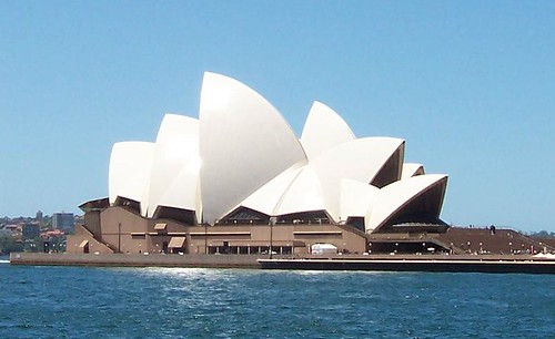
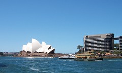
Sydney Opera House from Circular Quay (where the Sydney ferries go from).

It appears to float on the water but actually sits at the tip of Bennelong Point on Sydney Harbour. For those vainly scouring international atlases, Sydney Harbour is also known as Port Jackson.

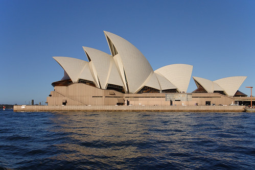
Our Opera House turned 35 on Sunday. Yep, the cool white pointy one on the Harbour. We love our Opera House as much as the tourists do.


House stats
(Bugger the stats, gimme the photos!)

* Planning started late 1940s

* Site chosen 1954

* Competition for design started 1955, got 233 from 32 countries

* 1957 Jørn Utzon's design announced as winner & Utzon arrives to supervise construction

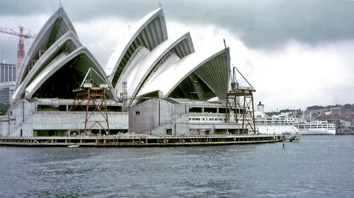
* Old tram depot on site demolished 1958, construction begins March 1959

* 1961 spat erupts about who designed construction method for roof ribs, Utzon eventually buggers off home (Denmark) in 1966

* Opened by the Queen in 1973, a mere 13 years late

* Final bill $102 million, only $95 million over budget

* Made a UNESCO World Heritage Site in 2007

* Used for all the usual purposes an opera house is used for: ballet, opera, musical theatre & sumo wrestling

* Roofs consist of 1,056,006 white and cream tiles, which have to be scrubbed every now and then by not as often as you'd think

* Held up by 588 concrete piers sunk up to 25 metres below sea level

* Power supply is equivalent to that needed for a town of 25,000 people and snakes about through 645 kilometres of electrical cable

* covers 1.8 hectares (4.5 acres) of land

* 183 metres (605 ft) long and about 120 metres (388 ft) wide at its widest point


The Coathanger & the House

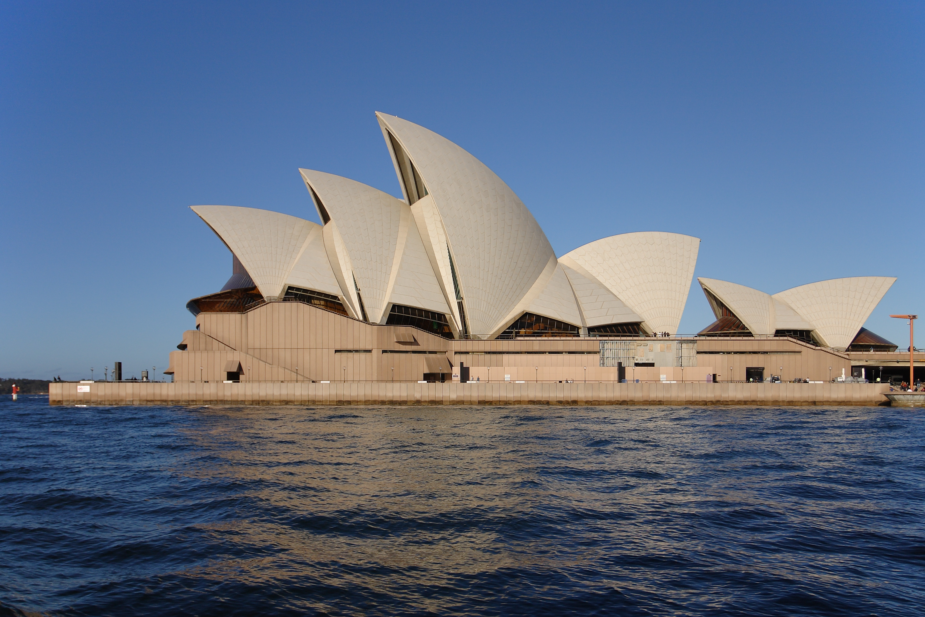
The Coathanger and the Opera House. Seen from Garden Island in 2006.

The House, couple of Sydney ferries & the Toast-Rack


Sydney Opera House
Wiki Creative Commons, high res photo, click for bigger


Sydney Opera House
Wiki Creative Commons, high res photo, click for bigger


Sydney Opera House under construction 1968
Wiki Creative Commons, high res photo, click for bigger


Sydney Opera House
Wiki Creative Commons, high res photo, click for bigger


For your reading pleasure

Sydney Opera House at Wiki

Official website

Opera House paperweights etc

Construction photos

Photos and Art

La Opera de Sídney o Sydney Opera House (Espanol, fotos)

Mitts off our Opera House, writes Paul Keating (former Prime Minister

The House on Flickr (all angles & sides)

The House on Google's logo


Just because

Beverly Hills Sydney Australia

Beverly Hills. In suburban southern Sydney.


In unrelated news

Women office-workers prefer computer to men (Dr* Spike recommends straight guys wash more often)


Stuff up unstuffed

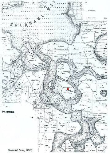
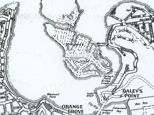
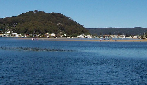
Michael's photos of Woy Woy & nearby are here not there. Only took me three goes to get it right!


Holiday

I'm snatching a holiday while it's snatchable. Back 3rd or 4th of November. Stick yer thingy in the slot for update email. (No bloody spam)


Enter your Email


Powered by FeedBlitz


Atom


Subscribe with Bloglines

Add to Google


* Doctorate found in cereal packet

Sunday, October 19, 2008

On the water

Only things and angles of things seen from the water are in this post.

The Rip Bridge Daleys Point end

The bridge nestled into a bit of bush at the Daleys Point end. The other end is at Booker Bay.

The Rip Bridge


Old wooden boat Hardys Bay

Old wooden boat in Hardys Bay. Is it me or does this boat have a certain ferry-ness about its lines?


St Huberts Island ramp St Huberts Island

Ramp to St Huberts Island. A very well-known feature of the landscape to locals but a sloping ramp to an island is probably not a common sight.

It's not as steep as it looks. A person with a 40-a-day habit could get up there without an ambulance.


1950s Empire Bay Drive Daleys Pt nr St H's ramp

From the road and other shores all you can really see of Daleys Point is all those balconied houses from the 1970s to now.

But nestled in among them, dozing in the sun, are little old houses bearing witness to the price of land on the waterfront just a few decades ago.


1950s & 40s Empire Bay Drive Daleys Pt nr St H's ramp

1950s and 1940s houses nestled down among the big balconied houses.


Merritts Wharf Rickard Road Empire Bay

Merritts Wharf, at the end of Rickard Road Empire Bay.

Meritts Wharf Estate 1912

The "Anniversary Day" referred to in that link is now called Australia Day


Rickard Road Empire Bay

Perched above Merrits Wharf on Rickard Road Empire Bay. You can see it in the photo above.

The style could be Federation Arts & Crafts and it could be Federation Queen Anne (both circa 1890 - c. 1915) but I think it's Victorian Rustic Gothic (circa 1840 - c. 1890) with its Rustic ripped off. The Rustic bits are generally wooden bargeboards and that rough-ish stone you can just see under all that ivy.

There are only a few houses I really fancy. This is one of them.


Clean forgot to blog yesterday. Got to bed at dawn. Still got that stunned mullet feeling today. Off to another barbie in a bit. Sunshine, bit of breeze, the scent of firelighters, beer and sausage sangers. Bliss.


Excellent photo

Ghost Ship by New Found Hero (Glen Holdaway) on Flickr. Clicking on the "go large" link is recommended.


Dear Old Games

Been thinking about death and old age recently, what with losing so many of my own oldies. My grandmothers were both in their nineties but my grandfathers died young and all around me are old men drinking themeselves into the grave. I'm fucked if I'll end up like that.

My Gran and Olive Riley were good Dear Old Role Models. I'm aiming for the way Gran and Olive did it and the way the Masters Games crowd are doing it.

On the telly last week there was a thing about some bloke of around 70 who rode 50 kays to get to the start line and then won his race then entered another. Can't find the bloody link but I remember he planned to ride home after. Bugger me, that's fit.


Aussie Aussie Aussie

Posted a couple of weeks back about the Woy Woy local at the Beijing Paralympics and missed a perfect opportunity to start a chant:

Aussie Aussie Aussie! Woy Woy Woy!

Bewildered Americans click here

Monday, October 13, 2008

Hardys Bay

(Hardys Bay walkies #4)

Bustling Downtown Hardys Bay

Bustling Downtown Hardys Bay

View down Killcare Road to the waterfront near the ferry wharf, across Hardys Bay to The Rip Bridge. Look at the colour of that water.

It's yonks since I walked at Hardys. More than a year in fact.

To get to Hardys you can go via Empire Bay Drive and Wards Hill Road, or you can get the Codock ferry from Woy Woy Wharf during the school holidays. Get off at Hardys. (Map)


Bustling Downtown Hardys Bay from Heath Road Hardys Bay

Bustling Downtown Hardys Bay from Heath Road Hardys Bay

That long jetty you can see is the public wharf and the marina. The ferry pulls in there (after waiting patiently for fishing lines to be shifted), there's a concrete boat and a crowd of yachts tied up along it.

At the shore end there's a public loo and a couple of nice shady trees, a bus-stop, 3 cafes, a real estate, a gallery, and a bottle-shop with icecreams, newspapers and milk.


Hardys Bay from Araluen Drive Hardys Bay

Hardys Bay from Araluen Drive Hardys Bay

A quiet sunny day on the foreshore. You wouldn't be dead for quids.


Sulphur-Crested Cockatoo at Hardys Bay

Sulphur-Crested Cockatoo at Hardys Bay

Local resident enjoys morning tea. No idea what he was eating but he was clearly enjoying it.

Wooden boats in Hardys from another post last year.

I'm buggered. Had a rowdy weekend and it's bloody ten thirty already. Shit, I've missed half of Shameless.

Saturday, October 11, 2008

Rileys Island

Rileys Island in Brisbane Water NSW Central Coast
Clicking leads to bigger photos

South-eastern side of Rileys Island

Rileys was once inhabited by a single family. The Rileys. They bought it in 1855 and built a house there and an oyster farm nearby. The house is long gone. Rileys is now a nature reserve and home to various birds and beasts and plants. The family still lives in the area.


Ferries map
(The ferries crowd won't mind me nicking their map, I link them often enough)

Rileys Island is the green one just above St Huberts, the one with all the blasted canals.

Can't find it? Map with Rileys marked and another one.

There's not a lot of aerial views of Rileys. This one of St Huberts & most of Rileys looks like the best. You can clearly see the mangroves and the schlerophyll forest bits.


St Huberts Narrows between St Huberts & Rileys Islands

St Huberts Narrows between St Huberts (left) & Rileys Islands

A ferry will fit through there, as the ferries map above shows in a dotted line.


St Hubert's Island map 1901
1901, St Huberts marked with red dot, Rileys above it

Rileys is not the only uninhabited island in Brisbane Water. All up, there's nearly a dozen islands and islets. Only St Huberts is inhabited by humans. Some of the islets are so tiny they are in danger of being washed away with the king tides.

The islands are pretty stable. They are Pelican Island, St Huberts Island (inhabited) and Rileys Island. You can see in the old maps they've changed shape a bit over time but there till there.


Rileys Stats

* Sold in 1855 as Shell Island to John Riley for 140 pounds, 17 shillings & sixpence

* 45 hectares in area (0.17 square miles in American)

* A ship called the Maggie Riley built there in 1878

* Two or three other ships built there in the 1860s

* The Riley family's oyster farm had "large slabs of flat ashlar stone...[stood] upright in the shallows near Riley's Bay"

* They also had "a few cattle [and] a banana plantation, using seaweed for fertiliser", on the island (History of Woy Woy)

* The island was made into a park June 1989

* Its flora (plants & trees) is mangrove swamp round the edges and dry schlerophyll forest in the middle

* The mangroves are Avicennia marina (Grey Mangrove) and Aegiceras corniculatum (River Mangrove)

* Before before us whitefellas came, the food available on and near Rileys was stuff like "shellfish, fruit, tubers, insect larvae, snakes, lizards and small animals...and speared fish with multi-pronged fish spears tipped with fish teeth or bones...Shellfish middens were so large that they were later excavated for a local lime burning industry that supplied lime for building works in Sydney." (Historical info on the Illoura Walk at Davistown)

Map showing main area of mangroves & adjacent oyster farms


St Hubert's & Riley's Islands

St Hubert's & Riley's Islands

Check out the bridge sketched in between St Huberts (lower) and Rileys (cut off island). They were gonna canal Rileys as well as Huberts.

"During the 1960s efforts were made by Hooker-Rex Estates to develop canal subdivisions on both Riley’s Island and the adjoining St. Hubert’s Island. The latter island was eventually developed for residential use in the early 1970s, but a major environmental battle was waged to preserve Riley’s Island. This was ultimately successful, and Riley’s Island is now a sanctuary supporting a wide variety of fish and bird life." (History of Davistown includes 1854 map)


Rileys Island from the creek under Morton Crescent Davistown
Rileys Island from Morton Crescent Davistown


St Huberts & Rileys Islands from Blackwall Mountain

St Huberts & Rileys Islands from Blackwall Mountain

The reason I haven't shown you a photo of the whole of Rileys is the bastard is so hard to photograph. Even when you get a clear shot at it, the bastard melts into the background. It's not much easier to see with the naked eyeball. You gotta know what you're looking for.

Anyways, it's a bloody lovely bit of nature and I'm glad it wasn't canal'd and built on.

Tuesday, October 07, 2008

Clear blue sky

(Random ferry rides)

I am buggered so very few words today. But after a long weekend of wind and storms and rain, the pictures speak for themselves.

Brisbane Water

Gone fishing. Off Woy Woy.


Sandbar on Brisbane Water

Wading on the sandbar off Ettalong.

(Both photos have low res at larger size. Click on them to get to it.)


Bits & bobs

Umina bloke gets medal for rescue

Ghost Plane - always put the handbrake on, people!

Tourist's review of The Excrescence & some beach photos

The Excrescence

Saturday, October 04, 2008

Iconic

(Random Woy Woy walkies)

Shocking walkies and photo weather so far this long weekend. Here's some I took last week.

Cabbage Tree Palm

Cabbage Tree Palms at Woy Woy Station. Proper name Livistona Australis.

Iconic local tree. Grows in the under-storey (under the trees) in local bush and pushes up to the canopy as it grows. Also grows in backyards and in carparks and on roundabouts on the F3.


Cabbage Tree Palm leaves

Close-up of the Cabbage Tree Palm. Note the fan-shape of the fronds.

Early whitefellas in Australia made Cabbage Tree hats.

Food Standards Australia New Zealand says the heart of it is edible but doesn't say how to cook it.

Picture of teenage Cabbage Tree Palm


Bottlebrush

Bottlebrush. Iconic Australian flower. At the top, a third of the way across, you can see the buds. At the right, third of the way down, you can see the afters. They look like nuts but are not woody. (There's a joke in there somewhere.)

Bottlebrushes are flowering like mad at the moment in people's gardens and as streets trees in a street near the hospital. Might be Vidler Avenue, might be Mascot Street.

And are much enjoyed by lorikeets down the beach end of Ocean Beach Road.


Oleander
Wiki Image

Dwyer Avenue has got oleanders as street trees.

"All parts of this plant are toxic" says Westmead Children's Hospital and "a single leaf could be lethal to an infant or child" says Wiki and "nausea and vomiting, excess salivation, abdominal pain, diarrhea...Extremities may become pale and cold due to poor or irregular circulation...can also affect the central nervous system...drowsiness, tremors or shaking of the muscles, seizures, collapse, and even coma that can lead to death".

Great plant for a street tree.


The boating news

It's nearly Putt Putt Regatta time again.

26th of October. Davistown foreshore. Get the ferry there from Woy woy Wharf.

2008 Regatta details

2007 Regatta - scroll down for photos


Havagoodlongweegend. I'm off to a barbie and it's just started raining again.

Wednesday, October 01, 2008

Paperbark Forest

(Woy Woy walkies)

Missed the Everglades Wetland talk completely. Buggered off to Point Clare in the morning having completely forgotten the talk was on in Woy Woy. Scampered back in time to see the last of the organisers leaving. D'oh!

Everglades Wetland Woy Woy
Everglades Wetland Woy Woy (Click for embiggened versions)

Everglades Wetland is the proper name of the Paperbark Forest. It is a narrow silver of bushland beside the golf course on Dunban Road in Woy Woy.

This photo is the lagoon. The floating weed in the left foreground is alligator weed, according to one of the Dear Old Things. Got here from South America a while back in the ballast of a ship.

The trees are mostly paperbarks (Melaleuca quinquenervia, with a casuarina (she-oak, Allocasuarina) poking its head up there in the left of the photo. The casuarinas have a beautiful sound, a soft rushing howl in the wind.

The reeds are some sort of reed I can't find anything out about. Can't find much at all on the Everglades Wetland online. This is off some wildlife website:

"The lagoon...habitat for birds, fish, reptiles, amphibians, and mammals." (CEN, includes map)

So it's home to various native birds and beasties. Plus a few golf balls no doubt, given that the golf course is only a fence away.


Paperbark Forest Kerrawah Blvd Woy Woy
The bark of a paperbark in the wetland

The foliage of the local paperbarks is like this and not like the photo at the top of the Wiki page. Smallish flat tough leaves, wee nuts in short rows along the twigs, small creamy white and pale yellow flowers.

The Aborigines used to and still use the bark of the paperbark for all sorts of things from making cradles for babies and shrouds for the dead, bandages for wounds, sleeping mats, humpies (tent-like shelters) and canvasses for paintings. There are some paperbark paintings in Australian art galleries but now most Aboriginal artists use yer bog standard painting canvas.

Modern science is using the oil of the paperbark as an anti-fungal for all sorts of things, including Siamese Fighting Fish. (Wiki)


Casuarina foliage
Casuarina foliage


Casuarina foliage close-up
See original photo at Wiki

Casuarinas have needles instead of leaves. Very fine needles which, if you have a good squint at them up close, have got segments like tiny wee bamboo poles.


Fake raffle targeting Woy Woy's elderly

Tell yer granny not to open the door to strangers.

From the NSW Police site:

"Bogus raffle ticket sellers steal from elderly
26 Sep 2008

Police are urging elderly residents to be on lookout for bogus raffle ticket sellers after four robberies on the Central Coast this month.

On each occasion, a group of teenagers have stolen money from each victims home after offering to sell them what turn out to be fake raffle tickets.

The group have falsely claimed to be selling tickets on behalf of a local youth or netball club.

They have been able to enter each home either by being invited in after gaining the victims trust, or by being allowed to use the victims’ toilet.
...
“We are advising residents to...[ask] to see some form of identification".


Local linkage

Steve's Virtual Tours

Michael's photos of Woy Woy & nearby