Sunday, November 29, 2009

Drive-by

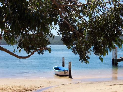
Dingy at Wagstaffe Wharf Mulhall Street Wagstaffe

Wagstaffe Wharf Mulhall Street Wagstaffe

This is a drive-by posting. Been out all day and about to go out again. I am a wee bit drunk.

Anyways, there was another bloody dust-storm today. My throat's as dry as a dead dingo's donger and that's after all the beer and some hideous cask wine. Will have a furry tongue in the morning.

And I am fucking hating this evil early summer crap.

That is all.

And the photo is there because everyone likes it.


Local lickage

Coast not perfect but we love it, Pulse survey finds

Saturday, November 21, 2009

Green Point 1839

(Green Point walkies #5)

Pt Fred & West Gosford from Green Point

Always charge yer bloody camera before going walkies. I bloody well forgot and the bastard died on me one photo in. Nothing worked. No amount resting it, no amount of swearing at and threatening to gouge out its USB port with a rusty knife, nothing worked.

But the sky is blue and the water is a very nice shade. It was a warm day. Spring has not sprung this year and we've gone straight from a mild winter into a red hot summer.

This was taken from a nameless laneway off Avoca Drive between Merindah Avenue and Edgewater Avenue, on the water side of Avoca Drive.


About Green Point

From the history obelisk thingo (Green Point 1789) we know when Green Point was settled by whitefellas and the name of the first one:

"This spot is on the original grant of
640 acres of Crown land
Promised to John H. Edwards
By Sir Ralph Darling in 1829
And granted on 30.9.1839
To Major Henry Smyth who called it
GREEN POINT"


The local history whatsit at the library has some stats:

"1788 - The true extent of the Aboriginal population in the Brisbane Water District is unknown, however it is estimated that several hundred people lived in the area before white settlement.

1823 - James Webb, the first white settler of Brisbane Water, takes up land at The Rip.

1828 - The Census of 1828 records approximately 100 persons in the Brisbane Water Police District, which included Lake Macquarie, Brisbane Water and Lower Portland Head. This figure did not record the number of aboriginal persons, however a census of aboriginals in Brisbane Water taken in the same year records 65 persons between the Hawkesbury River and Wyong. This figure is increasingly believed to underestimate severely the native population, which may have numbered several hundred.

1836 - 621 persons
...
1901 - 7,186 (Census)
...
1947 - 18,700
...
2001 - 161,204 - (Preliminary estimate)"

So 3 years before the major got his land, there was 621 whitefellas and perhaps the same amount of blackfellas living round the whole of Brisbane Water. Not what you'd call a crowd.

On the "1843 Brisbane Water list of Electors" a "Smyth, Henry (Major)" is listed as having "Freehold" on a property at "Broadwater".

Bear in mind that "Broadwater" is not The Broadwater, up between Fagans Bay and Point Frederick on yer 2009 map of Brisbane Water, or even Kincumber Broadwater. It's a vague and confusing term that was applied to pretty much everywhere on Brisbane Water at some point in the past.

In Greville's Official Post Office Directory NSW - 1872 there's no-one listed as living at Green Point but some of the names on the list of locations don't exist anymore (the names not the locations) and some are extremely vague.

In 1882, waterfront land and big fat blocks were being sold at Green Point as "Suitable for Country Residences, Villa Sites and Farms".

In 1911, another land sale has a map of Green Point showing 2 existing waterfront cottages, Green Point Wharf, Green Point Post Office, three un-named streets and Avoca Drive down as "Kincumber Road". Looks like the 1882 land auction made bugger-all impact.

The un-named road leading to the wharf looks like the current Orana Street, just near the Bayside Drive lights.

Have yerself a gander at the Sub-division maps for Green Point and Kincumber, which borders on Green Point in the north.


Nowadays Green Point is a thriving suburb-slash-village of the Greater Gosford/ the Gosford City Council area/ Brisbane Water district. Bustling Downtown Green Point is a supermarket, a bottle-shop (liquor store), a local history marker and a nice park, a teasing hair-dresser, a couple of estate agents and another shop I can't remember for the life of me.


Code Red

Most of New South Wales was on a total fire ban during the week, due to the drought and the wind and stuff.

Then the storms came on Friday and there were fires started here and there by lightning strikes. Nothing here, thank fuck, but summer ain't over yet. Hasn't even officially started.

Are you prepared to survive? - checklists & stuff at the RFS site

I've got me go bag sorted, like they said after Black Saturday. Photos, insurance policy, data back-up, towel, clean underpants. Grab and go.


Local linkage

My trek to Nepal - local bushwalker training for trekking

Kayaking Ettalong to Iron Ladder Beach - good photos, Iron Ladder is just near Box Head and the Palm Beach ferry goes quite near it.
Saturday, November 14, 2009

We tease to please

(Green Point walkies #4)

Asca Drive Green Point

Nice old weatherboard house on Asca Drive. Looks about 1900 to 1920s. But don't quote me on that. Can't find the book to check.


Stone piles Asca Drive Green Point

It had both brick piers (stumps) and stone ones but the stone ones are not original. They're too wide for their sheets of tin (to stop the white-ants). Original stone stumps are as narrow as these brick ones. Sometimes all the old stone piers on an old house get replaced, sometimes just some of them.


Road works on Avoca Drive Green Point

Green Point traffic is on a go-slow for a bit while they rip up bits of Avoca Drive (the main road) around Bayside Drive. Not sure what they're doing on this side but on the other side it looked like they were widening it.

Avoca Drive is one of the main roads of the Lower Central Coast/ Greater Gosford/ Brisbane Water area. If you're in Woy Woy and you want to go to Bloody Erina (Erina Fair, one of them big shopping centres) you go over The Rip Bridge to Daleys Point, along Empire Bay Drive past St. Huberts Island, Empire Bay, Bensville and Kincumber South, left onto Avoca Drive and through Kinumber, past Yattalunga, round and up through Green Point and right into The Entrance Road, past the barracks then right at Fountain Plaza and up Karalta Road and there you are at Bloody Erina.


We tease to please, cnr Bayside Drive & Avoca Drive Green Point

Stared at this sign for a good long while as I walked towards it. It looked like it belonged to the real estate agent and I wondered how the fuck teasing prospective home buyers was a good idea. Eventually I noticed the name if the hairdresser at the top of the sign. Jesus, I'm quick.


Mangrove stump in the shallows, Green Point

Just for pretty. Mangrove stump in the shallows.


Bonus photo

The Cockatoo ferry AKA Codock II

The lovely old wooden ferry at her mooring in Cockle Channel not far from Central Wharf (where you get off for the Davo) at Davistown.

She still does some runs over to Hardys and so forth. They changed the timetable again so I better get a new one. Haven't been on her for a bit. She's my favourite local ferry. Possibly my favourite ferry ever.


Google-botted

My stats are showing heaps of human and machine visits from Googlebot HQ. Must find out what that's about before I crash or something. Am I being checked out for some sort of fabulous feature thingy on the blogspot blog about blogspot blogs? The Inaugural Blogger Award for the Gratutious Use of the Word Fuck in a Walkies Context? Or maybe the googlebot just got the hiccups.

Saturday, November 07, 2009

Along the water

(Green Point walkies #3)

Memorial park at Orana Street Green Point

Starting point. Rocky Point in fact. Bottom of Orana Road.

To get to this park, come down Avoca Drive from The Entrance Road and turn right into Bayside Drive at the lights or Orana Road just after them.

If you're coming from Woy Woy, come up Maitland Bay Drive and over The Rip Bridge and up Empire Bay Drive to the wee stone church at the roundabout in Kincumber and turn left into Avoca Drive and go straight through Kincumber then up the hill and round and left into Orana Road just before the lights.


Houses on Point Frederick from Green Point

Wee old houses nestled between big flash houses on Point Frederick.

This is pretty much the same as anywhere there's big pricey houses along the water round Woy Woy and Brisbane Water and up and down the Central Coast. There's still some wee old houses from before the seventies, before the war and before the first war when land was cheap and there was fuck-all houses around Brisbane Water anyways.

It's like a miniature history of the Coast on one street. This particular street being Albany Street, the street running from stem to stern of Point Frederick AKA Longnose. In the background yer looking at Rumbalara Reserve (hill in shadow) and what appears to be Waterview Park AKA Presidents Hill above the trots in Gosford. Locals will know Presedents Hill as the hillside on which The Castle sits.


Green Point foreshore reserve

Bit of the park. It's a narrow strip of grassed land between the water and the houses with a private jetty and boat parked opposite nearly every house. Again, same all round Woy Woy and Brisbane Water.


Tall mangroves at Green Point

Some mangroves can get quite tall. These ones were about 15 metres (49.21 feet). Usually they're 2 to 6 metres (6.56 to 19.69 feet).


Tinny at Ironbark Point (near Green Pt)

The inevitable tinny.


Wee muddy creek at Ironbark Point (near Green Pt)

A wee muddy creek at Ironbark Point, about halfway up the park. Could be a storm drain all full after the bit of rain we had in October but it looked more creeky with the trees round it.


Scribbly gum bark Kenmare Road Green Point

Scribbly gum bark found in the wee bit of bush beside Kenmare Road. Scribbly gums are Eucalyptus haemastoma. The link has a good photo of the tree.

The scribbles are made by a wee tiny beastie, the larvae of the Scribbly Gum Moth (Ogmograptis scribula).


Bonus photo

Woy Woy/Koolewong footbridge from Green Point

Woy Woy to Koolewong footbridge as seen from Green Point.

Much clearer view of the footbridge. Couldn't find the bastard last week.


New new timetable

Local ferries timetable. Yep, same ferry as takes the Dear Old Things to the Davo.

I don't get paid for the local ferry adverts, by the way. I just love ferries.