I'm grinning from ear to ear as we speak. The bequest and, more importantly, Gran's stuff came today. It's taken my father six months to post it but it's all over at last. No more crap and the money gets tucked away towards Gran's memorial tree.
My relief and I will shortly be floating in a celebratory sea of tequila and singing raucously.
Monday, October 31, 2005
Sunday, October 30, 2005
More Photos From St Hubert's Island
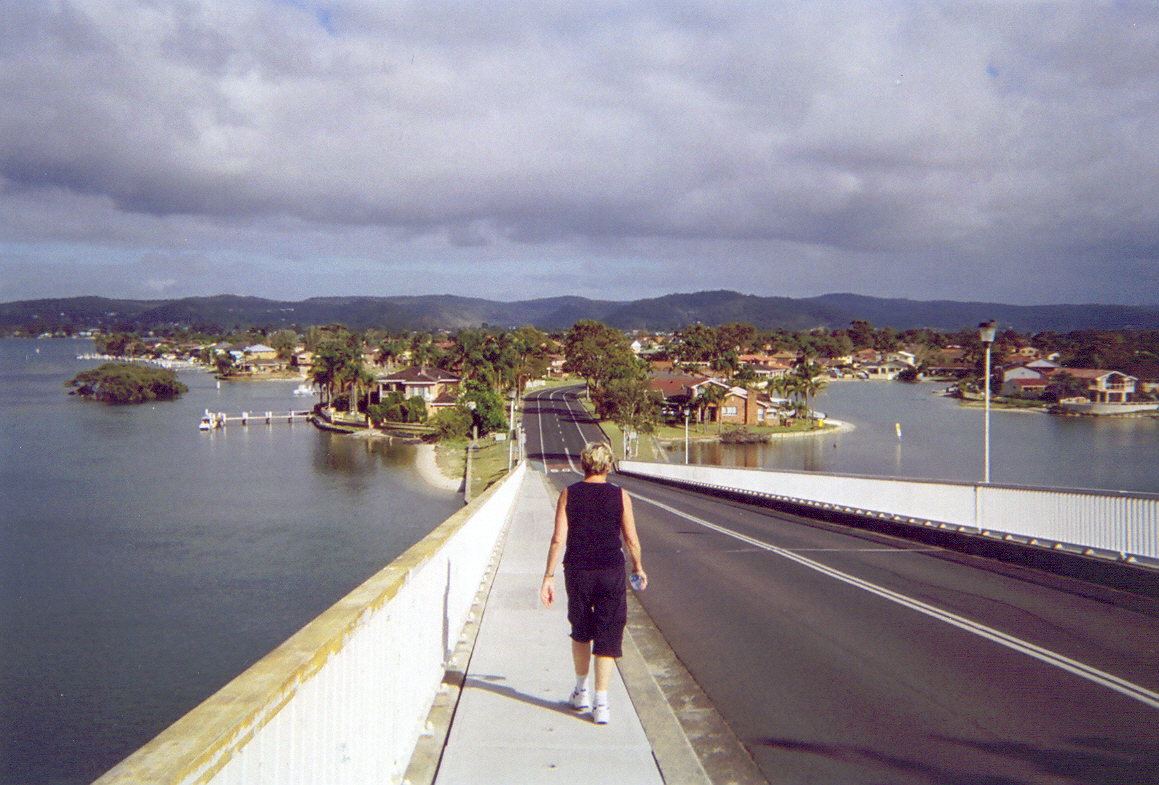
Brisbane Water Walk # - St Hubert's Island.
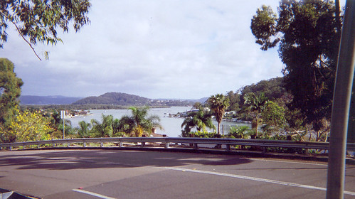
Biggest version
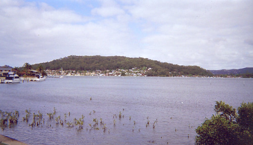
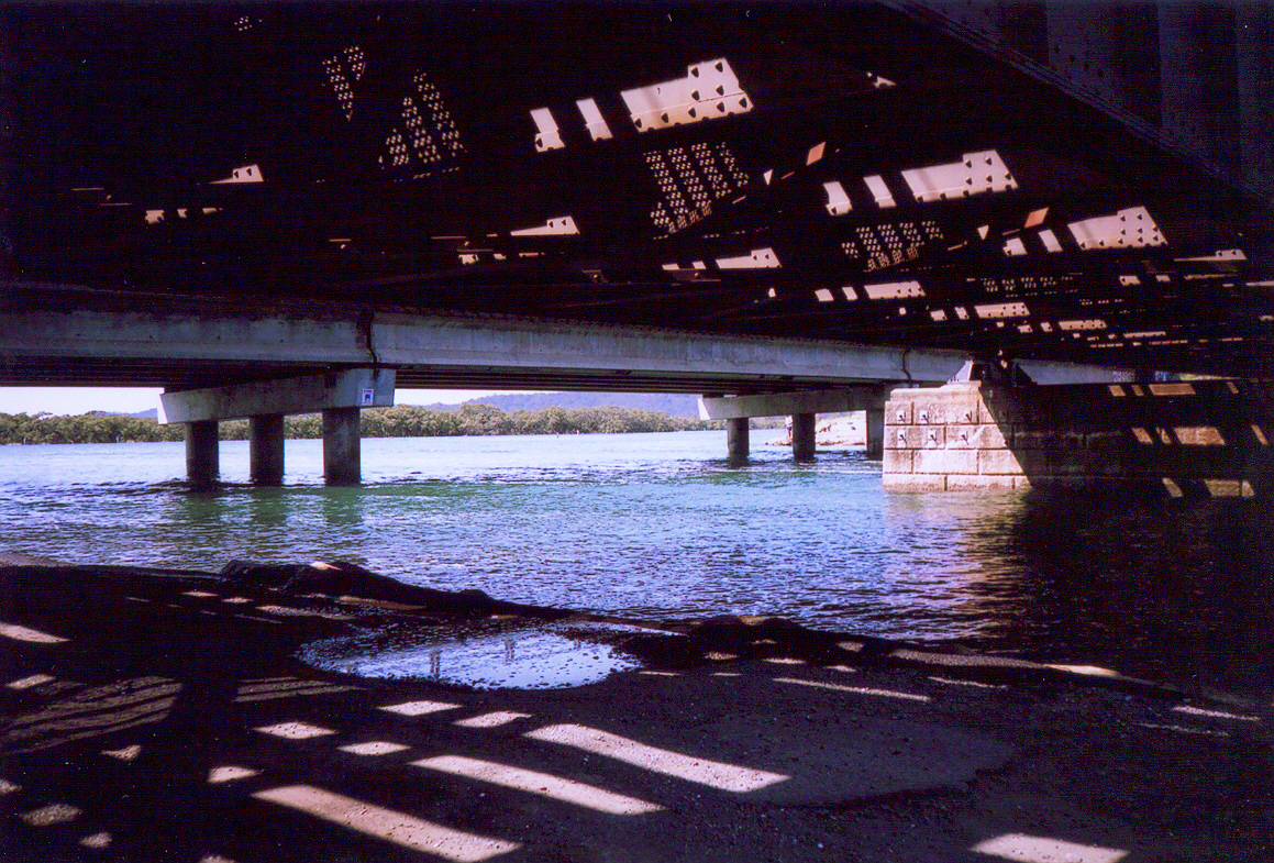
Looking north-east from the top of the ramp. The hill is Saratoga. Between it and St Hubert's is Riley's Island, which is all mangroves and trees. The hill on the right behind the trees is Daley's Point. In the background on the left of Saratoga is Tascott and Point Clare, on the right is Gosford.
Biggest version
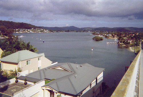
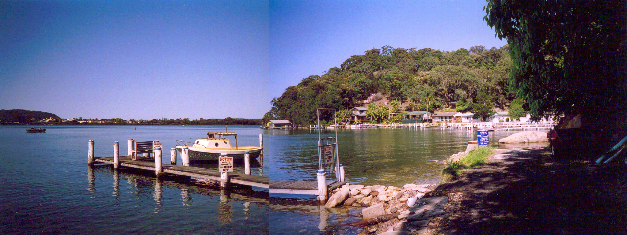
Looking west-south-west, halfway down the ramp. The houses in the foreground has swimming pools and their own wharfs.
Clockwise, from the left middle distance:
Daley's Point.
Blackwall Mtn & Orange Grove Road.
In the distance, Woy Woy Bay, Koolewong, Tascott & Point Clare, right across to the right hand side.
In front of that, Blackwall foreshore, from Orange Grove Road right across to the right hand side.
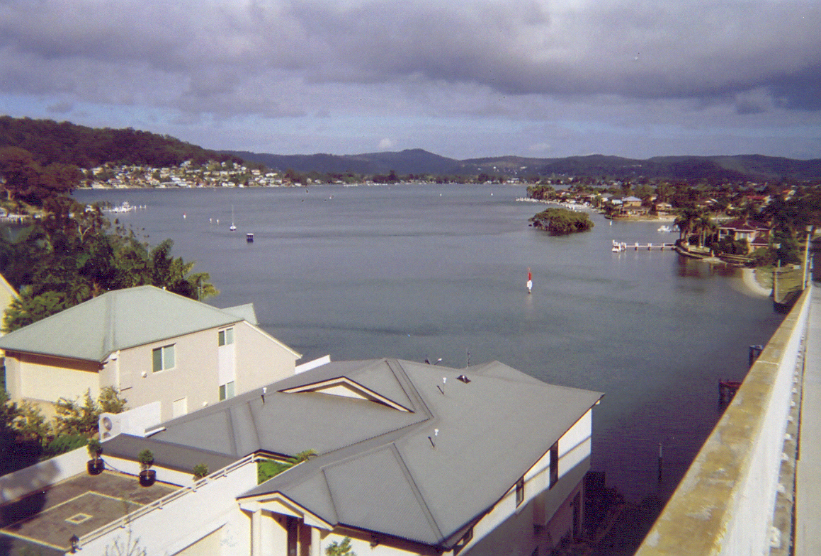
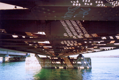
Retention Islet & St Hubert's Island. The articial inlets are Shelter Cove & Sandy Cove. There's 7 inlets altogether.
Biggest version
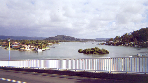
Looking north-east, halfway down the ramp. The tiny islet is Oyster Islet. St Hubert's in on the left. That's about half of it you can see there. It's not big. Walked it in a morning.
The hill in the middle ditance is Saratoga. Between it and St Hubert's is Riley's Island, which is all mangroves and trees.
The hill on the right is Daley's Point.
In the background on the left of Saratoga is Tascott and Point Clare, on the right is Gosford.
Biggest version
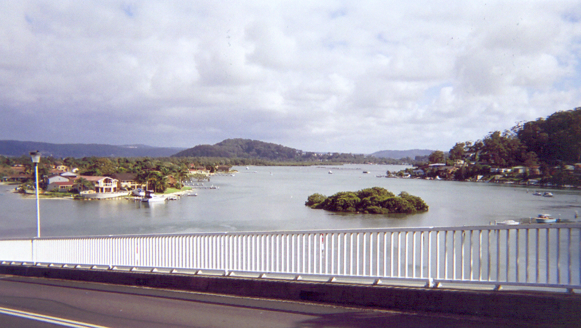
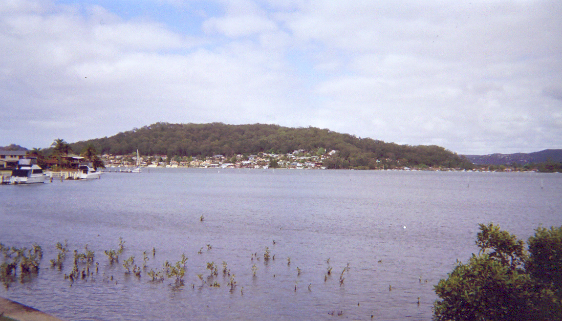
Looking west, halfway down the ramp. St Hubert's & Retention Islet. Koolewong, Tascott & Point Clare in the distance.

Biggest version
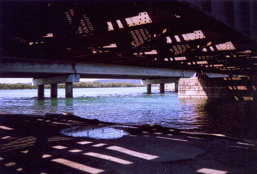
Looking west, at the bottom of the ramp. Retention Islet's just behind that jetty. Blackwall Mtn and Orange Grove Road, Woy Woy peninsula on the left. Woy Woy Bay, Koolewong & Tascott in the distance.
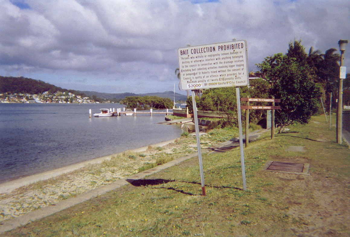
Big sign: "BAIT COLLECTION PROHIBITED Persons who wilfully or negligently remove, damage or destroy or otherwise interfere with anything belongng to the council in connection with the drainage reserves (including bait collecting activites involving nipper digging or pumping) of St Huberts Island without the consent of Council is guilty of an offence which provides for a Maximum penalty of twenty (20) penalty points, $2000 BY ORDER Gosford City Council".
Small sign: "Welcome to St Huberts Island, Please drive carefully".
Biggest version
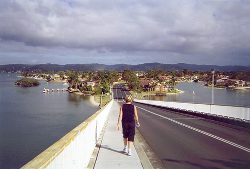
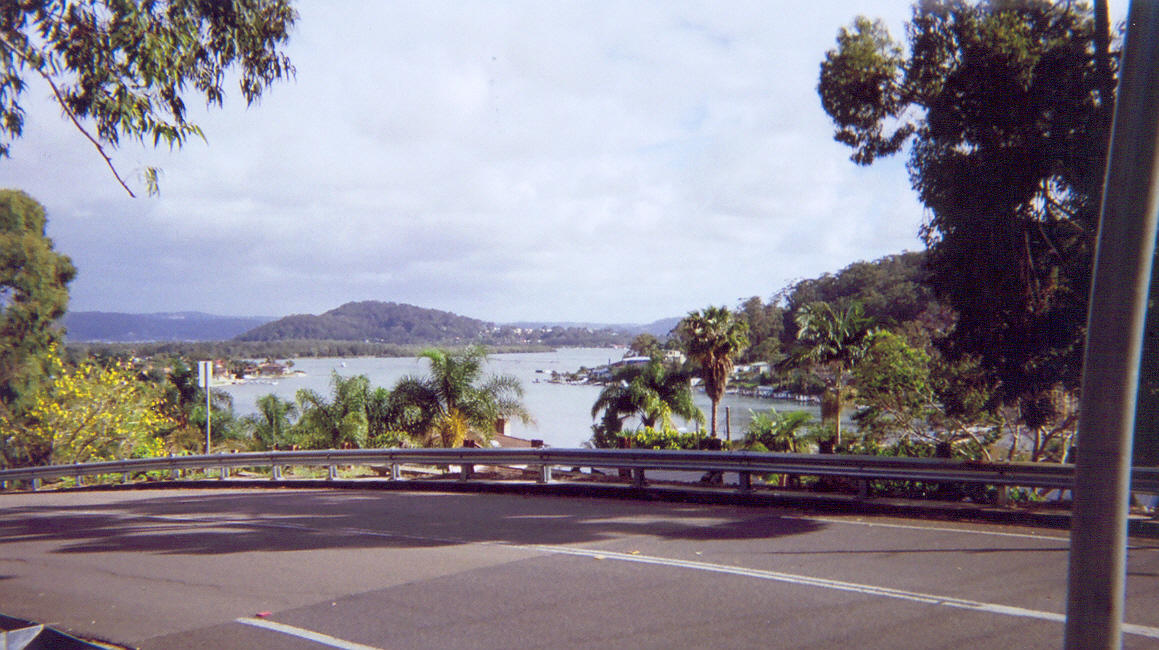
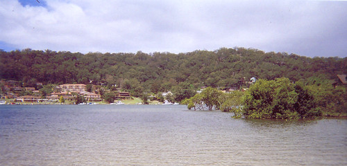
Looking south-west, from Helmsman Boulevard, opposite Marina View Parade. Blackwall Mountain and Orange Grove Road on the Woy Woy peninsula. Blackwall foreshore on the right. Phegan's Bay behind it.
I'm not loving the hard edges and colours in this set of photos. Took them on a Kodak one-shot. Took some a couple of years back on a Kodak one-shot and they came out great. They shouldn't've changed the recipe.
Biggest version
Looking north-east from the top of the ramp. The hill is Saratoga. Between it and St Hubert's is Riley's Island, which is all mangroves and trees. The hill on the right behind the trees is Daley's Point. In the background on the left of Saratoga is Tascott and Point Clare, on the right is Gosford.
Biggest version
Looking west-south-west, halfway down the ramp. The houses in the foreground has swimming pools and their own wharfs.
Clockwise, from the left middle distance:
Daley's Point.
Blackwall Mtn & Orange Grove Road.
In the distance, Woy Woy Bay, Koolewong, Tascott & Point Clare, right across to the right hand side.
In front of that, Blackwall foreshore, from Orange Grove Road right across to the right hand side.
Retention Islet & St Hubert's Island. The articial inlets are Shelter Cove & Sandy Cove. There's 7 inlets altogether.
Biggest version
Looking north-east, halfway down the ramp. The tiny islet is Oyster Islet. St Hubert's in on the left. That's about half of it you can see there. It's not big. Walked it in a morning.
The hill in the middle ditance is Saratoga. Between it and St Hubert's is Riley's Island, which is all mangroves and trees.
The hill on the right is Daley's Point.
In the background on the left of Saratoga is Tascott and Point Clare, on the right is Gosford.
Biggest version
Looking west, halfway down the ramp. St Hubert's & Retention Islet. Koolewong, Tascott & Point Clare in the distance.
Biggest version
Looking west, at the bottom of the ramp. Retention Islet's just behind that jetty. Blackwall Mtn and Orange Grove Road, Woy Woy peninsula on the left. Woy Woy Bay, Koolewong & Tascott in the distance.
Big sign: "BAIT COLLECTION PROHIBITED Persons who wilfully or negligently remove, damage or destroy or otherwise interfere with anything belongng to the council in connection with the drainage reserves (including bait collecting activites involving nipper digging or pumping) of St Huberts Island without the consent of Council is guilty of an offence which provides for a Maximum penalty of twenty (20) penalty points, $2000 BY ORDER Gosford City Council".
Small sign: "Welcome to St Huberts Island, Please drive carefully".
Biggest version
Looking south-west, from Helmsman Boulevard, opposite Marina View Parade. Blackwall Mountain and Orange Grove Road on the Woy Woy peninsula. Blackwall foreshore on the right. Phegan's Bay behind it.
I'm not loving the hard edges and colours in this set of photos. Took them on a Kodak one-shot. Took some a couple of years back on a Kodak one-shot and they came out great. They shouldn't've changed the recipe.
Saturday, October 29, 2005
Tottie
Bloody Yahoo. I can't get into my blondiebearbot2 at yahoo email. So if you emailed me there in the last few days and I didn't reply, you know why. Either it'll come good in a bit or I'll abandon the bastard to the spammers.
Spoiler free zone
Went to see Wallace & Gromit at the flicks. Bloody good. It's the real Wallace and Gromit, not some bloody Hollywood crap with all the juice sucked out of it and too-perfect CGI.
Nah, this was the real McCoy, claymation and Pommy (Limey) accents where oughta be and Lady Tottingham or Tottington or whatever is fucking spot on. It may well become my new second favourite of Nick Park's. Right after A Grand Day Out.
Friday, October 28, 2005
St Hubert's Island Photos
St Hubert's Island Walk
St Hubert's Island Stuff
Big version
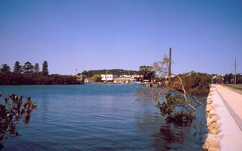
Looking aross to Daley's Point from the park at Long Arm Parade on St. Hubert's Island.
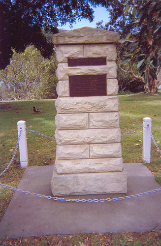
(Won't give you a link to the big version. Too fuzzy to read.)
Plaque no 1.: "Australia 1788 - 1988 From the State Govt., Gosford City Bicentennial history Subcommittee & the St. Huberts Island Resisents Association an Australian Bicentennial Project To commemorate the nation's Bicentenary in 1988".
Plaque no 2.: "Monday 3rd March, 1788 When the tide had slacken'd we picked up and found several small inlets between mangroves on one of which island we stop'd and pitch'd the tents: had a very hard rain all the morning Lieut. Wm Bradley March, 1788".
Plaque no 3.: "Tuesday, 4th While the tents and clothes were drying... a crab was caught and proved very good AM, at day light proceeded up... we found natives all the way up. Lieut. Wm Bradley March, 1788".
Plaque no 4.: "This plaque was laid on the 3rd of March 1988 to commemorate the landing in this vicinity of Gov. Phillip, Lieut. Hunter and their party on 3rd March 1788".
More St Hubert's Island photos to come.
St Hubert's Island Stuff
Big version
Looking aross to Daley's Point from the park at Long Arm Parade on St. Hubert's Island.
(Won't give you a link to the big version. Too fuzzy to read.)
Plaque no 1.: "Australia 1788 - 1988 From the State Govt., Gosford City Bicentennial history Subcommittee & the St. Huberts Island Resisents Association an Australian Bicentennial Project To commemorate the nation's Bicentenary in 1988".
Plaque no 2.: "Monday 3rd March, 1788 When the tide had slacken'd we picked up and found several small inlets between mangroves on one of which island we stop'd and pitch'd the tents: had a very hard rain all the morning Lieut. Wm Bradley March, 1788".
Plaque no 3.: "Tuesday, 4th While the tents and clothes were drying... a crab was caught and proved very good AM, at day light proceeded up... we found natives all the way up. Lieut. Wm Bradley March, 1788".
Plaque no 4.: "This plaque was laid on the 3rd of March 1988 to commemorate the landing in this vicinity of Gov. Phillip, Lieut. Hunter and their party on 3rd March 1788".
More St Hubert's Island photos to come.
Koolewong Completed - Koolewong #4 - Brisbane Water Walk #4
Finished the fourth walk of my Brisbane Water Walk in four walks. Try saying that when you're pissed.
It was a short walk. Half an hour. Towards the end I was gazing longingly up at the steep slope of Melaleuca Crescent and wanting to get some photos from up there. But I had a shitload to do and Melaleuca wasn't going anywhere.
Today's walk was along Brisbane Water Drive. Only a train track away from Wednesday's. Today's was a metre above the water. The road was along the water except for maybe a dozen houses at the start. They're just beside Couche Crescent on the Gosford side. A couple of them were ugly dark brick seventies places then there were four or five from around 1900. There was a building site as well and as far as I can remember there was another circa 1900 house or a forties fibro place on brick piers there. A tiny place if I remember right, with no garden.
Annotated version
Between the houses and Tascott station there's a long skinny park. Up the Woy Woy end there's a couple of picnic tables in the shade. I sat at one and enjoyed the view. The sun on the water was bright. Across on the other side of the water the hills were slightly hazy. The peaks of Tascott and Point Clare were on my left with Tascott station at the bottom of them. Past Point Clare was President's Hill in the background then Gosford and its hill to the right of that. From where I was it took a minute to pick out the long finger of Point Frederick against the background of Caroline Bay and Peek's Point.
The tip of Point Frederick is all trees. There's a park there with the old cemetery in it. My hist list has it down as "Park: former cemetery, 'Pioneer Park' ... C. of E. Burial Ground, Town of Gosford, Ded. 1847". What the fuck is "Ded."? Does it mean the last person was buried there in 1847 or the first? Must be the last. Guess I'll find out when I walk it.
To the right of Peek's Point is Kincumba Mountain sitting squat and broad with Green Point at the foot of it. Then Yattalunga further back then the hill of Saratoga. The houses I'd just passed blocked my view south of Saratoga.
There wasn't much happening on the water. There's a shitload of retirees and wealthy business peeps around Gosford and quite a few yacht races on weekdays. Perhaps they all buggered off to Pittwater for some big race there.
In the park there were dozens of dingies standing up against the pines. Normally I'd hear the quiet rush of wind through the pines but there was only a gentle breeze and the morning peak traffic was twenty feet behind me.
Beside the park there's a carpark, with a narrow slipway for the dingies to launch and three public jetties. Must be too shallow there at low tide for standard boat ramps. Among the thirty or so small yachts anchored just offshore was a floating caravan (trailer). Not an actual caravan floating in the water. One of those small power boats its owner's built up into a single straight-sided cabin. Probably not terribly legal. This one didn't look healthy either. It was listing quite a bit to the left back corner. I'd say starboard stern but this thing was more caravan than boat. It had about a foot square of deck at the back and that was only so you could get to the outboard. The bastard probably steered like a lawnmower.
I got moving again. Across the carpark and under the trees on the other side. The park waxed and waned as the road and the water's edge came close and separated then close again. There was a sturdy brick loo (toilet) close to the road under the trees. Well used and not a great place for a beat due to the amount of traffic. I know there's beats somewhere around here. Where there's blokes there's beats.
It wasn't far from the loo to the end of my walk. Just a hundred yards (91.44 metres) along the footpath. I sat there at the bus-stop fending off the flies and watching a sulphur-crested galah fly across the trees and disappear into one. You can't see their yellow crest from that distance, just the white of their body against the dark green of the trees.
The bus came and took me back to Woy Woy. I coloured in today's street and realised I'd finished Koolewong already. Very speedy.
Brisbane Water Walkies
Brisbane Water #1 - Woy Woy peninsula - started 1st March, finished 30th September
Brisbane Water #2 - Park's Bay - 3rd October
Brisbane Water #3 - St Hubert's Island - 18th October
Brisbane Water #4 - Koolewong - started 22nd October, finished today
Thursday, October 27, 2005
Circumnavigation & Halloween
Went all the way round Brisbane Water today. Didn't realise it until I was most of the way round. It was fun.
Had to go to Kincumber this morning and got the bus. It leaves from Woy Woy station, rushes over The Rip Bridge, trundles up Daley's Point, past the ramp down to St. Hubert's Island, round Empire Bay's hill, then down to the ferry wharf at Empire Bay. Then through the bush and straggling houses between Empire Bay and Bensville, round past a massive retirement village and the bus depot in Kincumber South, down past the 1847 sandstone church (St. Paul's on the corner of Avoca & Empire Bay Drives), past through or possibly between endless brick retirement villages in Kincumber proper (they were all the same, couldn't work out if it was the same village seen from seventeen different angles or seventeen villages & about seventeen thousand Dear Old Things clambered slowly aboard at each stop) and down the long straight stretch of Avoca Drive to the Kincumber shops and the pub.
Then, after my thingy in Kincumber, out of Kincumber at the other end and up over Dunlop Hill (in an older bus this time which groaned a bit on the steep stretches) and down the other side, past Yattalunga (the handle suburb on the hammer of Saratoga & Davistown), up and over the end of Kincumba Mountain at Green Point (Kincumba & Kincumber, same place different spelling), out onto Erina Road beside the heliport, through Erina Fair (known to loathers of shopping centres as Bloody Erina), alongside Erina Creek, through East Gosford with its private schools, past The Finger (AKA Pt Frederick), through Gosford, through Point Clare, Tascott and Koolewong on Brisbane Water Drive along the west side, across the bridge at Park's Bay and back into Woy Woy station.
Annotated map
Probably a two hour trip all up. Pretty good way to get the big picture of where I'll be walking. Got to see which roads have shade and which have killer curves. From Green Point I could see straight across to where I was walking yesterday and from this side of the Point Clare hill I had a clear line of sight down between Saratoga and Koolewong, over Pelican Island and Brick Wharf, past Blackwall Mountain and over Umina to the distinctive shape of Lion Island. Behind it is Pittwater but without a pair of binoculars its tricky to pick out what bit's what there.
There was a fire at Point Clare. Just a small one on the ridge above the houses. I could see it as we crested the hill at Green Point. Not visible smoke. Just those whatsits that come invisibly before the visible smoke. You know what I mean. I'm rambling. Anyways, it wasn't a big fire then but it might be getting bigger. The wind's up now and I can smell the smoke through the window beside my desk. I can also hear those bloody mynahs fluttering and squawking about in the guttering of my balcony. Building a nest and having a shag no doubt.
Halloween
Got home in time to watch a thing on the telly about the Celtic traditions of Halloween. The first twenty minutes was fascinating. After that I was trying to tune the fucking telly because it was going off the fucking station every fucking minute. Can't find the fucking manual so now I'm without a watchable SBS. Bastard!
Anyways, what I did see some very illuminating stuff. Made sense of the various elements of it. The main thinking behind the whole of Halloween is that as the longest night of the year (in the Northern Hemisphere) and Celtic New Year's Eve, it's the one night when the realm of the living and the realm of the spirits are not separated.
The elemental spirits (spirits of earth, wind, fire & water), faeries (the evil Irish sort not the wussy Hallmark sort) and the souls of the dead roam amongst the living and try to carry them away to the realm of the spirits. To confuse them you disguise yourself as an animal or some fierce creature. The noise and carry-on is also to confuse them.
The boundaries of houses and fields were protected with bonfires. Didn't hear about the jack-o-lanterns but they look like a combination of a fierce mask and the protective fire. There was also a thing about a "great black sow" who grabs the last person to leave the dying fire and "crunches their bones". That'd make you run home fast and bolt the door behind you.
Didn't hear the history behind trick or treating but there's somewhere in the UK (Britain) where trick or treating was considered too dangerous for children. And some particularly evil crowd of faeries on an island off Ireland took a yearly tribute in the form of food, drink and children.
Now I get it. Before it was just a jumble of apparently meaningless and conflicting whatsits. Now it looks like good scary fun.
Wednesday, October 26, 2005
Lord Of The Flies - Koolewong #3 - Brisbane Water Walk #4
The breeze didn't come up until the last bit of my walk and the flies drove me barmy. It was pretty warm too, only a few cirrus and cirrostratus (wispy & high clouds) in the sky and the sun beating down already at 8AM.
Anyways, apart from the flies and the heat it was a good walk and a decent length and had great views. Looking at the map of Brisbane Water the Finger (AKA Point Frederick) doesn't look close to Koolewong and Tascott but while I was walking it did. It made a very pleasant view with Point Clare in front of it and Ironbark Point behind it. The tide was running out and the sun sparkled on the water here and there. The reflections of the hills and ridges were dark green and the rest of the water was a light blue. The streets I walked today weren't high enough to get above the big old paperbarks and gums along the railway line but the view was good all the same and I managed to find a spot for a bit of a panorama photo.
There was only one place on my hist list to look out for today : "House 'Sunny Haven' 154 Glenrock Road Koolewong ... c.1920". It's still there. A small white wooden house with a veranda set way back from the road. The block slopes so it was visible above the garden. Nice cottage garden, lavender, daisies, wistaria (I think) on the frame over the front gate, nasturtiums and an orange tree. I love citrus trees. The house was in pretty good nick with the original window frames by the look of it. I hate to see a nice old cottage wrecked by those graceless seventies aluminium windows.
There were a couple of dozen more cottages from around the same era scattered along Glenrock. They mixed in with the clumps of forties houses between Koolewong station and Berala Avenue and up near Thomas Street. There were three fifties houses and one or two sixties ones, but other than then it was lots of seventies then eighties, nineties and noughties, including a whole street of nothing but seventies. The same mix as the Peninsula.
Because the roads are up on the foot of the ridge, there's a bit of bush every now and then. One minute you're wandering along in suburbia then you come to a bit of road where it's too steep on both sides for houses so you're in the bush. I've caught the bus along today's walkies route and never noticed today's bit of bush. Normally I'm gawking out the other window at the view.
The bit of bush was between two sharp curves and cut off visually from suburbia. The down side of the road was cut off from the view and the traffic noise by trees. A car came round the bottom curve too fast and came fairly close to collecting me but it was the only car. It was pretty quiet except for the bush sounds. A whip bird sounded only a few metres away and there were others further up. There was a short bird sound that might've been a kookaburra deciding not to laugh. No twitterings and screeches from the rainbow lorikeets so not many flowers they like were blooming there.
I slowed down but it still only took me five minutes to walk from the bottom curve to the top. Then I popped back out into suburbia again. But while I was in the bush I soaked it up.
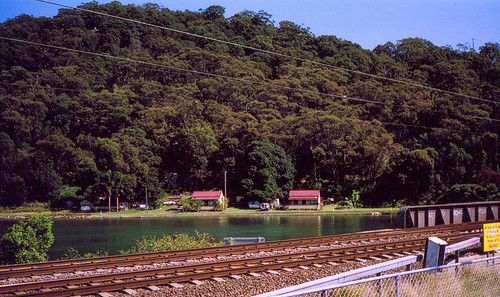
Half an hour later I was at a park at the end of my walk. It's on the corner of Murrumbooee and Glenrock near the station. There's a creek there and a small monument that neatly sums up the history and the naming of Tascott:
"To honour Thomas Alison Scott 1.7.1777 - 16.10.1881 who arrived in the colony in 1816, pioneered the sugar industry in Australia, he lived and died in this vicinity, this village bears his name T. A. Scott, unveiled by his great grandson Donald Harold Scott 18th Oct. 1981".
Technology in Australia 1788-1988 says "sugar cane was introduced to the Sydney Botanical Gardens in 1817 and that the crop was grown experimentally at Port Macquarie from 1823" and "there T. A. Scott refined the first sugar produced in Australia". As far as I know, it's all grown in Queensland now. It's not tropical enough down here.
After the park I marked off the last bit of my walk and crossed over the station to the bus stop. Tascott station is an eighties job by the look of it. Two short steel and concrete platforms and a footbridge over them, not old enough or the right style to be seventies. The shelters they made new last year. Steel roofs with a curve and steel mesh walls.
Beyond the station there was a seventies house up on Melaleuca Crescent and a dozen more houses visible on two other streets. Above them was a low stretch of the ridge, green with gums. A goods train thundered and juddered past. Two loud bangs on the track just before it came. Small charges laid to warm the guys at work on the track. They stop and stand aside in their blue shorts and orange fluoro vests then go back to crowbarring the rails.
My bus came and I soaked up some ground level views of the water. I was bloody warm and looking forward to taking off my shoes. Gotta find solutions soon to beating the heat and the flies so I can walk all but the hottest days of summer. Lately it's felt like 10AM at 8AM and the sun is up at 5.01. Daylight saving starts on Sunday and the clocks will go forward so the sun gets up at six. That'll help.
Anyways, apart from the flies and the heat it was a good walk and a decent length and had great views. Looking at the map of Brisbane Water the Finger (AKA Point Frederick) doesn't look close to Koolewong and Tascott but while I was walking it did. It made a very pleasant view with Point Clare in front of it and Ironbark Point behind it. The tide was running out and the sun sparkled on the water here and there. The reflections of the hills and ridges were dark green and the rest of the water was a light blue. The streets I walked today weren't high enough to get above the big old paperbarks and gums along the railway line but the view was good all the same and I managed to find a spot for a bit of a panorama photo.
There was only one place on my hist list to look out for today : "House 'Sunny Haven' 154 Glenrock Road Koolewong ... c.1920". It's still there. A small white wooden house with a veranda set way back from the road. The block slopes so it was visible above the garden. Nice cottage garden, lavender, daisies, wistaria (I think) on the frame over the front gate, nasturtiums and an orange tree. I love citrus trees. The house was in pretty good nick with the original window frames by the look of it. I hate to see a nice old cottage wrecked by those graceless seventies aluminium windows.
There were a couple of dozen more cottages from around the same era scattered along Glenrock. They mixed in with the clumps of forties houses between Koolewong station and Berala Avenue and up near Thomas Street. There were three fifties houses and one or two sixties ones, but other than then it was lots of seventies then eighties, nineties and noughties, including a whole street of nothing but seventies. The same mix as the Peninsula.
Because the roads are up on the foot of the ridge, there's a bit of bush every now and then. One minute you're wandering along in suburbia then you come to a bit of road where it's too steep on both sides for houses so you're in the bush. I've caught the bus along today's walkies route and never noticed today's bit of bush. Normally I'm gawking out the other window at the view.
The bit of bush was between two sharp curves and cut off visually from suburbia. The down side of the road was cut off from the view and the traffic noise by trees. A car came round the bottom curve too fast and came fairly close to collecting me but it was the only car. It was pretty quiet except for the bush sounds. A whip bird sounded only a few metres away and there were others further up. There was a short bird sound that might've been a kookaburra deciding not to laugh. No twitterings and screeches from the rainbow lorikeets so not many flowers they like were blooming there.
I slowed down but it still only took me five minutes to walk from the bottom curve to the top. Then I popped back out into suburbia again. But while I was in the bush I soaked it up.
Half an hour later I was at a park at the end of my walk. It's on the corner of Murrumbooee and Glenrock near the station. There's a creek there and a small monument that neatly sums up the history and the naming of Tascott:
"To honour Thomas Alison Scott 1.7.1777 - 16.10.1881 who arrived in the colony in 1816, pioneered the sugar industry in Australia, he lived and died in this vicinity, this village bears his name T. A. Scott, unveiled by his great grandson Donald Harold Scott 18th Oct. 1981".
Technology in Australia 1788-1988 says "sugar cane was introduced to the Sydney Botanical Gardens in 1817 and that the crop was grown experimentally at Port Macquarie from 1823" and "there T. A. Scott refined the first sugar produced in Australia". As far as I know, it's all grown in Queensland now. It's not tropical enough down here.
After the park I marked off the last bit of my walk and crossed over the station to the bus stop. Tascott station is an eighties job by the look of it. Two short steel and concrete platforms and a footbridge over them, not old enough or the right style to be seventies. The shelters they made new last year. Steel roofs with a curve and steel mesh walls.
Beyond the station there was a seventies house up on Melaleuca Crescent and a dozen more houses visible on two other streets. Above them was a low stretch of the ridge, green with gums. A goods train thundered and juddered past. Two loud bangs on the track just before it came. Small charges laid to warm the guys at work on the track. They stop and stand aside in their blue shorts and orange fluoro vests then go back to crowbarring the rails.
My bus came and I soaked up some ground level views of the water. I was bloody warm and looking forward to taking off my shoes. Gotta find solutions soon to beating the heat and the flies so I can walk all but the hottest days of summer. Lately it's felt like 10AM at 8AM and the sun is up at 5.01. Daylight saving starts on Sunday and the clocks will go forward so the sun gets up at six. That'll help.
Monday, October 24, 2005
It's All Over Now, Baby Blue
Halle-fucking-lujah! My father's finally fulfilled his legal obligations re Gran's Will. Which means shaking a solicitor under his nose works.
He's also informed me I'm not good enough to be part of his family anymore. Which sounds like bad news but is actually good news. It's not great to have no parents but with parents like mine who needs enemies.
He's also informed me I'm not good enough to be part of his family anymore. Which sounds like bad news but is actually good news. It's not great to have no parents but with parents like mine who needs enemies.
Bloody Flies - Koolewong Walk #2 - Brisbane Water #4
Crawling all over me and trying to get in my ears. Blasted things! I'm bloody irritable this morning. It was a hot, sticky walk with flies and hayfever.
So would I rather've stayed home with the fan and the remote? Nup. Even in crap weather I enjoy my walkies. Today the water was still and silver and green. A tiny breeze came up on my way back to the station but otherwise all was still but for the rush of the traffic as it went past below.
Big version
Koolewong has two main streets. Brisbane Water Drive snakes along Brisbane Water from Woy Woy to Gosford. Glenrock Parade is on the other side of the railway line and wiggles and jerks around following the path of least resistance and swooping up and down along the foot of the folds of the ridge.
I went up the Woy Woy end of it today, the south end. The road's split in two there. The two halves run parallel to each other but they're separated by a steep slope and a concrete staircase. I walked the lower half then climbed the staircase and walked the top. They were nice shady trees but there were too many trees and powerlines for a clear, photograph-able view. But hey, I'm walking round the edge of Brisbane Water for the next six months. There'll be plenty of views.
Between the trees and powerlines I could see across to Saratoga. On all the maps there's a tiny mangrove islet off the tip of it. There's a park there on the tip and a sailing club then this little islet just off it. But it was low tide this morning and it looked joined to Saratoga by a sandbar. Guess I'll find out when I walk Saratoga.
At low tide you can see just how many oyster farms there are. Heaps. Not many up the Gosford end of Brisbane Water. Most of them are close in around the shorelines of the Woy Woy end. There's mussels as well as the oysters. With it's sea and bays and lakes and estuaries, the Central Coast is seafood heaven. It's where fishermen go when they die. Googled a bit and found out there's an Oyster Festival next month, you can't take more than 2 bass, 2 marlin and 50 oysters a day and that crowd of kayakers I saw the other day were on a Oyster & Wine Tasting Kayak Tour. Interesting mental picture there of peeps quaffing wine and chucking oysters down whilst clutching their paddles in the other hand. Sounds fun. Perhaps I'll go.
Back up on Glenrock Parade, a fight broke out amongst some rainbow lorikeets in a bottlebrush. Couldn't tell if they were fighting over nesting privleges or food. Perhaps both. Further back a lone male brush turkey had wandered across the road. He didn't notice me until I was maybe six feet away. The males are everywhere lately and all of them very distracted. Looking for lerve I expect, what with it being spring. There're plenty of ducks out and about as well, mostly with ducklings already, and there was a pet rabbit nibbling someone's lawn.
It was a shortish walk. Too bloody muggy for tramping for hours. I marked off the day's streets, enjoyed the view for a few minutes longer then wandered back down the hill to the train station.
There's three stops between Woy Woy and Gosford. Koolewong, Tascott and Point Clare. Koolewong and Tascott stations are short and as the train leaves Woy Woy the conductor comes over the thingy with "Negs top Koolewong, Tascott, Point Clare, Gosford, passengers for Koolewong and Tascott please travel in the reeeeear two carriages". Wondabyne, on Mullet Creek between Woy Woy and Brooklyn (Hawkesbury station) is minute. You have to travel in the rear carriage there and they only open one door.
Not all the trains stop at Koolewong. Only one an hour. The Newcastle train stops at Woy Woy and Gosford. It went past and I got a lovely cool swoosh of air on my face. Didn't have long to wait for the all-stops train. Just long enough to enjoy looking up at the ridge. It was fairly high there, maybe as high as the peak at the Woy Woy end and that's 139 metres (456 feet). The houses in Koolewong go far up the ridgeside and above them the ridge is covered in gums. A couple of swallows flickered over the treetops, skimming up the less cautious insects. A sulphur-crested galah gliding across and disappearing into a tree. And everywhere the twittering and carry-on of the rainbow lorikeets. It was a peaceful view and, apart from swatting the flies, I enjoyed it until my train came.
It's dark now, not night dark, storm dark. Hopefully there's another one on its way or some rain.
Speaking of storms
There's a thingy in today's Herald:
Blame Sydney's urban sprawl for some of the summer thunderstorms that lash the city.
The changing landscape is also responsible for increasing the violence of some storms, say two Macquarie University researchers who have spent more than a year using a supercomputer to model the impact that two centuries of clearing Sydney's vegetation has had on severe weather.
They've got way more research to go but their theory'd explain why so many times there's just a bit of rain or a rumble of thunder on the Coast but when I turn on the news there's flash flooding, trees down, roofs off and the power out all over Sydney.
Saturday, October 22, 2005
Waiting - Brisbane Water Walk #4 - Koolewong #1
Storms were promised for yesterday and there was nowt but a single flicker of lightning. This morning was bloody muggy and bloody hot. The storm clouds came in from the north-west while I walked. It was too bloody hot to walk far and I came home after an hour.

Big version
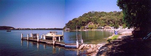
Anyways. I walked in Koolewong. It's one train stop from Woy Woy. I was going to walk there as well as back but it was too bloody hot. Koolewong's a narrow strip of land along the edge of Brisbane Water. Brisbane Water Drive, the road from Woy Woy to Gosford, snakes along the edge of the water, swaying towards and away from the water to stay on the flattest land. There's one street between Brisbane Water Drive and the water at Koolewong, Couche Crescent. It goes up onto a tiny headland and back down again.
There's a fair few forties houses on Couche, particularly on the hill side of the street. There was also a beautiful blue and white house I thought was maybe 1900. A neat wooden cottage with a veranda all round and an office in the garage. I was pretty close. In my hist list it's down as "House & wharf, Fred Couche 'Glenrock', 12 Couche Cres Koolewong ... (wharf opposite) ... c.1902". So that explains the street name aas well and also the broken old rock and bitumen jetty opposite (down the grassed lane beside the private tennis court) and the name of Glenrock Parade which is the main street of Koolewong. The other local connection is the "House: former boarding house, Fred Couche 'Roma', 45 The Boulevarde Woy Woy ... c.1891", which you can see in this photo.
Further round there was a path down to Couche Park. It was a beautifully cool park. 3 or 4 house blocks wide, half a dozen huge old paperbarks, a dodgy seventies toilet block and a long jetty. The tidal flats go out maybe 50 metres along there. I sat down at a picnic table. I was hot already and I'd only been walking ten minutes. There was a lawnmower in action on a waterfront lawn nearby, powerboats buzzed and droned on the water and a goods trains rattled and grumbled past behind me. The sky was still clear and there was a slight haze.
I could see from Gosford at the top end of Brisbane Water to Woy Woy near the south end. Looking at Gosford you mostly notice the pointy sun shades over the yacht club near the footy oval and the twelve storey blocks of flats pressing themselves against the hill. There's 4 or 5 of those blocks but they're probably the tallest buildings between Sydney and Newcastle. This is not the Gold Coast. Thank Christ. To the right of Gosford there was a hill in the background. Erina Heights? Probably. Then Green Point back on the water's edge, a wide sqare-ish hill and one of my future walkies targets. To the right of Green Point there were 3 small hills in a row. Yattalunga and the back of Saratoga? Must be. One of the things I get out of this Brisbane Water walk is finding out what all the hills and gullies are. Then the peak of Saratoga, much closer. Between it and Blackwall Mountain's familar bulk there was a glimpse of Mount Ettalong. Lion's Island you can see from Point Clare and maybe from Tascott but not from Koolewong. To the right of Blackwall Mtn, Pelican Island blocked most of Woy Woy's foreshore from view. To the right of it was the officially nameless hill the rail tunnel goes through. I call it Tunnel Hill and no doubt I'm not the only one. And cutting the hill off was hill dividing Park's Bay from Koolewong and on it I could clearly see the houses in Johns Road, the furtherest point of today's walk.
I couldn't stay there long. It was getting hotter and stickier. I came out the end of Couche and waited for a break in the traffic on Brisbane Water Drive. Some loser was sitting scrunched into the corner of the bus-stop opposite, screaming and ranting into his phone at someone. Something about "not gonna take that, bitch" and "I'll fucking kill you and I mean it". Lovely. So if someone goes missing and the fuzz are looking for evidence...
Psycho Guy hung up on his victim and I crossed the road. There's a level crossing there next to the train station. Might be a good place to bring the camera back to for some pedestrian's-eye-view train pictures. Glenrock Parade runs paralel to the railway line. I stood there looking along Glenrock as it undulated up and down along the ridge. I was sweating again already and I thought, Buggrit, I'll cut it short today and do Glenrock when it's cooler.
Nimala and Nimbin went up the hill a bit and looped back down to the train station. Up at the end of Nimala the view looked back down to Brisbane Water Drive. Close to the shore the water reflected the green of the ridge then it turned a silvery blue. Ahead was Point Clare and Gosford and between them was President's Hill. It was getting muggier and the smell wistaria in a garden nearby was heavy. The view was good. Not a wide view from where I stood but a very pleasant one.
The houses on Nimala and Nimbin were forties and seventies and continuous from maybe the late eighties. The forties ones were mostly still small and recently renovated. The seventies ones had bigger balconies than their original ones. On the hill side of the streets there were the usual pole houses with huge balconies. The view from up there would be pretty extensive but I'm not sure if they could see out over Terrigal to the sea.
In Nimbin there was a funicular, one of those tiny railways up a steep incline, like the one near Blackwall Mountain. That one had an open car with just a railing round it. This one had a full glass enclosure. Excellent for getting the view as you rose and avoiding the rain but on a day like today you'd probably be boiled in yer own juices before it got to the top. Further along there was a barking dog behind a fence. A bull terrier with its tail wagging hopefully. I scratched its chest and behind its ears and it licked my hand the whole time and gazed up at me lovingly.
Back down at the level crossing I stood close to the tracks and got a nice cool breeze from the train going past. There wasn't much shade on Brisbane Water Drive. I stopped in a tiny park called Koolewong Reserve then trudged along in the heat back towards Woy Woy. I stopped to take a picture of the two tiny circa 1900 houses at Murphy's Bay. The clouds were creeping over and the end of Woy Woy Bay was in their shadow. I wanted to get home and sit on my balcony with a cold drink and my bare feet in the rain. I thought I'd just make it home before it started but nothing all afternoon until now. The thunder's coming close and it's getting dark and cool. Better log off before my modem gets zapped.
Big version
Anyways. I walked in Koolewong. It's one train stop from Woy Woy. I was going to walk there as well as back but it was too bloody hot. Koolewong's a narrow strip of land along the edge of Brisbane Water. Brisbane Water Drive, the road from Woy Woy to Gosford, snakes along the edge of the water, swaying towards and away from the water to stay on the flattest land. There's one street between Brisbane Water Drive and the water at Koolewong, Couche Crescent. It goes up onto a tiny headland and back down again.
There's a fair few forties houses on Couche, particularly on the hill side of the street. There was also a beautiful blue and white house I thought was maybe 1900. A neat wooden cottage with a veranda all round and an office in the garage. I was pretty close. In my hist list it's down as "House & wharf, Fred Couche 'Glenrock', 12 Couche Cres Koolewong ... (wharf opposite) ... c.1902". So that explains the street name aas well and also the broken old rock and bitumen jetty opposite (down the grassed lane beside the private tennis court) and the name of Glenrock Parade which is the main street of Koolewong. The other local connection is the "House: former boarding house, Fred Couche 'Roma', 45 The Boulevarde Woy Woy ... c.1891", which you can see in this photo.
Further round there was a path down to Couche Park. It was a beautifully cool park. 3 or 4 house blocks wide, half a dozen huge old paperbarks, a dodgy seventies toilet block and a long jetty. The tidal flats go out maybe 50 metres along there. I sat down at a picnic table. I was hot already and I'd only been walking ten minutes. There was a lawnmower in action on a waterfront lawn nearby, powerboats buzzed and droned on the water and a goods trains rattled and grumbled past behind me. The sky was still clear and there was a slight haze.
I could see from Gosford at the top end of Brisbane Water to Woy Woy near the south end. Looking at Gosford you mostly notice the pointy sun shades over the yacht club near the footy oval and the twelve storey blocks of flats pressing themselves against the hill. There's 4 or 5 of those blocks but they're probably the tallest buildings between Sydney and Newcastle. This is not the Gold Coast. Thank Christ. To the right of Gosford there was a hill in the background. Erina Heights? Probably. Then Green Point back on the water's edge, a wide sqare-ish hill and one of my future walkies targets. To the right of Green Point there were 3 small hills in a row. Yattalunga and the back of Saratoga? Must be. One of the things I get out of this Brisbane Water walk is finding out what all the hills and gullies are. Then the peak of Saratoga, much closer. Between it and Blackwall Mountain's familar bulk there was a glimpse of Mount Ettalong. Lion's Island you can see from Point Clare and maybe from Tascott but not from Koolewong. To the right of Blackwall Mtn, Pelican Island blocked most of Woy Woy's foreshore from view. To the right of it was the officially nameless hill the rail tunnel goes through. I call it Tunnel Hill and no doubt I'm not the only one. And cutting the hill off was hill dividing Park's Bay from Koolewong and on it I could clearly see the houses in Johns Road, the furtherest point of today's walk.
I couldn't stay there long. It was getting hotter and stickier. I came out the end of Couche and waited for a break in the traffic on Brisbane Water Drive. Some loser was sitting scrunched into the corner of the bus-stop opposite, screaming and ranting into his phone at someone. Something about "not gonna take that, bitch" and "I'll fucking kill you and I mean it". Lovely. So if someone goes missing and the fuzz are looking for evidence...
Psycho Guy hung up on his victim and I crossed the road. There's a level crossing there next to the train station. Might be a good place to bring the camera back to for some pedestrian's-eye-view train pictures. Glenrock Parade runs paralel to the railway line. I stood there looking along Glenrock as it undulated up and down along the ridge. I was sweating again already and I thought, Buggrit, I'll cut it short today and do Glenrock when it's cooler.
Nimala and Nimbin went up the hill a bit and looped back down to the train station. Up at the end of Nimala the view looked back down to Brisbane Water Drive. Close to the shore the water reflected the green of the ridge then it turned a silvery blue. Ahead was Point Clare and Gosford and between them was President's Hill. It was getting muggier and the smell wistaria in a garden nearby was heavy. The view was good. Not a wide view from where I stood but a very pleasant one.
The houses on Nimala and Nimbin were forties and seventies and continuous from maybe the late eighties. The forties ones were mostly still small and recently renovated. The seventies ones had bigger balconies than their original ones. On the hill side of the streets there were the usual pole houses with huge balconies. The view from up there would be pretty extensive but I'm not sure if they could see out over Terrigal to the sea.
In Nimbin there was a funicular, one of those tiny railways up a steep incline, like the one near Blackwall Mountain. That one had an open car with just a railing round it. This one had a full glass enclosure. Excellent for getting the view as you rose and avoiding the rain but on a day like today you'd probably be boiled in yer own juices before it got to the top. Further along there was a barking dog behind a fence. A bull terrier with its tail wagging hopefully. I scratched its chest and behind its ears and it licked my hand the whole time and gazed up at me lovingly.
Back down at the level crossing I stood close to the tracks and got a nice cool breeze from the train going past. There wasn't much shade on Brisbane Water Drive. I stopped in a tiny park called Koolewong Reserve then trudged along in the heat back towards Woy Woy. I stopped to take a picture of the two tiny circa 1900 houses at Murphy's Bay. The clouds were creeping over and the end of Woy Woy Bay was in their shadow. I wanted to get home and sit on my balcony with a cold drink and my bare feet in the rain. I thought I'd just make it home before it started but nothing all afternoon until now. The thunder's coming close and it's getting dark and cool. Better log off before my modem gets zapped.
Friday, October 21, 2005
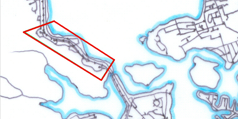
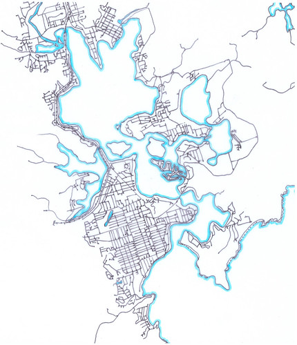
Brisbane Water Streets
To give you a better idea of how much more walking I've got ahead of me in my walk round Brisbane Water.
Big version
Big version
Thursday, October 20, 2005
St. Hubert's Island Stuff
Okay. Went to the library and looked up that stuff about the monk and got the general low-down on St. Hubert's.
Stats
The island is at the southern end of Brisbane Water and is "154 acres and 2 roods". I didn't even know there were roods but it turns out a rood is a quarter of an acre and I don't know why the fuck they didn't just say '154 1/2 acres'.
Anyways, it's less than 5 kilometres from Woy Woy and "25 sea miles" from the Sydney CBD. Whatever sea miles are. Okay, here we go, "unit of approx. 1,852 metres (2,025 yards)". There you go. But it's nearly 100 kilometres (62.14 miles) by road and rail due to having to skirt round the gorges and inlets of the Hawkesbury River.
Who's Who of Hubert's
In 1856 it was still called Bird Island and Riley's Island (right next to it) was called Shell Island. It was sold to a Father Cornelius Dominic Coghlan for £154 and 10 shillings. Coghlan was an Irish priest in the Dominican Order who came to Sydney in his early fifties. He's the bloke who gave it the name of St Hubert's.
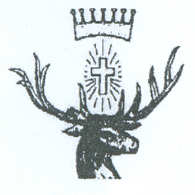
(The island's insignia. The stag because he was a hunter, the cross for Christianity obviously and the crown presumably because he was the eldest son of a duke.)
St Hubert
He was some rich bugger born around 626 who's dad was a French duke. He was a dead keen hunter and is the patron saint of hunters. He got religion after he was chasing some stag through the woods and it stopped and told him he was a naughty boy and to go off to church. (Which is liable to happen if you eat magic mushrooms before gallivanting about in the woods.) So then he does as ordered by the stag and gets religion and chucks over the life of wealth and luxury and does something churchy then carks it in 727.
Back to the Who's Who
When this Coghlan guy kicked it in 1872, he'd Willed the island to the Most Rev. Father Polding who was Arch Bishop of Sydney at the time. When he kicked it he left it to a Rev. Roger Vaughan and the Reverend Roger flogged it to a land agent called Francis Fahey in 1881 for £72 and Vaughan flogged it a few months later for £152 to some Sydney brickmaker called Collins. Collins sold it to Browne, Browne & Abbott and the bank got it in a mortgage foreclosure in 1905.
The bank subdivided it in 1906 and started selling it in 120 lots of "2 roods to 5 acres 2 roods". It had a "network of roads 66 feet wide" then but no canals yet. 18 lots sold between June 1914 and September 1924 so it wasn't exactly a hot property.
In 1947 some bloke called Swallow seems to've snapped up all the lots left and he sold 28 blocks between '47 and '52. In October 1961 all the lots he had left were bought up by some crowd calling themselves St Hubert's Island Pty Ltd. They seem to have been the last pair of hands the island went through. After that it was all private lots in the hands of residents.
A bridge over the Creek Cockle
Up to the seventies there was no permanent bridge or whatever to the island. There were some causeways going to Woy Woy via the unnamed islets and to Daley's Point and so on. A causeway, my Pocket Oxford tells me, is a "raised road across low or wet ground or water". Sand dredged up or dug up from somewhere no doubt, and dumped at low tide to make a cart-wide road across to the mainland. Which must've mucked the tidal flows about something cruel.
Anyways, in the late sixties work starts on The Rip Bridge. Which connects the Peninsula to Daley's Point. Daley's Point is pretty close to one end of the island so plans were drawn up and a ramp was built from Daley's down to the island and opened in 1971. The Rip Bridge was opened in 1974. With the bridge and the ramp it's about 15 minutes drive from Woy Woy station to St Hubert's.
I'm not sure when the canals went in. There's an early seventies photo in one of the library books showing a brand spanking new ramp and the canals built and a single house being built on a canal-front block of land. There's 3 or 4 established houses but they're in spots that would've been unaffected by the canal building. There's also a photo of four forties houses on Beachfront Parade. That's undated and so is the photo showing two houses, probably on what was eventually Beachfront.
That photo also shows a house and some other building on Riley's Island. Riley's was privately owned early on and the Rileys used it for boat building apparently. It was saved from a fate worse than death (being canal'd) by Paul Landa. He was the Minister for Something or Other and saved many a bit of wilderness from a grim death. I sat in one of his memorial parks at Pearl Beach.
In March 1788, Governor Phillip sussed out Broken Bay. I went on about this a bit when I walked Ettalong and Pearl Beach. As well as those two places the other place he landed in Brisbane Water was at St Hubert's. In 1988 (Australia's bicentennial of white settlement) there was a memorial to Phillip bunged up and a celebratory sausage sizzle put on at Long Arm Parade, complete with a costumed re-enactment of the landing. A newspaper report in 1988 says the monument was paid with a Bicentennial grant and the sausage sizzle paid for "by the sale of St Huberts spoons".
Governor Phillip's memorial
Plaque no 1.: "Australia 1788 - 1988 From the State Govt., Gosford City Bicentennial history Subcommittee & the St. Huberts Island Resisents Association an Australian Bicentennial Project To commemorate the nation's Bicentenary in 1988".
Plaque no 2.: "Monday 3rd March, 1788 When the tide had slacken'd we picked up and found several small inlets between mangroves on one of which island we stop'd and pitch'd the tents: had a very hard rain all the morning Lieut. Wm Bradley March, 1788".
Plaque no 3.: "Tuesday, 4th While the tents and clothes were drying... a crab was caught and proved very good AM, at day light proceeded up... we found natives all the way up. Lieut. Wm Bradley March, 1788".
Plaque no 4.: "This plaque was laid on the 3rd of March 1988 to commemorate the landing in this vicinity of Gov. Phillip, Lieut. Hunter and their party on 3rd March 1788".
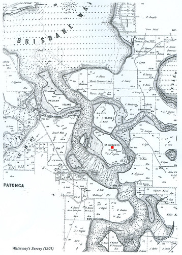
(Biggest version)
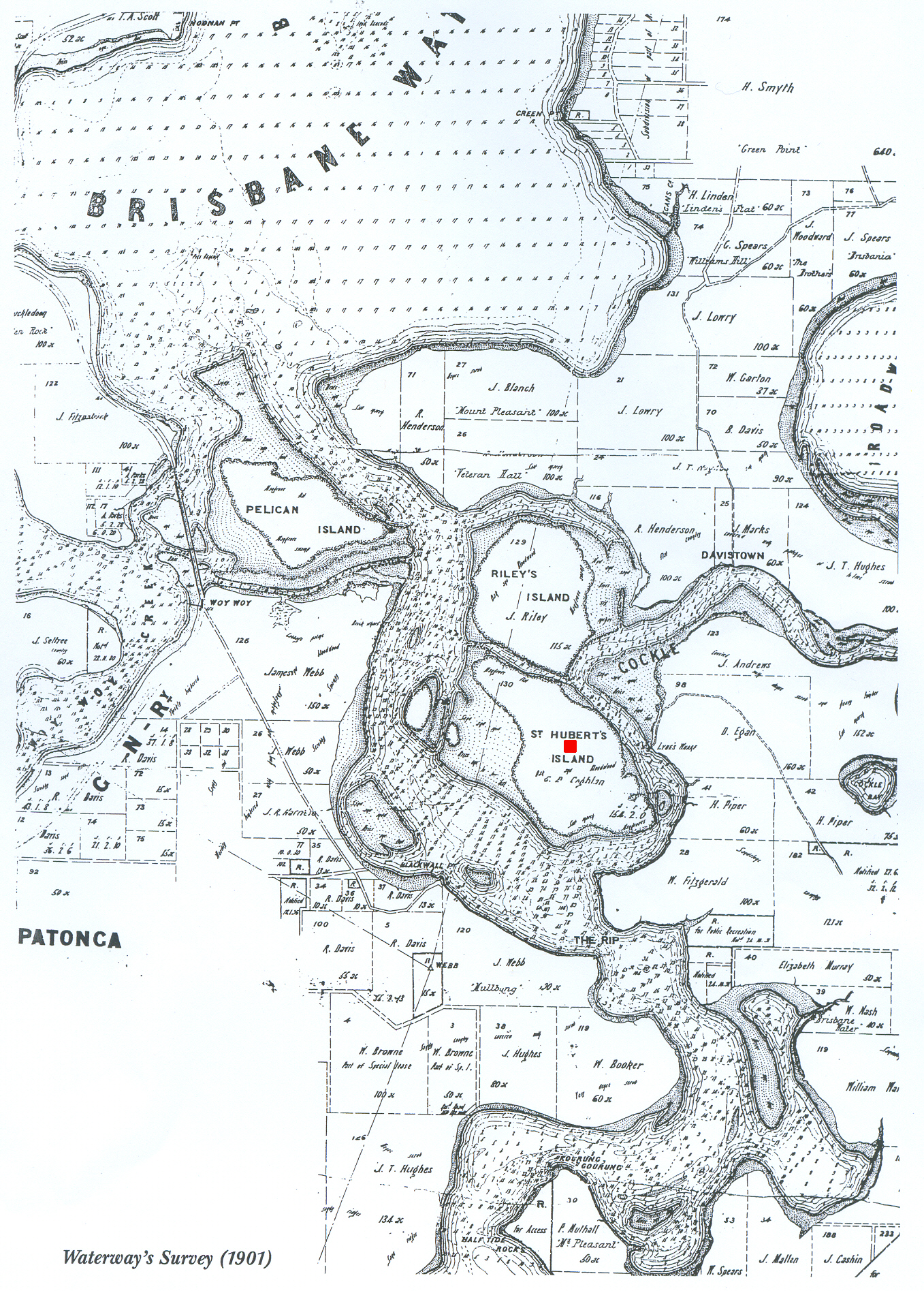
Waterman's Survey 1901. St Hubert's is the one with the red dot on it.
Stats
The island is at the southern end of Brisbane Water and is "154 acres and 2 roods". I didn't even know there were roods but it turns out a rood is a quarter of an acre and I don't know why the fuck they didn't just say '154 1/2 acres'.
Anyways, it's less than 5 kilometres from Woy Woy and "25 sea miles" from the Sydney CBD. Whatever sea miles are. Okay, here we go, "unit of approx. 1,852 metres (2,025 yards)". There you go. But it's nearly 100 kilometres (62.14 miles) by road and rail due to having to skirt round the gorges and inlets of the Hawkesbury River.
Who's Who of Hubert's
In 1856 it was still called Bird Island and Riley's Island (right next to it) was called Shell Island. It was sold to a Father Cornelius Dominic Coghlan for £154 and 10 shillings. Coghlan was an Irish priest in the Dominican Order who came to Sydney in his early fifties. He's the bloke who gave it the name of St Hubert's.
(The island's insignia. The stag because he was a hunter, the cross for Christianity obviously and the crown presumably because he was the eldest son of a duke.)
St Hubert
He was some rich bugger born around 626 who's dad was a French duke. He was a dead keen hunter and is the patron saint of hunters. He got religion after he was chasing some stag through the woods and it stopped and told him he was a naughty boy and to go off to church. (Which is liable to happen if you eat magic mushrooms before gallivanting about in the woods.) So then he does as ordered by the stag and gets religion and chucks over the life of wealth and luxury and does something churchy then carks it in 727.
Back to the Who's Who
When this Coghlan guy kicked it in 1872, he'd Willed the island to the Most Rev. Father Polding who was Arch Bishop of Sydney at the time. When he kicked it he left it to a Rev. Roger Vaughan and the Reverend Roger flogged it to a land agent called Francis Fahey in 1881 for £72 and Vaughan flogged it a few months later for £152 to some Sydney brickmaker called Collins. Collins sold it to Browne, Browne & Abbott and the bank got it in a mortgage foreclosure in 1905.
The bank subdivided it in 1906 and started selling it in 120 lots of "2 roods to 5 acres 2 roods". It had a "network of roads 66 feet wide" then but no canals yet. 18 lots sold between June 1914 and September 1924 so it wasn't exactly a hot property.
In 1947 some bloke called Swallow seems to've snapped up all the lots left and he sold 28 blocks between '47 and '52. In October 1961 all the lots he had left were bought up by some crowd calling themselves St Hubert's Island Pty Ltd. They seem to have been the last pair of hands the island went through. After that it was all private lots in the hands of residents.
A bridge over the Creek Cockle
Up to the seventies there was no permanent bridge or whatever to the island. There were some causeways going to Woy Woy via the unnamed islets and to Daley's Point and so on. A causeway, my Pocket Oxford tells me, is a "raised road across low or wet ground or water". Sand dredged up or dug up from somewhere no doubt, and dumped at low tide to make a cart-wide road across to the mainland. Which must've mucked the tidal flows about something cruel.
Anyways, in the late sixties work starts on The Rip Bridge. Which connects the Peninsula to Daley's Point. Daley's Point is pretty close to one end of the island so plans were drawn up and a ramp was built from Daley's down to the island and opened in 1971. The Rip Bridge was opened in 1974. With the bridge and the ramp it's about 15 minutes drive from Woy Woy station to St Hubert's.
I'm not sure when the canals went in. There's an early seventies photo in one of the library books showing a brand spanking new ramp and the canals built and a single house being built on a canal-front block of land. There's 3 or 4 established houses but they're in spots that would've been unaffected by the canal building. There's also a photo of four forties houses on Beachfront Parade. That's undated and so is the photo showing two houses, probably on what was eventually Beachfront.
That photo also shows a house and some other building on Riley's Island. Riley's was privately owned early on and the Rileys used it for boat building apparently. It was saved from a fate worse than death (being canal'd) by Paul Landa. He was the Minister for Something or Other and saved many a bit of wilderness from a grim death. I sat in one of his memorial parks at Pearl Beach.
In March 1788, Governor Phillip sussed out Broken Bay. I went on about this a bit when I walked Ettalong and Pearl Beach. As well as those two places the other place he landed in Brisbane Water was at St Hubert's. In 1988 (Australia's bicentennial of white settlement) there was a memorial to Phillip bunged up and a celebratory sausage sizzle put on at Long Arm Parade, complete with a costumed re-enactment of the landing. A newspaper report in 1988 says the monument was paid with a Bicentennial grant and the sausage sizzle paid for "by the sale of St Huberts spoons".
Governor Phillip's memorial
Plaque no 1.: "Australia 1788 - 1988 From the State Govt., Gosford City Bicentennial history Subcommittee & the St. Huberts Island Resisents Association an Australian Bicentennial Project To commemorate the nation's Bicentenary in 1988".
Plaque no 2.: "Monday 3rd March, 1788 When the tide had slacken'd we picked up and found several small inlets between mangroves on one of which island we stop'd and pitch'd the tents: had a very hard rain all the morning Lieut. Wm Bradley March, 1788".
Plaque no 3.: "Tuesday, 4th While the tents and clothes were drying... a crab was caught and proved very good AM, at day light proceeded up... we found natives all the way up. Lieut. Wm Bradley March, 1788".
Plaque no 4.: "This plaque was laid on the 3rd of March 1988 to commemorate the landing in this vicinity of Gov. Phillip, Lieut. Hunter and their party on 3rd March 1788".
(Biggest version)
Waterman's Survey 1901. St Hubert's is the one with the red dot on it.
Wednesday, October 19, 2005
Photos from Park's Bay
Did Park's Bay - Brisbane Water Walk #2 a couple of weeks ago.
Big version
Taken from Brisbane Water Drive between Woy Woy and Park's Bay.
Left to right:
Pines at the Memorial Park on the foreshore.
Pelican Island in front of the pines.
Light at the footy oval.
The fish & chip shop on the foreshore where they do the pelican feeding.
Possibly the former 'Roma' boarding house circa 1891. The elaborate plaster ceiling and the general style of the building certainly fit.
CWA (low, grey roof).
Old Woy Woy pub, 1897 (behind CWA).
Some old shops.
The sticking up thing is a crane or something on an oyster boat or dredger. Behind istyou can just see the Bay View Hotel, built in 1929.
At the end of the road are some more old shops on Railway Street opposite the station, which is behind the trees on the far right.
Big version.
These 2 houses are still occupied. They're listed in my hist list as "Edmund Parks ... c. 1900".
The railway bridge over on the right has 2 plaques on it. One is "DMR 1984" and the other one is the official opening thingy saying "Woy Woy Bridge opened by the Hon. L. S. Brereton M.P. Minister for Public Works & Ports and Minister for Roads 25 January 1985". You go under the bridge at the other end to get to Park's Bay.
Koolewong is on the other side of that hill.
Biggest version, not much detail on Woy Woy.
Left to right:
Either Blackwall Mountain or the nameless hill the railway tunnel goes under.
Woy Woy. Railway Street & Woy Woy Bay Road.
Deadman's (Correa) Bay (above the boat).
Oyster shed.
Behind the row of houses, according to my map, is the street I couldn't find.
You stand at the blue barrel and wave at the oyster shed if you want fresh oysters and they come over.
Big version
You go down a dirt road between Brisbane Water Drive and the railway bridge and under to get to Park's Bay. The water was a beautiful green.
That's Pelican Island in the background and the hill is Blackwall Mountain.
Big version
I like the light and the patterns.
Big version
Taken from Brisbane Water Drive between Woy Woy and Park's Bay.
Left to right:
Pines at the Memorial Park on the foreshore.
Pelican Island in front of the pines.
Light at the footy oval.
The fish & chip shop on the foreshore where they do the pelican feeding.
Possibly the former 'Roma' boarding house circa 1891. The elaborate plaster ceiling and the general style of the building certainly fit.
CWA (low, grey roof).
Old Woy Woy pub, 1897 (behind CWA).
Some old shops.
The sticking up thing is a crane or something on an oyster boat or dredger. Behind istyou can just see the Bay View Hotel, built in 1929.
At the end of the road are some more old shops on Railway Street opposite the station, which is behind the trees on the far right.
Big version.
These 2 houses are still occupied. They're listed in my hist list as "Edmund Parks ... c. 1900".
The railway bridge over on the right has 2 plaques on it. One is "DMR 1984" and the other one is the official opening thingy saying "Woy Woy Bridge opened by the Hon. L. S. Brereton M.P. Minister for Public Works & Ports and Minister for Roads 25 January 1985". You go under the bridge at the other end to get to Park's Bay.
Koolewong is on the other side of that hill.
Biggest version, not much detail on Woy Woy.
Left to right:
Either Blackwall Mountain or the nameless hill the railway tunnel goes under.
Woy Woy. Railway Street & Woy Woy Bay Road.
Deadman's (Correa) Bay (above the boat).
Oyster shed.
Behind the row of houses, according to my map, is the street I couldn't find.
You stand at the blue barrel and wave at the oyster shed if you want fresh oysters and they come over.
Big version
You go down a dirt road between Brisbane Water Drive and the railway bridge and under to get to Park's Bay. The water was a beautiful green.
That's Pelican Island in the background and the hill is Blackwall Mountain.
Big version
I like the light and the patterns.
Tuesday, October 18, 2005
Brisbane Water Walk #3 - St. Hubert's Island
It looked like rain this morning but I thought, Fuck it, I'm off anyways. Haven't walked since the 3rd and have felt it something cruel. Aches and pains and an urge to be out and about.
Got off the bus at the top of the ramp and stood there for a few minutes, just drinking in the scene. I wasn't up high but I got a good view. Nice green water in the foreground changing to bright blue further out, soft dark green of the closer hills and misty green of the hills and ridges in the distance. It wasn't yet eight a.m., the breeze was stirring and I was very happy to be on the road again. I trotted off down the ramp.
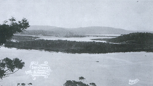
Biggest version (very grainy)
(Old postcard, taken from Blackwall Mountain)
Behind me was the hill of Daley's Point. Down to the left was Retention Islet, a tiny sand and mangrove island. Down on the right was Oyster Islet, which was the same. Over on the left the lumpy bulk of Blackwall Mountain and the Peninsula foreshore stretching away, with the folds of the ridge behind it. Behind the Peninsula was the ridges of Phegan's and Deadman's (Correa) and Woy Woy Bays.
On the right was the hill above Empire Bay. No idea what it's called, there's no name for it on any of my maps. To the left of it was Davistown and Saratoga. To the right of the sharp hill of Saratoga was Kincumba Mountain and Green Point. Behind St. Hubert's (it's flat) were the ridges of Koolewong and Tascott.
In this photo you can see how close St. Hubert's is to Woy Woy. In this aerial photo you can see all the canals or coves or whatever you want to call them. On the old postcard above you can see what it looked like with nothing on it but trees.
St. Hubert's is a flat island half a mile wide and not quite a mile long. It's got 19 streets, 6 canals/ coves, 5 parks, 1 memorial, 1 public boat ramp and no shops. It gets its name from when some monk guy late last century wanted to build a monastery or a school or something there. I noticed a spiel about it in a library book when I was looking up Woy Woy stuff months back. Been too irritable to do research lately.
Anyways, it was originally one of the mangrove islands and there's still mangroves round its edges here and there. Other than that all traces of its original form have been obliterated by development. When land went on sale there real estate agents must've been climbing over each other to sell it. With the artificial canals/ coves, 80% of the houses have waterfrontage and probably 90% have views. The street names are all but two (Boyd & Luderick) dreamed up by estate agents: Helmsman, Beachfront, Weatherly, Skiff, Mooring, Marina View, Nautilus, Mainsail, and so on.
On this 1950s map the streets are shown as not yet built. But I found two 1940s houses, one on the corner of Beachfront and Sirius and one in Discovery. Interesting. Perhaps some of the roads were built but not yet sealed and so the dashed lines on the map. Anyways, whenever the roads were built or sealed, most of the building appears to've happened in the seventies and early eighties. And we all know how much I hate seventies architecture. There's plenty building after that and there were several building sites today but the seventies and eighties dominate.
Other than the architectural horrors, it's rather pleasant. The streets trees were paperbarks and gums, the gardens were pretty bushy and the views are great. Grey cloud had come up from Sydney and the mist of rain in the distance made the furtherest hills seem further. Looking across to the Peninsula and seeing where I've walked was good. So was looking across to future walkies at Saratoga and Davistown and Daley's Point.
The best park was the one with the memorial on Long Arm Parade. More of a marker really. Another one of Governor Phillip's landing sites in 1788. The park was a narrow strip of grass along the side of the road. A picnic table and a couple of seats, the memorial thingy, some trees and a tiny bit of beach. The water was maybe a foot deep for 10 metres out and there was a patch of mangroves. Directly ahead was the hill above Empire Bay. I watched a bus change gear and roar up the hill and listened to the water lap against the sea wall. The birds were twittering and carrying on, enjoying the sun again after the rain. A lovely spot.
It was a great walk. Got in some more exploring, walked a whole island in one morning, smelt some beautiful roses and saw some red red poppies (I love that poppy shade of red) and got some great views. I'm a bit footsore after the fortnight off but it really perked me up.
Got off the bus at the top of the ramp and stood there for a few minutes, just drinking in the scene. I wasn't up high but I got a good view. Nice green water in the foreground changing to bright blue further out, soft dark green of the closer hills and misty green of the hills and ridges in the distance. It wasn't yet eight a.m., the breeze was stirring and I was very happy to be on the road again. I trotted off down the ramp.
Biggest version (very grainy)
(Old postcard, taken from Blackwall Mountain)
Behind me was the hill of Daley's Point. Down to the left was Retention Islet, a tiny sand and mangrove island. Down on the right was Oyster Islet, which was the same. Over on the left the lumpy bulk of Blackwall Mountain and the Peninsula foreshore stretching away, with the folds of the ridge behind it. Behind the Peninsula was the ridges of Phegan's and Deadman's (Correa) and Woy Woy Bays.
On the right was the hill above Empire Bay. No idea what it's called, there's no name for it on any of my maps. To the left of it was Davistown and Saratoga. To the right of the sharp hill of Saratoga was Kincumba Mountain and Green Point. Behind St. Hubert's (it's flat) were the ridges of Koolewong and Tascott.
In this photo you can see how close St. Hubert's is to Woy Woy. In this aerial photo you can see all the canals or coves or whatever you want to call them. On the old postcard above you can see what it looked like with nothing on it but trees.
St. Hubert's is a flat island half a mile wide and not quite a mile long. It's got 19 streets, 6 canals/ coves, 5 parks, 1 memorial, 1 public boat ramp and no shops. It gets its name from when some monk guy late last century wanted to build a monastery or a school or something there. I noticed a spiel about it in a library book when I was looking up Woy Woy stuff months back. Been too irritable to do research lately.
Anyways, it was originally one of the mangrove islands and there's still mangroves round its edges here and there. Other than that all traces of its original form have been obliterated by development. When land went on sale there real estate agents must've been climbing over each other to sell it. With the artificial canals/ coves, 80% of the houses have waterfrontage and probably 90% have views. The street names are all but two (Boyd & Luderick) dreamed up by estate agents: Helmsman, Beachfront, Weatherly, Skiff, Mooring, Marina View, Nautilus, Mainsail, and so on.
On this 1950s map the streets are shown as not yet built. But I found two 1940s houses, one on the corner of Beachfront and Sirius and one in Discovery. Interesting. Perhaps some of the roads were built but not yet sealed and so the dashed lines on the map. Anyways, whenever the roads were built or sealed, most of the building appears to've happened in the seventies and early eighties. And we all know how much I hate seventies architecture. There's plenty building after that and there were several building sites today but the seventies and eighties dominate.
Other than the architectural horrors, it's rather pleasant. The streets trees were paperbarks and gums, the gardens were pretty bushy and the views are great. Grey cloud had come up from Sydney and the mist of rain in the distance made the furtherest hills seem further. Looking across to the Peninsula and seeing where I've walked was good. So was looking across to future walkies at Saratoga and Davistown and Daley's Point.
The best park was the one with the memorial on Long Arm Parade. More of a marker really. Another one of Governor Phillip's landing sites in 1788. The park was a narrow strip of grass along the side of the road. A picnic table and a couple of seats, the memorial thingy, some trees and a tiny bit of beach. The water was maybe a foot deep for 10 metres out and there was a patch of mangroves. Directly ahead was the hill above Empire Bay. I watched a bus change gear and roar up the hill and listened to the water lap against the sea wall. The birds were twittering and carrying on, enjoying the sun again after the rain. A lovely spot.
It was a great walk. Got in some more exploring, walked a whole island in one morning, smelt some beautiful roses and saw some red red poppies (I love that poppy shade of red) and got some great views. I'm a bit footsore after the fortnight off but it really perked me up.
Monday, October 17, 2005
Photo Investigator
There's a photo search thingy here which brings up some lovely old photos of Woy Woy.
There's also some rather pleasant steam train porn here.
There's also some rather pleasant steam train porn here.
Photos from My Final Walk
My final walk in Woy Woy was Walk #68 - Brick Wharf Road on the 30th of September 2005. (2006 walkies here.)
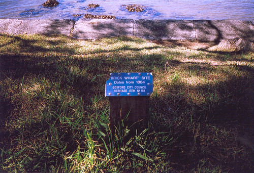
(Big version)
The end of my final walk of the Woy Woy peninsula. A well-known local history site.
It says: "Brick Wharf site, dates from 1884, Gosford City Council, Heritage Item No 168". You can't see the original structure of the wharf but the foreshore juts out in a square shape.
The Woy Woy Tunnel was built in the 1880s. It's the longest railway tunnel in NSW, has 10 million bricks in it, is 1791 metres long (1.11 miles) and takes three minutes to go through on the train. Some bloke called Rock Davis brought the bricks in by boat to the wharf and they were moved to the tunnel site on the rails already laid this side of the tunnel. Hence Brick Wharf and Brick Wharf Road.
(Big version)
Sat on this seat when I finished my walk and soaked up the completion vibe and gazed out over Brisbane Water at all the other walks I can do.
The road runs along side the water most of the way. At the pub end there's the fish-n-chip shop, then the Memorial park then the flat grassy foreshore (see some photos here) then a few houses and the Bowls (the indoor bowling club-cum-pub), a couple more houses then the foreshore.
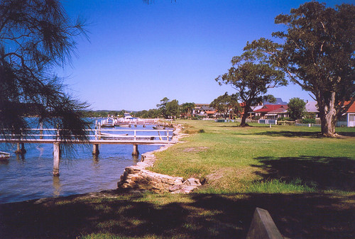
(Big version)
Looking in the direction of Blackwall Mountain. Early in the morning and at dusk this is dog-walkies central. It's very peaceful in the middle of the day.
Plans for more walks
2006 walks
(Big version)
The end of my final walk of the Woy Woy peninsula. A well-known local history site.
It says: "Brick Wharf site, dates from 1884, Gosford City Council, Heritage Item No 168". You can't see the original structure of the wharf but the foreshore juts out in a square shape.
The Woy Woy Tunnel was built in the 1880s. It's the longest railway tunnel in NSW, has 10 million bricks in it, is 1791 metres long (1.11 miles) and takes three minutes to go through on the train. Some bloke called Rock Davis brought the bricks in by boat to the wharf and they were moved to the tunnel site on the rails already laid this side of the tunnel. Hence Brick Wharf and Brick Wharf Road.
(Big version)
Sat on this seat when I finished my walk and soaked up the completion vibe and gazed out over Brisbane Water at all the other walks I can do.
The road runs along side the water most of the way. At the pub end there's the fish-n-chip shop, then the Memorial park then the flat grassy foreshore (see some photos here) then a few houses and the Bowls (the indoor bowling club-cum-pub), a couple more houses then the foreshore.
(Big version)
Looking in the direction of Blackwall Mountain. Early in the morning and at dusk this is dog-walkies central. It's very peaceful in the middle of the day.
Plans for more walks
2006 walks
Full Bloody Stop
Got a copy of my Gran's Will today. In it there's no "small cash
bequest" to anyone, let alone to me.
What the fuck?
Do I think my father has suddenly recovered from a lifetime of being tightfisted (cheap) and started handing out his own money to relatives? No, I do not. Do I think the "small cash bequest" he says Gran left to me and my cousins is his way of giving me money? No, I do not.
Not in the light of his various tantrums and sulks and ego-mania in the past and the recent thing where he claimed to have "power over you all". I think it's just another promise he doesn't intend to keep, just another petty power play in a life full of petty power plays.
The games my father plays are set up so no-one can win. The only way to avoid losing a game you can't win is to not play the game.
It's a harsh thing to have to say about your own parent but if I never see my father again it will be too soon.
Sunday, October 16, 2005
Stuff
Pasted from mailing group & from here.
1.
What to do with Bin Laden/ George Bush/ John Weasel Howard:
Killing him will only create a martyr. Holding him prisoner will inspire comrades to take hostages to demand his release. Therefore I suggest we do neither.
Let the special Forces, Seals, or whoever covertly capture him, fly him to an undisclosed hospital, and have surgeons quickly perform a complex sex change operation.
Then return her to Afghanistan/ America/ Australia to live as a woman under the Taliban/ as her own wife.
2.
They told me you weren't dumb enough to lie all the time. I stuck up for you and said you were.
3.
What do you get when you cross the Godfather with a narcissist? An offer you can't understand.
4.
Hear about the terrorist that hijacked a 747 full of narcissists? He threatened to release one every hour if his demands weren't met.
Thank you. I'll be here all week.
Wednesday, October 12, 2005
A Sense Of Scale
A little orientation for my non-Sydney visitors, prompted by Suzanne's comment.
According to Ask Jeeves, it's 63 kilometres (39 miles) from Sydney to Gosford and Gosford is maybe 10k from here. On the fast train it's 1 hour & 20 mins to Central. Which is the main Sydney train terminal. It takes a standard commuter train about an hour to travel the width of Sydney.
From Central you get a 15 minute train round the City Circle. Which is not circular and goes under the 19th century part of Sydney (except The Rocks) to Circular Quay (which is also not circular) and back. And this underground circle comes up onto the roof at the Quay, which is not underground.
When you get off at the Quay and go down to the ferry wharves, you can see the Opera House and the Coathanger (Sydney Harbour Bridge) by turning your head from left to right. Tourists love that. Two for the price of one and an over-priced cafe at the Quay at which to recover from the excitement. Then they go out to the Opera House and take photos of themselves on the Opera House steps with the Bridge in the background.
There's a stack of stats on Australia at the CIA's site. But take them with a grain of salt. If they've got "chief of state: Queen of Australia" then they'll have something else wrong too. For the last time peeps, she's not the queen of Australia, she's the queen of England. As queen of England the Queen is head of the Commonwealth, part of which is Australia.
Okay. I'm off to enjoy the rain and the cool.
Tuesday, October 11, 2005
Pearl Beach Photos III
From Walk #67 - Pearl Beach.
(Big version)
I like these. They're not usually as bright as this one is. Maybe my monitor's buggered.
Anyways, they're proteas or something. They're flowering right now. They cost five bucks a go at the florist.

(Big version)
The park on the tip of Green Point. That's the Green Point at Pearl Beach, not the Green Point at Gosford.
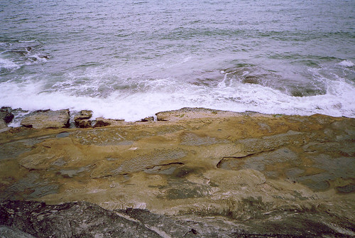
(Big version)
One of those rock ledges fishermen get swept off. Below the park at the tip of Green Point.

(Big version).
Looking down into Pittwater from the park at the tip of Green Point. That's Lion Island on the far left. Then Sandy Point. Clareville. Bilgola. Newport. Probably. Commodore Heights in Ku-ring-gai Park, a nameless point opposite Lion Island. And Green Point in the foreground. And a commercial fishing boat.

(Big version)
Ettalong and Blackwall Mountain from the park at the tip of Green Point. The hills on the right are Daley's Point and Wagstaffe. The one on the left is Mt Ettalong (AKA Patonga Ridge).
Got the photos from my last walk to go yet. Gotta remember to put the fucking film in for developing.
Next walk
(Big version)
I like these. They're not usually as bright as this one is. Maybe my monitor's buggered.
Anyways, they're proteas or something. They're flowering right now. They cost five bucks a go at the florist.
(Big version)
The park on the tip of Green Point. That's the Green Point at Pearl Beach, not the Green Point at Gosford.
(Big version)
One of those rock ledges fishermen get swept off. Below the park at the tip of Green Point.
(Big version).
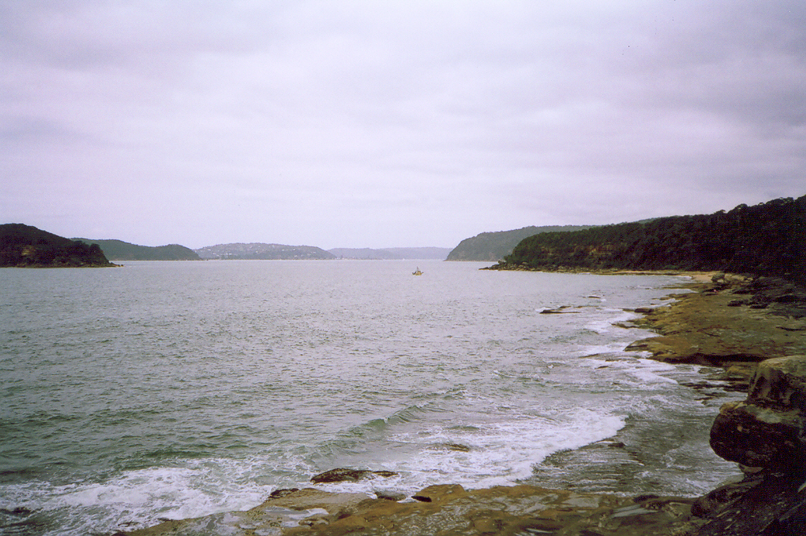
Looking down into Pittwater from the park at the tip of Green Point. That's Lion Island on the far left. Then Sandy Point. Clareville. Bilgola. Newport. Probably. Commodore Heights in Ku-ring-gai Park, a nameless point opposite Lion Island. And Green Point in the foreground. And a commercial fishing boat.
(Big version)
Ettalong and Blackwall Mountain from the park at the tip of Green Point. The hills on the right are Daley's Point and Wagstaffe. The one on the left is Mt Ettalong (AKA Patonga Ridge).
Got the photos from my last walk to go yet. Gotta remember to put the fucking film in for developing.
Next walk
Monday, October 10, 2005
History Outing
Plodded off to Sydney for another history talk this morning. Didn't get much sleep last night so I wasn't at my alertest ever. But it was an interesting enough talk. Poked around the Quay after having another look for the Tank Stream but still no luck.
(Big version. The Tank Stream goes from the middle to the left. And Sydney Cove is now Circular Quay.)
Got some maps. Including the one above. In it Sydney looks pretty much as it does now. The Tank Stream's still there underground. It's been in a pipe for a long time and somewhere there's a glass floor where you can see down into a hole in the pipe and have a gander at it.
Sunday, October 09, 2005
Fuck A Truck
I'm tired and pissed off and still got the fucking flu and bad news is coming in from all quarters. This post will be peevish and full of fucking swearing. Consider yerself warned.
1. 7.6 earthquake with aftershocks of up to 6.0. Poor bastards.
2. Weasel blinks. Not exactly good news but a lesseining of bad news. But we'll still be sacked for being queer or the wrong religion or for not wanting to be sexually harrassed or just because the boss is having a bad day.
3. More legal crap to be ploughed through re my father's crap.
4. Australian develops cancer vaccine. Some good news for a fucking change.
In the meantime, go and have a read:
Do gays cause tornados? Which I think I nicked off Suzanne.
Mating season in the Antarctic defies intelligent design by Emma Tom.
Survivor Toyland.
Best vagina smalltalk ever.
Nee Naw. London ambo dispatcher's blog.
Totally unauthorised. A side of the film industry most never see.
I'm off to eat something foolish and ring peeps up and whinge.
Saturday, October 08, 2005
Catch Up
Mine Host has been and gone and got pnuemonia for the second time this year. He's on the mend now but there's a technical hitch as well. So my main blog (sexinthesuburbs.info) won't be back up until November.
But such is life. This blog has sufficed so far and will until my main one is back up.
For readers of my main blog who've just joined us, I went to History Week, finished the Woy Woy Walk, did all of Park's Bay I could find, had more crap from my father and am starting the next walk next week.
In the right hand column (--->) is a map of my walkies plans. The orange coloured-in bits are the walks I've done so far. The orange outlines are planned walks that'll take me right round Brisbane Water.
Recent photos
Walk #51 - Plateau
Hist List
Walk #53
Walk #56 - Up The Mountain
Walk #56 - Up The Mountain
Walks #59 & 60 - Music To My Ears
Walk #64 - Fearsome Schmearsome
Walk #65 - Patonga
Walk #65 - Patonga II
Walk #65 - Patonga III
Walk #67 - Pearl Beach
Walk #67 - Pearl Beach II
Or go to Flickr & start here.
Friday, October 07, 2005
Pearl Beach Photos II
From Walk #67 - Pearl Beach.
See big version.
Little narrow lagoon lurking between Coral Crescent & Diamond Street, Pearl Beach. There's houses backing onto it but a public park round it and plenty of ducks.
See big version.
This track goes off the access from Coral Crescent.
Note using it put you in danger of "death or serious injury". Coupla minutes later I saw someone cycling merrily along one of the dodgier parts.
See big version.
A better photo of Pearl Beach & Green Point.
Behind the camera is Mt Ettlong (AKA Patonga Ridge) and behind that is Umina Beach & Woy Woy. To the right of the camera is Pearl Beach the township. To the left is the open sea as seen through the heads and Box Head.

See big version.
Top: "Pearl Beach visited 2 March, 1788".
Left: "At 9 at night moored the boats in a cove on the N. side of the bay off which the surf broke violently... They were met by a great number of the natives men, women and children... They were all very friendly. Lieut. Wm. Bradley R.N. March 1788".
Right: "We slept in the boat that night within a rocky point in the north-west part of the bay (which is very extensive) as the native tho very friendly appeared to be numerous. Gov. Capt. A. Phillip R.N."
Bottom: "This plaque was unveiled on 2nd March 1988 to commemorate the visit to Pearl Beach by Captain Phillip & party on 2nd March 1788".
"Lieut." is Lieutenant, "Wm." is William, "R.N." is the British Royal Navy, "Gov." is Governor, who is the representative of the Queen/King of England.
Walk #67 - Pearl Beach.
Pearl Beach Photos I.
Pearl Beach photos III
See big version.
Little narrow lagoon lurking between Coral Crescent & Diamond Street, Pearl Beach. There's houses backing onto it but a public park round it and plenty of ducks.
See big version.
This track goes off the access from Coral Crescent.
Note using it put you in danger of "death or serious injury". Coupla minutes later I saw someone cycling merrily along one of the dodgier parts.
See big version.
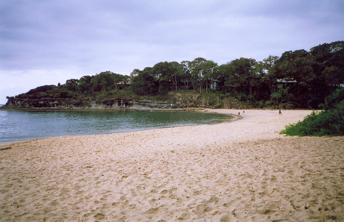
A better photo of Pearl Beach & Green Point.
Behind the camera is Mt Ettlong (AKA Patonga Ridge) and behind that is Umina Beach & Woy Woy. To the right of the camera is Pearl Beach the township. To the left is the open sea as seen through the heads and Box Head.
See big version.
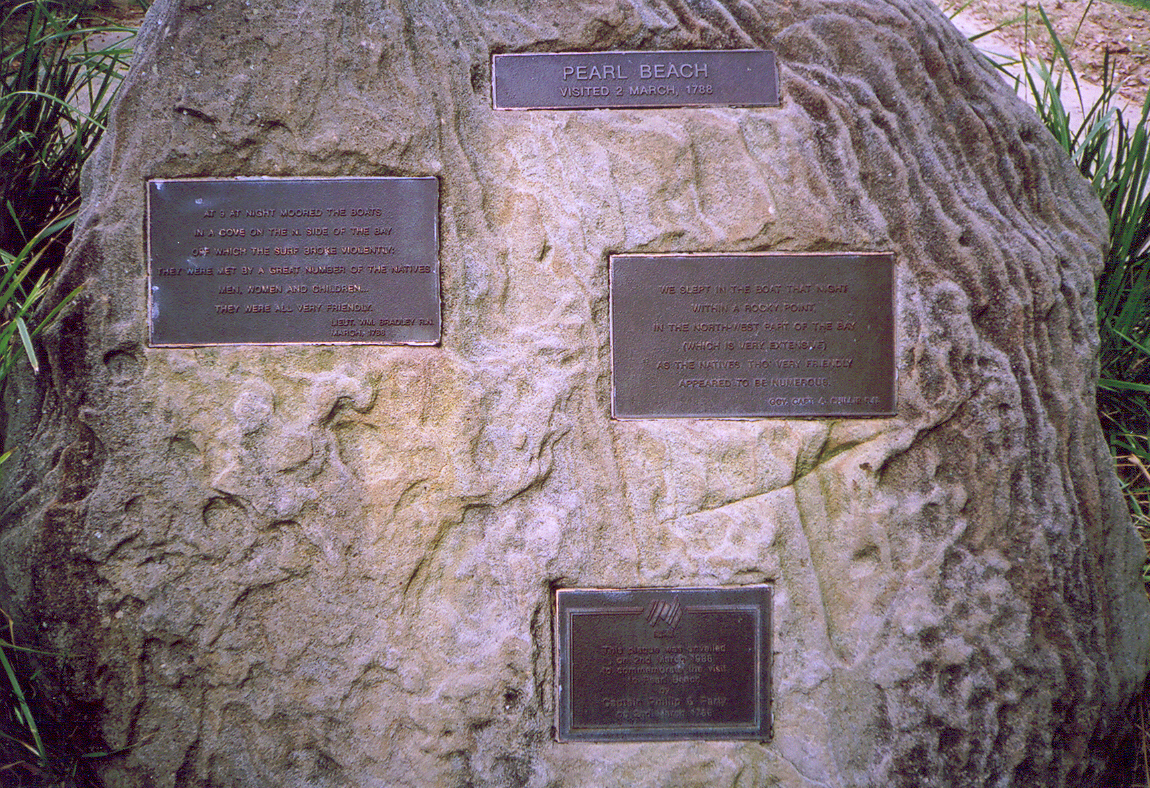
Top: "Pearl Beach visited 2 March, 1788".
Left: "At 9 at night moored the boats in a cove on the N. side of the bay off which the surf broke violently... They were met by a great number of the natives men, women and children... They were all very friendly. Lieut. Wm. Bradley R.N. March 1788".
Right: "We slept in the boat that night within a rocky point in the north-west part of the bay (which is very extensive) as the native tho very friendly appeared to be numerous. Gov. Capt. A. Phillip R.N."
Bottom: "This plaque was unveiled on 2nd March 1988 to commemorate the visit to Pearl Beach by Captain Phillip & party on 2nd March 1788".
"Lieut." is Lieutenant, "Wm." is William, "R.N." is the British Royal Navy, "Gov." is Governor, who is the representative of the Queen/King of England.
Walk #67 - Pearl Beach.
Pearl Beach Photos I.
Pearl Beach photos III
Thursday, October 06, 2005
Pearl Beach Photos
From Walk #67 - Pearl Beach.
Pearl Beach was my 2nd last walk on the Woy Woy Peninsula Walk, which was Brisbane Water Walk #1. Brisbane Water Walk #2 was Park's Bay.
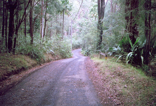
(See big version)
The quietest street on the Peninsula Walk.
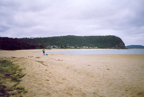
(See big version).
From the end of Gem Road, Pearl Beach. The beach-front houses are on Coral Crescent. Behind them is the south side of Mt Ettalong (AKA Patonga Ridge) with the water tank on top. On the right you can see part of Umina Beach and behind it Blackwall Mountain.
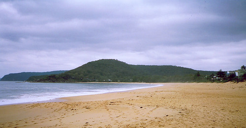
(See big version).
From left to right: In the background, Commodore Heights at the northern tip of Ku-ring-gai Chase National Park. Green Point, with Paul Landa Reserve on it. The hill in the middle is Warrah Trig. I always thought a trig was some sort of beach so there you go. The houses at the foot of the Trig are probably on Green Point Road and Gem Road (going up) and Pearl Parade (level). Houses on the right are on Coral Crescent.
More photos
Pearl Beach was my 2nd last walk on the Woy Woy Peninsula Walk, which was Brisbane Water Walk #1. Brisbane Water Walk #2 was Park's Bay.
(See big version)
The quietest street on the Peninsula Walk.
(See big version).
From the end of Gem Road, Pearl Beach. The beach-front houses are on Coral Crescent. Behind them is the south side of Mt Ettalong (AKA Patonga Ridge) with the water tank on top. On the right you can see part of Umina Beach and behind it Blackwall Mountain.
(See big version).
From left to right: In the background, Commodore Heights at the northern tip of Ku-ring-gai Chase National Park. Green Point, with Paul Landa Reserve on it. The hill in the middle is Warrah Trig. I always thought a trig was some sort of beach so there you go. The houses at the foot of the Trig are probably on Green Point Road and Gem Road (going up) and Pearl Parade (level). Houses on the right are on Coral Crescent.
More photos
Coinage
Happy Insult A US Senator Day!
Celebrate and get a free word to add to your vocab at Trying to Make 'Santorum' Stick.
Celebrate and get a free word to add to your vocab at Trying to Make 'Santorum' Stick.
Wednesday, October 05, 2005
Tuesday, October 04, 2005
Vital Bits
Been leaving vital bits out of conversations and posts recently. And I've been getting less out of my walkies and various other activities. It's this crap with my father and the effects it's having on my various ailments and my concentration.
F'rinstance, Suzanne pointed out that calling yesterday's Park's Bay walk 'Brisbane Water Walk #2' was a bit out of the blue.
When I was rabbitting on about my future walkies the other day, I totally forgot to say I'm counting the Woy Woy walk I just finished as Brisbane Water Walk #1.
Brisbane Water Walk #1 - Woy Woy peninsula - 1st March to 30th September 2005
Brisbane Water Walk #2 - Park's Bay - 3rd October 2005
Brisbane Water Walk #3 - destination undecided
Haven't started walking 19th century Sydney yet. I'm hoping to get started before the hot weather really sets in. This crap with my father has got to be brought under control so I can get back the energy to do it.
This crap with my father
The day after Gran's funeral he started ranting about how he had "power over you all". "You" being my aunts & uncles, me & my cousins and the "power" being the job of executor Gran left him with.
Gran's estate consists of one ordinary suburban house, a couple of thousand in the bank and her personal effects. There's no Picasso, no pot of gold hidden under the stairs, not much dollar value. The house has been sold and the proceeds split between her four kids, one of course being my father.
So he's got the money. But this isn't about money. For him it's about power. He's now delaying handing over the personal effects and the tiny cash bequest Gran left to her grandchildren. As soon as he hands that over his job as executor is finished and all this power he thinks he has is gone.
I want him replaced as executor. The job should go to his brother or sister. I want to go to a solicitor now and get him replaced and be done with it.
They're not thinking very clearly at the moment. No wonder. They've only just met the monster and they're still reeling. They met him the day after Gran's funeral. He's been like that as long as I've known him. As soon as the front door shut behind us, shutting the world out and shutting us in with him, out came the monster. No-one believed me. He was so nice and mild and pleasant on the public side of the front door. After a while I gave up asking for help.
My aunt and uncle are hoping for a peaceful resolution. One where my father comes to his senses and starts behaving like an adult. A reasonable expectation but it's just not going to happen. I've known the monster all my life and I know that this can only end in court.
Now they're starting to remember what he was like as a child. They're realising that he was always the monster and the pleasant behaviour he displayed as an adult was just a cover. It must be horrible for them to find out there's a monster still living in the family. But the sooner they remember who he really is the less damage he can do them and my cousins.
Monday, October 03, 2005
Park's Bay Park - Brisbane Water Walk #2
Park's Bay is a snippet of a place. A couple of dozen houses perched at the foot of a hill next to the railway line. You leave Woy Woy and head towards Gosford on Brisbane Water Drive. On the right there's the low flat green of Pelican Island. Then you're on the short bridge across the narrows and to the right of the bridge is Park's Bay. Look out the wrong window and you'll miss it.
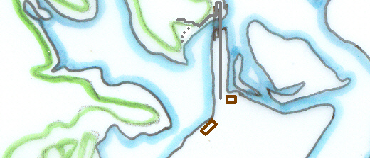
As a walk it was twenty minutes from the Bay View pub near the ferry wharf to where the narrow dirt access road goes under the railway bridge. It was nice and cool under there. By nine this morning it was already 25 degrees (77 Fahrenheit) or more and there was no shade along Brisbane Water Drive.
Park's Bay looks pretty peaceful but it can't be very quiet. Goods trains thunder along there at various hours of the night and day and the passenger trains go through more than once an hour. Maybe it's cheap. Anyways, whatever else it is, the hillside is choked with lantana and I couldn't find the second of its two streets.
It looks clear enough on my map. One long narrow street and a short one coming off it not far from the hill end. Found the end all right. Just not the short street. The only path that might've connected them was too narrow for cars and ended in a private property sign.
I was getting a bit cross and tired. I thought, Fuck it, I'm not clambering back up the hill and thrashing about in the lantana looking for a missing street. The bastard will have to wait for another day.
So I came home. And I might just go back to bed after lunch. Feel okay but I'm bloody tired and anxious not to lapse back into the flu and have another fucking six week bout.
Victory & Gloom
There was another Grand Final last night. Rugby league. Sydney's Wests Tigers gave the North Queensland Cowboys a bit of a thrashing.
30-16. I'd forgotten it was on. Woke up late yesterday afternoon to the sound of hoots and drunken victory howls from Wests supporters prancing along the street.
Turned on the telly and there's been more bombing in Bali. Poor bastards.
30-16. I'd forgotten it was on. Woke up late yesterday afternoon to the sound of hoots and drunken victory howls from Wests supporters prancing along the street.
Turned on the telly and there's been more bombing in Bali. Poor bastards.
Sunday, October 02, 2005
Patonga Photos - Part III
From Walk #65 - Moonlight Bay.
Click on the photos for bigger versions.
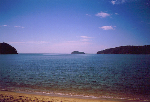
Left to right: Dark Corner. Barrenjoey Head. Commodore Heights in Ku-ring-gai Park.
Barrenjoey looks tiny from the side huh? I'd link you to a photo that shows it from the Woy Woy side but there isn't a clear one. Never realised before how hard it is to spot Barrenjoey in a photo.
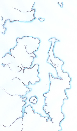
Top to bottom, left to right:
Pearl Beach on the Woy Woy Peninsula. Box Head.
Patonga. Lion Island.
*
Commodore Heights (in Ku-ring-gai). Barrenjoey Head & lighthhouse.
Ku-ring-gai Chase National Park. Palm Beach, Whale Beach, Newport & other Northern Beaches.
Scotland Island. Church Point.
Bayview.
Ingleside. Monavale.
* Above the * is Central Coast, below is Sydney.
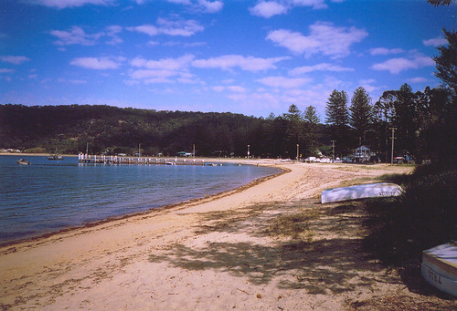
That building on the right hand side is the corner shop, the bottle shop, the restaurant, the bait & tackle shop and the fish & chip shop. There is no other shop.
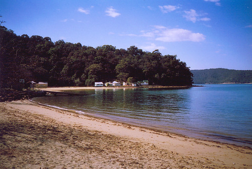
From my hist list: "Houses (5), 'Dark Corner', Dark Corner, Patonga, permissive occupancies, c.1920s". No idea what permissive occupancies are.
On the right is Commodore Heights in Ku-ring-gai National Park.
Next walk
Click on the photos for bigger versions.
Left to right: Dark Corner. Barrenjoey Head. Commodore Heights in Ku-ring-gai Park.
Barrenjoey looks tiny from the side huh? I'd link you to a photo that shows it from the Woy Woy side but there isn't a clear one. Never realised before how hard it is to spot Barrenjoey in a photo.
Top to bottom, left to right:
Pearl Beach on the Woy Woy Peninsula. Box Head.
Patonga. Lion Island.
*
Commodore Heights (in Ku-ring-gai). Barrenjoey Head & lighthhouse.
Ku-ring-gai Chase National Park. Palm Beach, Whale Beach, Newport & other Northern Beaches.
Scotland Island. Church Point.
Bayview.
Ingleside. Monavale.
* Above the * is Central Coast, below is Sydney.
That building on the right hand side is the corner shop, the bottle shop, the restaurant, the bait & tackle shop and the fish & chip shop. There is no other shop.
From my hist list: "Houses (5), 'Dark Corner', Dark Corner, Patonga, permissive occupancies, c.1920s". No idea what permissive occupancies are.
On the right is Commodore Heights in Ku-ring-gai National Park.
Next walk
Saturday, October 01, 2005
Patonga Photos II
From Walk #65 - Moonlight Bay.
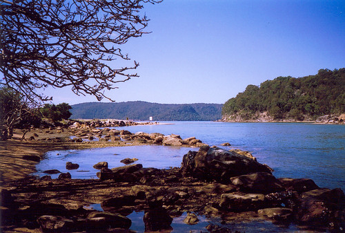
Taken from the caravan park at the south-east end of Patonga.
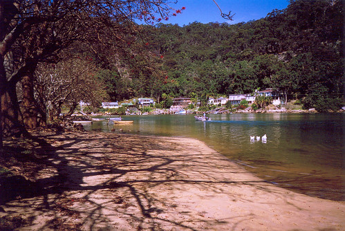
Also taken from the caravan park at the south-east end of Patonga.
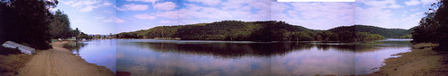
Behind the township of Patonga is the creek. Bigger and biggest versions.
More photos
Next walk
Taken from the caravan park at the south-east end of Patonga.
Also taken from the caravan park at the south-east end of Patonga.
Behind the township of Patonga is the creek. Bigger and biggest versions.
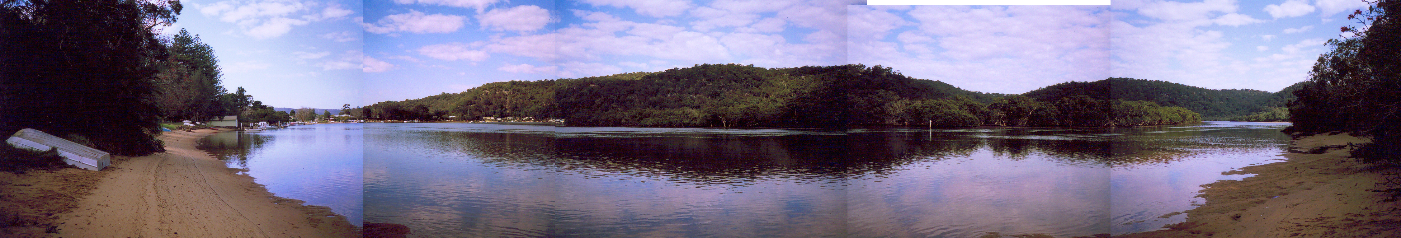
More photos
Next walk
Plans & Stuff
Stuff
First, some summary stuff about the Peninsula Walk. Finished it yesterday, as regular readers will know.
Suzanne pointed out down here we are "so lowkey about these things". It's true. We tend to stare at our toes and squirm with embarrassment while our mates do the boasting for us :)
But also, I'm in contact with other walkers round the world and sometimes my walk seems tiny compared to theirs. Okay, I started off barely well enough to totter round the block and I did have a four hour nap after that first walk and naps after every walk for yonks. So my Walk has been and still is a walk back to health. I wasn't at death's door or anything but I was bloody worn down and wrung out.
Part of my motivation for walking the rest of the way round Brisbane Water is to keep up with my fellow walkers. There's Francine who just walked Minneapolis and Caleb who's walked Manhattan, Dinah who's walking San Fransisco, Suzanne who's doing a whole county, including towns, Steve who's doing a gob-smacking feat of endurance by walking across America and Mike who's just started with a small town. (There's heaps of others as well but they're on my back-up CD which I'm too lazy and full of flu to find.)
The main part of my motivation for more Walks is the same as when I started. Getting back to fitness, getting to know the place I live in and a bit of its history, getting out there and enjoying the natural world more. (There was more and it was better expressed and I'll come back to it another day.)
As I've walked the Peninsula I've noticed how beautiful it is. It's the main reason I moved here and noticing it again has really added to life. Now that I've taken all those pictures of beautiful views, I want more. I want to see the places I haven't been to yet, places I see all the time across the water. I want to see the places I have been from the places I haven't been. I want to stand on the foreshore at Saratoga and look across at the end point of my first Walk. I want to see all the islands and islets and peninsulas and bays of Brisbane Water.
Plans
So I'm going to see all the islands and islets and peninsulas and bays of Brisbane Water. I'm going to walk round Brisbane water.
(Brisbane Water)
No idea how far it is. I'll find out as I go. I'll be getting one of those pedometer thingies before I go much further.
I've done all the streets of Woy Woy. The lanes of Woy Woy I'm saving for January and February. They're our hottest months and the time when I least want to stick to some vinyl bus seat for an hour just to get to the start of a walk.
Walks List
Woy Woy peninsula - 1st of March to 30th of September 2005 - photos
Okay. Go to put up some more photos then I'm off to fight off the bloody flu. No way is it going to stop me from walking on Monday.
Subscribe to:
Posts (Atom)