Click on pictures to see bigger versions.

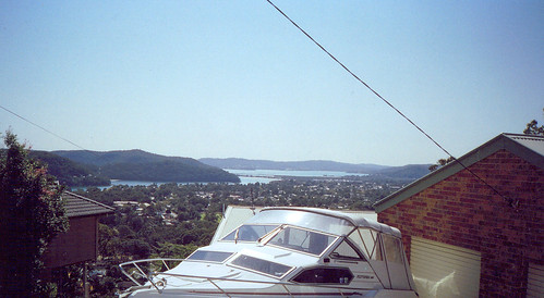
From left to right:
Phegan's Bay, Woy Woy Bay, Koolewong (behind Woy Woy Bay), Park's Bay (partially hidden behind tip of Koolewong), the railway line & Brisbane Water Drive connecting from the Peninsula to Koolewong (middle), the Peninsula (flat suburban bit), Pelican Island (thick line to right of railway), Saratoga (hill in middle distance on right) and from Gosford across to Green Point (distant hills).
Taken from The Sanctuary. Which is one of the 5 streets of the Plateau walk.

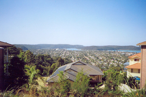
From left to right:
Horsfield Bay, Phegan's Bay & Woy Woy Bay, the ridge of Koolewong above Woy Woy Bay, Brisbane Water and from Gosford to Green Point (between trees) in the background.
Some detail on the original size.

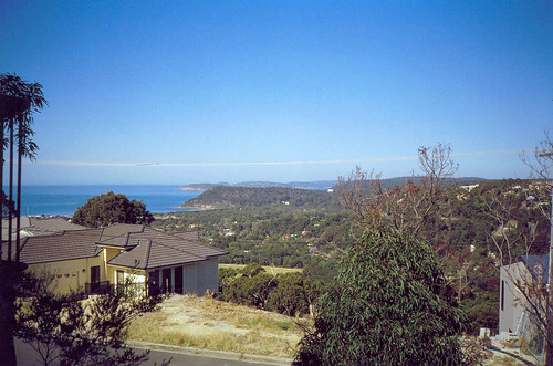
Ettalong & Wagstaffe from The Palisade. The water in the middle is off Ettalong and you can see the white blot on the lanscape that is Ettalong Club. The water on the right is between Lobster Beach and Umina Beach. Blackwall Mountain is partly visible over on the left. The hill behind it is Daley's Point. Killcare Heights is in the middle background.
That's the Peninsula laid out there in the middle of course. You can see maybe 1/6th of it in this photo. Where I was standing to take this photo is back against the ridge on the south-west side of the Peninsula and from there to Ettalong Club is about as wide as it gets.
The biggest version will give you a lot more detail. Including the two pines marking the entrance to the old Booker Bay cemetery in Bogan Road.

Box Head is just out of the picture to the left. Barrenjoey Head is in the background in the middle. That's Patonga Ridge (AKA Mt Ettalong) in front of it. The sliver of water behind Patonga Ridge is Pittwater. Bloody pricey spot to buy a house. Beyond Pittwater is Bayview & Ingleside. Maybe. The bit between that & Barrenjoey Head is probably Ku-ring-gai National Park.
The street in the foreground is The Palisade and the oval below it is probably McEvoy Oval. I was there a few weeks ago on the Egg & Spoon walk.
You can see a lot more detail on the biggest version.

The biggest size shows plenty of detail. Takes a minute to download though.
From left to right:
Blackwall Mountain, Daley's Point & Booker Bay, Fisherman's Bay & the knob of Ettalong, Riley's Bay & Killcare, Hardy's Bay & Killcare Heights, Wagstaffe, Lobster Beach, the sandbar (where the breakers are), Little Box Head and Box Head beyond it.
Ocean Beach/ Umina Beach is from about where to sandbar is to Patonga Ridge (Mt Ettalong) on the right. Beyond Patonga Ridge is Barrenjoey Head. Between them is the high end of Lion Island (you can only see it in the biggest version). In the distance on the right is Bayview & Ingleside. Maybe. They're part of Sydney. So is Barrenjoey Head. Between Bayview & Ingleside and Patonga Ridge is Green Point (the Pearl Beach one, other one's between Saratoga and Gosford).
Between the Heads is the Tasman Sea.
Photos from this walk
Next walk
2 comments:
I absolutely love how the pictures show up on this new blog.
Yers. They do look good this size.
Maybe I'll size them up on my main blog when I can get back into it.
Post a Comment