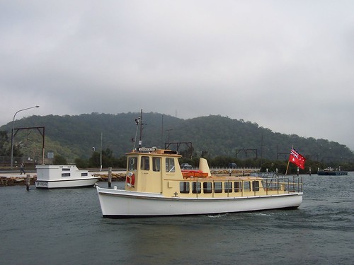
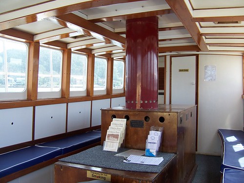
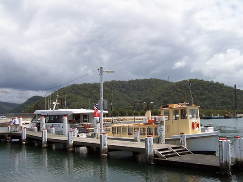
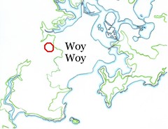
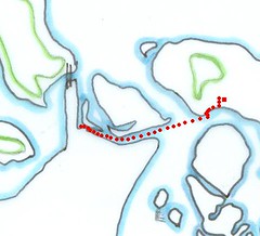
Monday, February 26, 2007

Roses and bills

February has been a crap walkies month and January wasn't much better. This time last year I was having similar troubles with the weather so I'm thinking I'll just cross Februarys off my calendar as far as walkies are concerned. Either that or get up at 4AM for a month. Nah, that's not going to happen. Anyways, here's a few photos from last week.

Trafalgar Avenue Umina

The rose house, near the corner of Bourke Road. There's a bus-stop right outside it, for the number 54 bus (from Woy Woy Station or from West Street). People waiting at the bus-stop often pass the time sniffing the roses.

All its roses are blooming now. The red rose on on the right at the front has the best scent. One of the white ones has a good scent as well and one of the pink ones.

Trafalgar Avenue Umina

Sinking fast off Tascott on Brisbane Water

Boat sinking on Brisbane Water off Tascott. This boat has been listing a bit for ages. Then there was a big wind a week or so back. This photo is from last week. The boat's gone now. Sunk completely or removed I don't know, but I'm thinking there's a big bill to be paid whichever it is.

Friday, February 23, 2007

PMG

(Random walkies)

PMG

Telephone manhole covers on Brisbane Water Drive, just level with Parks Bay.

The interesting bit about them is they've got "PMG" on them. Before Telstra (Australia's original national phone provider) was called Telstra it was called Telecom and before that, way back when Noah was a lad, it was called PMG.

PMG is short for Postmaster General. When the telephone was a new and wondrous thing it was run by the Post Office not separately like it is now. Then, after the newness and the wondrousness had worn off, it took the government yonks to put phones in their own department.

"The Postmaster-General's Department (PMG) was created at Federation in 1901 to control all postal (and later, telecommunications) services within Australia. ... The earliest telephone exchanges in Australia date back to 1880. All phone calls were manually switched by human operators. The Melbourne exchange opened with just 44 customers.

The first automatic exchange did not open until 1912, featuring electromechanical switching equipment. So-called "cross-bar" systems started appearing in 1960. Electronic switching began in the late 1970s." (Wiki)

The Posmaster General's Department got renamed as well, to Australia Post in 1975 when Telecom was split off.

Ex-convict Isaac Nichols was the first Postmaster in New South Wales. He signed on in 1809 and part of the job was to go onto the ships as they pulled up at the wharf and collect all the post. Otherwise the locals were just charging on board in droves asking if there was any letters for them.

The post started going overland between Sydney and Melbourne in 1838. Before that it would've going on coastal shipping. Nichols got the world's first pre-paid postage started as well. And in 1956 sea mail started going monthly to the UK, no doubt carrying many postcards of Bondi with 'weather is great, get on the next ship out' on the back. (Wiki)


Eureka!

New tshirts

Finished two thirds of the lettering I was on about the other day. I cracked the GIMP and made better lettering for the shirts and hoodies and stuff in my wee shop.

There's more than in this picture. There's tee shirts, long sleeved tee shirts & windcheaters (sweaters), hoodies and mugs.

There's new colours in the tee shirts as well. Just click on little coloured squares under the picture.

New tee shirts at CP

Wednesday, February 21, 2007

Picnic Parade

Sitting inside today slaving over a hot GIMP. I'm making some new lettering for the tee shirts in my wee shop. Or rather, I'm alternating between shouting at the computer and stamping away from it in a fit of pique, threatening to heave it out the window. There's something about making images I just don't get.

Picnic Parade Ettalong

Inter War California Bungalow (circa 1915 - c. 1940) at the water end of Picnic Parade Ettalong. Love those double doors out ont that nice deep veranda. Lovely spot for sitting.

We're looking here at the side of the house facing the water. The grass just visible in the foreground is Lance Webb Reserve, which runs along the Ettalong foreshore between Picnic Parade and Ferry Road. The view from this house and the Reserve is of Wagstaffe, Barrenjoey Head and Lion Island and, between Barrenjoey Head and Wagstaffe, the Tasman Sea.

Wagstaffe, Barrenjoey Head & Lion Island from Memorial Ave Ettalong

The view from the bungalow's front veranda. From left to right: Wagstaffe, Barrenjoey Head, Pittwater (distance) and Lion Island with Commodore Heights in the Ku-ring-gai behind it.

Monday, February 19, 2007

Under the sea

(Random walkies)

Rawson Road Level Crossing Woy Woy

Mural* painted one of two railway structures at the level crossing at the corner of Rawson Road and Railway Street Woy Woy.

There are two railway crossings in Woy Woy, this one and the underpass from Railway Street to Woy Woy Bay Road near the Home for the Terminally Bewildered in Woy Woy South.

Rawson Road Level Crossing Woy Woy

Dolphin enjoying a swim on the shed.

The Local Rag says the murals were painted by Ettalong artist and rail worker Tony Garland. "[T]here are plans to put murals both near Koolewong station and south of Woy Woy station." Those murals are up as well. Also tagged but still looking good.

Rawson Road Level Crossing Woy Woy

From the Woy Woy Bay side of the tracks. Railway Street is behind the structures and in front of the trees. Rawson Road is on the right of the picture, heading over to Ocean Beach Road. The blue sign points to "Woy Woy Shopping Area".

This photo was taken on another day, hence the different light.

Sunken ship on painted structure at Rawson Road Level Crossing Woy Woy

My favourite bit of the murals. A sunken ship.

The taggers have been at work again on the shed (back). Don't think they're local. Most of what they tag is near the railway line and they're only active every few months. I've seen the same tags in Gosford, the next stop on the faster train.


Exclusion zone

As Inexplicable Device pointed out, there's not many people in my photos. Well spotted, that witch!

When I started blogging my walkies I took photos with humans and without. The ones with didn't look right. They gave the impression that Woy Woy was crowded. It's got its fair share of traffic and people but it's also quite peaceful. My namesake called it the world's only above ground cemetery for a reason.


* It is of course a muriel, as us Pratchett fans well know, but one must speak Roundworld when one blogs to the heathen masses.

Friday, February 16, 2007

View over Woy Woy Bay

(Random walkies)

Woy Woy Bay from near Woy Woy station

Having a bit of a crap week with the health. Rather tiresome. Tottered into Woy Woy mid morning and snapped this then tottered back home. Woy Woy Bay is one of my favourite views in the Brisbane Water/Greater Gosford area. It's shape and quietness are pleasing.

In the foreground you can see Woy Woy Station (right) and the bus station (centre), part of the walkway from the station to the Clocktower Building (green roof, right) and the rusty tin roof of the Masonic Hall in the right corner. All on Railway Street.

Gosford

Mind, my week was nothing on that of the poor bastard who died in the Gosford fire on Wednesday night. The guy's name is Edgar Griesberg and on Tuesday night he was working late at Gerry's Electricals, his business at the corner of Donnison Street and Albany Street North in Gosford. It's in today's Central Coast Express.

The building collapsed and presumably will be completely demolished. Normally when I add a photo to my Gone set on Flickr it's because an old house has been replaced by a block of units or something. Pity this addition isn't happening under those circumstances. My sympathies to the Griesbergs.

Gerry's Electricals cnr Donnison Street & Albany Street North Gosford

Gerry's Electricals on the corner of Donnison Street & Albany Street North Gosford. A pleasant old factory unit just up the hill from the Gosford Court and behind the Marketplace shopping centre. Built in the 1940s I think. I never got round to posting it when I walked those streets in the winter of 2006. I was going to take a front-on photo but never got round to it.

Wednesday, February 14, 2007

Bay View Hotel

(Random walkies)

Bay View Hotel The Boulevard Woy Woy
(Embiggulate)

Look down into the left hand corner of the picture, between the street sign and the bush. That's Brisbane Water there, and that hill in the distance is Kincumba Mountain. So you can see this pub is close to the water. It is in fact, if you squint between the Armaguard van and the pub you can see a boat at the ferry wharf.

The street in the foreground is Brisbane Water Drive and those cars are stopping at the lights just out of frame on the right. The railway station is to the right of the camera. The Boulevard runs down the longer side of the pub.

Bay View Hotel The Boulevard Woy Woy

Bit closer for some detail. Not close enough I admit but this one's a hard bastard to photograph. It's either half obscured by cars or just a black block with the morning sun rising behind it.

Anyways. It was built in 1929. Look carefully on The Boulevard side and you can see a change in the roofline where the 1929 part of the building ends and the circa 1980s extension starts. That extension is the motel rooms bit as far as I can tell, and the hotel rooms are in the upstairs of the 1929 part.

Can't find it in the NSW Heritage database or the Australian Heritage database but in Strom it's listed as "Heritage Act status ... Sect. 130 23-1-81". The style seems to be Inter War Free Classical (circa 1915 - c. 1940).

The original Bay View Hotel had a view over the bay, hence the name. The bay was Woy Woy Bay. It, the pub not the bay, was on Railway Street where the Deepwater Plaza extension is now, opposite the railway line at the corner of Charlton Street. It was a lovely 2 storey place and it opened there in 1907. It was right opposite the old railway station. The new hotel was built after the new railway station was built.

The old building became the Nielsen Slipper Factory then, in 1957, Osti Knitting Industries turned it into temporary accommodation. The decorative bits on the verandas were taken off and the verandas closed in with fibro (asbestos sheeting).

This was a cruel thing to happen to a lovely old building. It's remembered fondly by those who knew it in its heyday but there's no known photos of it. (If you've got a photo of the old Bay View email it to me at spikebotster at gmail dot com and I'll post it on here with your name on it, or you can take it to Librarian Geoff at Gosford Library.)

I'm not sure yet when the old pub was pulled down. When I moved to Woy Woy that Deepwater extension was an empty block being used as a carpark by the Deepwater employees.

That's it from me today. I'm off for my afternoon nap.

Monday, February 12, 2007

The Cockatoo ferry

(Random walkies)

Codock II AKA the Cockatoo ferry coming in to Woy Woy Wharf

Here she is coming round ready to sidle up to the wharf.

That's Brisbane Water Drive and Parks Bay/Koolewong in the background and we're looking north-north-west.

The white boat is called Up & Down. Someone painted a pair of heterosexuals demonstrating this motion on the back but it got scrubbed off.

Codock II AKA the Cockatoo ferry at Woy Woy Wharf

She's sidling up to the wharf here, ensign flying in the breeze. The best seats are up there on the aft deck on that bench you can see across the back.

That's Pelican Island in the background and we're looking north-north-east.

Codock II AKA the Cockatoo ferry

Licensed to carry 51 persons. That's what it says above the doorway. 49 passengers and 2 crew.

Codock II AKA the Cockatoo ferry

That's her flue going up the middle there. You can see it come out the top deck in the yellow paint.

She's a game old thing. She putts slowly along and her engine throbs like buggery crossing from the shelter of Pelican Island to Lintern Channel but she gets there and it's a nice ride.

She was built around 1945, at the end of World War Two, and worked for the defence forces in Sydney Harbour. She probably looked a lot like the Gladstone then. She is 40 feet long, her beam is 12 feet and her draft is 5 feet. Draft is how far below the water her lowest point is and beam is how wide she is from side to side. Her displacement is 16 tonnes.

There's more about her on the Hardys Bay site and a map below showing Cockatoo Island in Sydney Harbour.

Saratoga & Codock II at Woy Woy Wharf

Here she is cheek to cheek with her stablemate Saratoga at the Woy Woy wharf. They're both in the Central Coast Ferries fleet.

Cockatoo Island Sydney

She's known as the Cockatoo ferry because she comes from Cockatoo Island in Sydney Harbour. That's Cockatoo Island in solid black.

The island now belongs to the Sydney Harbour Federation Trust and they only let it off the leash for the yearly Cockatoo Island Festival. They're still doing it up. It was made into a dockyard in the mid 19th century, using convict labour. Before that it was a grain store for a bit and before that it was part of HM Prisons. Captain Thunderbolt, one of our colonial bushrangers escaped it when his missus swam across to rescue him.

The Slightly Wobbly Print(TM) says "Sydney CDB" (Sydney Central Business District). That's where the Coathanger (Sydney Harbour Bridge) and the Opera House are and where the first white settlers settled in 1788. Back then it was referred to as Port Jackson and the harbour still bears that name.

The other islands are, from bottom left to mid right, Rodd, Spectacle, (Cockatoo), Goat, Pinchgut/Fort Denison and Clarke. Shark Island is out of frame to right of Clarke.

By the way

The Coathanger is 75 this March by the way. Be there or be square.


Beautiful cooling rain

Last night it rained and it's raining again now. I stood out on my balcony in it last night. It hadn't rained for a while so the scent of it was beautiful. My orange jessamine was flowering. The two scents mingled and I stood there for yonks just drinking them in, with the rain falling on my skin and tapping on the trees. It rained all night I think and today is gloriously cool.

They may not feel the same in Campbelltown, particularly not the poor bastard who got squished by a tree, and Queenslanders will probably be quite glad of a dry spell after the cyclone weather. Particularly those still drying out from Larry last year.

World Wide Weird

Don't do drugs, man. You might mistake a person for a rodent. It's probably not a good idea to bite random straight guys in nightclubs either.

Friday, February 09, 2007

Veteran Hall

Ferry trip to Veteran Hall Cemetery Saratoga

Take the ferry, the Saratoga or the Codock II, from Woy Woy Wharf to the first ferry stop in Lintern Channel, Veterans Hall. When you get off you're on Henderson Road Saratoga. Head right along the waterfront. There's a nice new path there. The road will curve then come to a corner and right there at that corner is a tiny cemetery. It's my very favourite cemetery in the area, topping even St Paul's, Kincumber South and Point Clare.

Veteran Hall Cemetery Henderson Road Saratoga

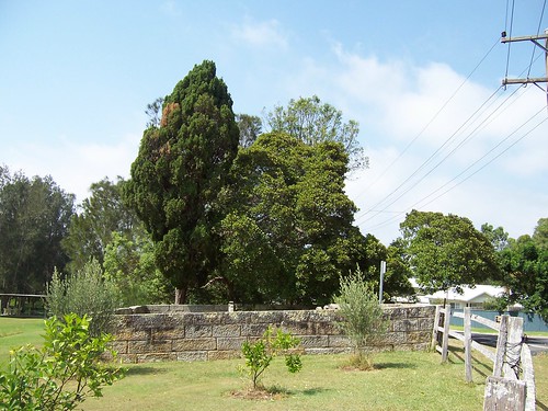
Veteran Hall and Veterans Hall are the same place. Locals tend to say Veterans Hall. It was the name of Robert and Catherine Henderson's house and the ferry wharf nearby still has the name. The house was on the slope above the wharf as far as I can tell, maybe 300 yards from the cemetery and to the right of the photo above. It was a sandstone place and probably quite pleasant but it was knocked down in 1909. A newspaper article of 1909 described it as:

"...a very old homestead of the farmhouse type, with shingled roof and attics, deep verandas and wide stone hall".

Sounds very similar to Rock Davis's old place in Orange Grove Road. That's still standing.

Robert Henderson was one of the local movers and shakers. His parents came out from Ireland on the Sugar Cane as convicts in 1793. He was born at Parramatta (now a suburb of Sydney) in 1796 and married Catherine Geary there in 1817. Robert got a land grant at Pittwater near Palm Beach. His father-in-law had a land grant at Brisbane Water, a short boat trip away. Robert and Catherine moved there in the first few years of white settlement. They named their house Veteran Hall in honour of her father's time as a private in the New South Wales Corps (early colonial army-cum-police-cum-prison guards).

Veteran Hall Cemetery Henderson Road Saratoga

Robert had several careers. In 1824 he was appointed District Constable. This was something like the job of sheriff in the Hollywood movies I gather. He and Catherine cleared their land and began to farm. They bought more local land and Robert left the police in 1829. The farm was still running and the 1828 Census has it at 500 acres and 14 male employees. He went into shipbuilding and nearly got done for rum smuggling. He popped back to Sydney for a bit then came back and was appointed to the District Council in 1850 or 1854. Around 1842 there was a school at Veteran Hall. Not in the house itself by the look of it. He popped off for good in November 1869, of cancer of the face, and is buried in this wee cemetery.

(Info from Six Brisbane Water Cemeteries: A heritage tour, by Jillian Baxter (1992), Historical Records of the Central Coast of NSW: Bench Books & Court Cases: 1826-74, published by the Gosfrod District Local History Study Group (1990) & The Shipbuilders of Brisbane Water NSW by Gwen Dundon (1997).)

Veteran Hall Cemetery Henderson Road Saratoga

The stone set against the wall reads:

"This land enclosed by wall of stone is bequeathed and willed by me to the dead who sleep within its walls during eternity
Robert Henderson Brisbane Water September 1869".

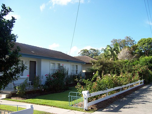
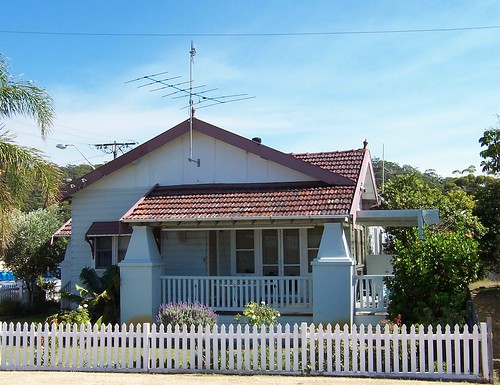
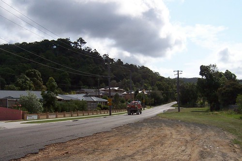
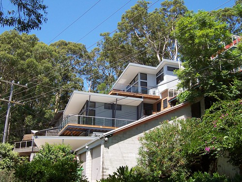
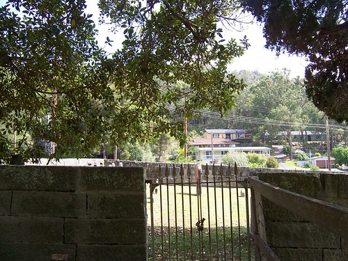
As you can see, the cemetery's not set apart from the houses in any way now. In 1869 it would've been a different matter. I'm not sure how many houses would've been in Saratoga but I'm guessing less than five on this side of the hill.

The houses you can see in the background are on Henderson Road, Fernview Avenue and Treeview Place, Saratoga. Fernview and Treeview have views across to Woy Woy with Rileys Island, St Huberts Island and the unnamed isles in between. Not the very best views on Brisbane Water but well worth the dosh.

Veteran Hall Cemetery Henderson Road Saratoga

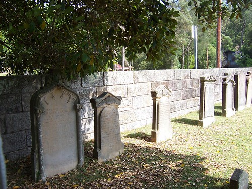
The closest headstone reads:

"Sacred
to the memory of
Elizabeth Catherine
Henderson
the dearly beloved wife of
Robert Henderson
who departed this life

30th [?] of August 1884 [?]
aged [?] years

[then the quote, possibly biblical]"

To Elizabeth Catherine's right are Letitia Catherine Henderson and Florence [Madeline?] Henderson. The rest are illegible.

Bakewell's Index of Combined Central Coast Cemeteries has a list of the occupants:

Patrick Geary, died 7th of January 1827 aged 63. (One of the earliest white burials in the area.
John Jacob Pester [Pister in some books], died 10th of July 1832 aged 52.
Thomas Daily, died 22nd of August 1837 aged 85.
Catherine Hargraves, died 3rd of August 1866 aged 18.
Annie Cox, died 7th of May 1867 aged 5.
Robert Cox, died 26th of February 1868 aged 2 years and 6 months.
Florence Henderson, died 23rd of April 1868 aged 8 years 11 days.
Letitia Henderson, died 26th of April 1868 aged 5 years 1 month.
Hannah Henderson, died 16th of July 1868 aged 39.
Michael Cox, died 17th of November 1868 aged 65.
Catherine Henderson, died 29th of November 1868 aged 68.
Robert Henderson, died 11th of November 1869 aged 73.
Thomas Henderson, died 29th of May 1870 aged 32.
Elizabeth Henderson, died 30th of August 1885 aged 43.
Madeline Ward, died 2nd of May 1934 aged 80.

A lovely little cemetery.

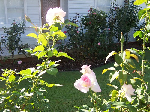
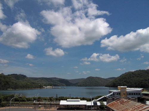
I'm glad I got out and walked today. The weather was iffy but there were sunny patches as you can see.

I've been cooped up indoors too much lately. Lots of indoor stuff to do before the end of February. It's the ideal time to do it. February heat is crap. I walked bugger-all this time last year as well. Bring on winter, for fuck's sake.


Mystery solved

Umina Rampart says Wednesday's fire was in the tip (garbage dump) which is off the end of Nagari Road. Ta, mate.

Wednesday, February 07, 2007

Small fire & small flowers

Fire truck on Nagari Road Woy Woy South

Fire truck on Nagari Road Woy Woy South. This was as close as I got to a decent photo of the fire. But the bastard didn't get out of control so I'm good. I saw a little bit of smoke then five minutes later the first fire truck went howling up there. Didn't see any more smoke after half an hour.

Small bushfire in Woy Woy on 6th of February 2007

The fire was up on the ridge yesterday afternoon, just over the crest of it. The fieries (firefighters) were in like Flynn. Half a dozen or more firetrucks went howling up Nagari Road to get to it. The Great North Walk (GNW) goes off the end of the rubbish tip road which goes off the end of Nagari Road.

Didn't catch the local TV news. Any locals got details about it?

Nagari Road Woy Woy South

After gawking at where the smoke had been I went home. These flowers were on the way. In fact you can see them on the left edge of the photo above.

They look like pink gum blossoms. They were on a bush at the Home For The Terminally Bewildered at the corner of Nagari Road and the railway underpass.

Only seen these blossoms on trees before and I got no idea what they're called when they're on bushes. Unless this is a baby tree. My plant recognition skills are abyssmal, as you probably realise by now.

Other stuff

There's a nice storm forecast for this afternoon. I'll enjoy that from the comfort of my balcony. I'm working on my wee shop again today. It's giving me a pounding fucking headache but I got to get the bastard up to scratch before the end of February. 12 months it was in the thinking stage, 12 bloody months. Since I created the shopfront in December I've made maybe 50 things for it.

Rock Walk is another walkies blog. Two people walking Staten Island in New York City. They haven't done much walking yet but have some beautiful photos up.

Monday, February 05, 2007

Watersedge

Watersedge Motel The Boulevard Woy Woy

Watersedge Motel on The Boulevard, Woy Woy. Just round the corner from the railway station, just across the road (at the back) from the ferry wharf and Pelican Island and halfway between the two pubs.

At first glance this is just another eighties building. I thought so the first time I saw it but then I noticed the old-fashioned factory style windows across the front (first floor) and the old windows and doorways down the side.

I looked it up on my next visit to the eyrie of Librarian Geoff (Gosford Library's Local Studies person) and indeed it is an ex-factory. The Super Fit Clothing Company opened there in 1947, just after the war, and closed in or after 1965-66.

The shop on its right is Huckleberry Finn's, the old fish & chip shop, and the Bay View Hotel carpark is on its left.

Michael gave me a lot of extra info (scroll to end of Huck Finn link), including that before it housed the motel the Watersedge building housed a wee arcade of shops and there was a supermarket opposite it near where the pawn shop on the corner of The Boulevard and Chambers Place.

When I've finished getting photos of all the Woy Woy shops we'll be able to clearly see where the tide of time has washed the shoppers away from The Boulevard and into Blackwall Road and George Street (Deepwater Plaza).

Despite local rumours to the contrary, this building was never the old slipper factory. That was where the extension to Deepwater Plaze is now on Railway Street. It was a beautiful old hotel before it was the slipper factory but there are no known photos of it. Bit of a bugger.


Wowers*

At the bottom of this blog there's thingy showing the number of visitors to this site. When I click I can see what countries those visitors come from. I used to get a trickle of readers from India, Pakistan and China.

Tank Guy
(1989: Massacre in Tiananmen Square)

China blocks what it doesn't like on the net. I watched sadly as my Chinese visitors stopped coming and their government made their world smaller.

I'd got only one or two Pakistani visitors and I didn't really notice them not coming anymore. Then my Indian visitors stopped coming too. Apparently the whole of Blogger.com (anyblog.blogspot.com) has been banned by India, Pakistan and China.

But yesterday I found this anti-blocker:


pkblogs.com


By putting this on my website visitors from banning countries can surf on in then surf on out via any blogspot link in my sidebar. Apparently some corporations aren't onto it yet so you can also use it to get to Blogger sites from work.

Friday, February 02, 2007

Wagstaffe again

It's a grey misty day. There's a fine drizzle falling silently and the clouds are low. Crap light for photos but a beautiful cool day. Saved you some photos from Wagstaffe on Monday.

Albert Street Wagstaffe

On Albert Street at the top of the T junction with Mulhall Street. A rather pleasant house built in the last 10 years, maybe 5. Makes great use of a nice view down over Wagstaffe and Hardys Bay. There's probably bugger all yard at the back but who needs it with all those nice balconies. If I was having a house built I'd probably go with this look.

On its right is a green house (partly visible behind the jacaranda tree) achieving a similar effect with additions over a span of about 70 years.

Notice the rooflines of the newer house and the angled veranada poles on the side. Nice bit of fifties retro. There's a few nice examples around the Brisbane Water area.

Mulhall Street Wagstaffe

Mulhall Street. Charming old cottage going to rack and ruin. Living out its declining years as a rental by the look of it. I give it 5 years max before it's bulldozed and turned into units or some swanky house with a massive balcony.

Very hard to date. It's facing the road with its side to the view so either the owner didn't notice the view (unlikely) or there was a nice big veranda on the side which was ripped off so the land could be sold to build that beige 70s place on its right (not very likely) or it was built after the street was but not before (likely).

The third theory puts it probably in the Federation period (circa 1890-circa 1915) or the Inter War period (circa 1915-circa 1940) rather than in the Victoria (circa 1840-circa 1890).

It could actually be Victorian Rustic Gothic (circa 1840-circa 1890 & also known as Gingerbread Gothic). But I can't see what's under that fibro, maybe original wooden weatherboard, maybe not) so I'll have to say not Victorian.

The main style, ignoring the lovely wooden bargeboards and looking instead at the main roof, is all over the Brisbane Water area and fits into Federation and Inter War (circa 1890-circa 1940).

So I'm left with Federaton Filligree (unlikely), Federation Queen Anne (unlikely) and, last but certainly not least, Inter War Poor Man's Default #1/Fisherman's Shack With Later Additions* (circa 1915-circa 1940) + a pair of recycled bargeboards.


By the way, Jimmy Little, the former Woy Woyan over at Tight Sainthood, has also bunged up a wee online shop. His shop is rather more professional than mine and he's got some lovely stuff up. My favourites are this estuary one and this lovely old building.


* Definitely not an official style.