Showing posts with label Broken Bay. Show all posts

Sunday, March 29, 2009

Working boats of Woy Woy

(Woy Woy and nearby anyways. The title looked way better without the nearby bit.)

Did not go walkies this week. Too much slaving over a hot keyboard and not enough exercise. I'll get fat. Anyways, here's some boats to look at. How'd yer be spending yer working week out on the water on one of these?

MV Rustbucket at Eulalia Wharf Davistown

Hard to tell with a boat this size if it's a commercial fishing boat or just belongs to a very keen amateur. Moored at Eulalia Wharf Davistown in 2007.


Working boat moored at Brick Wharf Road Woy Woy

This one is definitely a commercial fishing boat. Belinda K moored off Brick Wharf Road Woy Woy in 2007.


Empire Bay foreshore

Oyster farm boat moored at Empire Bay in 2006.


Barge and Pelican Island

Jetty building pontoons moored just off Woy Woy Wharf, along side Brisbane Water Drive. 2006.


MV Gladstone Gosford Wharf

MV Gladstone at Gosford Wharf in 2006. She appears to be a picker-up of flotsam and jetsam from Brisbane Water's traffic lanes.


Could not post yesterday. Bloody ISP had some sort of fit. Either that or the whole internets was down. Then I forgot it was Saturday. My brain is going soft. Thank fuck nothing else is. Fucking hours it's taken me to do this post today. Sunday brain. See yer next week.

Saturday, August 09, 2008

Ettalong Beach

(Random walkies on the Woy Woy Peninsula)

Golden Wattle at Ettalong Beach

Golden Wattle. Acacia is the proper name of the golden wattles. This one seems to be the Coastal Wattle AKA Acacia longifolia or A. sophorae and as you can see it's growing happily on the beach and the link below says "[g]rows in dunal, heath and sclerophyll communities including headlands" and "[d]istribution: Queensland to Victoria".

Species page at some govt site

Wattle wattle wattle - all my wattle photos at Flickr


Golden Wattle at Ettalong Beach

These photos were all taken just opposite the Excresence, that great white whale of a resort on the foreshore at Ettalong.


Lion Island & Ettalong Beach foreshore

Lion Island there in the distance, and on the right the Ettalong foreshore where the pines, drain and barbies are and where Mr Whippy dispenses icecreams of a weekend.

Barrenjoey Head & Lion Island from Ettalong Beach

Barrenjoey Head and Lion Island from Ettalong Beach.


Bustling Downtown Ettalong (Map)

Thursday, December 20, 2007

Palm Beach again

(Palm Beach again)

Fantasea Crystal at Ettalong Wharf Ettalong

Our trusty steed Fantasea Crystal at Ettalong Wharf. She is a 25 metre aluminium catamaran and takes a max of 192 passengers.


Lion Island, looking south from the Palm Beach ferry

Lion Island, looking south from the Palm Beach ferry. Notice the cliff at the head end, facing out therough the heads of Broken Bay, and the lion-ish shape of the whole thing.


Lion Island from the Pam Beach ferry

Lion Island from the Palm Beach ferry.


Lion Island head on from the Palm Beach ferry

Head on of Lion Island. Rock climbers can occasionally be spotted inching their way up its face.

The island is on a couple of my old maps as Elliott Island, named in 1789 by Governor Phillip after another Island where his mate General Elliott gave the Spanish and French a kicking. It's 8 hectares and was made into Lion Island Nature Reserve in 1956. There's quite a few beasties living on it, mostly birds though of course.

White-bellied Sea-Eagle
Osprey
Kookaburra
Grey Teal
Fork-tailed Swift
White-throated Needletail
Pied Currawong
Australian Raven
Mistletoe bird
Nankeen Kestrel
Peregrine Falcon
Silver Gull
Crested Tern
Yellow-faced Honeyeater
White-cheeked Honeyeater
Great Cormorant
Little Pied Cormorant
Little Black Cormorant
Tawny Frogmouth
Blue Petrel
Fluttering Shearwater
Sooty Shearwater
Wedge-tailed Shearwater
Short-tailed Shearwater
Eastern Rosella
Little Penguin
Southern Boobook
Silvereye

Water-rat
House mouse

Eastern Water Dragon
Robust Ctenotus
Copper-tailed Skink
Eastern Water-skink
Three-toed Skink
Lace Monitor

Proper names at NSW National Parks

Sydney Climbing


Barrenjoey Head from the Palm Beach ferry
Embiggen

Barrenjoey Head from Pittwater. Note the flat strip of land on the right hand side of the Head. That's the golf course, with Palm Beach itself on the other side of it and Barrenjoey Beach on the Pittwater side, which is this side.


Myra leaving Palm Beach Wharf

Myra leaving Palm Beach wharf. She does the bays and wharves of Pittwater. She's too small to go across the mouth of Broken Bay to Ettalong. She'd be all over the place in a decent swell.

She is a 15 metre woodern ferry and "the pride of Palm Beach Ferry Service". She takes a max of 130 passengers.

Sister ship Crystal Spirit at Wagstaffe wharf

Palm Beach ferry fleet

Ettalong to Palm Beach map

More Broken ferries & boats

Islands of Broken Bay


And that's yer lot for the year. I'm on me holidays now and will be laying on the beach and having barbies for a couple of weeks, storms permitting. Have a good Chrissy and come back on the 15th of January.

Tuesday, December 18, 2007

Palm Beach

Coupla days of blue sky sandwiched between storms so I shot out with the camera while the light was good. Felt like a ferry ride so I dragged a couple of mates over to Palm Beach.


Crystal Spirit coming in to Palm Beach Wharf

Crystal Spirit coming in to Palm Beach wharf in Pittwater. Just over that hill is the Pacific Ocean.

Palm Beach is near the top of a narrow peninsula known unofficially as the Insular Peninsula. Money lives there and visiting movie stars often hang out there. It looks onto the Pacific Ocean on its east side and onto Pittwater on its western side. Pittwater is the southern arm of Broken Bay, the Hawkesbury River is the western arm and Brisbane Water (where Woy Woy is) is the northern arm. Map.


Looking south down Pittwater from Barrenjoey Road Palm Beach

Looking south down Pittwater from Barrenjoey Road. In the background across the water is Ku-ring-gai National Park.


Looking north to Lion Island & Woy Woy Peninsula from Waratah Road Palm Beach

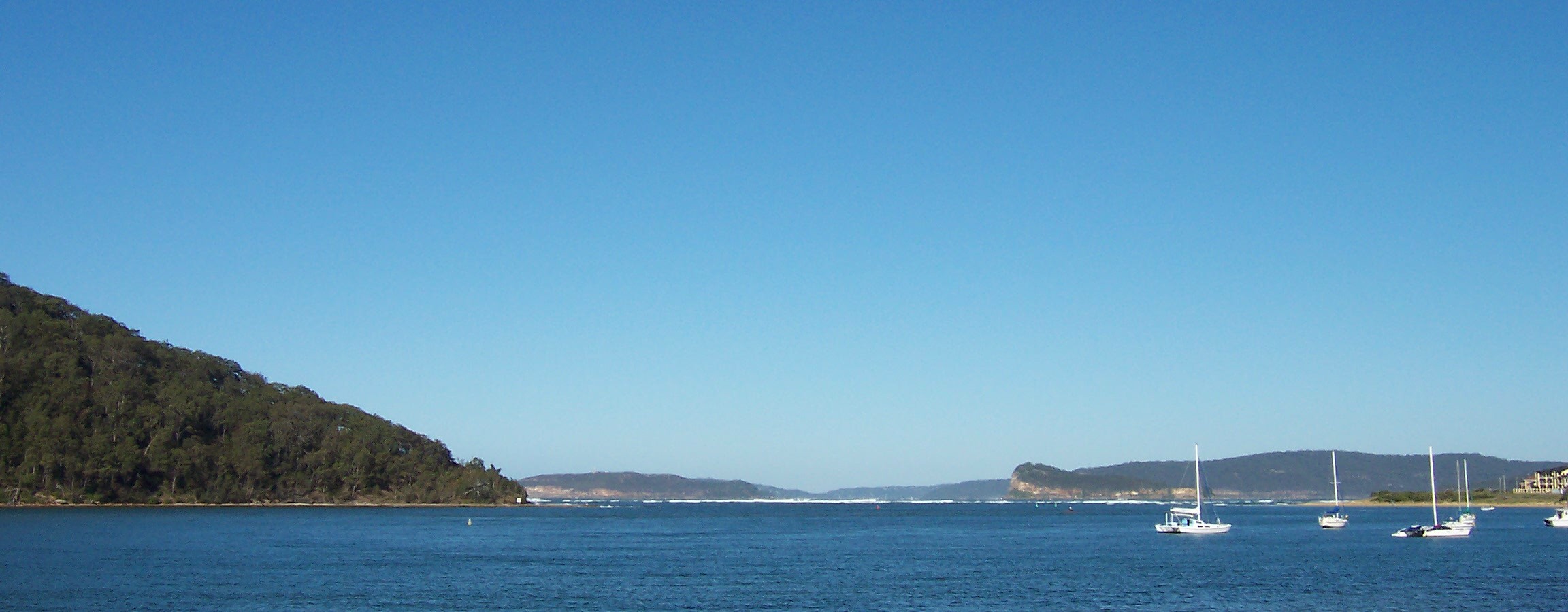
Looking north to Lion Island & Woy Woy Peninsula from Waratah Road. The Pacific was a bit rough but Pittwater was lovely and calm. Here we're looking from Pittwater, across the mouth of Broken Bay, to the mouth of Brisbane Water, just beyond Lion Island. That faint bit of beach you can see just to the left of Lion Island is Pearl Beach. If I hadn't deliberately excluded the bastard, you'd be able to see the fungoid blob of the Excrescence at Ettalong.


Looking north from Palm Beach to Barrenjoey Head & the Bouddi Peninsula

Looking north from Palm Beach to Barrenjoey Head & the Bouddi Peninsula. The closer hill with the lighthouse on it is Barrenjoey Head. The further land is Gerrin Point or thereabouts.

As we stood there gawking a Hercules or summat cruised silent and low up the beach and turned inland at Barrenjoey Head. We couldn't hear it over the surf and it probably couldn't hear us strike up a chorus of It's raining men in the vain hope it would drop sexy paratroopers.

View from the corner of Palm Beach Road & Pacific Road Palm Beach

Pacific Ocean from the corner of Palm Beach Road & Sunrise Place. That's a cargo ship there on the horizon, waiting to come into Sydney Harbour.


Woy Woy to Palm Beach

Woy Woy to Palm Beach by ferry. Note ferry pilot not plastered by avoiding sandbars.

Back to top


A wee bit of seasonal humour

When four of Santa's elves got sick, and the trainee elves did not produce the toys as fast as the regular ones, Santa was beginning to feel the pressure of being behind schedule.

At this time, Mrs. Claus thought it appropriate to tell Santa that her Mum was coming to visit, this stressed Santa even more.

When he went to harness the reindeer, he found that three of them were about to give birth and two had jumped the fence and were out, who knows where. This stressed poor Santa even more.

Then when he began to load the sleigh one of the boards cracked, and the toy bag fell to the ground and scattered the toys.

So, frustrated, Santa went into the house for a cup of apple cider and a shot of rum. When he went to the cupboard, he discovered that the elves had hidden the liquor, and there was nothing to drink. In his frustration, he accidentally dropped the cider pot, and it broke into hundreds of little pieces all over the kitchen floor. He went to get the broom and found that mice had eaten the straw end of the broom.

Just then the doorbell rang, and irritable Santa trudged to the door. He opened the door, and there was a little angel with a great big Christmas tree. The angel said, very cheerfully, "Merry Christmas, Santa. Isn't it a lovely day? I have a beautiful tree for you. Where would you like me to stick it?"

And so began the tradition of the little angel on top of the Christmas tree.

Friday, May 25, 2007

Up close & far away

Working today, not walking. Ugh. Here's one I made earlier.

Canna Lily

Canna Lily next to the Woy Woy to Gosford Cycleway. Perennially popular garden plants these and I only just found out what they're called. Quick, aren't I?

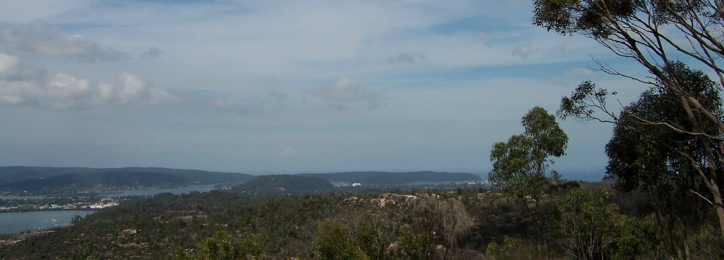
Woy Woy, Blackwall Mountain, Bouddi Peninsula & Box Head from Staples Lookout
(Embiggen to embiggest)

In the foreground you can see the trees still not fully recovered from the Boxing Day 2006 bushfires. Normally they're back on their feet in no time but they've had fuck-all rain since then, what with the drought and all.

Stretching across the background you've got the Tasman Sea (visible through the tree on the left) and the Bouddi Peninsula.

The Bouddi contains, in order from Maitland Bay (Tasman Sea side) round to Hardys (Brisbane Water side):
The Bouddi (Bouddi National Park, from Macmasters Beach to Box Head)
Killcare Heights
Gerrin Point
Putty Beach
Killcare
Tallow Beach & Little Tallow Beach
Box Head (at the mouth of Broken Bay)
Iron Ladder Beach
Lobster Beach
Half Tide Rocks
Wagstaffe
Pretty Beach
Hardys Bay

From the right, between Box Head and Blackwall Mountain, you've got Ettalong and The Excrescence (white blob), Blackwall Mountain, very faintly on its left The Rip Bridge, Daleys Point at the left end of the bridge, Rileys Island (uninhabited) in fron of Daleys, and between Rileys and the foreground, Bustling Downtown Woy Woy.

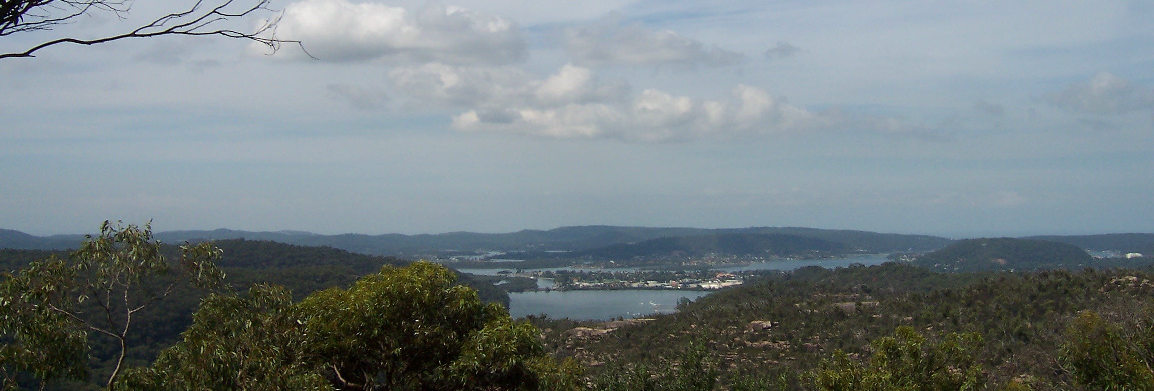
Brisbane Water from Staples Lookout
(Embiggen to embiggest)

From Kincumba Mountain coming into it on the far left and The Excrescence, that blot on the landscape, on the far right.

Similar view but more of Woy Woy and Pelican Island visible there in the middle distance on the left. Then it's up into the Kincumber Broadwater via Cockle Channel and, behind the Broadwater, the hills separating Kincumber (Brisbane Water side) from Macmasters Beach (Tasman Sea side).

Stakles Lookout is on the Woy Woy Road about 2.5 kays from the Phegans Bay turn-off. It's yer left if you're coming from Gosford. Keep an eye out because the traffic will be up your arse and you've got buckley's of doing a U-ey along there.

Wednesday, May 16, 2007

Ettalong

Overcast this morning, completely overcast. Won't need the camera, says I, I'll just be going walkies without it. And I don't need it because it's overcast all through my walkies. Then the minute I step back inside the bloody sky clears! It's a conspiracy I tell you, a bleeding conspiracy! What that's, nurse? Time for my medicine?

So anyways, these are from a completely sunny day a while back. Enjoy, while I have a soothing snack of Valium.

Barrenjoey Head & Lion Island from Ettalong Beach
(Embiggen)

Taken from Ettalong Beach near the Vietnam memorial.

That's Wagstaffe on the left and you can just see Half Tide Rocks off the right of it if you know what you're looking for (flat shelf of rock at water level).

Over on the left hand margin is the corner where Ettalong Beach ends and Ocean Beach starts. Those are flats and holiday rentals there on the very edge of the picture. The white line extending out to the left from that corner is the big sandbar, the last one the Palm Beach ferry has to avoid on its way back to Palm Beach.

In the distance you can see Barrenjoey Head, down into Pittwater, then Lion Island sticking up and Commodore Heights behind it.

Ettalong Beach
(Embiggen)

Showing Lobster Beach and Little Box Head with Wagstaffe out of frame to the left. In the right foreground there's a couple of banksias providing some shade for the seagulls when they get tired of pulling tiny crabs out of the sand.

You can't see Lion Island in this one, it's behind the trees. Behind the 2nd boat from the right you can see Barrenjoey Head.

Flathead Road Ettalong

I like these. I like fifties retro. They look well made as well. None of yer slapped up crap. And those wee huts at either side of the gate must hide the bins and stuff. Very neat.

That's Blackwall Mountain behind (hur hur). As mountains go it's more of yer small hill.