Showing posts with label Pearl Beach. Show all posts

Tuesday, November 27, 2007

Old villages

Old villages of the Woy Woy Peninsula

The line of red dots in the centre is not an old village but the WWII emergency airstrip. It was gravel and its remains are occasionally dug up in someone's backyard.

The other isolated and grouped red dots are the old villages of the Woy Woy Peninsula:

Woy Woy (uppermost group)
Umina/West Street (lowest group)
Booker Bay (3 dots on right)
Pearl Beach (2 dots at bottom)


Woy Woy village:

Railway Street, Woy Woy

Railway Street from the railway station

Masonic Hall Railway Street Woy Woy

Masonic Hall Railway Street from the railway station

CWA Woy Woy

CWA Anderson Park, opposite the (current) ferry wharf. CWA stands for Country Womens' Association. The equivalent of the W.I. in the UK, not sure what it's American equivalent is.

Woy Woy Hotel

Old Woy Woy Hotel, the one reputed to be built from bricks nicked from the construction of the railway tunnel.

Woy Woy Library

Woy Woy Library, corner of Oval Avenue. Used to be the old Council Chambers in the 1930s but now the Peninsula's part of Gosford City Council and is administered from Mann Street Gosford.

Woy Woy Memorial Park

Soldiers' Park, now known as Woy Woy War Memorial Park. On the water right next to the fish and chip shop.

Woy Woy Oval in Oval Avenue Woy Woy

Woy Woy Football Oval in Oval Avenue, next to the Library.

Woy Woy Public Wharf

Woy Woy Wharf. Central part of the village then and now. Within 100 yards of the railway station, the shops and both pubs.

More photos of Woy Woy village at Bustling Downtown Woy Woy


Umina village (West Street):

Weird Green Thing

West Street in 2005. West Street is not substantially changed in the last 2 years.
(Ignore the red circle, it marks a gas thingy up on the ridge.)

217-225 West Street Umina

Shop down the quiet end of the shops, past the pub.

Ocean Beach Hotel Umina

The pub, on the corner of Trafalgar Avenue. I have no front view of this pub. A glaring omission possibly caused by propping up the bar.

Shell petrol station West Street Umina

This servo (petrol station) stands where a cinema did in the 1950s, at the Ocean Beach Road roundabout at the south end of West Street.

West Street Umina

The West Street anomaly.

Night safe West Street Umina

Night safe on the former bank. Now the bike shop and now painted blue.

Catholic church West Street Umina

The Catholic church. Rumour has it this place is scheduled for demolition. I saw the drawings for the units to go up in their place but I was drunk at the time and may have imagined them.

Purple People Eater West Street Umina

Purple people eater, a recent addition to the old village of Umina.


Ettalong village:

The Excrescence Ettalong

The Excrescence. Where the carpark of this thing is there was the Ettalong Memorial Club, a three-storey lump in pebble-crete from whose open windows could be heard the aerobics instructor exhorting her ladies to lift! and lift! and lift!

Drop your trousers

Drop your pants/ A soul is wasted when there is no aim". Thus quoth the sign at the drycleaners opposite The Excrescence.

That's it for my Ettalong village photos. Hadn't realised it before but I've got bugger all from there. Must remedy!


Booker Bay village:

King's Store & Booker Bay General Store Booker Bay Road Booker Bay

King's Store & Booker Bay General Store Booker Bay Road Booker Bay.

Old Brick Shop opposite King's Store Booker Bay

Old Brick Shop opposite King's Store Booker Bay


This post is about the villages of the Peninsula but it's also revealed some serious gaps in my photo collection. Mostly in Ettalong. So we all learnt summat today. Bless.


P.S.

I don't pass on chain email but this one is amusing.


For those of you who watch what you eat,
here's the final word on nutrition and health.
It's a relief to know the truth
after all those conflicting
nutritional studies.

1. The Japanese eat very little fat and suffer fewer heart attacks than Australians.

2. The Mexicans eat a lot of fat and suffer fewer heart attacks than Australians.

3. The Chinese drink very little red wine and suffer fewer heart attacks than Australians.

4. The Italians drink a lot of red wine and suffer fewer heart attacks than Australians.

5. The Germans drink a lot of beers and eat lots of sausages and fats and suffer fewer heart attacks than Australians.

So eat and drink what you like. Speaking English is apparently what kills you!

Friday, October 05, 2007

Pathway to Pearl Beach

Path to Pearl Beach

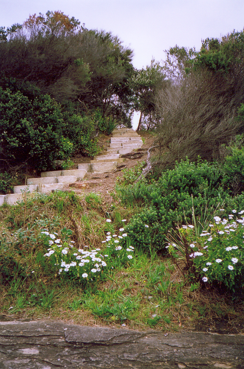
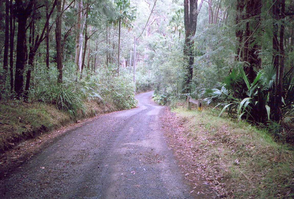
Pissed off work for the day and went walkies round to Pearl Beach. The bus goes there once in a blue moon and walking the road is a 50/50 chance of getting knocked off on a hairpin bend. Most of the locals use the path round the head of Mount Ettalong.

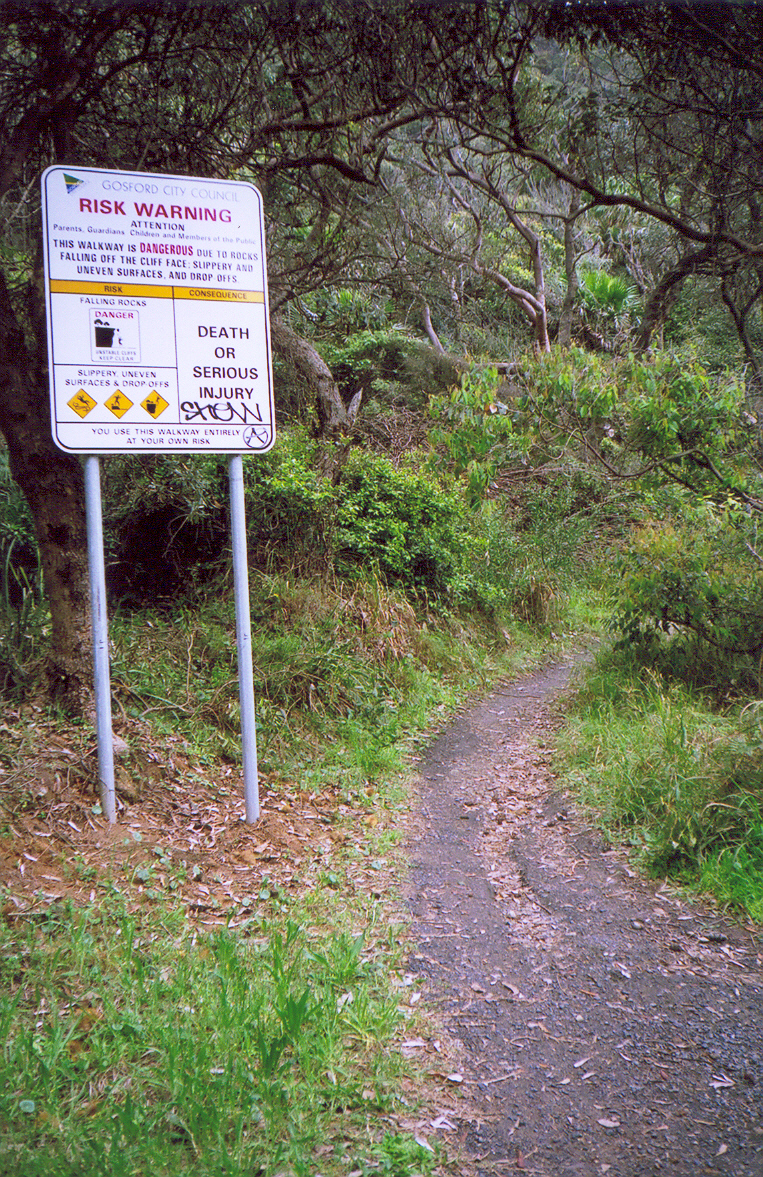
The sign says you could get doinked on the head by rocks falling off the cliff. And there's plenty of examples of said rocks, from marble sized to minivan sized. Popular path but.

Walk up the Mount Ettalong Road where it heads up to the first hairpin bend. Just before the bend there's a wee spot for pulling off the road. The guard-rail has a gap in it and the path goes from there. Not that I'm recommending you take a path where you could get doinked by rocks.


Pearl Beach, Pittwater in background
(Embiggen)

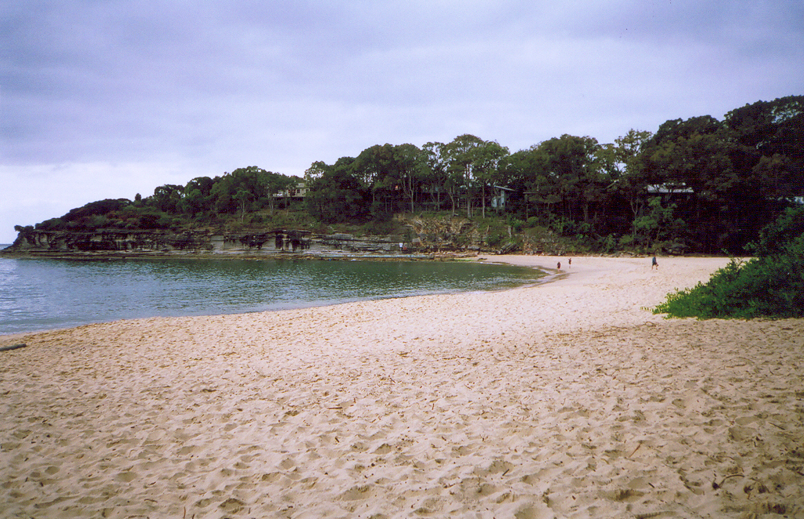
Bustling Downtown Pearl Beach. Busy innit? Actually, it is. There's a few dozen people on the beach, the school holidays crowd. Normally there's just an old bloke and his dog and a couple of skivving teenagers having a sunbake and a ciggy.

Come the Christmas holidays there'll be twice as many peeps on the beach as the holiday home crowd come up from Sydney and the holiday rentals along the beach begin to bulge at the seams.

The actual downtown part isn't visible in this photo. It's a shop-cum-cafe, a postbox (mailbox), a restaurant and a tiny town hall at the corner of Pearl Parade and Tourmaline Avenue.

Pittwater seen in the distance on the left. Northern Beaches of Sydney.


Barrenjoey Head to Green Point Pearl Beach
(Embiggen)

Not a view you'd ever tire of.

That faint line of brown cloud is the smoke from the still-smoldering bushfire in the Ku-ring-gai.


Bottlebrush blooming

Bottlebrush with bees buzzing about busily in the lull between the howling wind last weekend and the howling wind forecast for this weekend.


Waterfront cottage Pearl Beach

Nice little old place, bit of a backyard for a dog, right across from the beach. I want!

Mind, it's probably got a price tag of half a fucking mil with that location.


Pearl Beach Lagoon

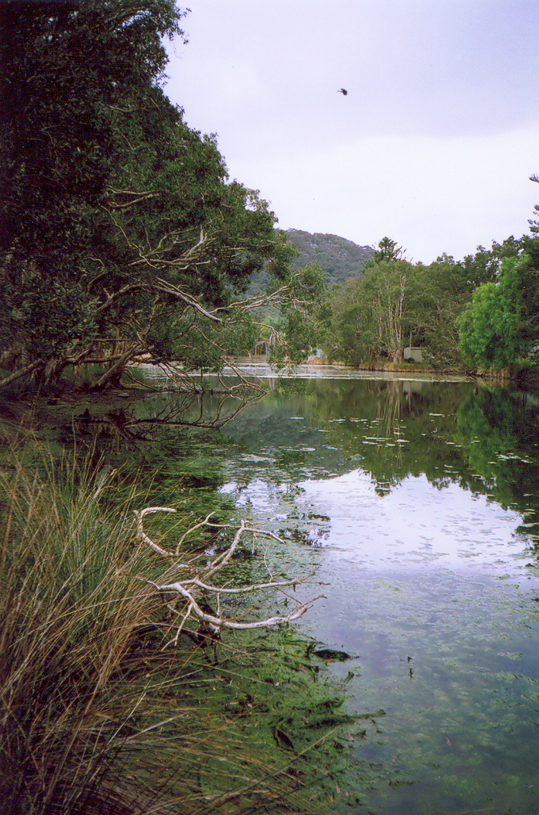
Pearl Beach Lagoon. Still as. Only a street back from the beach and it's a bit weird looking at a very still lagoon and hearing the surf nearby.

Public access from Coral Crescent (squeeze down beside someone's fence on the corner of Agate Avenue or Pearl Beach Drive (can't remember which) or stroll down the path from the "public access" sign on Diamond Road.

Brilliant address or what? 'Where do you live, darling?' 'Diamond Road, Pearl Beach, darling. And you?'

Look closely and you can see a white Spoonbilled Whatsit in the tree on the left and two ducks under it.

The hill in the background is Mount Ettalong.


Pearl Beach Creek, Pearl Beach & Green Point*

Pearl Beach Creek, Pearl Beach & Green Point. (Not that Green Point, the other Green Point.)

Creeks twist and turn all over the Peninsula and this is one. Pearl Beach in the middle distance, Paul Landa Reserve on Green Point in the background.


Previous visits to Pearl Beach

Tuesday, October 11, 2005

Pearl Beach Photos III

From Walk #67 - Pearl Beach.

Big Pink Flower
(Big version)

I like these. They're not usually as bright as this one is. Maybe my monitor's buggered.

Anyways, they're proteas or something. They're flowering right now. They cost five bucks a go at the florist.

Paul Landa Reserve
(Big version)

The park on the tip of Green Point. That's the Green Point at Pearl Beach, not the Green Point at Gosford.

Rock Ledge
(Big version)

One of those rock ledges fishermen get swept off. Below the park at the tip of Green Point.

Pittwater From Green Point
(Big version).

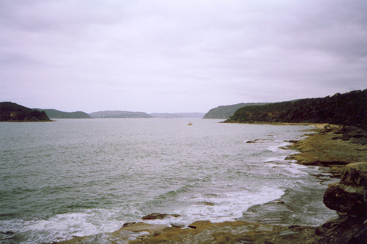
Looking down into Pittwater from the park at the tip of Green Point. That's Lion Island on the far left. Then Sandy Point. Clareville. Bilgola. Newport. Probably. Commodore Heights in Ku-ring-gai Park, a nameless point opposite Lion Island. And Green Point in the foreground. And a commercial fishing boat.

Ettalong From Green Point
(Big version)

Ettalong and Blackwall Mountain from the park at the tip of Green Point. The hills on the right are Daley's Point and Wagstaffe. The one on the left is Mt Ettalong (AKA Patonga Ridge).

Got the photos from my last walk to go yet. Gotta remember to put the fucking film in for developing.

Next walk

Friday, October 07, 2005

Pearl Beach Photos II

From Walk #67 - Pearl Beach.

Pearl Beach Lagoon
See big version.

Little narrow lagoon lurking between Coral Crescent & Diamond Street, Pearl Beach. There's houses backing onto it but a public park round it and plenty of ducks.

Dodgy Path
See big version.

This track goes off the access from Coral Crescent.

Note using it put you in danger of "death or serious injury". Coupla minutes later I saw someone cycling merrily along one of the dodgier parts.

Green Point
See big version.

A better photo of Pearl Beach & Green Point.

Behind the camera is Mt Ettlong (AKA Patonga Ridge) and behind that is Umina Beach & Woy Woy. To the right of the camera is Pearl Beach the township. To the left is the open sea as seen through the heads and Box Head.

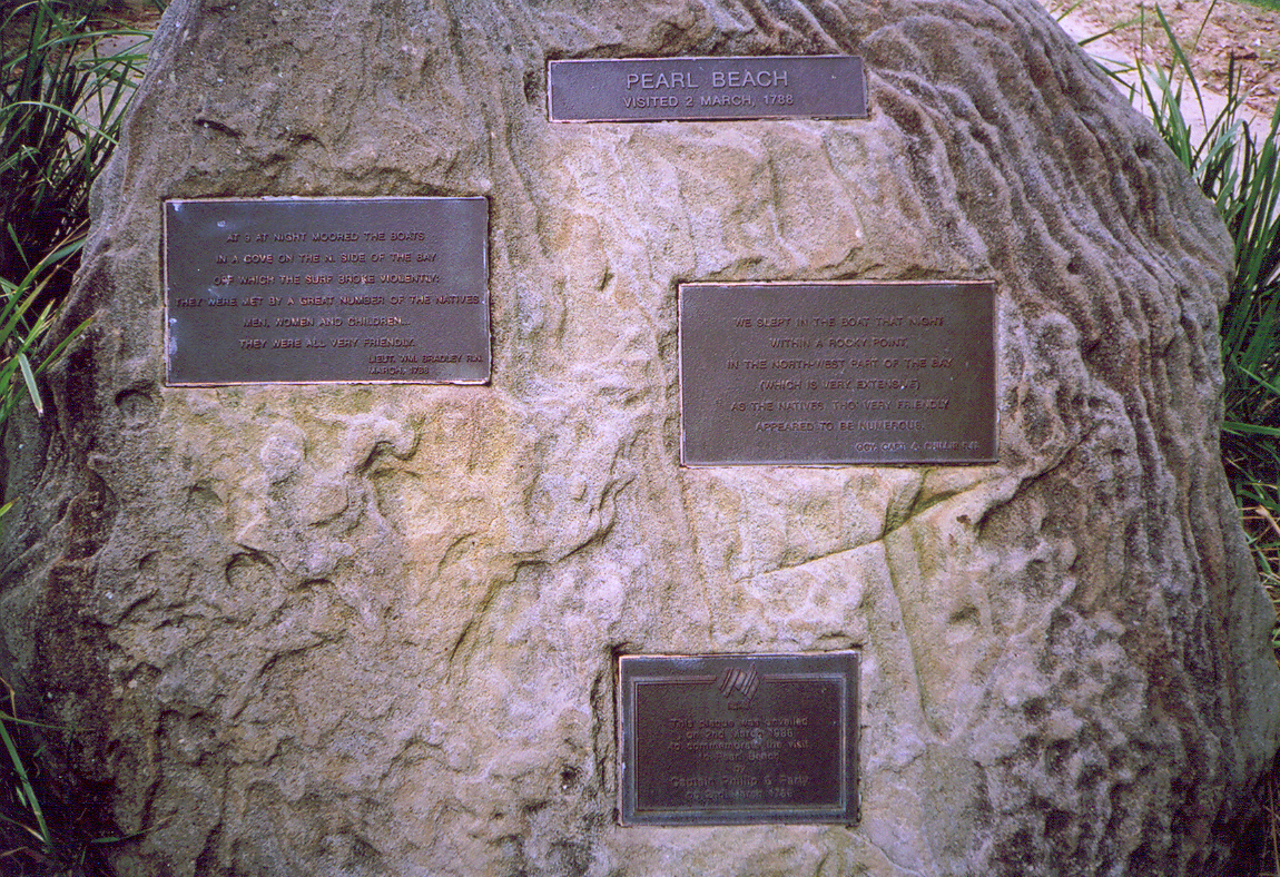
Governor Phillip Strikes Again
See big version.

Top: "Pearl Beach visited 2 March, 1788".

Left: "At 9 at night moored the boats in a cove on the N. side of the bay off which the surf broke violently... They were met by a great number of the natives men, women and children... They were all very friendly. Lieut. Wm. Bradley R.N. March 1788".

Right: "We slept in the boat that night within a rocky point in the north-west part of the bay (which is very extensive) as the native tho very friendly appeared to be numerous. Gov. Capt. A. Phillip R.N."

Bottom: "This plaque was unveiled on 2nd March 1988 to commemorate the visit to Pearl Beach by Captain Phillip & party on 2nd March 1788".

"Lieut." is Lieutenant, "Wm." is William, "R.N." is the British Royal Navy, "Gov." is Governor, who is the representative of the Queen/King of England.

Walk #67 - Pearl Beach.
Pearl Beach Photos I.
Pearl Beach photos III

Thursday, October 06, 2005

Pearl Beach Photos

From Walk #67 - Pearl Beach.

Pearl Beach was my 2nd last walk on the Woy Woy Peninsula Walk, which was Brisbane Water Walk #1. Brisbane Water Walk #2 was Park's Bay.

Crystal Street
(See big version)

The quietest street on the Peninsula Walk.

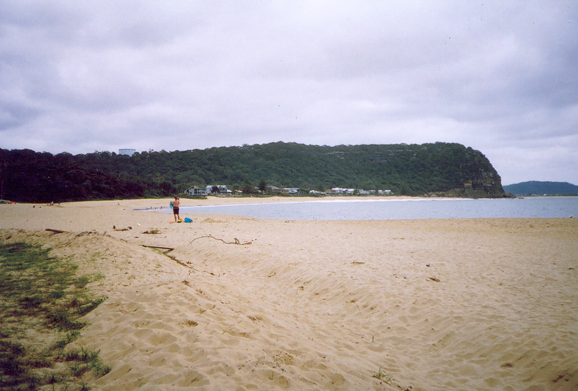
Pearl Beach Looking North
(See big version).

From the end of Gem Road, Pearl Beach. The beach-front houses are on Coral Crescent. Behind them is the south side of Mt Ettalong (AKA Patonga Ridge) with the water tank on top. On the right you can see part of Umina Beach and behind it Blackwall Mountain.

Pearl Beach Looking South
(See big version).

From left to right: In the background, Commodore Heights at the northern tip of Ku-ring-gai Chase National Park. Green Point, with Paul Landa Reserve on it. The hill in the middle is Warrah Trig. I always thought a trig was some sort of beach so there you go. The houses at the foot of the Trig are probably on Green Point Road and Gem Road (going up) and Pearl Parade (level). Houses on the right are on Coral Crescent.

More photos

Wednesday, September 28, 2005

Walk #67 - Pearl Beach

Pearl Beach is beautiful. Really green streets, plenty of trees and some great home design beach, long beach between two rocky heads, views over at Box Head and to Ettalong, and that great aural landscape I'm always banging on about.

It's also small enough to walk all of it in one day (twelve streets to Patonga's five) and that's what I did yesterday. I shot off two rolls of film and bunged them in for developing. In the meantime there's a few nice photos here and here.

Pearl Beach

(Pearl Beach is in the red circle. The head above it is Patonga Ridge AKA Mt Ettalong, which is at the bottom end of Woy Woy.)

Pearl Beach is one of the spots Governor Phillip and some of his men visited in 1788, a couple of months after the First Fleet arrived in Sydney. There's a quote on a plaque on a rock. Part of it says:

"At 9 at night moored the boats in a cove on the N. side of the bay off which the surf broke violently"

"N. side of the bay" is at the Mt Ettalong end of the beach. You can get to that end of the beach from the end of Coral Crescent. The beach slopes steeply there and there was a dull thud as the waves hit and then the sound of them breaking. The waves come in stronger at Pearl Beach than at Patonga because it's directly opposite the mouth of Broken Bay. The sand was coarse and new. Up the other end of the beach and in the middle the sand's the normal fine stuff.

There's a narrow bush track going off the access from Coral Crescent. The sign had the usual warnings about nicking native plants and dune erosion. It also said the track was dodgy and using it put you in danger of "death or serious injury". Coupla minutes later I saw someone cycling along one of the dodgier parts.

Took my hist list with me this time. The list of historic houses and sites from Beryl Strom's book. I found "House, 'Payne's', 59 Coral Cres. ... 1931" and "House, 'Coolabah', 2 Pearl Beach Drive ... c.1934". Both of them were in good nick and both have been recently and pleasantly renovated. 'Payne's' is painted in a darkish blue that looks good on a beachside house. 'Coolabah' had a lighter blue trim and its main colour was a deep cream. "House, 'Yamba', 13 Crystal Ave ... 1929" I didn't find. I think I saw it but I wasn't looking at the hist list while I walked Crystal Avenue.

There was a more recent bit of history up on Green Point. There's a road up it, almost to the end. Then the end bit slopes down to a bit of a cliff and some of those rock ledges fishermen get swept off. The sloping bit is a park called Paul Landa Reserve. Got a bit of deja vu when I got to it. When I read the plaque I found out why. This Paul Landa bloke was government minister, though he seems to've been more of a statesman than a politician. (They shoulda had him cloned.) The phrase repeated in most of the Google links about him is that "under his guidance the national parks of New South Wales doubled in size". That explains why I thought I'd seen the Reserve before. I've seen a couple of Paul Landa reserves and parks in WA (Western Australia) and they could've been done at the same time because they had the same sandstone blocks in a curvy line making a wee sheltered spot to sit and read the plaque and the same wooden steps down to seats where you could sit and enjoy the view.

I sat for a bit and enjoyed the view. It was great. I could see right along the beach, across to Ettalong and the Excresence (which wasn't great), across to Box Head and Barrenjoey Head and out to sea, Lion Island was quite close and I could see down into Pittwater to Palm Beach & Stokes Point and down to Newport & Church Island. The Palm Beach ferry inched its way along. It was sticking close into the lee of Box Head. It probably takes it twenty minutes to cross the mouth of Broken Bay and I bet there was a few green passengers by the time it got behind Barrenjoey.

My feet were aching a bit and I'd run out of muesli bars. So I found the State Survey mark ("PWD NSW State Survey No 459") and went off to lunch. Had it at a table under a big old pine in the foreshore park. Great spot for it. From there I could see across to Green Point at the southern end of the beach. It blocked my view of Pittwater and Lion Island. But I could still see Lobster Beach and Little Box Head and Box Head straight ahead, and across to Wagstaffe and Ettalong on my left and, blocking my view of Umina Beach, the head of Mt Ettalong where the surf thudded.

It was beautiful. Bit windier than I usually like my lunch. It was overcast all day and the wind was picking up. The school holidays just started and there were a dozen kids on the beach with their goosepimpled parents. Of course the kids were too engrossed with playing to notice the wind.

Pearl Beach Streets

I'd walked waterfront and the long street behind it before lunch. The road into town (Pearl Beach Drive) comes straight down the middle and ends at the beach.

On its left is Coral Crescent. There're houses on the beach side of Coral. They block the wind and some of the wave sound so it wasn't a very windy walk. Between it and Diamond Street there's a small lagoon. The lagoon was still and had algae blooming in patches on it. All the local creeks and lagoons are getting their Spring bloom of algae. Along the edges were clumps of reeds and paperbark trees. Ducks were waddling about enjoying the sun and looking for things to eat.

On the right of Pearl Beach Drive there's a footbridge taking you over a creek to the other half of the beach. There's no houses between the road and the beach there. Just a foreshore park with the usual grass and picnic tables and a couple of big old pines. At the end near Green Point there's a shop, a coffee shop, two restaurants and the plaque rock celebrating Phillp's visit in 1788.

After lunch I did the rest of the streets. I went up Pearl Beach Drive to the first elbow bend. After that it'stoo easy to get wiped out by a car on a blind curve. Amethyst and Emerald were flat streets running straight back from the beach to the back of the town. I could hear the waves all the way up them to the end. Then the rush of wind in the gums of the bush drowned out the waves. Jade Place was a high street. It sloped up steeply from Pearl Beach Drive then flattened out. On the hill side there were maybe a dozen houses. They have long staircases up the their front doors and huge balconies and windows staring out to Box Head. The aural lanscape up there was great. There was nothing blocking the sound of the waves so the wind in the gums didn't drown them out. Beautiful.

They were all pricey houses. One had a flag flying from its biggest balcony. According to my 1980s atlas it's the Czech flag. White stripe on top, red below and a blue triangle on the pole end. The house looked really Spanish though. Sandstone and render, the row of poles on the white veranda-cum-cloister, the details if the woodwork on the storey above that. Anyways, it was a pleasant bit of domestic architecture.

Although Pearl Beach has got some very pricey houses and a lot of great modern design, there's a patch of seventies hideousness lurking in the top right corner (looking from the beach) and at least thirty small old forties places scattered about. Some of the forties places have been recently renovated and added onto but quite a few still had a Dear Old Thing quietly mouldering away in them, enjoying their final years in the beauty of the town.

In the sheltered streets back from the beach there were a lot of birds. Even more than at Patonga. Magpies, a kookaburra dozing on a fence with its beak tucked into its chest, another one had a bit of a laugh to itself on an overhead wire, mynah birds (non-native species), rainbow lorikeets feasting off flowering bottlebrushes and off bread on someone's lawn. The same bread was feeding a male brush turkey and I saw six males all up, though three of them might've been the same one. I s'pose they're looking for mates now it's Spring. They're certainly less shy than usual.

I didn't hurry but walking the whole of Pearl Beach took only four and a half hours, including time spend on the beach and Green Point just goggling at the view. It's a small town ("population category 351-1,200" according to the 1995 Tidy Towns plaque on the Progress Hall) but I've got faster. It's months since 80-year-olds passed me as I tottered slowly along the footpath. Now my leisurely walking pace is faster than my fast walking pace in March. Go me!

By the time I got the afternoon bus home the wind was pretty much a howling gale. The parents had scurried indoors, dragging the littler kids with them kicking and screaming. The bus was toasty warm. It also had views down over Pearl Beach and Patonga, and at one point on the road down to Patonga, a brief glimpse across the hills to the Hawkesbury River near Brooklyn.

It was a great walk, one of my favourites of this Walk and I'll be hauling friends off there for picnics this Spring.

The wind's gusting strong again now. It's shrieking through the crack in the kitchen window and there's an unbroken line of raincloud coming up from Sydney. A thunderstorm was promised on last night's weather. I've got my fingers crossed.

Photos from this walk