But hardly anyone ever goes there. It's uninhabited, except by pelicans and trees. And mozzies (mosquitoes). Fucking squadrons of the bastards! We were eaten alive, even with the bloody repellant slathered on like cream on cake.

As you can see in the in-set map, Pelican Island is actually two islands with a narrow channel running between them. Another narrow channel, a dead end, runs into the interior of the larger island. (In-set map borrowed and modified from the local ferry crowd.)

There's a few tiny wee beaches for landing on the island. The biggest is maybe ten metres long. That's about 33 feet in American. Give or take.
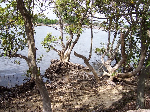
The rest of the shore is thick with mangroves. Those white lumps on the mangroves roots are rock oysters.
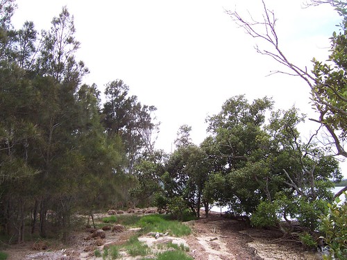
A few feet from the shore and the casuarina trees (left) start. The other name for them is she-oaks. They have needles instead of leaves, not smooth but with tiny segments like bamboo. (Close-up of needles) When the wind whispers through them it gives a soft whispery howl.
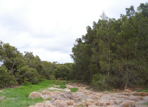
The island is made of sand and can't be more than a metre (about 3 feet) above sea level at high tide. We could see where big waves or king tides had swept sea grass and floating stuff up over the wee beach and several metres inland.
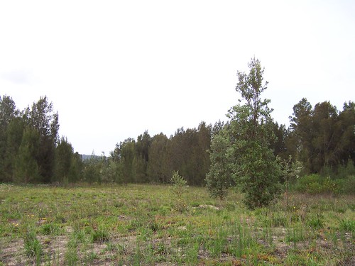
Going into the interior of the island it was surpisingly open. There were lots of casuarina but a few dozen banksia trees as well and grasses I didn't recognise. That's a banksia there in the middle ground.
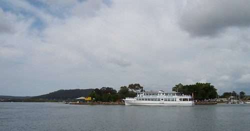
Once you're into the trees it's easy to forget how close you are to town. This is looking from the north-east end of the island across Woy Woy Channel to Lions Park at the end of North Burge Road (red cross on map.)
That's the Lady Kendall II of the Gosford ferries passing the park. She does the tours.

Then you look away to the east and there's Rileys, the other uninhabited island near Woy Woy. (There's also half a dozen wee islets barely wide enough to spit across.)
Pelican Island stats 'n' stuff
Rileys Island stats 'n' stuff
Wee islets nearby: Unnamed Isles, Oyster & Retention Islets at St. Huberts, Islets of Fagans Bay & the one people think is Pelican Island but isn't
Then there's Lion Island, which is in the mouth of Broken Bay not in the Brisbane Water estuary itself. But, just so yer good and confused, the estuary is in Broken Bay. (Maps)
7 comments:
The channel between the two parts of the island.
Found it right after I've posted the post. *&^%$#@!
The western half of Pelican Island and most of the rest were formed from the sand deposited from the dredging of Woy Woy channel , as with most of those tiny un-named islets around the place.
St Hueberts and Rileys are naturally formed islands , Spike Milligan helped save Rileys from the bulldozer of LJ Hooker in the 70's , God Bless im
great photos spike but are you actually allowed to go on the island?
Thank yer, Stevo. I wonder if we'll get another island if/when they dredge the Ettalong channel. I vote for calling it St Kev's after the patron saint of lost car keys.
Thank yer Michael. You are indeed allowed to go on it but only if you promise Parks and Wildlife you'll be good.
Also I love the photos, especially the close up of the needles
Thank yer, Suzanne, can't take credit for the close-up though. I think it might be a Wiki creative commons job and I've forgotten to tag the bastard.
The rest are mine but. Looking at them again I'm surprised at how sunny they are. It was bloody dodgy light that day, like most days the last couple of months.
can you fish from the island?
Post a Comment