Bloody hot day for a walk. Even with the midday breeze off Sydney Harbour. Forgot to blog yesterday but here's a treasure hunt post to be going on with.
Biggulate
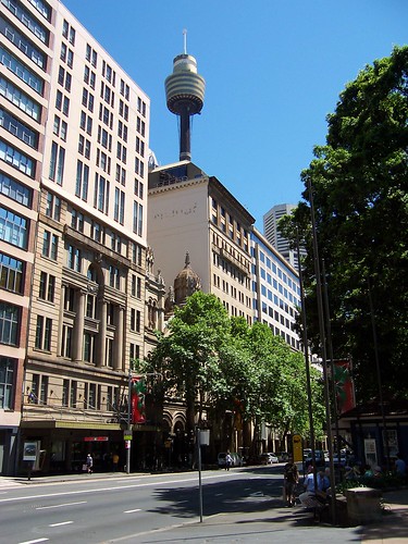
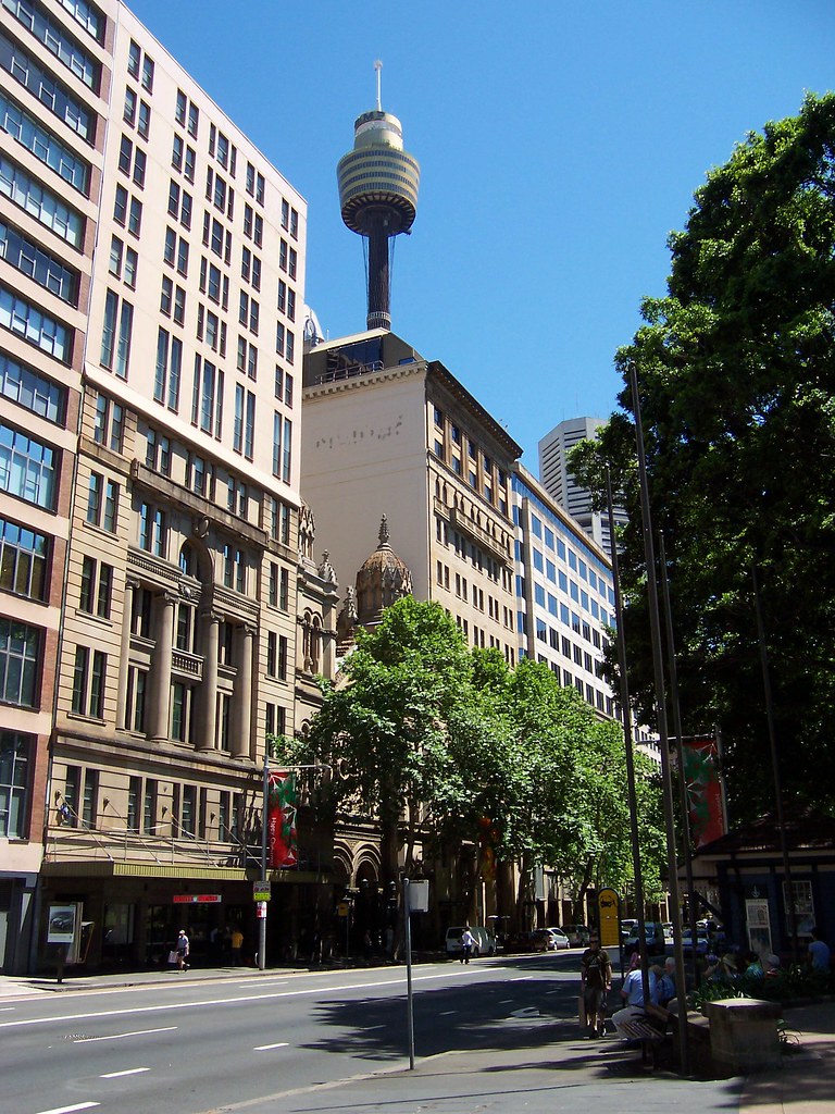
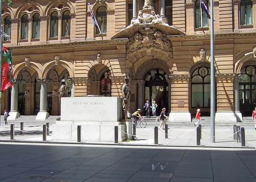
Elizabeth Street Sydney.
It was a marsh in 1788. That's when the Poms sent the first lot of convicts and soldiers to Port Jackson (Sydney Harbour) and Sydney was started. It was a tear-drop shaped marsh with its bottom in Hyde Park where I'm standing and its tip between Pitt and George Streets near Market Street.
Get off the train at Town Hall, take the Park Street exit and go down Park Street to Hyde Park.

Biggulate
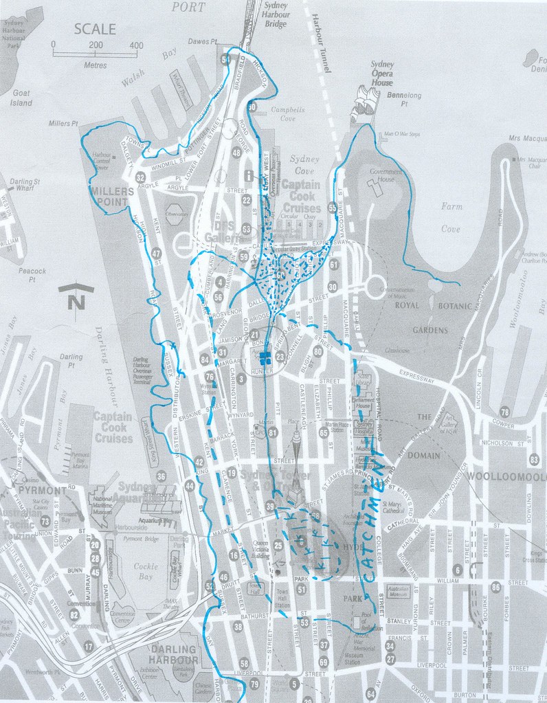
The blue lines are the 1788 shoreline of Sydney Cove (Circular Quay), the catchment area for the Tank Stream (larger area of broken line), the marsh at the head of the Stream (tear-drop shaped), the Tank Stream itself (centre), the tanks cut into the Stream (centre, circled) and the low tide banks at the mouth of the Stream (spotty areas).
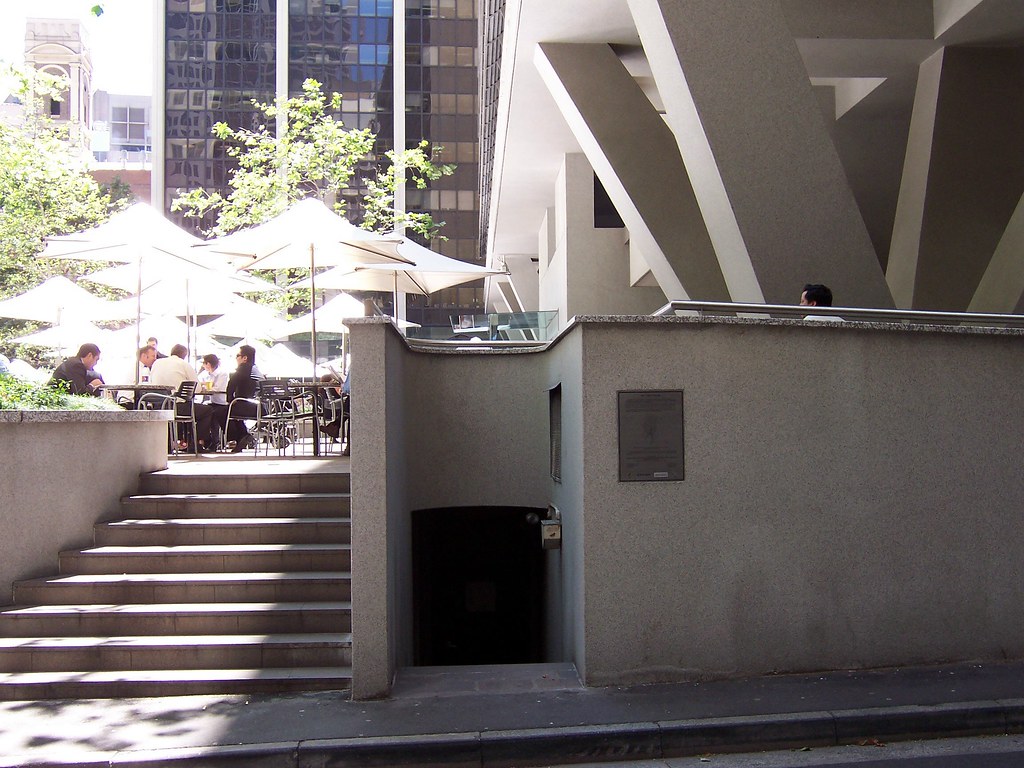
From Hyde Park, cross Elizabeth Street, go back along Park Street, turn down Castlereagh Street and walk one block north, towards the Bridge. This takes you across the middle of the old swamp.

Biggulate
Marker #1. In the pavement at the entrance to Sydney Arcade, 185-189 Pitt Street.
The textured stripes mark the direction of the Tank Stream in that spot.
From the corner of Castlereagh Street and Market Street, walk west (towards George Street) along Market Street and turn downhill into Pitt Street. Sydney Arcade is on your left just before King Street.
Mark #1 in close-up.
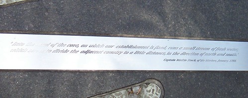
" 'Into the head of the cove, on which our establishment is fixed, runs a small stream of fresh water, which serves to divide the adjacent country to a little distance, in the direction of north and south.'
Captain Watkin Tench, of the Marines, January, 1788."
The stream socially divided the settlement from the word go. The government bits were on the eastern side and the convicts lived on the western side.
Biggulate
Marker #2. In the pavement next to the ANZAC Memorial AKA the Cenotaph, outside the GPO, Martin Place. You can see the marker in the right foreground of the photo. It looks like two ticks (checks).
From Sydney Arcade, walk downhill towards the Harbour and turn left into Martin Place. Walk past the Christmas tree. The marker is behind the ANZAC memorial.
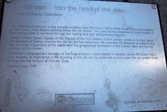
There's an explanatory plaque next to the marker. It says:
"Tankstream - Into the cove ...
Lynne Roberts-Goodwin
The Tankstream Artwork, in five separate locations from Pitt Street Mall to Alfred Street, marks the existence of the historic Tank Stream bubbling below the city streets. The subterranean movement of a fine stream of fresh spring water is conveyed through the rippling blue light and accompanying text.
Captain Watkin Tench, Captain of the Marines of the First Settlers at Port Jackson, wrote in his diary about the selection of Sydney Cove as the site for the first settlement. He recorded the presence of water at this site, his vision of grandeur of the settlement, the geographical description of the Sydney valley and the rise and flow of the stream.
Tankstream celebrates the memory of the original stream which started in the marshes where the Pitt Street Mall is now situated, its importance in the founding of the city, finally flowing into the harbour at Circular Quay.
Installed: June 1999"
Dunno about the rippling blue bit. The textured bits of the markers looked rippled but they're too grubby from foot traffic to be blue. They're nice anyways.
Hunter Street at the corner of Pitt Street Sydney.
On the Tank Stream underground tours the guides can tell they're near Hunter Street because the manhole covers rattle with the traffic.
Biggulate
Marker #3. Curtin Place, off Pitt Street next to Australia Square.
The tanks are under Australia Square. When the Tank Stream ran dry or low in drought Governor Philip ordered "tanks" cut into the sandstone bed of the stream to trap more water in the next good flow.
The tanks cut into the sandstone base of the Tank Stream are under Australia Square, which is up those stairs.
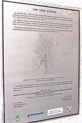
Down the stairs (bottom centre) beside the wall plaque is restricted access to the Stream. The plaque says:
"THE TANK STREAM
On January 26th, 1788, Governor Arthur Phillip landed on the shores of Sydney Cove. The selection of the site for the colony was influenced by the availability of a supply of fresh water from what became known as the Tank Stream.
In 1790 the "tanks" from which the stream took its name were excavated in solid rock on both sides of the stream, close to the location of this plaque. The stream enetered the Cove at what is now Circular Quay and provided the colony with water until the early 1820's.
The growth and development of the city during the middle of the 19th century led to the stream being progressively covered and now it carries stormwater.
(Under the map:) Original course of the Tank Stream and the boundary of its catchment superimposed on the area today.
This plaque acknowldges the gift to the people of Sydney of public access to the Tank Stream by the Water Board, Lend Lease Corporation and the New South Wales Bicentennial Secretariat.
Unveiled by the
MINISTER FOR LOCAL GOVERNMENT, MINISTER FOR WATER RESOURCES & ASSISTANT MINISTER FOR TRANSPORT,
The Hon. Janice Crosio, M.P., on February 17th, 1988."
From Martin Place, walk down Pitt Street, past Hunter Street and into Curtin Place right before Australia Square. You're looking for an ordinary service access thingy next to the steps up to Australia Square's fountain.
While you're in Curtin Place, look at the shape of it. By this time on the walk you can see you're in the shallow narrow gully that carries the Tank Stream.

Tank Stream Bar in Tank Stream Way, off Pitt Street just past Australia Square. A watering hole over a stream. Very appropriate.
Biggulate
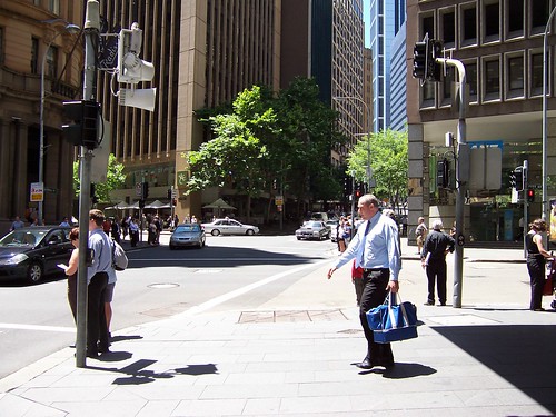
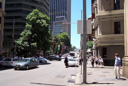
Marker #4. Bridge Street at the corner of Tank Stream Way. Tank Stream Way is an L-shaped lane from Pitt Street to Bridge Street.
That's the marker just under Blue Shirt's feet and the end of Tank Stream Way behind him.
Bridge Street may be the site of the original bridge over the Tank Stream. I'm pretty sure of that but I'm too buggered to check.

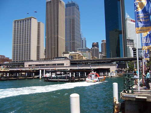
Marker #5. The Children's Fountain, Herald Square, Alfred Street, which is the street that runs along in front of Circular Quay, to the right of this photo.
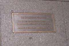
The Children's Fountain plaque, in the pavement next to the fountain in Herald Square, Alfred Street. Which is the street along the front of Circular Quay. It says:
"The Children's Fountain
Dedicated to all the children who have played around the Tank Stream.
Presented by John Fairfax & Sons Limited, 1981".

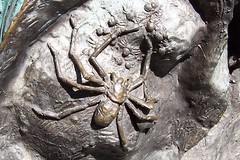
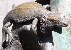
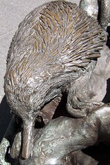
A few of the animals on the Children's Fountain. Platypus, spider, frill-necked lizard and echidna.
Biggulate
Circular Quay is Sydney Cove, the place where the First Fleet came ashore when they found fresh water in Port Jackson. They set up camp there and from that camp Sydney grew.
Where that orange and white boat is heading is around where the Tank Stream comes out, in its current incarnation as a stormwater drain.
FactFiles has some good pictures of the Stream's history.
Hope this post makes sense. Too tired to tell. Been a long day. It was good to get a walk in though and particularly to do the Tank Stream. I'm looking forward to doing it underground. That'll be a while. The tours are only twice yearly and there's a waiting list.
By the way, I’ll be swapping to Tuesday and Thursday blogging for a bit instead of Monday, Wednesday, Friday. Lotsa offline crap to be done at the moment.
16 comments:
Well done, Spike!
Great photos and story.
We have a covered stream in town that is now Alder Street. There is talk of "Daylighting" it when the mill property becomes available. We shall see.
I look forward to your report of the underground tour. Seattle, Washington has underground tours. Google it sometime.
I'll be eating the bird tomorrow during our single day of thanksgiving when fat guys sit around and watch football whilst the "little woman" slaves in the kitchen!
Weird.
there used to underground tours of the old abandoned rail tunnels leading from St James Station but not doing it anymore because of Security Reasons since 9/11
Ron, hope they daylight yours and ours. They did it in Seoul or somewhere with the city's original water source there. They lost a bit of road but it made bugger all difference to the traffic.
I've got me tongue hanging out waiting for the underground tour. Might be a while but. They only run 2 a year and it's always booked out.
Michael, did you do the St James tunnels? It's a cool tour. Splashing about in the old bits they never used and the bit where they put in a govt bunker during the war and shit. There's all the old blast wall;s still up and heaps of graffitti at the bunker bit. Soldiers names and units from the war when the bunker went in then again in the sixties when they took down the stairs or something.
Crying shame it's off limits now but there you go.
Thank yer, BTW, Ron.
no i didnt do them, but had read about them and seen pictures it would have been great to do
They were.
There's a weird metal thingy in one of the flooded bits behind the blast walls what the sound effects guys from Aunty used to dong to get various sounds. Looks like some sort of stubby bomb prototype.
All sorts of gear down there and old signal boxes and shit from when they did the tunnels in the late 20s/early 30s. Very fun.
thats where trains used to terminate before circular quay station opened
They built the Quay station when they built the Cahill and that was in the 1960s right?
yeah they build them both at the same time but it was 1956 when it was opened
51 years old and they're talking about pulling it down now.
it wouldnt be the same without it i dont think
Yeah. And if they're gonna do the Cahill they'll have to do the station as well to get the look they're after.
they said they would put the station underground
Great story, I only visited SYD about 4 weeks ago and was just surfing the net for bars and restaurants around Sydney and found a bar called Tank Stream Bar and my interest started from there. I didn't know the full history around the name. I must head back so I can follow the path around Sydney.
Do you know when the 1788 shoreline plagues were laid around circular quay?
Thankyou Spike, great walk and profiling of the Tankstream 'into the head of the cove' Public Artwork. It's currently in the second or 3rd iteration of maintenance/scope of works from the City Council with newly commissioned glass and led lights at a lower luminance level...Lovely to see these images and great profiling of your walk above and below ground. Lynne
Post a Comment