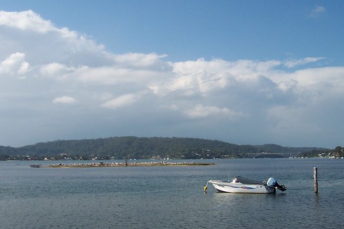
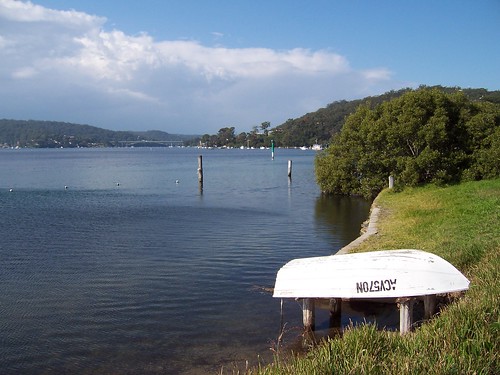
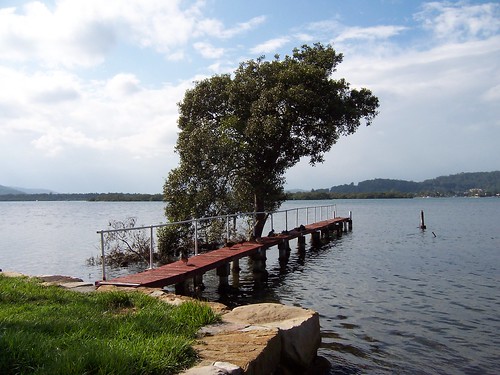
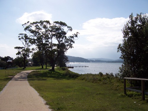
(Random walkies in Woy Woy)
Right now it's pissing down again but a few days ago the winter sun was blazing and the dogs frolicking and the locals popping down to the beach.
This is looking out from Umina Beach through the heads of Broken Bay.
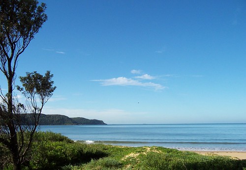
Box Head, the northern head of Broken Bay.
Box Head gave its name to the crowd who make Box Head surf gear. Or made. They don't got a website so maybe they got bought up. Anyways, they used to have their office in a house in Memorial Avenue right near Bustling Downtown Ettalong.
View south from Umina Beach. Mt Ettalong on the right, the arse end of Lion Island on the left edge of the photo, Pittwater and Commodore Heights (Ku-ring-gai) in the middle.
Lion Island from Umina Beach, looking south.
Geraldton Wax blooming in the winter sun. Proper name Chamelaucium uncinatum. It's an Australian native but is actually from WA (Western Australia) not NSW. I love it.
"[O]ne of Australia's most famous wildflowers and is widely used as a cut flower in Australia and overseas" says ASGAP. Pop into yer local Interflora today.
ASGAP fact sheet & photos
Second wave
We're well and truly into the 2nd wave of the swine flu now. The peeps who know about this sort of thing said it's normal and would happen and so it's happened.
But it's still not time to panic yet. Relax, eat yer vegies, lay back on the sofa with a DVD on and for fuck's sake don't watch those panic-merchant news reports on 7, 9 and 10. Bloody half-witted commercial TV channels. Switch over to Aunty and yer blood pressure will go down. ABC news is at 7pm.
What can you do?
"Influenza is spread from person-to-person through coughing or sneezing of infected people. There are many things you can do to prevent getting and spreading influenza:
* Cover your mouth when you cough, and wash your hands regularly.
* Cover your nose and mouth with a tissue when you cough or sneeze. Throw the tissue in the garbage bin after you use it.
* Wash your hands often with soap and water, especially after you cough or sneeze. Alcohol-based hands cleaners are also effective.
* Avoid touching your eyes, nose or mouth. Germs spread that way.
Try to avoid close contact with sick people.
* Influenza is spread from person-to-person through coughing or sneezing. Stay away from people who are sick.
* If you get sick, stay home from work or school and limit contact with others to avoid infecting them." (More at NSW Health Dept prevention info)
"Department of Health and Ageing swine influenza information...
Advice for returned travellers
...
Travel advisory" (Swine flu advice at the NSW Health Dept)
"Swine Flu Symptoms
Since swine influenza infections typically present in humans as seasonal influenza, most of the cases are detected by chance through flu surveillance. Swine flu symptoms, similar to those of seasonal influenza may include:
* Cough
* Runny nose
* Fever
* Headache
* Joint aches and pains
* Fatigue
* Nausea
* Vomiting
* Diarrhoea
* Acute pneumonia
The Federal Government has set up a swine flu hotline for public information: 1802007" (Aunty on teh interwebs)
Saturday, May 30, 2009
Saturday, May 23, 2009
Bloody wet
It is too bloody wet and too bloody dark for walkies. It is this dark. Took that in 2008 but it's the same dark this week only wetter.
Anyways, here's some I took last week when the sun was out.
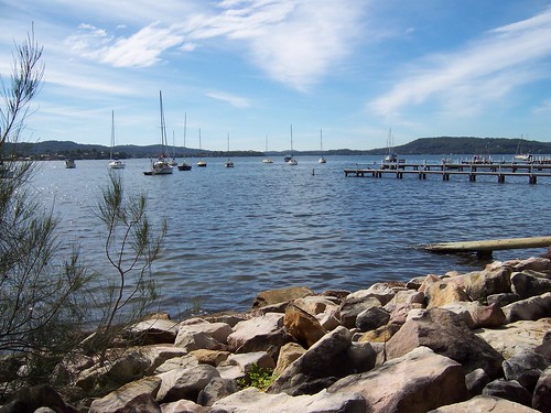
Rocks and yachts at Koolewong.
Looking north-north-east up towards East Gosford/Springfield. The low ground in the left background is the low bit of Tascott/Point Clare and Longnose (Pt Frederick) and the flat hill on the right is Kincumba Mountain.
Mangroves beside Brisbane Water Drive. The bare-branched one isn't bare-branched because it's winter. It's just dead. Mangroves are evergreen, like most Australian trees. It's mostly the imported species of trees that are deciduous.
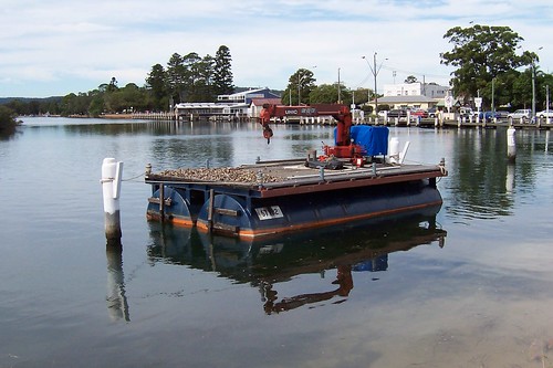
Jetty building equipment near Woy Woy wharf.
That's Pelican Island in the near background, with the pointy hill of Saratoga behind it.
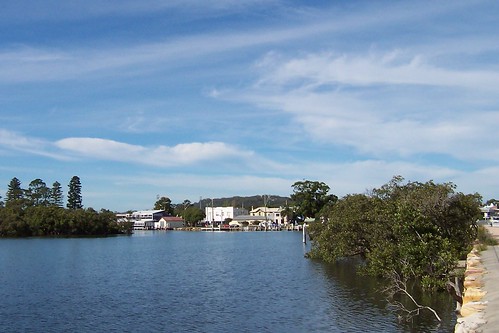
Woy Woy from Brisbane Water Drive
The pines are at the war memorial on Brick Wharf Road, the white building with the dark side is the fish and chip shop, the red-roofed building is a storage thingy either for the fish and chip shop or the commercial wharf in front of it. I forget.
The square white building is Roma (now St. Vinnie's), the two-storey building beside it is the pub (Woy Woy Hotel, the CWA is the low grey roof in front of the pub.
The ferry wharf is all those white pylons in the water and that big gum is in Anderson Park, a wee park behind the other pub.
Not drowning, wading
As soggy as it is here in Woy Woy, our rain is fuck-all compared to what they're copping up north.
"The worst drought in South-East Queensland's history is over." That's what the Queensland Premier said about the flooding in Brissie. Give that pollie an award for understatement.
Brissie (Brisbane) is a fucking disaster area. Brissie is one of Australia's bigger cities. It has about 2 million peeps. And it's built on a flood plain.
Thousands of peeps around the Queensland/NSW border were told to pack up and bugger off to higher ground. And maybe something has been learnt from the Victorian bushfires because they went and they went without a murmur. (Apart from a few argumentative types of course, but you always get them.)
The good news is Lake Eyre is filling with trickle-down from the flooding in Queensland a couple of months back (during the Victorian bushfires). Lake Eyre is a fucking huge salt lake in South Australia. Since 1885 it has filled six times.
Mappage:
Australia, with Queensland highlighted (New South Wales is immediately below Queensland)
A river runs through it (Satellite photo showing why Brissie is currently flooded)
Luscious satellite photo of Lake Eyre
Speaking of water
Lately I've been hoicking my carcass up to North Gosford and Wyoming and the like for walkies.
And not loving it. They are too far from the water. I like walking near the water. There's no two ways around it.
So I'm temporarily re-focussing my walkies to only towns and suburbs that border on the water.
That includes, from south to north:
Pretty Beach (started but not finished)
Hardys Bay (started but not finished)
Killcare
Killcare Heights
Empire Bay (started but not finished)
Bensville
Kincumber South
Kincumber (started but not finished)
Green Point
Rocky Point (part of Green Point)
Ironbark Point (part of Green Point)
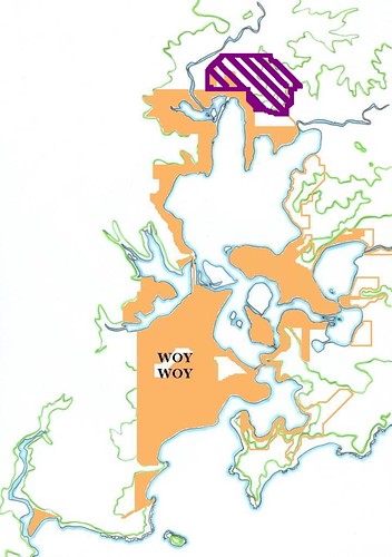
(Walkies Map May 2009)
The purple bit is what I've temporarily crossed off my list.
The orange lines outline my walkies target area. The filled-in orange bits are already walked.
The blank islands are uninhabited and have no roads. The green lines are landscape contours lines indicating hills and ridges.
Walked so far:
Woy Woy Peninsula:
(clockwise from station)
Woy Woy (station)
Blackwall
Orange Grove
Booker Bay
Ettalong
Umina, Ocean Beach & Umina Beach
Pearl Beach
Patonga, Dark Corner & Brisk Bay
Woy Woy South/Correa Bay
The Bays:
(where the fires were, next to Woy Woy)
Horsfield Bay (Deadmans Bay)
Phegans Bay
Woy Woy Bay
Parks Bay (old/semi-official name, part of Koolewong)
Clockwise round Brisbane Water from Woy Woy:
Koolewong /Murphys Bay
Tascott
Noonan Point (old/semi-official name, part of Tascott & Point Clare)
Point Clare
Fagans Bay
West Gosford (started but not finished, outside revised target area)
Gosford (started but not finished)
Point Frederick (Longnose)
Caroline Bay (part of East Gosford)
East Gosford (started but not finished)
Peeks Point
Springfield (started but not finished, outside revised target area)
Erina (started but not finished)
Yattalunga
Saratoga
Davistown
Kincumber (started but not finished)
Empire Bay (started but not finished)
St Huberts Island
Daleys Point (started but not finished)
Fishermans Bay
Hardys Bay (started but not finished)
Pretty Beach
Wagstaffe
Kourung Gourong Point (part of Wagstaffe)
'Started but not finished' doesn't mean I've abandoned that walk. It just means it's now outside my revides target are. Plus I'm just a random bastard these days.
Saturday, May 16, 2009
Mum
Streaky reflections from Brisbane Water Drive Koolewong
Was going to blog a stack of walkies photos today but there's a post I've been trying to get off my chest for a bit and now is the time.
Mum
My mother died 18 months ago. She had cancer and went twenty years ahead of her time.
Technically it was the cancer that killed her but there's a bloody good chance she would have beaten it if she'd got a bloody divorce.
I never understood my mother. She was a person of normal intelligence, not an idiot, she got along with people, she appeared to outsiders to be living a normal life. But behind closed doors she was the monster's keeper.
She threw her life away. She spent her entire adult life keeping my father out of the mental hospital. She refused to admit he was barmy. She spent her every waking moment pretending he was normal, that the daily foaming-at-the-mouth rants and the bizarre behaviour were "just his way".
Why? What the fuck was there that could possibly be gained from keeping an aggressive fuckwitted unmedicated nutter at large in the community? What possible advantage was to be had by his never being medicated?
It's not like she was happy when he was normal. Even when he wasn't having an episode, way back twenty years ago when he was still sane some days, even then he was a horrible prick.
What the fuck was wrong with her? What had gone so fundamentally fucking wrong that she thought staying married to an abusive nutter was worth doing?
I loved my mother but I will go to my own grave wondering what the fuck she thought she was doing.
Saturday, May 09, 2009
This isn't Pelican Island
(Random walikes in Woy Woy)
The clouds piled up high in the north-east in the morning, a big wide front in an otherwise blue sky. I went walkies while the sky was still blue.
Wandered along Blackwall foreshore. Which runs from the playground up behind the bowls at the end of North Burge Road to the jetty at Blackwall Point. Scroll down for the map.
That wee tiny islet covered is pelicans is pretty much a tidal islet, that is, it's not there at high tide. At low tide it whiffs something cruel due to all the pelican shit.
It is the islet that isn't Pelican Island. Peeps think it's Pelican Island because it's covered in pelicans but it ain't. Yer actual Pelican Island, as blogged in April 2009 and January 2007.
View along the waterline to The Rip Bridge joining Booker Bay/Orange Grove in Woy Woy to Daleys Point. That's Blackwall Mountain lurking in the background on the right. The bridge goes from its foot across to Daleys Point.
The ducks really appreciate the private jetties. That tree is a mangrove.
The bike path from Gosford to Woy Woy is finished at last. It goes up to Allfield Road or one of those streets near there then disappears.
The view is across to the low bit between Mt Pleasant at Saratoga and the lower hill of Davistown. That flat-topped mounain in the background is probably Kincumba Mountain at Green Point.
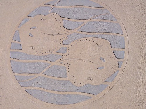
Small roundish stingrays what lurk in Brisbane Water. Someone sent me some photos of them last year.
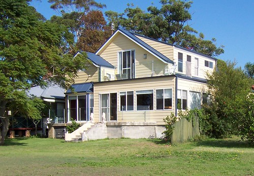
Look at that balcony there on the top. Excellent spot for drinking in the warm winter sun whilst eating yer breakfast.
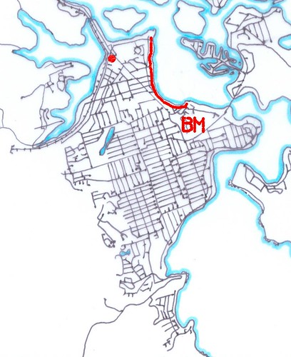
The red line is Blackwall foreshore.
The red spot is Bustling Downtown Woy Woy.
The BM is Blackwall Mountain.
The straight road running from the red spot to the BM is Blackwall Road.
Mmm...maps
Blackwall foreshore from Blackwall Mountain (photo)
Local linkage
K.P. Brown, another Yank in Oz, blogged a few nice view photos from the ridge above Koolewong.
Right then. Ravenous. Will stop adding links and go and hunt some lunch down. See yer next week.
Friday, May 01, 2009
Can we panic yet?
So this is it, we're all going to die!
Naaaaah. Not this time, not next time, not even the time after that.
"The first influenza pandemic was recorded in 1580 and since then influenza pandemics occurred every 10 to 30 years." says Wiki. So if they happen every 10 to 30 years and we're not all dead yet, it's probably not worth panicking.
All the news programmes keep talking about the 1918 flu pandemic that killed millions of people all over the world. But yer gotta remember we got antibiotics and shit now.
How the flu virus works
Influenza pandemics and how they work
1918 flu pandemic
Officials say don't panic (includes video of thermal scanner in action)
Australia still clear of new virus
"The areas with the most number of possible cases are South-East Sydney and the Illawarra with 20 and Northern Sydney and the Central Coast with 13. There are 12 each in Sydney's West and the Hunter and New England."
Notice that's possible cases not actual cases. Possible cases includes people with a bit of a sniffle, people with yer bog standard annual flu and man flu.
"Dr Grant encouraged anyone with symptoms such as fever, coughing and a runny nose whic began within 7 days of returning from an overseas holiday to contact their GP, local public health unit or to go to an emergency department, especially if they had been in the USA, Canada or Mexico."
Full article at SMH
Swine flu: a beat-up or a real fear?
The lighter side of swine flu
Masks
The word is to get the "fitted respirator masks known as P2 masks" and make sure they fit tight. No gaps to allow the germs to wiggle in through.
Full article at SMH
Wash yer bloody hands
That's what all the medical types are saying will help slow it down heaps. That and don't bloody well cough on people. Tissues were invented for a reason.
The shipping news
Codock II AKA the Cockatoo ferry
Wooden ferry fans, Bets of Central Coast Ferries says "The SARATOGA is getting a spruce up and a bit of engine maintenance this week so the trusty old CODOCK II is purring along on the run."
Timetable info
Local wildlife
Snakes on a beach
Subscribe to:
Posts (Atom)