Showing posts with label Australian native birds. Show all posts

Saturday, October 24, 2009

Green Point

(Green Point walkies #1)

Back. Somewhat refreshed from my holiday but shit continues to go down in my offline life so not really all that thrilled to be home.

Anyways. Green Point. Just before I went on holiday I started walking Green Point.


Green Point & Woy Woy

It's on the eastern side of the estuary (Brisbane Water) just above Yattalunga. It's a narrow strip of houses along Avoca Drive, squeezed in between the water and Kincumba Mountain.
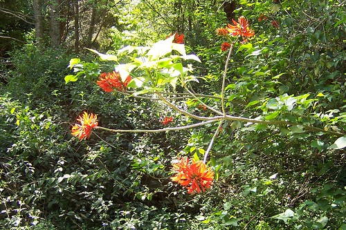

Illawara Flame Tree

There's not much flowering this year due to the bloody dry winter we had. This is an Illaware flame tree, a baby one leaning over an overgrown creek (Egan Gully [Creek]) in Beatties Road which is at the bottom of the hill, right next to the christian school, just as you head up Avoca Drive into Green Point proper. It's a quiet road with just a few houses and a couple of eldery golden retrievers that wander out of their front yards and gaze up at you lovingly.
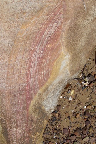

Stripy rock at Lexington Avenue Green Point

There's lots of places round Brisbane Water where there's flat rocks at the waterline. The park at the end of Lexington Parade and Merindah Avenue is one of those places. There's wee tiny rock pools and a scattering of broken shells and sea glass and, sometimes, stripy rocks where you can see how the sediment was laid down or whatever it was all those aeons ago. Cool.
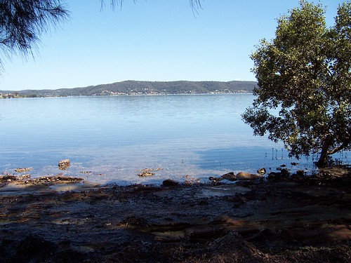

Footbridge & Koolewong from Elfin Hill Rd Green Point

Can you see it? Locals should be able to pick up the shape of it. It's the footbridge over at Woy Woy/Koolewong, the one with all the wires. It's photos like this that remind me to get a new camera already. This one has reached its limits.
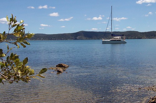

Tascott from Merindah Avenue Green Point

Just for pretty. Tascott and yacht. The other side of Brisbane Water always looks so far away in these photos I take across it. I swear it's not half that far.
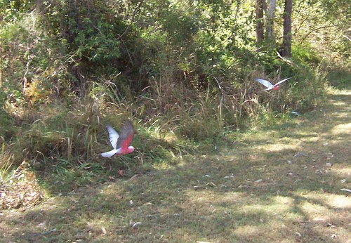

Galahs in flight Lexington Avenue Green Point

I walked fuck-all of Green Point on my first walk there. Just three tiny streets. They all had a park at the end and I slothed out on the grass for a while. It was a warm day. We skipped spring this year and went straight into summer. I laid there under a tree listening to the breeze making the casuarina trees whisper in their soft howl and watching a couple of pink and grey galahs fossick about for something to eat.
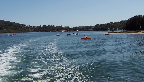

Kayak season in Lintern Channel between Davistown & Rileys Island

It's kayak season. Some local crowd at Koolewong I think it is runs a kayak tours thingy where you go on a wee tour of the estuary in their kayaks. You see an occassional hardy kayaker out on the water in winter but it's summer that's the busy season and it's par for the course to see them bobbing in the wake of the ferry as it heads round to the stop for the Davo. (Get off at Central Ave, walk up Davistown Road and turn right at Murna Road.)

Weird to put the first photo last I know but there you go.


Holiday reading

I bring you leopard porn, the bad!fic that broke Wincon 2007. Olden but golden. From the fandom that brought you yak!crack.

*hearts the internets even though it should probably take its meds more often*

Saturday, May 09, 2009

This isn't Pelican Island

(Random walikes in Woy Woy)

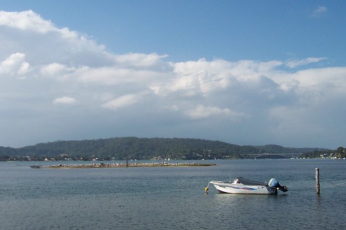
Tidal islet & The Rip Bridge from Blackwall foreshore

The clouds piled up high in the north-east in the morning, a big wide front in an otherwise blue sky. I went walkies while the sky was still blue.

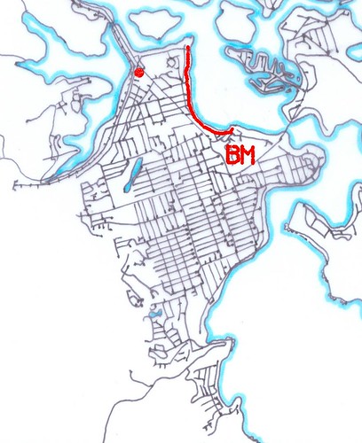
Wandered along Blackwall foreshore. Which runs from the playground up behind the bowls at the end of North Burge Road to the jetty at Blackwall Point. Scroll down for the map.

That wee tiny islet covered is pelicans is pretty much a tidal islet, that is, it's not there at high tide. At low tide it whiffs something cruel due to all the pelican shit.

It is the islet that isn't Pelican Island. Peeps think it's Pelican Island because it's covered in pelicans but it ain't. Yer actual Pelican Island, as blogged in April 2009 and January 2007.


The Rip Bridge & Blackwall Mtn from Blackwall foreshore

View along the waterline to The Rip Bridge joining Booker Bay/Orange Grove in Woy Woy to Daleys Point. That's Blackwall Mountain lurking in the background on the right. The bridge goes from its foot across to Daleys Point.


Private jetty at Blackwall foreshore

The ducks really appreciate the private jetties. That tree is a mangrove.


Blackwall foreshore bike path is finished

The bike path from Gosford to Woy Woy is finished at last. It goes up to Allfield Road or one of those streets near there then disappears.

The view is across to the low bit between Mt Pleasant at Saratoga and the lower hill of Davistown. That flat-topped mounain in the background is probably Kincumba Mountain at Green Point.


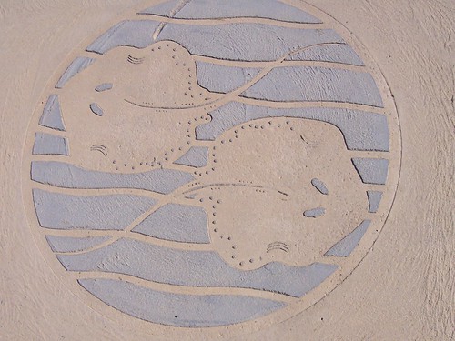
Stingray plaque on Blackwall foreshore bike path

Small roundish stingrays what lurk in Brisbane Water. Someone sent me some photos of them last year.


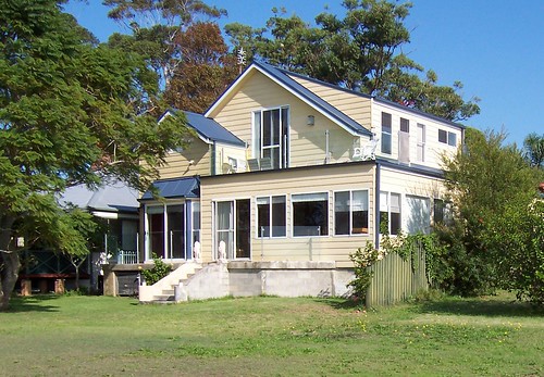
House on Blackwall foreshore

Look at that balcony there on the top. Excellent spot for drinking in the warm winter sun whilst eating yer breakfast.


Blackwall foreshore map

The red line is Blackwall foreshore.

The red spot is Bustling Downtown Woy Woy.

The BM is Blackwall Mountain.

The straight road running from the red spot to the BM is Blackwall Road.

Mmm...maps

Blackwall foreshore from Blackwall Mountain (photo)


Local linkage

K.P. Brown, another Yank in Oz, blogged a few nice view photos from the ridge above Koolewong.


Right then. Ravenous. Will stop adding links and go and hunt some lunch down. See yer next week.

Saturday, November 22, 2008

Kookaburras

470px-Kookabura

Wiki Creative Commons image

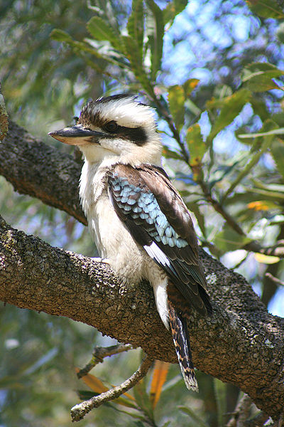
Kookaburra, Laughing Kookaburra, Dacelo novaeguineae.

Lots more kookaburras on the Peninsula lately. Maybe the La Nina was a good breeding season for them.

They are shy but live in the suburbs quite happily. The closest I've ever got to one was about 3 metres and that was prety unusual. Usually they get twitchy as soon as you look at them and then a few seconds later they're off.

They hang out in gum trees in gangs of three or four or half a dozen. As the sun gets low they give a few brief chuckles then they start up their chorus of full-on laughing. Other than the didgeridoo, you don't get a sound much more Straylyan.

MP3 of kookas laughing

(Device dear, you might consider the Blue-winged Kookaburra (D. leachii) as a replacement for Mrs Beaky as it specialises in maniacal cackling.

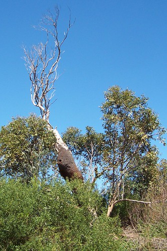
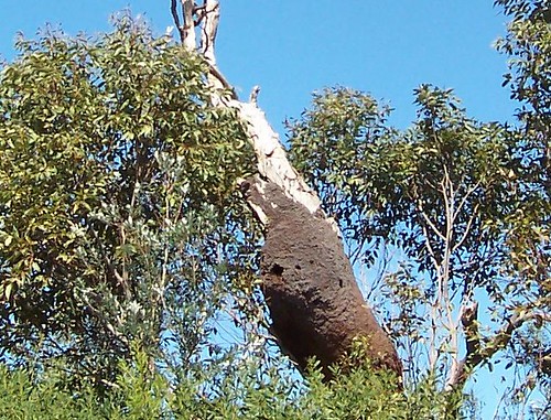
Kookaburra nest at Umina Beach

Kookaburra nest in a dead gum tree at Umina Beach. Can you see it?


Umina Beach

The entrance to the nest is the small dark hole in the brown section. (Hur hur.)


Kookaburra factoids

* Breeding males have blue bums, "Breeding male: Centre of rump bright blue" says the library book

* They are silent gliders when they come in to land in a tree or on a fence

* They land with their tails up then lower them slowly

* They sit on a branch and wait for the menu to wander past

* They eat meat, rats, small lizards and birds, large insects and snakes

* They are biggish compared to something like yer crow and come in 28-42 cm (11-17 inches in the old money)

* Families groups are 4 to 8 birds

* Teenage kookas often sit alone on a fence or in a tree

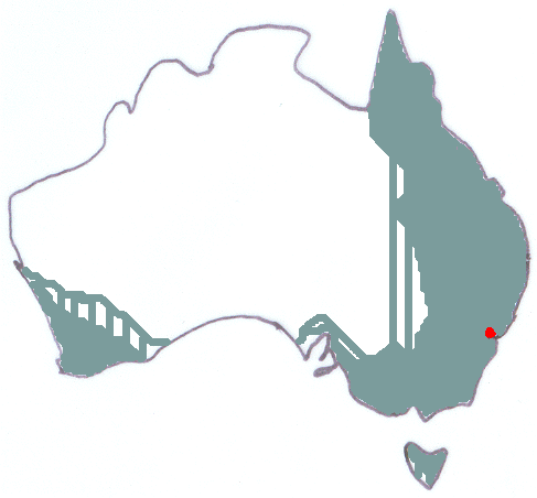
Kookaburra distribution map

Distributon map. Where kookas live in Australia. Red dot is Woy Woy.


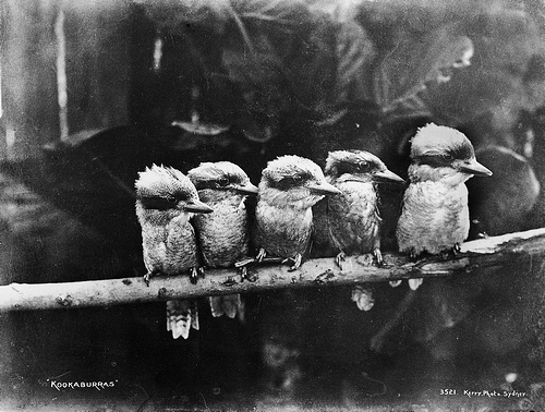
Kookaburras in Powerhouse Collection

An old photo of kookas found on the Powerhouse's Flickr.

"General information about the Powerhouse Museum Collection is available at www.powerhousemuseum.com/collection/database."

(The internets has made it possible for museum's to show off the shitloads of fabulous old photos they've have stashed away. I *heart* the internets.)


More kooka photos

Families that laugh together stick together

So whats for Lunch?

Head shot

Kookaburra Sits in the Old Gum Tree (pool of photos)

Wiki has heaps of good photos