The clouds piled up high in the north-east in the morning, a big wide front in an otherwise blue sky. I went walkies while the sky was still blue.
Wandered along Blackwall foreshore. Which runs from the playground up behind the bowls at the end of North Burge Road to the jetty at Blackwall Point. Scroll down for the map.
That wee tiny islet covered is pelicans is pretty much a tidal islet, that is, it's not there at high tide. At low tide it whiffs something cruel due to all the pelican shit.
It is the islet that isn't Pelican Island. Peeps think it's Pelican Island because it's covered in pelicans but it ain't. Yer actual Pelican Island, as blogged in April 2009 and January 2007.
View along the waterline to The Rip Bridge joining Booker Bay/Orange Grove in Woy Woy to Daleys Point. That's Blackwall Mountain lurking in the background on the right. The bridge goes from its foot across to Daleys Point.
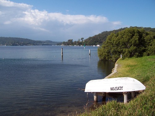
The ducks really appreciate the private jetties. That tree is a mangrove.
The bike path from Gosford to Woy Woy is finished at last. It goes up to Allfield Road or one of those streets near there then disappears.
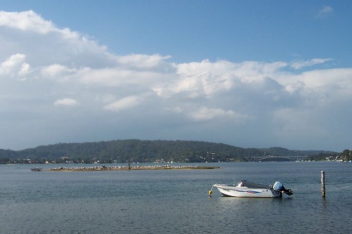
The view is across to the low bit between Mt Pleasant at Saratoga and the lower hill of Davistown. That flat-topped mounain in the background is probably Kincumba Mountain at Green Point.
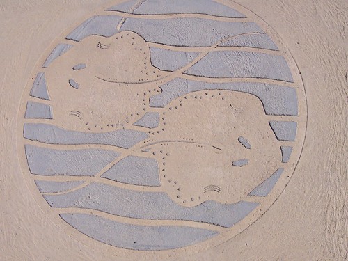
Small roundish stingrays what lurk in Brisbane Water. Someone sent me some photos of them last year.
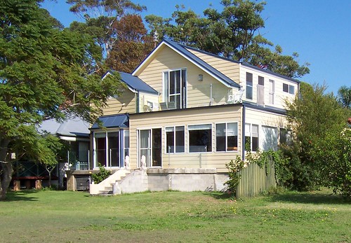
Look at that balcony there on the top. Excellent spot for drinking in the warm winter sun whilst eating yer breakfast.
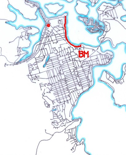
The red line is Blackwall foreshore.
The red spot is Bustling Downtown Woy Woy.
The BM is Blackwall Mountain.
The straight road running from the red spot to the BM is Blackwall Road.
Mmm...maps
Blackwall foreshore from Blackwall Mountain (photo)
Local linkage
K.P. Brown, another Yank in Oz, blogged a few nice view photos from the ridge above Koolewong.
Right then. Ravenous. Will stop adding links and go and hunt some lunch down. See yer next week.
8 comments:
Ohhh Magic
Cant wait to get there.!(again)
I love going for a walk along there, some great looking houses that would be pretty expensive I also noticed that the bikepath ends suddenly I thought it was going to go all the way down to Blackwall
I have gone for walks along there at night and you have to watch out for the bats in the trees as you are walking underneath them they have scared the shit out of me on a number of occasions
You live around there then Micheal.?
Lucky you.
I sure do Anonymous, been here all my life
hey spike
came across this photo of mann st gosford on flickr the other day thought you might be interested in seeing it
http://www.flickr.com/photos/intervene/3514869038/in/photostream/
Anon, thank yer. It's easy making a picture blog in a beautiful place like Woy Woy.
Michael, I live the mix of houses along there. The expensive glass boxes of the last couple of decades nestling in alongside the wee old cottages built when even waterfrontage on the peninsula was tuppence ha'penny an acre.
Haven't been walkies along there at night. Are the bats those wee fruit bats like in Sydney or the wee tiny microbats with the weird noses and the 6 inch wingspans?
Nice photo find on the old Gosford photos.
All of them
its the fruit bats that are in those trees and they are also around near my place mainly during the warmer months
Must pop along there one dry evening and have a gander.
Post a Comment