Winter in Woy Woy.
Actually up the road a bit in at Hastings Wharf in Bensville but I couldn't resist the alliteration.
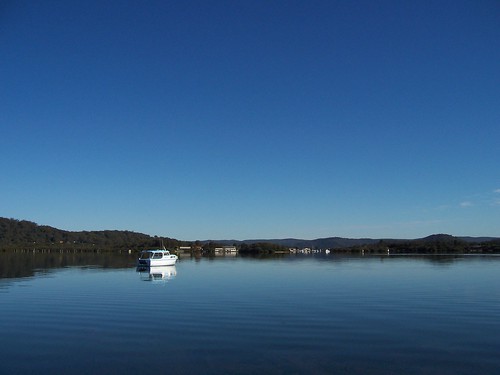
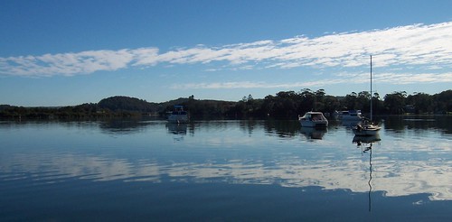
This is looking west towards Woy Woy. What you can see is the end of Shelly Beach Road in Empire Bay (left), Cockle Channel between Empire Bay and Davistown, and a bit of Davistown on the right where the mangroves are. That's Kyoga Avenue, Romford and Alkoomie Close in Davistown. Not that you can see the houses. Away in the distance there you've got yer hills and ridges behind The Bays on the other side of Woy Woy.

Bensville is the orange dot near the right hand edge of the map, bit under halfway up.
Bensville is a wee town in a quiet bay on the eastern shore of Brisbane Water. It has just under 3,000 peeps, four shops, a park, a scout hall and the wharf.
In March 1788, just after landing at Botany Bay, Governor Phillip, the boss of Straylya's first colony, came up from Sydney and had a sticky. He looked round near Bensville and other parts of Brisbane Water and went back to Botany Bay. (More on that.)
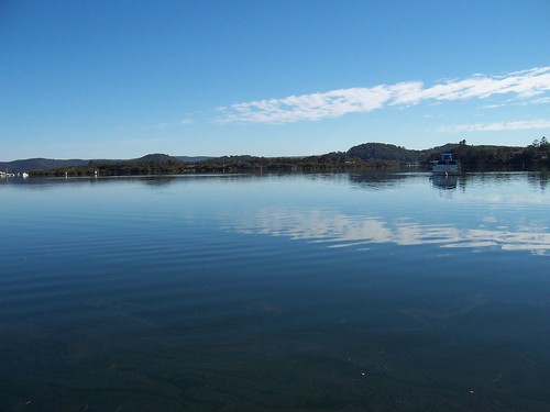
This is Davistown seen from Bensville.
Bensville is named after Ben Davis, of the local ship-building clan. He built 15 ships there in the 1870s. Davistown is named after another of the Davises. Bensville was called Sunnyside before it was changed to Bensville. Very apt. (More on that.)
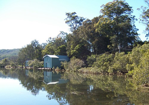
Bensville scout hall nestled in amongst the mangroves and casuarinas and gum trees.
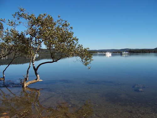
Mangrove tree. Just for pretty.
Cloud sandwich. There was one cloud. This was it.
Nice moody snap of the wharf itself
Fabulous Bensville photos by Bobesh
Moon or Mars?
Whatcher reckon? Do we go back to the moon and learn more stuff about it and probably about us or do we aim for a colony on Mars?
Peak of Eternal Light (coolest name ever for a lunar colony)
What's in it for us? (SETI Home board on what would spur Mars colonisation)
Mars Society Australia (Cool photos & mock-ups)
9 comments:
did you know that shelly beach road used to be part of the main road and it came out where the turnoff to empire bay is now?
the shops at bensville are mostly empty there is only a chemist open there now
Bensville..great place for a bit of fishing.Wonderful photos.thank you.
Why is blue so much blue-er down under?
Great photos Spike!
Michael, it used to be part of Greenfield Road?
Yeah, not exactly a thriving metropolis is it! I love those sort of places. Quiet and seemingly dead but all sorts of riotous behaviour going on behind closed doors :)
Thank yer, Pattie Penny Pot. What is to be caught there? Same as the rest of Brisbane Water?
Thank yer, Ron. Answer here.
sorry it wasnt shelly beach road that was part of the main road it was rickard road and it was part of greenfield road
I kept thinking that rickard road was shelly beach road for some reason
Beautiful shots.
Michael, did it used to be the main road like Empire Bay Road is now? Because that would make sense with it going past Merritt's Wharf and the connection is still there, just turned into foot access only.
Wait. Answered my own question already. Here.
Thank yer kindly, Neath. It's always a pleasure to get kudos for my photos.
yes you are right about merrits wharf that was the main road many years ago as was yugari cres and it went past merrits wharf and came out either at rosella road or greenfield road
Michael, found my fifties map and EB Drive is still down there at Merritt's Wharf then. Then it runs along Rickard to the junction with Rosella Rd and shoots up there, right through that end bit on the pother side of Greenfield and then it's where it is now opposite the flattened end of Cockle Bay.
Awinya Close is not there. Wards Hill Road is, Pomona Road is and there's a long wharf at the end of Palmers Lane. EB Drive goes down Palmers Lane to Allawa Close/Rachel Close and through them and back to where it is now.
It can't have been very busy then with the Rip Bridge not going in until the 70s.
Post a Comment