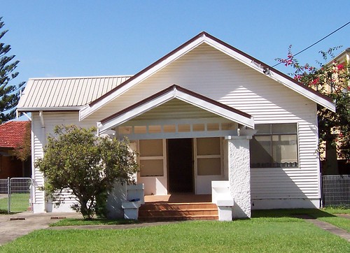
This lovely old house I've been trying to photograph for a year or more and every time I've had the chance to stop off there it's been pissing down or something. Got the bastard at last!
Architecturally speaking, it is a Federation Bungalow built circa 1890-c.1915. There's some lovely bungalows in Woy Woy and round Brisbane Water.
The house backs onto the water and has its own jetty and boatshed. There's a decent bit of garden as well and the house has a nice deep veranda for when it rains. Definitely on my list of favourite houses.
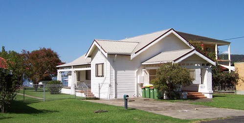
This photo is taken a few houses down. That hedge-y looking plant in the foreground is mangroves clipped low, thus maintaining the view whilst not getting expensive visits from the Council.
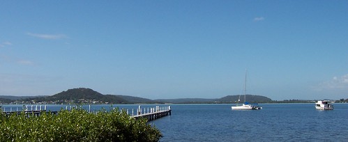
The street looks out across the water from Green Point (not the little one) on the eastern side of Brisbane Water, down past Yattalunga (just to the left of the tallest hill) and Saratoga (the tallest hill) to Pelican Island and Woy Woy at the south end, and even to Lion Island (locals & sharp-eyed readers will spot it behind the power boat) and then up the west side of the water to Koolewong and the main part of Tascott.
(Links go to posts on each suburb.)
Woy Woy is the white buildings on the right edge, behind the boat and in front of Lion Island, and those tall trees which are along Brick Wharf Road.
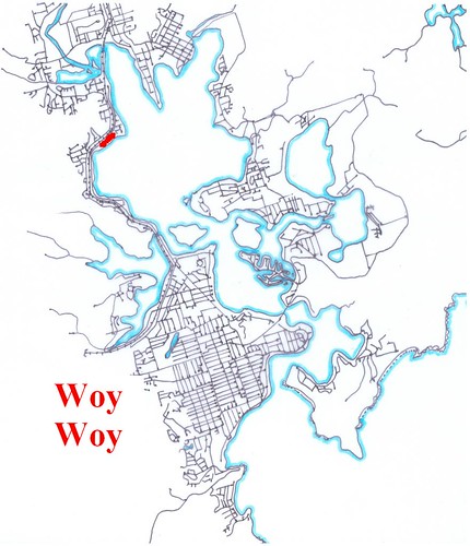
That's Victory Parade marked in the red line up the left side of the big bit of water.
More maps
1 comment:
Thank you for sharring
Post a Comment