Friday, September 30, 2005
Photos From Walk #65 - Patonga
Photos from Walk #65 - Patonga
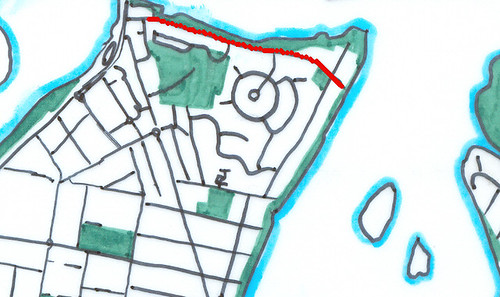
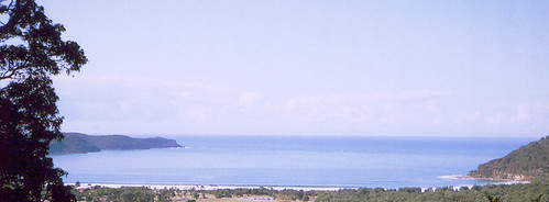
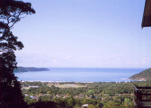
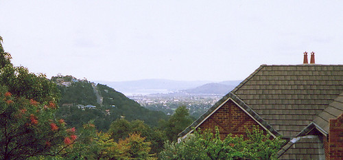
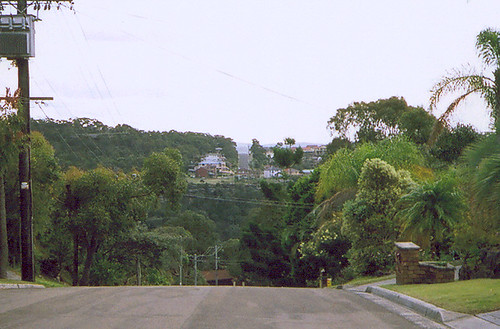
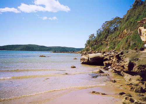
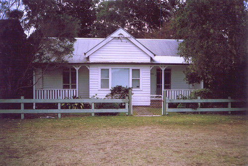
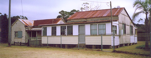
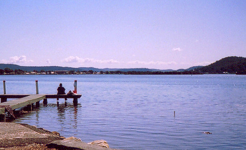
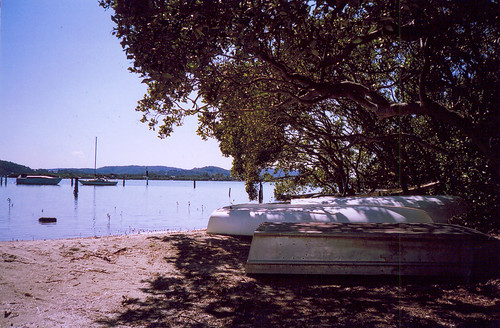
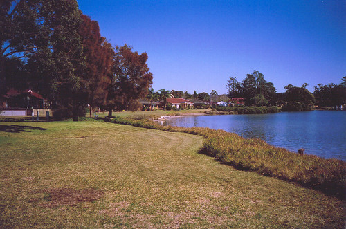
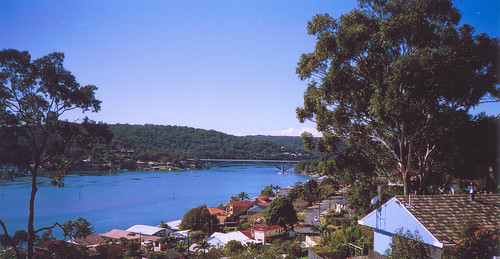
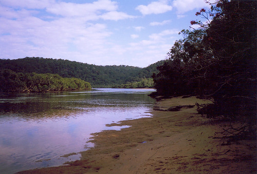
Behind the 5 streets of Patonga there's a creek.
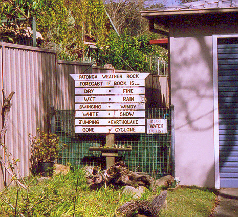
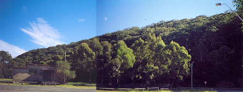
Local weather forecasting service. I couldn't see the rock so there must've been a cyclone.
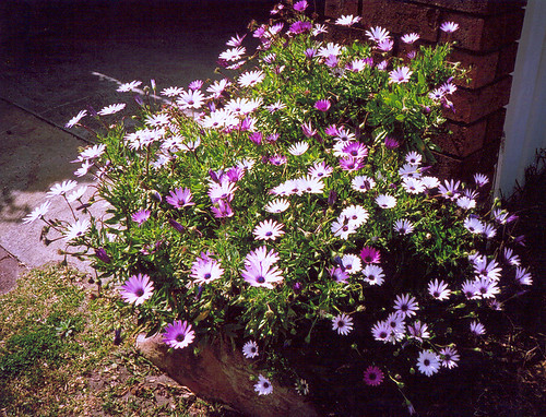
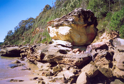
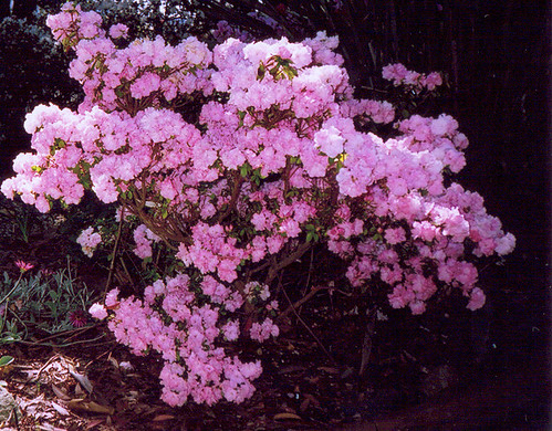
The white ones are the same as the daises on my balcony. They don't open on overcast days.
There's more Patonga photos. I'll upload when my brain hurts a bit less.
More photos
Next walk
Walk #66 - Brick Wharf Road
This was going to be a nice calm post about a nice calm walk at the end of which I was nice and calm.
But then I went to the doctor after and he had to go and fucking ask why I'm so fucking tense, didn't he? So I told him. For several minutes. The partition wall shook and people going past in the street looked about nervously and peeps in the waiting room stared at me when I came out. But the doctor gave me something stronger and I've emailed a solicitor so I should be calm again in about six months.
[UPDATE: I oughta clarify what I
So anyways. The nice calm walk. It was nice. I was calm. It was also my very last walk of the Peninsula Walk. Woo hoo!
When I started this walkies thing on the 1st of March I wondered if I was being a bit ambitious. I'd been quite sick and I was as unfit as Homer Simpson. Walking the whole Peninsula seemed an enormous task. But then I thought, What would Duff Man do? No, wait, that's Homer's brain. I was too tired and bewildered to think much of anything. I just kept doing it and doing it and before long I started getting fitter and fitter and now I wouldn't pass out if a cute policeman ask me to blow into the bag. And at the end of my walk today I sat looking hungrily at my next walking target.
Brick Wharf Road runs from the old Woy Woy pub to the old brick wharf. As you may've guessed by the name. Go to the end of Brick Wharf Road and walk across the foreshore to the water's edge. See that squarish bit of foreshore that sticks out? That's the remains of the brick wharf. Notice also the wee blue plaque-onna-stick that says "Brick Wharf site, dates from 1884, Gosford City Council, Heritage Item NÂș 168".
The Woy Woy Tunnel was built in the 1880s. It's the longest railway tunnel in NSW, has 10 million bricks in it, is 1791 metres long (1.11 miles) and takes three minutes to go through on the train. Some bloke called Rock Davis brought the bricks in by boat to the wharf and they were moved to the tunnel site on the rails already laid this side of the tunnel. Hence Brick Wharf and Brick Wharf Road.
The road runs along side the water most of the way. At the pub end there's the fish-n-chip shop, then the Memorial park then the flat grassy foreshore (see some photos here) then a few houses and the Bowls (the indoor bowling club-cum-pub), a couple more houses then the foreshore.
It's not a long road. I walked it at my usual leisurely pace and it took 10 - 15 minutes. At the end I sat on the wooden seat in front of the the wee blue plaque and soaked up the calm.
There was a soft breeze and dappled shade. A couple of tinnies (aluminium dingies) droned past. A couple of ducks rehearsed their mating dance. A couple of dogs splashed and played in the water and another one watched them from a boat. Behind me somewhere a hammer was being wielded and a boat squeaked against the private jetty beside me.
In front of me was St Hubert's Island. To the right were the unnamed islets and Blackwall Mountain behind a tree. The foreshore curved slowly towards me from the Mountain. On the other side it went along to the Scout Hall and the boat ramp on the point. To the left of St Hubert's was part of Riley's Island then the hilly hammer-head of Saratoga & Davistown.
St Hubert's is my next walkies target. Then Saratoga & Davistown. Can't hardly wait.
Photos from this walk
Thursday, September 29, 2005
Morals Vs Ethics
From Religion is society's biggest threat
Can't find the quote but I think it was William Blake who said something about someone being in a prison made of religion.
[UPDATE: It was the walls of brothels being made of religion. I knew what I meant.]
Wednesday, September 28, 2005
Walk #67 - Pearl Beach
It's also small enough to walk all of it in one day (twelve streets to Patonga's five) and that's what I did yesterday. I shot off two rolls of film and bunged them in for developing. In the meantime there's a few nice photos here and here.
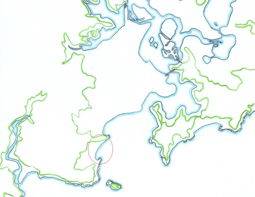
(Pearl Beach is in the red circle. The head above it is Patonga Ridge AKA Mt Ettalong, which is at the bottom end of Woy Woy.)
Pearl Beach is one of the spots Governor Phillip and some of his men visited in 1788, a couple of months after the First Fleet arrived in Sydney. There's a quote on a plaque on a rock. Part of it says:
"At 9 at night moored the boats in a cove on the N. side of the bay off which the surf broke violently"
"N. side of the bay" is at the Mt Ettalong end of the beach. You can get to that end of the beach from the end of Coral Crescent. The beach slopes steeply there and there was a dull thud as the waves hit and then the sound of them breaking. The waves come in stronger at Pearl Beach than at Patonga because it's directly opposite the mouth of Broken Bay. The sand was coarse and new. Up the other end of the beach and in the middle the sand's the normal fine stuff.
There's a narrow bush track going off the access from Coral Crescent. The sign had the usual warnings about nicking native plants and dune erosion. It also said the track was dodgy and using it put you in danger of "death or serious injury". Coupla minutes later I saw someone cycling along one of the dodgier parts.
Took my hist list with me this time. The list of historic houses and sites from Beryl Strom's book. I found "House, 'Payne's', 59 Coral Cres. ... 1931" and "House, 'Coolabah', 2 Pearl Beach Drive ... c.1934". Both of them were in good nick and both have been recently and pleasantly renovated. 'Payne's' is painted in a darkish blue that looks good on a beachside house. 'Coolabah' had a lighter blue trim and its main colour was a deep cream. "House, 'Yamba', 13 Crystal Ave ... 1929" I didn't find. I think I saw it but I wasn't looking at the hist list while I walked Crystal Avenue.
There was a more recent bit of history up on Green Point. There's a road up it, almost to the end. Then the end bit slopes down to a bit of a cliff and some of those rock ledges fishermen get swept off. The sloping bit is a park called Paul Landa Reserve. Got a bit of deja vu when I got to it. When I read the plaque I found out why. This Paul Landa bloke was government minister, though he seems to've been more of a statesman than a politician. (They shoulda had him cloned.) The phrase repeated in most of the Google links about him is that "under his guidance the national parks of New South Wales doubled in size". That explains why I thought I'd seen the Reserve before. I've seen a couple of Paul Landa reserves and parks in WA (Western Australia) and they could've been done at the same time because they had the same sandstone blocks in a curvy line making a wee sheltered spot to sit and read the plaque and the same wooden steps down to seats where you could sit and enjoy the view.
I sat for a bit and enjoyed the view. It was great. I could see right along the beach, across to Ettalong and the Excresence (which wasn't great), across to Box Head and Barrenjoey Head and out to sea, Lion Island was quite close and I could see down into Pittwater to Palm Beach & Stokes Point and down to Newport & Church Island. The Palm Beach ferry inched its way along. It was sticking close into the lee of Box Head. It probably takes it twenty minutes to cross the mouth of Broken Bay and I bet there was a few green passengers by the time it got behind Barrenjoey.
My feet were aching a bit and I'd run out of muesli bars. So I found the State Survey mark ("PWD NSW State Survey No 459") and went off to lunch. Had it at a table under a big old pine in the foreshore park. Great spot for it. From there I could see across to Green Point at the southern end of the beach. It blocked my view of Pittwater and Lion Island. But I could still see Lobster Beach and Little Box Head and Box Head straight ahead, and across to Wagstaffe and Ettalong on my left and, blocking my view of Umina Beach, the head of Mt Ettalong where the surf thudded.
It was beautiful. Bit windier than I usually like my lunch. It was overcast all day and the wind was picking up. The school holidays just started and there were a dozen kids on the beach with their goosepimpled parents. Of course the kids were too engrossed with playing to notice the wind.
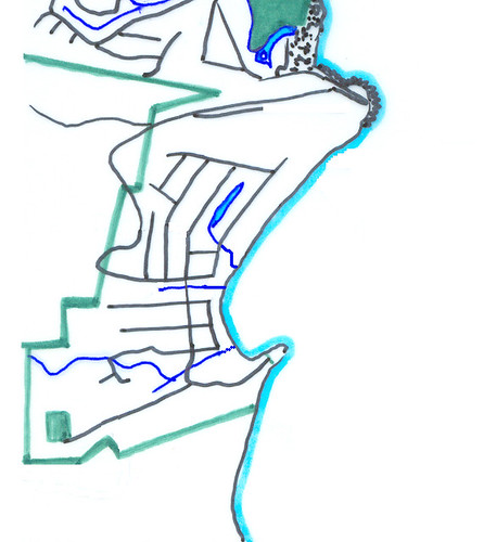
I'd walked waterfront and the long street behind it before lunch. The road into town (Pearl Beach Drive) comes straight down the middle and ends at the beach.
On its left is Coral Crescent. There're houses on the beach side of Coral. They block the wind and some of the wave sound so it wasn't a very windy walk. Between it and Diamond Street there's a small lagoon. The lagoon was still and had algae blooming in patches on it. All the local creeks and lagoons are getting their Spring bloom of algae. Along the edges were clumps of reeds and paperbark trees. Ducks were waddling about enjoying the sun and looking for things to eat.
On the right of Pearl Beach Drive there's a footbridge taking you over a creek to the other half of the beach. There's no houses between the road and the beach there. Just a foreshore park with the usual grass and picnic tables and a couple of big old pines. At the end near Green Point there's a shop, a coffee shop, two restaurants and the plaque rock celebrating Phillp's visit in 1788.
After lunch I did the rest of the streets. I went up Pearl Beach Drive to the first elbow bend. After that it'stoo easy to get wiped out by a car on a blind curve. Amethyst and Emerald were flat streets running straight back from the beach to the back of the town. I could hear the waves all the way up them to the end. Then the rush of wind in the gums of the bush drowned out the waves. Jade Place was a high street. It sloped up steeply from Pearl Beach Drive then flattened out. On the hill side there were maybe a dozen houses. They have long staircases up the their front doors and huge balconies and windows staring out to Box Head. The aural lanscape up there was great. There was nothing blocking the sound of the waves so the wind in the gums didn't drown them out. Beautiful.
They were all pricey houses. One had a flag flying from its biggest balcony. According to my 1980s atlas it's the Czech flag. White stripe on top, red below and a blue triangle on the pole end. The house looked really Spanish though. Sandstone and render, the row of poles on the white veranda-cum-cloister, the details if the woodwork on the storey above that. Anyways, it was a pleasant bit of domestic architecture.
Although Pearl Beach has got some very pricey houses and a lot of great modern design, there's a patch of seventies hideousness lurking in the top right corner (looking from the beach) and at least thirty small old forties places scattered about. Some of the forties places have been recently renovated and added onto but quite a few still had a Dear Old Thing quietly mouldering away in them, enjoying their final years in the beauty of the town.
In the sheltered streets back from the beach there were a lot of birds. Even more than at Patonga. Magpies, a kookaburra dozing on a fence with its beak tucked into its chest, another one had a bit of a laugh to itself on an overhead wire, mynah birds (non-native species), rainbow lorikeets feasting off flowering bottlebrushes and off bread on someone's lawn. The same bread was feeding a male brush turkey and I saw six males all up, though three of them might've been the same one. I s'pose they're looking for mates now it's Spring. They're certainly less shy than usual.
I didn't hurry but walking the whole of Pearl Beach took only four and a half hours, including time spend on the beach and Green Point just goggling at the view. It's a small town ("population category 351-1,200" according to the 1995 Tidy Towns plaque on the Progress Hall) but I've got faster. It's months since 80-year-olds passed me as I tottered slowly along the footpath. Now my leisurely walking pace is faster than my fast walking pace in March. Go me!
By the time I got the afternoon bus home the wind was pretty much a howling gale. The parents had scurried indoors, dragging the littler kids with them kicking and screaming. The bus was toasty warm. It also had views down over Pearl Beach and Patonga, and at one point on the road down to Patonga, a brief glimpse across the hills to the Hawkesbury River near Brooklyn.
It was a great walk, one of my favourites of this Walk and I'll be hauling friends off there for picnics this Spring.
The wind's gusting strong again now. It's shrieking through the crack in the kitchen window and there's an unbroken line of raincloud coming up from Sydney. A thunderstorm was promised on last night's weather. I've got my fingers crossed.
Photos from this walk
Tuesday, September 27, 2005
Photos from Walk #64 - Fearsome Schmearsome
Cropped from the 3rd photo.
Umina Beach in the foreground, Mt Ettalong AKA Patonga Ridge on the right, Box Head and Little Box Head on the left.
Couldn't decide which version I liked best so you got all three.
Umina Oval in the foreground, Umina Beach behind it, Mt Ettalong AKA Patonga Ridge on the right, Box Head and Little Box Head on the left.
Looking out from The Bastion past Phegan's Bay to Brisbane Water.
Phegan's Bay From Castle Circuit.
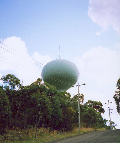
It's a sorta onion-shaped thing on a stalk that sits high on the ridgeside on a road called Castle Circuit and no-one knows what it's for. But I found out today it's a reservoir. Or maybe it's an alien thingy and it just says reservoir on the sign. The top’s bristling with aerials.
(You know I'm kidding about the alien thingy, right? Don't be emailing me and telling me how you got probed. Unless you got pictures.)
Next walk
Photos from Walk #59
Umina Beach at the Mt Ettalong (AKA Patonga Ridge) end. Looking across at Little Box Head.
Umina Beach at the Mt Ettalong (AKA Patonga Ridge) end.
Wedged under that rock there's a tree trunk washed up by the sea.
360 degree panorama. The rocks on the far left are immediately behind the rocks on the far right.
Left to right: Rocks against the bottom of Mt Ettalong (AKA Patonga ridge), Berrima Close with the houses of Onthanna Terrace behind on the hill, the caravan park with Blackwall Mtn behind. Umina Beach up to the corner where the sandbar is. The hills of Killcare Heights, Wagstaffe & Little Box Head. The slope of Mt Ettalong at the end of the beach.
The big size is detailed. Big file though.
Next walk
Rita & Friends
But some bloke on the telly last night said the hurricane season's not over yet. Bloody hell.
Our cyclone season starts on Saturday and it's looking like a big one. They don't come as far down as Sydney of course but all across the Top End (top part of Australia) is in for a pounding.
There was a thing on the telly last year about an increase in storm activity and ferocity. A thirty year period of big hurricanes, cyclones and typhoons, big electrical storms, heaps of flash floods and that sort of thing. Better put that home insurance policy somewhere high and dry.
In Other News
Amid all the trouble and toil of the last fortnight I forgot to tell you my soldier friend is back from Iraq and once more on home soil. Woo hoo! No more getting shot at!
Well, okay, he didn't actually get shot at while he was there, what with being a signals geek thingy. But no sooner had he and his unit piled onto a transport home than violence increased in the town nearby.
Anyways, he's home and hosed now and can start putting himself about.
Sunday, September 25, 2005
AFL
For those who don't know whatthefuck I'm on about, AFL is Aussie Rules football, West Coast is the West Australian team and the Swans have just won their first premiership (national level game) in 72 years. That's right, sports fans. The last time the Swans won the premiership was 1933.
Congratulations Swannies!
Friday, September 23, 2005
Walk #65 - Moonlight Bay
Went to Brisk Bay. Known to Peninsula peeps as Patonga. Beautiful spot. There's about 100 houses, six streets, one shop, a wharf opposite, three bus stops, one war memorial, an art gallery, a caravan park, a Progress Hall and a volunteer fire station.
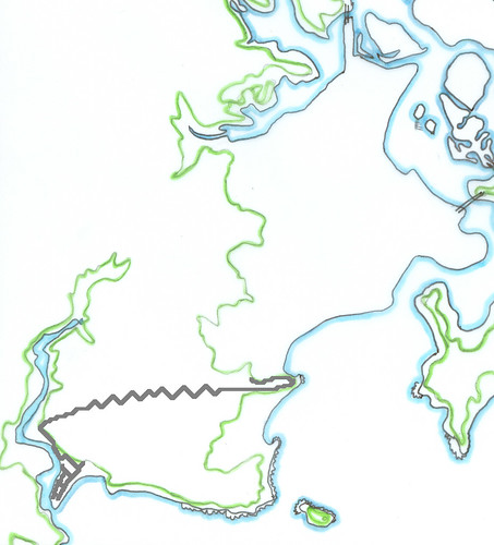
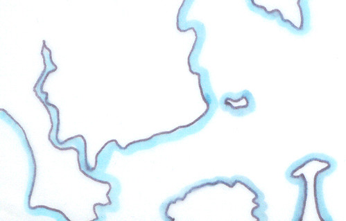
Patonga's the bit with the streets marked in right down the bottom of the map. The long road is the road back to Woy Woy. Didn't walk that road. Apart from being mostly serial killer country it's also a great place to get cleaned up by a car coming round one of the dozens of blind corners. Along most of the road there's nowhere to walk that isn't an inch from the traffic or an inch from a steep slope.
But I walked all of the streets of Patonga. I'd wondered if I'd get them all walked in a morning but as it turns out I got them all walked by ten o'clock. It was barely ten minutes walk from one end of the place to the other.
As you can see from the map, Patonga's a peninsula on a peninsula. There's a wide creek behind it and the bay in the front. Behind the creek is a ridge and beyond that it's bush across to Little Wobby Beach (I swear I didn't make that one up) and the Hawkesbury River at Brooklyn. From the beach on the bay side you can see Barrenjoey Head to the left and Ku-ring-gai dead ahead. It's surrounded by hills and ridges. I imagine it can get a bit rough when there's a storm coming in through the heads or a big wind. But other than that it seems pretty sheltered.
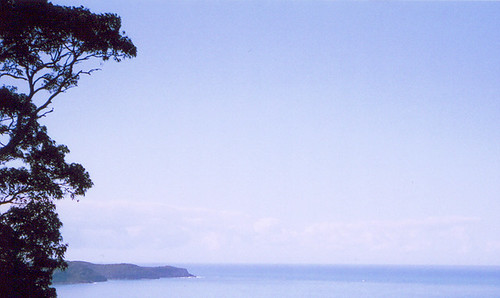
Barrenjoey Head (bottom right corner) is close. Probably not as close as it looks on a slightly hazy day but pretty close all the same. From Umina and Ettalong Barrenjoey Head is wide and looks quite massive. But viewed side-on from Patonga you can see it's just a small hill dropping down sharply to sea level and Palm Beach.
There was a lot of birds. Along the creek behind there's a long park. It's full of trees and there's also the mangroves on the other side of the creek. The park was chockers with wading birds looking for snails and the air was full of pelicans wheeling and looking down for fish in the water. There were also plenty of magpies and whip birds in the bush on the ridges.
When I sat on the beach on the bay side the sound of the waves was quiet but constant and soothing. There's a row of pines along the beach and in a high wind the sound of the waves and those pines must be great.
There were a couple of B&Bs (Bed & Breakfasts) and a couple of holiday rentals and I saw a trio of small girls wandering back from the beach with interesting shells and strange water-bleached twigs to show their parents. Patonga would be a fantastic place if you were a kid. Not too bad for adults either. The nightlife isn't exactly jumping but it's one of those low-key simple places that make treasured memories.
I'll be going back there some time soon with a picnic basket and a friend. I took a roll of film and I'll bung the photos up on Wednesday. There's a rush on this month at the developer's. People are getting all their pics of little Johnny and Suzie at the school swimming carnival.
Reading List
There's a nice potted history, some chat about someone's holiday house at Patonga and a few nice photos here.
Photos from this walk
Next walk
Next walk
Thursday, September 22, 2005
Hurricane Watch
History Week #2 - Audience Participation
The train trip into Sydney is always nice. Providing you don't sit next to someone who picks their nose the whole time or yells into their mobile (cell). This time there was one yeller but we went through a tunnel and they got cut off.
Anyways, the line goes along beside Mullet Creek which is a wide still creek off the Hawkesbury and in the middle bit of Broken Bay. It runs between two long folding ridges at Brooklyn and it's cut off visually from the rest of the world. It's beautiful at any time of day or night but my favourite is when the clouds are low on a winter's morning and the water's like a mirror.
The closest station to The Rocks is Circular Quay (which, in the way of such things, is actually rectangular). Next to the Quay is First Fleet Park. I trotted through it on my way to Globe Street. It was chockers with tourists and crocodiles of kids on school outings. There was a busker on a didgerdoo surrounded by mesmerised tourists and the toots and honks from the ferries coming and going from the Quay. Just glancing at them as I went past I realised they're named after the ships of the First Fleet. Cool! And very apt, what with Circular Quay being the site of the First Fleet landing in Port Jackson.
There was a bust of Arthur Phillip out the front of the MCA and a full figure statue of Bligh up the other end. Phillip was the first Governor of NSW and the guy in charge of the colony in 1788. Bligh's statue was cocky but defensive. He was the captain whose crew mutineed off Hawaii and put him off the ship in a small boat. As Governor of the colony he became the one and only Australian leader to be removed by armed uprising.
Okay. The talk. It was good. Lots of great photos like 'Garratt' locomotive going across the Hawkesbury Bridge and heaps more. There was plenty of detail about funny, sad and otherwise interesting stuff that happened. But I'm way too tired to tell you about it now. Have a gander.
The audience was plenty entertaining as well. It was full of trainspotters, former rail workers and model train owners. Some of them were all three. They constantly interjected. The speakers milked them for extra info and we got a lot of detail from them.
After the talk I fossicked about in the Records Centre looking at photos and maps. They've got some beautiful photos in their current rail exhibition and some random 19th century ones from round Sydney. Picked up a sheaf of info sheets and another walking tour thingy then got the train back home.
Right. I'm off to bed. Walkies tomorrow.
Wednesday, September 21, 2005
Walk #64 - Fearsome Schmearsome
Saw another brush turkey. Heard him kicking up the leaves on my way back down The Rampart. He wandered out of the undergrowth on the up side of the road and ambled across the road. I was maybe ten feet away from him by this time, untangling my camera from amongst the muesli bars and waterbottles. He saw me at last and peered at me shortsightedly. When he realised I was human he twitched and hurried into the bushes on the down side. I stopped and listened but there was no female with him.
There was a big flock of galahs screeching overhead as well and a few kookaburras having a bit of a chuckle further up the ridge. On the flat parts on the Peninsula (which is most of it) the kookas only laugh at dawn and dusk. But on the ridges I’ve heard them at all hours of the day. There were plenty of magpies hopping about investigating things as usual. But none of them looked like swooping. The return of the cool days probably.
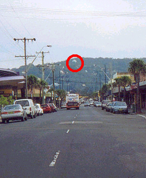
There’s a weird green thing up there. It's a sorta onion-shaped thing on a stalk that sits high on the ridgeside and no-one knows what it's for. But I found out today it's a reservoir. Or maybe it's an alien thingy and it just says reservoir on the sign. The top’s bristling with aerials.
(You know I'm kidding about the alien thingy, right? Don't be emailing me and telling me how you got probed. Unless you got pictures.)
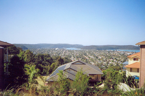
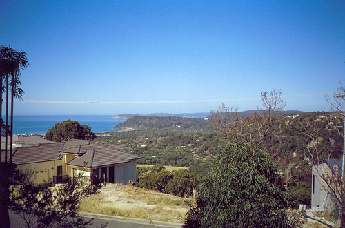
From up there I could see down to Umina Beach, over Patonga Ridge (AKA Mt Ettalong) to Barrenjoey Head and Pittwater, down along Brisbane Avenue and Whatsit Street, across to the ridge above Phegan’s Bay, out to Ettalong and Riley’s Bay and beyond to Brisbane Water and Gosford. Quite a view. More than on the Plateau walk.
When I went up there on the bus I got the view along the length of Umina Beach. Didn’t get that this time. There was nowhere high enough to stand. I’ll go up there on the bus again and get it out the window.
Walking along The Rampart I could see the surf down on Umina Beach and hear it very faintly. At the finish of the walk the sky was filling up again with grey-bottomed cumulus clouds. Up on Castle Circuit it had been sunny and the perfume of jasmine and roses and wistaria filled the air. Summer’s definitely on its way.
Photos from this walk
Next walk
Tuesday, September 20, 2005
Photos from Walk #53
High tide off Lance Webb Reserve at Ettalong.
Nice old place right on the foreshore.
The place on the left may still have a Dear Old Thing living in it. The place on the right looked empty and will probably be bulldozed in a bit and some swanky new flats slapped down in its place.
Next walk
Walk #63 - Uncaffeinated
Anyways, after the test I got a decent-sized walk in. Munched morosely on a muesli bar and wandered down the wrong street a few times but managed to cover quite a bit of unwalked ground.
It was a sunny day, warm, clear sky. Bit of a cool breeze but I warmed up quick. There were a few dogs laying in the sun on their front lawns and cats sitting perkily on car bonnets. They looked at me and I looked at them. They were too warm to bark or scarper.
I trudged on, brooding and mulling things over and feeling hard done by. I was practically asleep on my feet. A wandering dog wandered silently up to me and pressed its moist nose into my hand. I jumped several feet and yelled a bit but the dog just gazed up at me mildly and waited for a scratch.
I scratched its chest and pondered. Haven't been feeling crash hot lately. The guts and various other ailments playing up again and there's all that crap with my father still going on. But this walkies thing has really pulled me through. It's been a constant in a time of ups and downs. It's also shown me that even if this guts thing never gets much better I can still get fit again and have some fun.
Now I just need to find my sex drive and I'll be sitting pretty.
P.S.
An amusing link for your reading pleasure:
Emma Tom taking the piss out of Bushshit.
Next walkies post
Next walk
Sunday, September 18, 2005
Photos from Walk #56 - Up The Mountain - Part II
Fishing off the jetty at Blackwall Point. Perfect day for just sitting there holding your rod.
Left to right:
St Hubert's Island. Hill of Daley's Point. Saratoga & Davistown behind St Hubert's on left. Hill of Empire Bay to the left of Daley's Point. Kincumber (probably) in the distance.
Detailed size.
Foreground: Blackwall Point.
Left to right: Blackwall foreshore on the Peninsula. Saratoga & Davistown right of centre in the background. Riley's & St Hubert's Islands on the right.
Detailed size (takes yonks to load).
Blackwall Point. Detail from Blackwall Pt Panorama.
Blackwall Point & foreshore. Detail from Blackwall Pt Panorama.
Next walk
History Week #1 - Green Fatty Matter
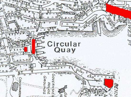
It was at Customs House. Which is directly opposite when you get off the train at Circular Quay. Square old place, built in 1885, big tall windows and high ceilings.
(Customs House is the small red bit on the left. The red line next to it is the train station at Circular Quay. The red bit in the top right corner is part of the Coathanger (Sydney Harbour Bridge) and the red bit in the bottom right corner is the Sydney Opera House.)
The talk was about the history of Sydney's cemeteries. You're thinking, Y-a-w-n. But not so. It was all tales of dodgy burials, wandering livestock, grave-robbing, strange stinks and beer.
In the first five years of the colony it was chaos. Peeps were buried pretty much where-ever and there was no Health Department making sure they got six feet under.
After that it was George Street. Where the Town Hall is now. When they built the Town Hall they dug up the bodies and moved them to new graveyards like Devonshire Street. But they didn't get all of them. Pretty much every time there's some work done below ground at Town Hall they turn up some more bodies. Cool! In a creepy sorta way.
There was some talk about how overcrowded and stinky the George Street graveyard got. The people at the time complained about hideous smells coming from it. Plus it was right in the middle of town and the land would've been useful for buildings and shit. So eventually it got the Town Hall built on it. The bodies they dug up got shipped off to other cemetries to be buried again and some of them went to the new cemetery on the new outskirts of town. Devonshire Street. Which wasn't the outskirts for long and has had Central train station on it since 1855. Government planning 'twas ever thus.
Anyways. Can't remember if it was the George Street cemetery that was being used as an outdoor loo (toilet) at night or if it was Deveonshire Street. Blokes wandering through there late at night were crapping in the shallower graves apparently. Gross.
There was also some digging up of coffins to nick the lead linings to sell. Don't suppose the grave-robbers stoped to re-bury the bodies either.
Devonshire Street was nice when it opened. Pleasant site, views over the city, nicely laid out rows and so on. But it got pretty crowded pretty quick and worrying whiffs started emanating from there too. By the time it was closed in 1867 there was somewhere between 38,000 and 58,000 peeps buried there and some of them were way too close to the surface.
Camperdown I've got down in my notes as doing business from 1849 to 1867. It's on Church Street and there's St Stephen's church next to it. It used to be a lot bigger. It's only 4 acres now and when it was cut down to that there were no exhumations. There's some festival held on the park that used to be part of the cemetery.
General Cemeteries Act was passed in 1847. Just as well. There was the strange smells problem still going on and one of the cemeteries had "a green fatty matter" in the water running off from it. Gross. The Act was all about where bodies could be buried (not where green fatty matter can get into the water that ends up as drinking water), how (six feet under, special methods for some diseases) and how many (not too close together, keeping proper records). No doubt there's a stack of other stuff in the Act. Can't find it on the net. Pity. It'd make interesting reading. Not for the squeamish though, I expect.
Rookwood's my favourite cemetery. I like the Victorian part. That's the old bit you can see from the train. Get off at Lidcombe station and go up East Street about a hundred yards and there's the gates. They've got their Open Day on today actually. Love the way peeps look when you say 'cemetery' and 'open day' in the same sentence. You get to go into the Fraser Mausoleum. Don't worry, it's empty now. Nice building. Black and white tiled floor if I remember right. Could be marble, can't remember. Tiny high windows letting in a nice light.
Anyways, it's just as well they opened Rookwood when they did. There was a measles epidemic that year in Sydney and they had to bury a lot of kids. There was another epidemic a few years later. Can't remember which epidemic this particular grave is from. It's a family grave. Nothing flash. It's on one of the Friends of Rookwood tours because most of the family was buried there inside a year. One parent and six or seven of their kids. All from one epidemic. Shit.
At the end of the talk there was a bit of a reading list and the room we were in was filled with the sound of scribbling pens. From the socialising round the urn afterwards I got the impression half the audience was in COSHA (City of Sydney Historical Association). Grabbed a newsletter and a membership form. They look like a useful crowd to join. They do talks and tours of the streets and so on. Right up my alley re my 19th century Sydney walkies.
After tea and a bikkie (biscuit) I wandered off to find the model of Sydney. I was expecting to find one of those models on a table like you see when some corporation is building some massive new skyscraper. But it was under the floor in the foyer. Good spot for it.
It was handy to see Sydney like that. I could see more clearly where I'd be starting my 19th century explorations. Can't hardly wait.
Saturday, September 17, 2005
Photos from Walk #56 - Up The Mountain
Glancing at my notes this walk is coming back to me. It was a hot day, more like summer than spring. I went up the mountain then along Orange Grove Road in front of it. The views weren't bad. The best views to be had would've been from the lookout but the path up there was too overgrown and I was too buggered already to scramble up there. I'll go again after the next burn-out on the Mountain.
Taken a third of the way up Blackwall Mountain.
From left to right: Woy Woy peninsula stretching across to halfway along the roofline. Behind it is Brisbane Water. The tiny sand islet off Blackwall foreshore. Some vegetation's growing on it now so it might be permanent soon. Unnamed magrove islet below Saratoga. Hill on right is Saratoga. Hill behind Saratoga is Kincumba Mountain. Distant hills from left to right are Point Clare & Gosford. Behind them are the hills of Narara, Lisarow & Ourimbah.
(Big version) Taken from a building site halfway up.
From left to right: St Hubert's Island behind the tree. Ramp down to St Hubert's to the right of the tree. Daley's Point. Half the Rip Bridge against the tree on the right. Houses on Orange Grove Road in the foreground.
Taken from the same building site.
The road in the foreground is Orange Grove Road. The bridge is The Rip Bridge. The houses behind the bridge look to be in Riley's Bay and the hill behind them is Killcare Heights. The houses on the left in the middle distance are on Daley's Point.
The intense blue of the water is from the natural light plus a little something from the death throes of my camera.
In someone's garden near the foot of the Mountain.
When I came back down the Mountain I went down to Blackwall Point then along Orange Grove Road. From there I could see down into the end of Cedar Crescent, down to that shingled house I couldn't date before. When I walked Cedar I thought it was on Cedar. But my hist list sorted it out. It's "hospital (part): former house, Rock Davis, 380 Orange Grove Road ... 1860s". It's on a big block that goes from the gate up on Orange Grove Road down past the end of Cedar Crescent to the water. Rock Davis is the Rock Davis of Brick Wharf fame and is buried in the graveyard of that nice little church at Kincumber.
More photos from #56 (This URL is correct and the post exists (archive > scroll down). Despite this, there's a 404 on it. No idea what that's about.)
Friday, September 16, 2005
Walkies Musings
Not so.
Sometimes I'm walking in what feels like an endless tract of flat suburban streets, sometimes I'm so close to the ridgeside it feels like I'm way out in the bush, sometimes I'm wandering beside dark secretive houses with tangled overgrown gardens like something of a creepy movie set, sometimes up on the ridge there's so much view I know how it feels to be rich and sometimes, like today, it's like I'm in the mountains.
That doesn't just make Woy Woy more interesting. It also makes it feel bigger. When I started this, the Peninsula felt big. There was a lot of it I'd never laid eyes on and I didn't know how long it took to walk from one end to the other. When I was about halfway through the Walk, I'd found out how far it is from end to end and it felt small. Now I've seen almost every street it feels big again. Not huge but comfortably big. Like a small country. It's got all the amenities I need, it's got rich bits and poor bits, suburbia and busy streets full of shops, a beach and a river, forests and off-shore islands, and even its own tiny mountain range in the form of the ridges.
Before I started it was a nice place to live. Now I know it better it's a very rich environment.
Next walk
Walk #62 - Mountain Cool
It started off rather crappily. Couldn't sleep again, feeling rather grim, guts aching like buggery and so on. But I'm buggered if I'm going to let that crap stop me from finishing this Walk when I planned to finish it (end of September). Won't be letting it keep me from History Week either.
Anyways. It was cool, even slightly nippy. The cloud cover had come over at dawn and was keeping the temperature down. The birds were twittering and flitting about the trees. There were plenty of native trees for them to flitter and twit in. The first street in my walk went up to the foot of the ridge. There were a lot of seventies houses at the end and seventies houses tend to have gums or paperbarks in their gardens. And there was a park on the corner and a creek winding its way round the foot of the ridge. With the cool and the low clouds and the ridge rising almost vertical from the end of the street, it was like being in the mountains. Very nice.
The feeling didn't fade over the length of the walk. I walked a long lazily-curved street glorying in the name of Greenhaven. It was hilly at either end and ran beside the creek in the middle. The few cars that passed me went up onto the ridge and the sound of their engines straining up the incline just added to the impression of mountains.
The creek was pretty dry. A few stagnant puddles here and there, the lantana making a dense prickly tangle of undergrowth, the dead dry leaves lying thick in the creek bed. But the magpies were leaping about on the bank, examining things and staring in the way magpies always do and when I stood still for a few minutes I could hear a brush turkey scratching about in the leaves on the other side of the creek.
Up at the end of Greenhaven there were two more turkeys. The male I could see. He was wandering about on the slope of someone's front yard. He stopped when he saw me and watched me from behind a small bush. Then I heard the female scratching in the leaves on the ridgeside. The male saw me look at her and started stamping about, kicking the leaves up and generally trying to distract me from her. I see the ducks on my foreshore walks doing the same thing. As soon as you look at the female duck she freezes and the male duck starts quacking and flapping. I don't know much about animal behaviour but I remember reading that in a Gerald Durrell when I was at school.
Walking back along Greenhaven I looked up at the top of the ridge ahead. All over the ridges and hills of the Peninsula there are outcrops and small cliffs of grey rock. There were maybe a dozen of these cliffs along the bit I was looking at. Most of them had a house or two built on top of them. That must be The Rampart up there. The last big hill of my Walk. At the base of some of these little cliffs there were dark holes and crevices. Must be deep overhangs. Not caves. It's the wrong sort of rock for caves. But if you were a kid a deep overhang at the bottom of the cliff under your house would make a great cubbyhouse. The views'd be great too. You're gonna like the photos I take when I walk up there.
I wanted to walk up there this morning. I was tired but I was just as tired when I did the Plateau walk and I managed that fine. But I had to go to Whatsit Street and see the bloody doctor. More bloody tests. Do I look like a fucking guinea pig or something? On the plus side, I got the all-clear from an on-the-spot test for something or other.
This afternoon is just as pleasant as this morning. Still nice and cool. Cooler actually and it's raining now. Got all my pot plants pushed to the railing of the balcony to get a thorough wetting, got the kettle on and got a packet of biscuits to eat. I'm good.
Next walk
Thursday, September 15, 2005
Walk #61 - Buggered
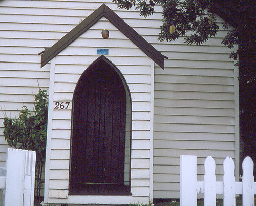
Had another gander at the church while I was there. The Uniting one on Picnic Parade with the foundation stone saying "28-11-'31". With what I've learned about brick pier foundations, I'm thinking the '31 is 1931 rather than 1831.
The style of the church fits in with St Luke's (1904) and St David's (1908 - 20) as well. The library's copy of A Pictorial Guide to Identifying Australian Architecture says the style of Ettalong Uniting, St Luke's & St David's is "Carpenter Gothic circa 1840 - circa 1890". The three of them are very simple, like St Luke's below.
I've seen plenty of Carpenter Gothic churches in American movies and TV shows but they all have a bell tower or they're bigger. All the little white wooden churches I've laid eyes on in Australia are the same stripped-back version of the style as St Luke's.
There's a bit of a gap between the end of the style and the building of the Woy Woy churches. Presumably the plans were chosen then there was a couple of decades of funding drives before they could buy the materials. I don't know. My brian's too tired to work it out right now.
Anyways. There was just a bit of breeze this morning. I couldn't hear the gums on the Mountain until I was up close.
Bit of noise from Maitland Bay Drive as it heads up the on-ramp and over Rip Bridge but that was it. Been quiet the last couple of days. Probably shock over the Poms beating us at the cricket.
I found an old shop on the corner of Fassifern Street and Memorial Avenue. It's three flats now apparently and used to be a grocer then a butcher. It looks about the same age as King's. I had a sticky at the caravan park. Which actually is all holiday cabins but calling it a cabin park sounds weird. Along the Maitalnd Bay Drive side of it you can see some of the residents have been there a while. They've done their own paving in the miniscule backyards and bought bird-baths and so on. They'd get a lot of native birds visiting what with being right across the road from the Mountain.
Okay, I'll stop now. I'm raving. Hardly slept last night and I was buggered before this morning's walk but I had no trouble doing it then going off to do other stuff after. Shows how far I've come in the seven months since I started this walkies thing.
Think I'll put the kettle on and potter about for a few minutes then watch Wallace & Gromit on the telly.
Next walk
Hist List
There was a wharf at Blackwall Point in the 1860s, acording to my list.
It's down as "off Blackwall Road, Blackwall Point". There's a public slipway and a carpark on Blackwall Point today and it's off Blackwall Road so I'm guessing that's where the wharf was.
Details visible on the biggest size.
Stood there for yonks and still no clear shot. It was one of those days for traffic.
The Booker Bay General Store at 72 Booker Bay Road is in my history list as built circa 1918. The house on the back of the shop is lived in, presumably by the current owners.
King's Store at 78 Booker Bay Road is down as circa 1920. The house at the back is lived in and the shop itself is now part of the house by the look of it.
Booker Bay is one of the original villages on the Peninsula before it filled up with houses. You can see the village still in the number of pre-war houses around the bay.
My history list for the Peninsula says Noonan's was built in 1914 (which you can see on the building itself). It's at 8-10 Blackwall Road, right near the station corner. One half of Noonan's is the funeral director. They have a good display of photos and stuff on Anzac day.
Anti Bushshit
When I see peeps wading unprotected through the water in New Orleans it gives me the heebies. No way would I wade through that shit.
Wednesday, September 14, 2005
The Ashes
All my Pommy (British) mates are offline today. No doubt dancing in the streets like drunken bears with their countrymen. England won the Ashes. Which is a major cricket match between Australia and England.
The ashes referred to are the ashes of English cricket which was declared dead after some Australian victory over England several decades ago. The trophy looks not unlike an egg in an egg-cup.
Victory parade through London
Australian captain Ricky Ponting's post mortem.
P.S. We will thrash you bastards next time!
Walkies Stuff
But I'm starting to perk up again. Getting a decent night's sleep and so on. And next week is History Week and I won't be missing that, come what may.
Looks like I won't have to miss any walks out during History Week either. Did a bit of re-shuffling and marked in a few walks for Sundays. Should be able to complete the Peninsula by the end of September and go on the history whatsits.
Walks #59 & 60 - Music To My Ears
#59 - Monday
Edgecliff Road was nowhere near a cliff, certainly not on the edge of one. It was hard against the foot of Patonga Ridge (Mt Ettalong). One of life's little mysteries.
Sylvannia Road was quite woody. It ended at the foot of the ridge and the last house had a bamboo grove on either side of its driveway. Most of it was the bog standard bamboo you see wherever there's bamboo but behind it on one side there were maybe a dozen trunks of golden bamboo soaring up to maybe 40 feet high.
I could hardly hear the soft whisper of the bamboo groves over the sound of the gums on the ridge. They roared like a distant waterfall. As I walked along the street I could hear other trees in the foreground. A few European trees and, near the creek, some paperbarks and tea trees. Plenty of banksias dotted about too.
My all-time favourite recipe for wind-in-the-trees noises is a background of gums and pines overlaid with a palm or two, a small cluster of tea trees and a couple of dozen nicely spaced banksias. And the wind needs to come in gusts to cover the range of noises the trees can make. HMV oughta stock a CD of that.
Wandered down to the beach. You can get to the caravan park end of Umina Beach from Berrima Crescent. There's a wee carpark there and a loo. Doubt if it's a beat though. Too close to someone's house.
I perched on a rock at the end of the beach and listened to the sound of the surf in front of me and the gums behind me on the ridge. The sun was warm and the wind had a pleasant bite to it. There was a huge boulder perched on the rocks. No idea whether it rolled down the hill or washed up in a storm. Wedged under the front edge of it was a tree trunk. It was beautiful. Bleached white as milk by the sea and the sun and sitting against a background of brown and cream and purple rocks.
It was a good day for a brisk walk along the beach and I could see a dozen people doing just that. A few were taking their dogs for a walk and there was one Dear Old Thing stumping along with a fixed stare and a determined expression. He was missing all the scenery but no doubt he'll notice it another day.
I could've happily sat there for an hour or two mesmerised by the people change from black dots at the far end of the beach to fully formed humans as they got close. But I had to be home by lunch so I set off again.
A block back from the beach I couldn't tell how far I was from the water. Couldn't hear the waves over the wind. Not that they're loud anyways. Due to the beach being protected by the heads. Or something. I'm no oceanographer.
Off in the side streets it was quieter still. Bugger all traffic. Just the wind and the dogs barking and the scrape of a rake. Some guy was raking leaves up into a pile. The wind was really starting to gust by this time and, sadist that I am, I was hoping there'd be another big gust just as he turned away from the pile. But no such luck.
When I was a wee thing we used to go every Autumn to a place we called the Autumn Park. It's part of King's Park in Perth. It's down on Mounts' Bay Drive near the old brewery building. It's full of big old London Plane trees and in Autumn they drop all their leaves and the leaves make a carpet of crunchiness on the grass. God, that was good to run through and roll in. The joy of of the crunch was indescribable. I still pick up as many leaves as I can in Autumn and have a bit of a handheld crunch session. Very soothing. Maybe they should have leaf-crunching sessions at these pricey spas people go to.
Anyways. Walkies. Albany Square sounded very grand but when I rounded the corner into it, it was just the stub end of the road, an unsealed dead end. Pleasant enough. A bit of bush along the creek and the bend in the road cut it off visually from the surrounding houses and gave it the air of a tiny village. A dog sat grinning at me from behind a fence. A biggish dog, short-haired and biscuit brown. There's so many crossbreeds now I don't know what I'm looking at half the time.
Did a couple more streets after that and I was finished for the day. Went back to Mt Ettalong Road to wait for the bus home. The wind was starting that eerie thrumming along the powerlines. Which I realise now is where they got that sound they used in Twister. Wouldn't mind a CD of that noise as well.
Photos
#60 - Wednesday
Plenty of wind again today. Bit of a bummer for the firefighters. They've got a fire to fight in an awkward spot up on the ridge. Saw it as I was coming home and I can smell it very faintly coming in the window. They'll probably have to get the choppers in to water-bomb it.
I was up near the Patonga end of the ridge this morning. It was quiet there. Bugger-all traffic and what dogs there were were sunning themselves and couldn't be stuffed barking at me.
The ridge was close on two sides of me. The wind in the gums was beautiful. A rushing sound like a creek close by. The creeks themselves were not rushing. We're s'posed to get rain in October, according to some bloke on the bus, so maybe they'll rush then. Right now they're still and muddy and overgrown with lantana.
The main part of today's walk was in streets no more than ten years old. They were in one of those estates where you have to buy a house from the developer or not at all. The houses were all brick jobs and most of them had Federation repro details. There were a few designs with Federation era (circa 1890 to circa 1915) rooflines as well.
Not many houses in Australia's suburbs are named. There's always a few called 'Weona' or 'Ruo Emoh' of course. I've been keeping an eye out for unusual ones and so far I've seen a house called 'Jerry Sue', one called 'CherMar', a large brick-and-tile called 'Boar Shack' or Boar something and today there was one 'Weona', a 'Itldousal', a 'St Clements' and a 'Lanark Brae'. Lanark's a town in the Scottish county of Lanarkshire, which is the county Glasgow's in. I always thought a brae was a small river but a quick google suggests it's a mountain. You learn something new every day.
Today's walk was much quicker than it looked on the map. It was also the 10th last walk and the finish of that part of the Peninsula. I've got another nine walks scattered here and there over the Peninsula and then I'm finished.
Next walk
Tuesday, September 13, 2005
Photos from Walk #51 - Plateau
Click on pictures to see bigger versions.
From left to right:
Phegan's Bay, Woy Woy Bay, Koolewong (behind Woy Woy Bay), Park's Bay (partially hidden behind tip of Koolewong), the railway line & Brisbane Water Drive connecting from the Peninsula to Koolewong (middle), the Peninsula (flat suburban bit), Pelican Island (thick line to right of railway), Saratoga (hill in middle distance on right) and from Gosford across to Green Point (distant hills).
Taken from The Sanctuary. Which is one of the 5 streets of the Plateau walk.
From left to right:
Horsfield Bay, Phegan's Bay & Woy Woy Bay, the ridge of Koolewong above Woy Woy Bay, Brisbane Water and from Gosford to Green Point (between trees) in the background.
Some detail on the original size.
Ettalong & Wagstaffe from The Palisade. The water in the middle is off Ettalong and you can see the white blot on the lanscape that is Ettalong Club. The water on the right is between Lobster Beach and Umina Beach. Blackwall Mountain is partly visible over on the left. The hill behind it is Daley's Point. Killcare Heights is in the middle background.
That's the Peninsula laid out there in the middle of course. You can see maybe 1/6th of it in this photo. Where I was standing to take this photo is back against the ridge on the south-west side of the Peninsula and from there to Ettalong Club is about as wide as it gets.
The biggest version will give you a lot more detail. Including the two pines marking the entrance to the old Booker Bay cemetery in Bogan Road.
Box Head is just out of the picture to the left. Barrenjoey Head is in the background in the middle. That's Patonga Ridge (AKA Mt Ettalong) in front of it. The sliver of water behind Patonga Ridge is Pittwater. Bloody pricey spot to buy a house. Beyond Pittwater is Bayview & Ingleside. Maybe. The bit between that & Barrenjoey Head is probably Ku-ring-gai National Park.
The street in the foreground is The Palisade and the oval below it is probably McEvoy Oval. I was there a few weeks ago on the Egg & Spoon walk.
You can see a lot more detail on the biggest version.
The biggest size shows plenty of detail. Takes a minute to download though.
From left to right:
Blackwall Mountain, Daley's Point & Booker Bay, Fisherman's Bay & the knob of Ettalong, Riley's Bay & Killcare, Hardy's Bay & Killcare Heights, Wagstaffe, Lobster Beach, the sandbar (where the breakers are), Little Box Head and Box Head beyond it.
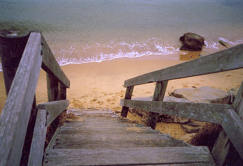
Ocean Beach/ Umina Beach is from about where to sandbar is to Patonga Ridge (Mt Ettalong) on the right. Beyond Patonga Ridge is Barrenjoey Head. Between them is the high end of Lion Island (you can only see it in the biggest version). In the distance on the right is Bayview & Ingleside. Maybe. They're part of Sydney. So is Barrenjoey Head. Between Bayview & Ingleside and Patonga Ridge is Green Point (the Pearl Beach one, other one's between Saratoga and Gosford).
Between the Heads is the Tasman Sea.
Photos from this walk
Next walk
Walk #58 – Astronauts
(This walk was done last Saturday. My main blog's been down since then. Hence the posting here.)
Hot today. Started out at 8.30 but I was sweating pretty freely pretty quick. It was overcast when I set out and I hoped it’d be cooler than yesterday. But there’s storms forecast for the Sydney region and so it’s a muggy day. Maybe we'll get a storm up here. Haven’t had one for yonks. I like storms.
The clouds cleared as I walked and the morning birds were noisy. I was walking seventies streets again and seventies streets have a lot of gums and paperbarks. Gums and paperbarks are native trees and they bring native birds. All those native bird noises and gums and paperbarks make you feel like you're in the bush not suburbia. Very pleasant.
Because of the heat most of the dogs were laying down and just watched me with mild interest as I went past. Normally, even on a Saturday, they rush to the fence barking their heads off.
It smelt like Spring. A faint whiff of orange blossom coming over someone’s fence, some beautiful white roses with a good fragrance and more jasmine. More daisies and bottlebrushes and wattles are flowering every day and the azaleas are still going strong. The lilac trees leaves are going yellow and will drop soon. Then the streets and backyards will be dotted with soft purple flowers.
Today’s walk was the 12th last. My map is very nearly finished now. It was a hot walk and I was glad to get home. But the satisfaction of colouring in another street on my map never wanes, no matter how hot or cold it gets.
Blogstipation
So I'm bunging a few posts up here in the meantime.
Walk #58 - Astronauts
Photos from the Plateau walk (can't remember what #)
Monday, September 12, 2005
History Week
So. History Week. It starts next week in NSW. There's a programme thingy on their website.
I've got mine here in front of me. Lots of excellent stuff. Tours and walks and gawking opportunities and nice spooky stuff like poking about in old cemeteries in the CBD and stuff.
There's so much good stuff to choose from. I'll be doing as much First Fleet stuff as I can.
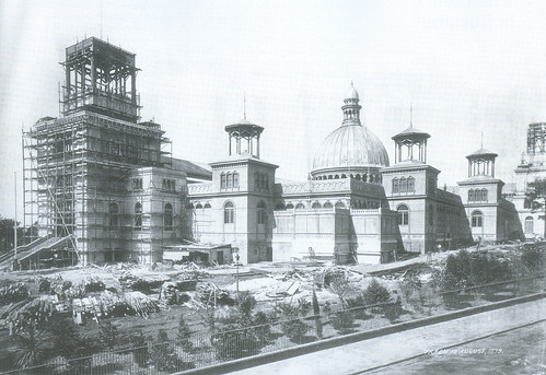
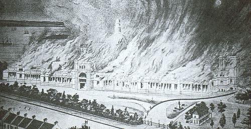
Garden Palace
The Garden Palace was built in the Botannic Gardens for the 1879-80 International Exhibition. The Botannic Gardens are right next to the Opera House.
This photo has "taken 13 August, 1879" in the bottom corner.
It burnt down on the 22nd of September 1882 and the residents of Macquarie Street got their harbour views back. Hmm.
Saturday, September 10, 2005
.
.
.
.
.
.
.
.
.
.
.
.
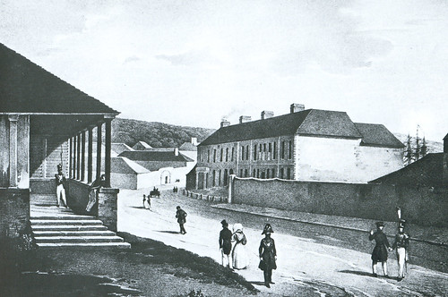
From left to right we've got: Main Guard building, the gaol (middle distance), James Underwood's house, the Tank Stream behind it and the wall of the Male Orphan Asylum.
The guy in the foreground is Bungaree, king of Sydney. Don't know much about him yet.
Underwood was a convict who became a merchant. Successful one, if the size of that house is anything to go by. Don't know much about his life as a merchant yet. There's a James Underwood listed on the First Fleet database.