Quite warm today. 24 degrees (75.2 F). Walked from Punt Bridge to Bloody Erina (Erina Fair Shopping Centre) along The Entrance Road, got some stuff, came home. Bit noisy when a truck went past but a nice flat walk beside the creek.
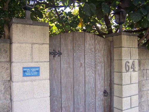
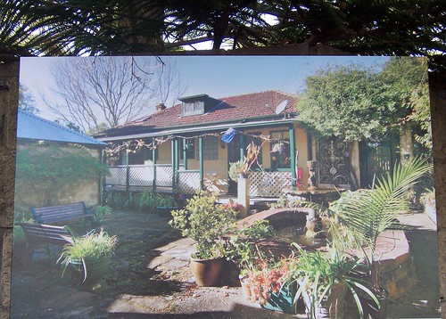
'Stonehurst' George Street East Gosford. The 1880s home of one John Smith. Park on George Street just before the Punt Bridge at Erina Creek. The house is on the left (facing Erina) immediately before the bridge. If you're quick you can see pictures of the inside on the For Sale sign.
The blue plaque reads:
"HERITAGE 'STONEHURST'
Built c. 1880s
GOSFORD CITY COUNCIL
HERITAGE ITEM No 57".
A family history researcher on Roots Web says: "John Smith of "Stonehurst" near the Punt Bridge, East Gosford.... became the licensee of the Union Hotel."
The Union is one of the main pubs in Gosford. It's on Mann Street, the main street, on the corner of Donnison Street. James Spears built it in 1885 (RootsWeb).
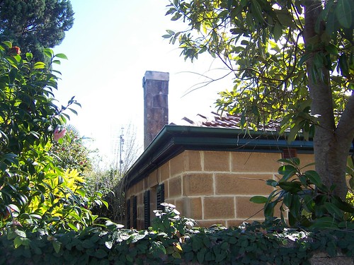
You can't see much from the street. Garden looks nice and lush.
I gather from the position of the house relative to Punt Bridge that it overlooks the creek there.
Look for the For Sale sign next to the wooden gate on the left just before Punt Bridge as you're going to Erina.
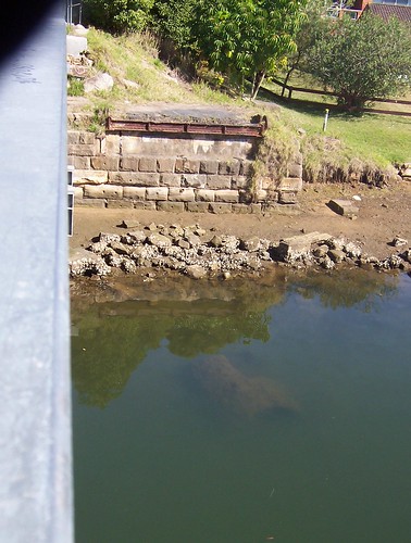
This end of the old Punt Bidge is just in front of 'Stonehurst'. Look down from the Punt Bridge footpath where George Street East Gosford becomes The Entrance Road Springfield and crosses Erina Creek.
The old Punt Bridge dates from 1885. In the water there you can see what might've been a bridge pylon. Can't tell what it's made of, it's covered in greebies.
Erina side of the old Punt Bridge. You can just see a round pylon-ish shaped bit of somehing in the water there too.
The middle section rolled back on rails to let bigger boats through. It was manually operated and "would take two men 15 minutes to open, with the sliding portion moving back towards the Gosford side. ... At the peak of Erina Creek timber traffic, the bridge was reportedly opened up to seven times a day. The last opening of the old bridge took place sometime around 1928 ... The bridge became a fixed bridge in 1930, reflecting the gradual decline in the local timber industry, the growth in road transport, and the siltation of Erina Creek."
The new bridge was built right next to the old one in 1962 and the old one demolished the next year.
(Gosford City Council, scroll down for photo)
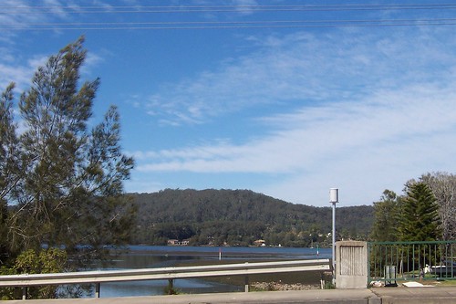
Erina Creek lets onto a nameless bay. Nameless on every map in my possession anyways.
It's between Peeks Point and Ironbark Point, between East Gosford and Green Point. The bay is part of the Brisbane Water estuary which is the northern arm of Broken Bay, just above Sydney.
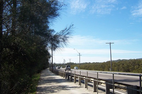
Walking along The Entrance Road beside the creek. A long flat easy walk with just the right amount of shade.
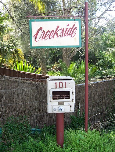
Letterbox made from an old firebox or summat. Opposite the heliport at Pateman Street.
Erina Creek Nursery, a few doors along from this letterbox, is for sale. But I'm sure just looking at it makes real estate agents weep. There's a couple of falling down houses, the fence patched together from bits and bobs, the overgrown yard full of odds and sods of rusting metal and broken PVC pipe and a "Beware of the dog" sign. Didn't see the dog but ten bob says it's either an hysterical barker or a silent mangy cur lurking in there waiting to take a chunk out of the unwary visitor.
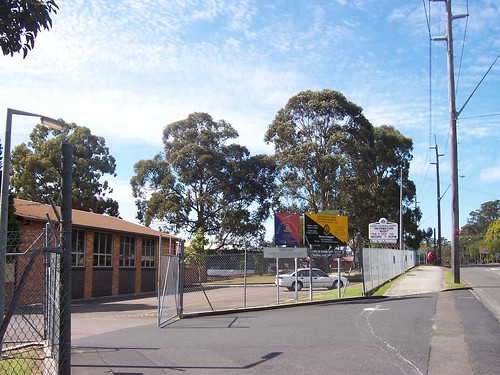
Local army barracks. The red & blue sign says:
"7 Something Regiment"
Can't read the rest of it even at the highest magnification, bugger it. A quick Google brings up a "311 (City of Gosford) Squadron" at Erina.
The yellow & black sign says:
"Australian Army
General Reserve
Royal Australian Infantry Corps
[under the insignia:]
Bravo Company
2nd/17th Battalion
The Royal New South Wales Regiment"
Their motto is Nulli Secundus - Facta Probant. Second to None - Deeds Prove. Very butch.
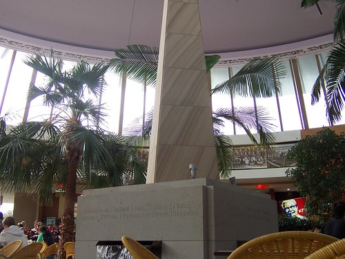
The old part of Bloody Erina (Erina Fair). I like the old photos round the dome.
The lettering above the windows blathers on about "sustainable design" and energy efficiency or summat.
The lettering on the obelisk thingy says [side nearest camera]:
"Distance to Gosford 5kms, Sydney 51kms
Canberra 294 kms (Parliment House Flagpole)".
[South side:]
"Latitude 33 degrees 26' 12" South
Longitude 151 degrees 23' 34" East".
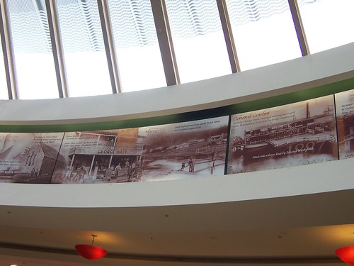
Old photos round the dome of The Atrium. The one on the left might be The Blackett at Gosford. The third one from the left looks like Narara Creek in the 1860s - 1880s. A sign said the photos are available from the Gosford Library. I'll have to pop in for my copies.
That's it for today. Was going to tell you something but I'm buggered if I can remember what it was. I'm off to put me dinner on.
8 comments:
Stonehurst is currently for sale.
It still looks the same.
The internal shot is of Erina Fairs latest addition.
It is not of an old part of Erina Fair
The timbers of the old Punt Bridge were used in a House at the top of Waratah Street East Gosford to build a stair way in a pole home.
Hope they don't extend bloody Erina Fair again. I need a trail of breadcrumbs when I go in there. And that giant telly shits me, in the Hub or the Hive or whatever that round bit is called. I hate shopping centres.
Thank yer for that info about the old timbers.
Thanks for acknowledging traditional owners. The stretch of water between Punt Bridge and Yerin Bridge (photo on your Wells St Gosford Walkies No 31) was called 'Yerin' and was a meeting, ceremony and trading place for Dharug and guringai people. The mixing of fresh water and salt water in this part of the creek has deep metaphorical meaning.
Yer welcome, Ian. It's the least I can do.
Thanks for the info. Local history, white and black, is welcome here.
Yerin ... Erina. A strange change in the name. Perhaps they are from different dialects of a local language or Erina was more comfortable on the whitefella tongue. Who knows?
Wells Street/Gosford walkies #31
The bay that you say is nameless is actually a parto fthe Broadwater. I lived at Green Point on the other side and as a child we would pretend there were Pirates in that bay. I lost a watch I got for Christmas when I was 7 years old in that bay.
This is fantastic!
I am Tom Donald, former Councillor Gosford City Council 1995 to 1999.. I was the one that suggested the name Yerin for the bridge. If anyone is really interested I can tell you the true story behind the name..
Tom.donald461@gmail.com
An enduring joke for prosperity
Post a Comment